
Cape Canaveral, Florida facts for kids
Quick facts for kids
Cape Canaveral, Florida
|
||
|---|---|---|
| City of Cape Canaveral | ||

Cape Canaveral City Hall
|
||
|
||
| Nickname(s):
"The Space Between" or "Space City"
|
||
| Motto(s):
Sun, Space, and Sea
|
||

Location in Brevard County and the state of Florida
|
||

Cape Canaveral, Florida
Location in the United States
|
||
| Country | ||
| State | ||
| County | ||
| Incorporated | May 16, 1963 | |
| Government | ||
| • Type | Council-Manager | |
| Area | ||
| • City | 2.26 sq mi (5.85 km2) | |
| • Land | 2.22 sq mi (5.75 km2) | |
| • Water | 0.04 sq mi (0.10 km2) | |
| Elevation | 10 ft (3 m) | |
| Population
(2020)
|
||
| • City | 9,972 | |
| • Density | 4,487.85/sq mi (1,732.79/km2) | |
| • Metro | 543,376 | |
| Time zone | UTC-5 (Eastern (EST)) | |
| • Summer (DST) | UTC-4 (EDT) | |
| ZIP code |
32920
|
|
| Area code(s) | 321 | |
| FIPS code | 12-10250 | |
| GNIS feature ID | 0279995 | |

Cape Canaveral is a city in Brevard County, Florida. It is part of the Palm Bay–Melbourne–Titusville Metropolitan Statistical Area. The city is famous for its connection to space exploration. In 2020, about 9,972 people lived there.
Contents
Early Settlements and Clubs
In 1848, a lighthouse was built in the area. Soon after, a few families moved in and started a small community. As the danger from Seminole Indian attacks lessened, more settlers arrived. They set up post offices and small stores. One post office was called Artesia, likely because of the natural springs there.
Around 1890, a group of former Harvard University students started a hunting club. They bought over 18,000 acres of land. Their hunting trips helped clear the land, making it easier for new settlers to move in.
Journalism and the Great Depression
In the early 1920s, some journalists from Orlando invested a lot of money in the beach area. They called their new development Journalista. Today, this area is known as Avon-by-the-Sea. A wooden bridge had just been built, connecting Merritt Island to the area. The developers hoped many visitors would come.
At that time, fishermen, retired people, and families of Captain Mills O. Burnham lived in the northern part of what is now the city. Captain Burnham was the first official keeper of the Cape Canaveral Light.
The Great Depression caused many problems. Many investors lost their land. A newspaper owner named R.B. Brossier and his son, Dickson, bought much of the Avon area. They used the money from selling their Orlando home to do this.
Archaeology and Space Age Growth
In the 1930s, archaeologists from Yale University studied Native American sites in the area. Later, in 1951, another Yale anthropologist, Irvine Rouse, also did research there.
By 1958, the space exploration program was growing fast. This brought many new jobs and helped the local economy. Nearby property owners worried that Cocoa Beach might take over their area. They felt Cocoa Beach had more debt and higher taxes than they wanted.
Becoming a City
The idea for the City of Cape Canaveral began in 1961. A group formed a committee to officially make it a city. After some delays with paperwork, the city's official document was approved by the Florida State Legislature. This happened on May 16, 1963.
In 1967, the city started its annual Sun and Space Festival. It featured airplane flyovers and a parade. The parade even stopped at the new Museum of Sunken Treasure. This museum showed items from the 1715 Treasure Fleet, which sank off the coast.
Since 1990, the city has held an annual Patriot's Day Parade on October 9. This parade honors the last naval battle of the American Revolution. That battle was fought near Cape Canaveral in 1783.
In March 2013, the city celebrated its 50th anniversary. Author Jay Barbree shared stories about the early days. On May 16, 2013, a time capsule was sealed. It will be opened 50 years later.
In 2017, Cape Canaveral won the "Most Fit City" challenge. This challenge was hosted by Health First.
Location and Land Area
The city of Cape Canaveral is on a barrier island along Florida's Atlantic coast. It is just south of the famous geographical feature, Cape Canaveral. Rivers and islands separate it from the mainland. These include the Banana River, Merritt Island, and the Indian River.
The city covers about 2.3 square miles (5.85 square kilometers) in total. Most of this area is land, about 2.22 square miles (5.75 square kilometers). A small part, about 0.04 square miles (0.10 square kilometers), is water.
Climate and Weather
Cape Canaveral has a humid subtropical climate. This means it has hot, wet summers. The winters are warm with some rain. Sometimes, tropical storms or hurricanes can affect the area in late summer and fall. For example, in August 2008, Tropical Storm Fay brought over 20 inches (50 cm) of rain.
| Climate data for Cape Canaveral, Florida | |||||||||||||
|---|---|---|---|---|---|---|---|---|---|---|---|---|---|
| Month | Jan | Feb | Mar | Apr | May | Jun | Jul | Aug | Sep | Oct | Nov | Dec | Year |
| Record high °F (°C) | 89 (32) |
92 (33) |
93 (34) |
97 (36) |
97 (36) |
101 (38) |
102 (39) |
101 (38) |
98 (37) |
96 (36) |
91 (33) |
90 (32) |
102 (39) |
| Mean daily maximum °F (°C) | 71 (22) |
74 (23) |
77 (25) |
81 (27) |
86 (30) |
89 (32) |
91 (33) |
91 (33) |
88 (31) |
84 (29) |
79 (26) |
73 (23) |
82 (28) |
| Daily mean °F (°C) | 60 (16) |
63 (17) |
66 (19) |
71 (22) |
77 (25) |
81 (27) |
82 (28) |
82 (28) |
81 (27) |
76 (24) |
70 (21) |
63 (17) |
73 (23) |
| Mean daily minimum °F (°C) | 49 (9) |
52 (11) |
55 (13) |
60 (16) |
67 (19) |
72 (22) |
73 (23) |
73 (23) |
73 (23) |
68 (20) |
60 (16) |
53 (12) |
63 (17) |
| Record low °F (°C) | 17 (−8) |
27 (−3) |
25 (−4) |
35 (2) |
47 (8) |
55 (13) |
60 (16) |
60 (16) |
57 (14) |
41 (5) |
30 (−1) |
21 (−6) |
17 (−8) |
| Average precipitation inches (mm) | 2.27 (58) |
2.68 (68) |
3.28 (83) |
2.13 (54) |
3.29 (84) |
6.71 (170) |
5.96 (151) |
7.68 (195) |
7.64 (194) |
5.06 (129) |
2.88 (73) |
2.57 (65) |
52.15 (1,325) |
| Source: TWC | |||||||||||||
| Historical population | |||
|---|---|---|---|
| Census | Pop. | %± | |
| 1970 | 4,258 | — | |
| 1980 | 5,733 | 34.6% | |
| 1990 | 8,014 | 39.8% | |
| 2000 | 8,829 | 10.2% | |
| 2010 | 9,912 | 12.3% | |
| 2020 | 9,972 | 0.6% | |
| U.S. Decennial Census | |||
Population Changes (2010 and 2020)
The population of Cape Canaveral has grown over the years. In 2010, there were 9,912 people living in the city. By 2020, the population had slightly increased to 9,972 people.
The city has a mix of different backgrounds. Here's a look at the racial makeup of Cape Canaveral, not including people of Hispanic or Latino origin:
| Race | Pop 2010 | Pop 2020 | % 2010 | % 2020 |
|---|---|---|---|---|
| White (NH) | 8,766 | 8,475 | 88.44% | 84.99% |
| Black or African American (NH) | 221 | 217 | 2.23% | 2.18% |
| Native American or Alaska Native (NH) | 27 | 43 | 0.27% | 0.43% |
| Asian (NH) | 179 | 155 | 1.81% | 1.55% |
| Pacific Islander or Native Hawaiian (NH) | 7 | 6 | 0.07% | 0.06% |
| Some other race (NH) | 14 | 51 | 0.14% | 0.51% |
| Two or more races/Multiracial (NH) | 136 | 391 | 1.37% | 3.92% |
| Hispanic or Latino (any race) | 562 | 634 | 5.67% | 6.36% |
| Total | 9,912 | 9,972 | 100.00% | 100.00% |
In 2020, there were 9,972 people living in 5,951 households. About 2,633 of these were families.
Cape Canaveral has many types of homes, including houses and apartments. There are also many hotels and timeshares for visitors. Many people in the city work in the service industry. Others work for engineering companies or at the Kennedy Space Center nearby.
Workforce and Jobs
In 2007, about 5,824 people in Cape Canaveral were part of the workforce. This means they were old enough to work. Out of this group, 5,533 people had jobs. About 291 people were looking for work, making the unemployment rate 5%.
Housing Market
In 2008, no new building permits were given out for homes. This was a decrease from previous years. For example, in 2007, five permits were issued for six new homes. In 2006, 19 permits were issued for 42 new homes.
In 2007, the average price for a home in Cape Canaveral was $215,000.
Tourism and Visitors
Tourism is very important to Cape Canaveral's economy. Like other Florida beach towns, many visitors come here. The largest hotel in Brevard County is located in the city. It has 284 rooms and a large meeting space of 30,000 square feet.
Transportation and Roads
Most people in Cape Canaveral travel by road.
 SR A1A is the main road. It runs north and south through the city. In some parts, it's called Astronaut Boulevard, and in others, Atlantic Avenue.
 SR 528 is a major highway. It connects the city to the mainland. SR 528 joins SR A1A for a short distance.
Public transportation is available through Space Coast Area Transit (SCAT). The #9 Beach Trolley bus line goes through Cape Canaveral. It also connects to Cocoa Beach and other bus lines in Brevard County.
Water Supply
The city of Cocoa provides drinking water to Cape Canaveral residents. A single water pipe from Cocoa runs under the Sykes Creek Bridge.
- Allison Anders: She grew up in the city. In 2001, she filmed her movie Things Behind the Sun in Brevard County.
- Mills O. Burnham: He was a member of the Florida House of Representatives. He moved to Cape Canaveral in 1853. He was the keeper of the Cape Canaveral Light for 30 years.
Sister Cities
Cape Canaveral has special connections with several cities around the world. These are called "sister cities."
 Kloten, Zurich, Switzerland
 Sagres, Faro, Portugal
 Guidonia Montecelio, Lazio, Italy
- Fonte Nuova, Lazio, Italy
 Ithaca, Kefallinia, Greece
Images for kids
-
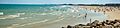
Beach in Cape Canaveral, Florida
See also
 In Spanish: Cabo Cañaveral (Florida) para niños
