Cherry County, Nebraska facts for kids
Quick facts for kids
Cherry County
|
|
|---|---|
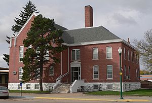
Cherry County Courthouse in Valentine
|
|
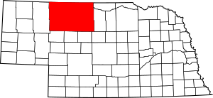
Location within the U.S. state of Nebraska
|
|
 Nebraska's location within the U.S. |
|
| Country | |
| State | |
| Founded | 1883 |
| Named for | Samuel A. Cherry |
| Seat | Valentine |
| Largest city | Valentine |
| Area | |
| • Total | 6,009 sq mi (15,560 km2) |
| • Land | 5,960 sq mi (15,400 km2) |
| • Water | 49 sq mi (130 km2) 0.8%% |
| Population
(2020)
|
|
| • Total | 5,455 |
| • Density | 0.90780/sq mi (0.35051/km2) |
| Time zones | |
| Eastern part of county | UTC−6 (Central) |
| • Summer (DST) | UTC−5 (CDT) |
| Western part of county | UTC−7 (Mountain) |
| • Summer (DST) | UTC−6 (MDT) |
| Congressional district | 3rd |
Cherry County is a large county in the state of Nebraska. In 2020, about 5,455 people lived there. The main town, or county seat, is Valentine.
The county was named after Lt. Samuel A. Cherry. He was an Army officer who died in 1881. Cherry County is located in the Nebraska Sandhills. It is the biggest county in Nebraska. It's almost 6,000 square miles, which is larger than the entire state of Connecticut!
If you look at Nebraska license plates, cars from Cherry County have the number 66. This is because it had the 66th-most registered vehicles when the system started in 1922.
Contents
Geography of Cherry County
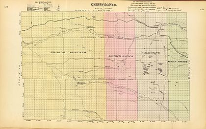
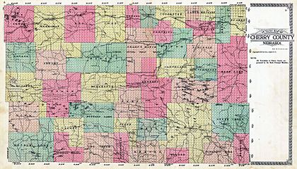
Cherry County is in the northern part of Nebraska. Its northern border touches South Dakota. The county covers about 6,009 square miles. Most of this is land (5,960 square miles), and a small part (49 square miles) is water.
It's the largest county in Nebraska by land area. It's even bigger than the states of Delaware and Rhode Island put together! The county is part of Nebraska's unique Sandhills region. The sand dunes you see there were formed a long time ago by glaciers. Later, grasses grew and covered them.
Main Roads
 U.S. Highway 20
 U.S. Highway 83
 Nebraska Highway 12
 Nebraska Highway 61
 Nebraska Highway 97
Protected Natural Areas
Cherry County has several special places where nature is protected:
- Fort Niobrara National Wildlife Refuge
- Fort Niobrara Wilderness
- Niobrara National Scenic River (part of it)
- Samuel R. McKelvie National Forest
- Valentine National Wildlife Refuge
State Parks and Recreation Areas
- Bowring Ranch State Historical Park
- Cottonwood Lake State Recreation Area
- Merritt Reservoir State Recreation Area
- Smith Falls State Park
Neighboring Counties
Cherry County is so big that it borders 11 other counties! This is more than any other county in Nebraska. Seven of these counties are in Nebraska, and four are in South Dakota.
- Bennett County, South Dakota – to the north
- Todd County, South Dakota – to the north
- Tripp County, South Dakota – to the northeast
- Brown County – to the east
- Keya Paha County – to the east
- Blaine County – to the southeast
- Grant County – to the south
- Thomas County – to the south
- Hooker County – to the south
- Sheridan County – to the west
- Oglala Lakota County, South Dakota – to the northwest
People in Cherry County
In 2020, the population of Cherry County was 5,455 people. The county has a low population density, meaning there aren't many people living in each square mile.
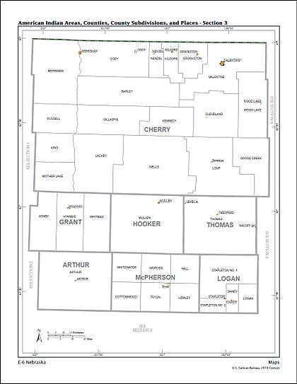
Towns and Communities
City
- Valentine (This is the main town and county seat.)
Villages
Census-designated place
Other Small Communities
Famous Ranches
- Abbott Ranch
- Bowring Ranch
- Spade Ranch
- Sunny Slope Ranch
Time Zones
Cherry County is interesting because it uses two different time zones! The eastern part of the county, including Valentine, is in the Central Time Zone. But the western two-thirds of the county, including Merriman, is in the Mountain Time Zone.
See also
 In Spanish: Condado de Cherry para niños
 | Frances Mary Albrier |
 | Whitney Young |
 | Muhammad Ali |


