Clayton Bay facts for kids
Quick facts for kids Clayton BaySouth Australia |
|||||||||||||||
|---|---|---|---|---|---|---|---|---|---|---|---|---|---|---|---|
 |
|||||||||||||||
| Established | 1858 (town) 31 August 2000 (locality) |
||||||||||||||
| Postcode(s) | 5256 | ||||||||||||||
| Elevation | 70 m (230 ft) | ||||||||||||||
| Time zone | ACST (UTC+9:30) | ||||||||||||||
| • Summer (DST) | ACDT (UTC+10:30) | ||||||||||||||
| Location |
|
||||||||||||||
| LGA(s) | Alexandrina Council | ||||||||||||||
| Region | Fleurieu and Kangaroo Island | ||||||||||||||
| State electorate(s) | Hammond | ||||||||||||||
| Federal Division(s) | Mayo | ||||||||||||||
|
|||||||||||||||
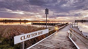
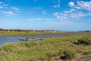
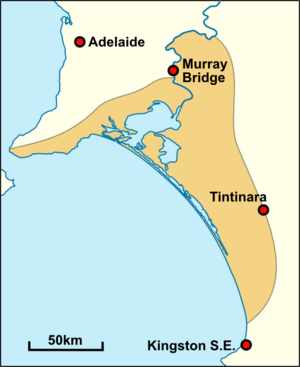
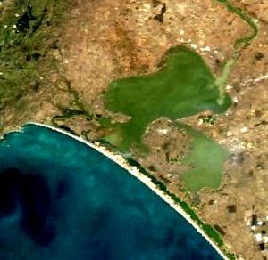
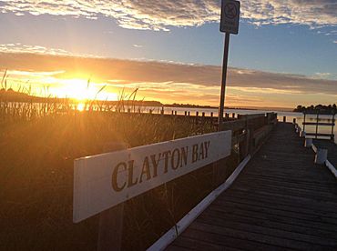
Clayton Bay is a small town in South Australia. It is located on the edge of Lake Alexandrina and the Lower Murray River. This area is part of the important lower lakes and Coorong region, which is where the Murray River System ends.
The town is about 87 kilometres (54 miles) southeast of Adelaide. It is also 30.7 kilometres (19 miles) by road from Goolwa. Clayton Bay is just north of the top part of Hindmarsh Island.
In 2008, the town's name was officially changed from Clayton to Clayton Bay. This was done to avoid confusion with another town called Clayton, Victoria.
Contents
What is Clayton Bay like?
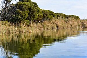
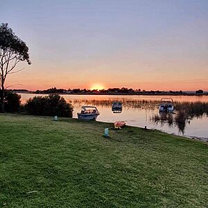
Clayton Bay is known for its amazing wetlands, waters, and shoreline. Many people visit to see the spectacular sunsets. It attracts people who love nature, like bird watchers, photographers, and artists. It's also a great spot for ecotourism and water activities, especially sailing. The area often has strong winds, which makes sailing very popular.
Staying Safe on the Water
If you want to do water activities, it's good to have some experience. The area can be very windy, and the shallow Lake Alexandrina can create large, choppy waves.
The South Australian Government has rules for boating safety. Waters around Clayton Bay are called 'protected' or 'semi-protected.' This means you need to have the right safety gear for your boat. For example, if you are on a motorised boat shorter than 4.8 metres, everyone must wear a life jacket. Children aged 12 or younger must always wear a life jacket in open areas of boats up to 12 metres long.
Why is Clayton Bay important?
Clayton Bay is part of a very special area in Australia. It is included in the Coorong, Lower Murray, Lower Lakes, Murray Mouth, Lake Alexandrina, and Lake Albert wetland. This whole area is one of Australia's most important wetlands.
A Wetland of International Importance
In 1985, Australia named this large wetland area a Wetland of International Importance under the Ramsar Convention on Wetlands. This means it is protected because it is so valuable for nature. The Ramsar site covers about 140,500 hectares in South Australia. It includes the Coorong National Park, Lake Alexandrina, Lake Albert, and the rivers that flow into them.
Amazing Birds and Animals
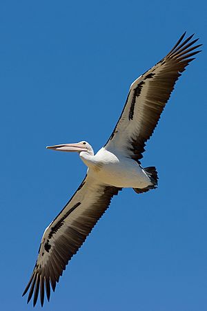
The wetlands in Clayton Bay are important places for many birds to nest and breed. This includes many birds that travel long distances (migratory birds).
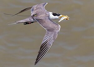
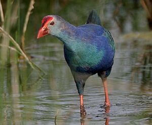
Here are some of the bird species that use these wetlands:
- Australian Pelican
- Black Swan
- Greater Crested Tern
- Australian Shelduck
- Whiskered Tern
- Fairy Tern
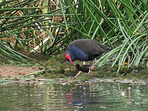
- Australasian Swamphen
- Australasian Shoveler
- And many more, like Magpies, Willie Wagtails, and Galahs.

The area is also home to many other animals, including mammals, amphibians, and reptiles. Some of these are:
- Swamp Rats
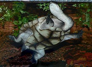
- Murray Turtles
- Eastern Brown Snakes and Tiger Snakes (be careful!)
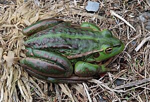
- Southern Bell frogs, which are an endangered species.
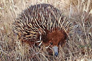
You might also see kangaroos, sleepy lizards, and short-beaked echidnas living in and around the town.
Plants and Fish in the Wetlands
The wetlands are full of different plant species, like:
- River club rush
- Silver Daisy-bush
- Various types of reed beds
- Swamp Paperbark
- And many more unique plants.
About 43 different fish species live in the Ramsar site, including:
- Murray Cod
- Yarra Pygmy Perch
- Freshwater Catfish
- Southern Pygmy Perch
- And several types of gobies and lampreys.
A Look at History
Aboriginal History: The Ngarrindjeri People
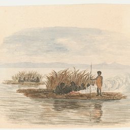
The Ngarrindjeri people are the traditional Aboriginal Owners of the land around the lower Murray River, including Clayton Bay. They have lived here for thousands of years. This region was once one of the most populated areas in Australia.
The Ngarrindjeri people lived in communities and found everything they needed from the land (called ruwe or ruwar) and waterways. This included clean water, food, medicines, shelter, and warmth.
Ngarrindjeri Caring for Country
The Ngarrindjeri people have worked for many years with the Government of South Australia to protect their land and waters. They want to make sure their culture and traditions are respected.
In 2002, the Alexandrina Council made an agreement with the Ngarrindjeri Nation called the Kungun Ngarrindjeri Yunnan (KNY) Agreement. This agreement promised to work together and apologised to the Ngarrindjeri people.
In 2007, the Ngarrindjeri Nation created the Ngarrindjeri Nation Yarluwar-Ruwe Plan. This plan shares their vision for caring for their land and sea country: "Our Lands, Our Waters, Our People, All Living Things are connected. We implore people to respect our Ruwe (Country) as it was created in the Kaldowinyeri (the Creation). We long for sparkling, clean waters, healthy land and people and all living things. We long for the Yarluwar-Ruwe (Sea Country) of our ancestors. Our vision is all people Caring, Sharing, Knowing and Respecting the lands, the waters and all living things."
Native Title Rights
In 2017, the Native Title rights of the Ngarrindjeri people were officially recognised. This means they have special rights to access and use their traditional lands and waters in certain ways. These rights include hunting, fishing, gathering, using natural water, and protecting cultural sites. Any new building or clearing of plants in Clayton Bay's Native Title areas needs approval from the Ngarrindjeri people.
European History
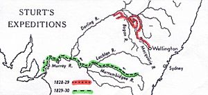
In 1829, Captain Charles Sturt led an expedition to explore the Murrumbidgee River. His team built a boat, and a carpenter named Mr Clayton helped supervise the work.
In 1830, Sturt and his crew reached the Ngarrindjeri lands. They noticed the Ngarrindjeri people already knew about firearms. The Ngarrindjeri told them the ocean was close. Sturt then sailed into a large lake, which he named Lake Alexandrina. A few days later, they found where the Murray River flowed into the sea.
In the 1840s, Dr John Rankine ran a ferry service from Clayton Bay to Hindmarsh Island. He mainly transported his sheep and workers. This ferry was known as 'Rankine's Ferry.'
The town of Clayton was officially named by Governor MacDonnell in 1858. Land was sold in 1859 in the area known as 'Old Clayton.' A store, post office, and a few homes were built. Over the years, more areas were developed, creating the town we see today.
The Great Drought and the Regulator
During the 2000s Australian drought, the water levels in the Lower Murray and lakes became very low. This was the lowest in over 90 years. The water levels in Lake Alexandrina and Lake Albert dropped a lot.
To prevent further problems, the South Australian government built a barrage (a type of dam) at Clayton Bay. This was called the 'Clayton regulator.' It was built to stop the flow of Lake Alexandrina waters towards the mouth of the Murray River. This helped prevent the lake from becoming too salty and acidic.
However, a group called the River, Lakes and Coorong Action Group strongly argued for the regulator to be removed to allow water to flow naturally again. The regulator was removed in 2011.
Jones' Lookout
Jones' Lookout was opened in 2009. It is named after Henry Jones, a local fisherman and environmentalist. The lookout is on a concrete platform where a water tower used to stand.
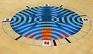
The lookout features a beautiful mosaic artwork by artist Michael Tye. It shows a compass rose made of blue ripples. The colours at the north point show a sunset over the water. The compass points name important places and their distances from Clayton Bay. You can see great views of Lake Alexandrina and the Lower Lakes from here. The artwork also includes footprints of the purple swamp hen, a bird that disappeared from the area during the drought.
Protecting the Environment
Clayton Bay is part of an internationally important Ramsar site wetland. This means it is a very delicate natural area with important Indigenous cultural heritage sites. The wetlands help filter and clean the water that flows into the Lower Lakes.
Threats to the Environment
There are several serious threats to the environment in Clayton Bay:
- Climate change** and **droughts reduce the amount of water.
- Water extraction (taking water out of the river) also lowers water levels.
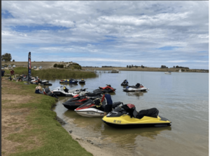
- Human activities like too many tourists, wakeboarding, waterskiing, and jet skis can harm the wetlands.
- Noise and light pollution can disturb wildlife.
- Introduced plants like kikuyu grass can take over native plants.
- Feral animals like foxes and cats can harm native wildlife.
The Problem with European Carp
European Carp are a big problem in the Murray-Darling Basin. These fish were introduced in the 1920s and have spread widely. They are very adaptable and can increase their numbers quickly. Carp can harm the environment by making the water quality worse and damaging river banks. They can also cause algae blooms. The spread of carp has hurt native fish species and water plants.
Scientists are looking into using a natural virus (called carp herpesvirus) to control the number of carp. In Clayton Bay, European carp are considered a pest. If you catch a carp, you must not put it back in the water. It should be destroyed and properly disposed of.
Working Together to Protect Clayton Bay
The Ngarrindjeri Native Title holders, local residents, and the Alexandrina Council are all working together to protect Clayton Bay. They want to balance tourism with protecting the environment. They promote ecotourism (tourism that helps the environment) and work to preserve cultural heritage sites. They also try to prevent harmful developments and activities. Their goals include:
- Protecting and restoring the wetlands.
- Increasing water flows in the river system.
- Improving water quality.
Many people who live in Clayton Bay are involved in environmental efforts. They help with:
- Citizen science: Counting birds and frogs, surveying plants, and measuring temperature.
- Conservation: Working to preserve and restore the wetlands.
- Turtle rescue programs: Helping turtles that are in danger.
- Revegetation programs: Planting native plants.
- Protecting breeding grounds: Especially for Eastern long-necked turtles, which are vulnerable to human activity and predators like foxes and cats.
- Raising endangered frogs: A program in town raises Southern Bell frogs in captivity to release them back into the wetlands.
- Dark sky policies: Working with the council to reduce light pollution, so people can see the stars better. The town only has five street lights!
Notable People from Clayton Bay
- Annabelle Collett (Artist)
- Deane Fergie (Anthropologist)
- Elizabeth Grant (Architect/Anthropologist)
- Gloria Jones (Environmentalist/Restaurateur/Fisherman/Activist)
- Henry Jones (Environmentalist/Fisherman/Activist)
- Rob Lucas (Anthropologist)


