Coyote Butte Limestone facts for kids
Quick facts for kids Coyote Butte LimestoneStratigraphic range: Sakmarian (Wolfcampian)-Kungurian ~296–273Ma |
|
|---|---|
| Type | Formation |
| Lithology | |
| Primary | Limestone |
| Other | Sandstone |
| Location | |
| Coordinates | 43°58′N 119°44′W / 43.96°N 119.74°W |
| Approximate paleocoordinates | 17°54′N 38°48′W / 17.9°N 38.8°W |
| Region | Crook County, Oregon |
| Country | |
| Extent | Isolated buttes (Coyote & Tuckers) south and north (Triangulation Hill) of Grindstone & Twelvemile Creeks, Crook County, Oregon |
| Type section | |
| Named for | Coyote Butte |
| Named by | Merriam & Berthiaume |
| Year defined | 1943 |
The Coyote Butte Limestone (also called OR085) is a special type of rock layer found in Oregon. It holds fossils that are very old, from a time called the Permian period. This period lasted from about 296 to 273 million years ago.
You can find this rock formation in separate hills called buttes. These buttes are located in Crook County, Oregon, near Grindstone and Twelvemile Creeks. Some of these hills are Coyote Butte and Tuckers Butte.
Contents
What is the Coyote Butte Limestone?
Scientists Merriam and Berthiaume first described the Coyote Butte Formation in 1943. It is found in isolated hills in central Oregon. These hills are made of limestone that formed in shallow ocean waters. This limestone is special because it is very well-preserved. It gives us clues about the Permian period in western North America.
The Coyote Butte Formation looks like separate limestone hills. Most of these hills are small, from 0.1 to 2.0 square kilometers (0.04 to 0.77 square miles). These strong limestone blocks stand out from the softer rocks around them. The formation shows that it was once a shallow ocean platform. It contains many different kinds of fossils. These include corals, bryozoans (tiny sea animals), algae (sea plants), and other ancient sea creatures.
Scientists have studied the Coyote Butte Formation. They found that it is similar to other limestones in Nevada. This suggests that these rocks might have once been part of a much larger area of shallow ocean. Over millions of years, Earth's movements broke up and moved these rock sections. This is why we now find them in separate places.
Where was it located?
The Coyote Butte Limestone formed during the Sakmarian to Kungurian stages. These stages are part of the Early to Middle Permian period. This was about 296 to 273 million years ago.
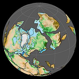
During that time, the land that is now central Oregon was on the edge of a huge supercontinent called Pangea. It was in a warmer zone, around 16-18 degrees north of the equator.
Ancient Climate
Earth's Movements (Tectonics)
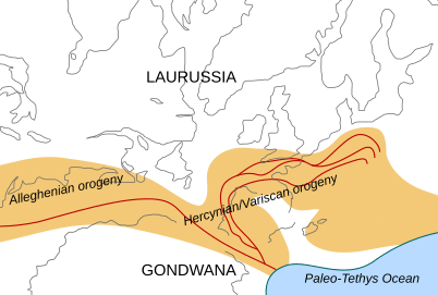
The area where the Coyote Butte Limestone formed was a shallow ocean. Behind it were dry lands in what is now Arizona and Utah. This was happening as Pangea slowly began to break apart. Big mountain-building events were also happening in other parts of the world. For example, the Alleghanian orogeny was active in eastern North America and western Europe.
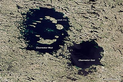
Interestingly, the time when these rocks were forming also matches up with a huge asteroid impact. This impact created the Clearwater West crater. It happened about 286.2 million years ago.
Why are the fossils important?
The Coyote Butte Formation is the only place in Oregon where scientists have found Paleozoic fossils. The Paleozoic Era was a very long time ago, from about 541 to 252 million years ago. This makes the Coyote Butte Limestone very important for understanding ancient life in Oregon.
The rocks here are well-preserved. They show us what shallow ocean environments were like during the Permian period. This formation also formed just before a major mass extinction event. This event is called Olson's Extinction. It happened about 273 million years ago. It was a smaller extinction that happened before the much larger Permian–Triassic extinction event.
Fossils Found Here
Many different types of fossils have been found in the Coyote Butte Formation. They help us learn about the ancient sea life that lived there.
Brachiopods
These are ancient sea creatures with two shells, similar to clams.
- ?Alexenia occidentalis
- Anidanthus minor
- Antiquatonia cooperi
- Calliprotonia inexpectatum
- Kochiproductus transversus
- Krotovia oregonensis
- ?Marginifera profundosulcata
- Martinia berthiaumei
- Probolionia posteroreticulata
- ?Proboscidella carinata
- Rostranteris sulcatum
- Spiriferella pseudodraschei
- Stenoscisma cf. plicatum
- Tiramnia semiglobosa
- Yakovlevia transversa
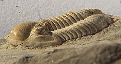
Trilobites
These are extinct sea arthropods, like ancient crabs or insects.
- Proetida
- Phillipsiidae
- Cummingella (Cummingella) sp.
- Phillipsiidae
Rostroconchia
These are extinct mollusk-like animals with a single shell.
- Conocardiida
- Conocardiidae
- Arceodomus sphairikos
- Conocardiidae
Gastropods
These are ancient snails.
- Prosobranchia
- Acteoninidae
- Acteonina permiana
- Acteoninidae
Polyplacophora
These are ancient chitons, a type of marine mollusk with eight shell plates.
- Neoloricata
- Acutichitonidae
- Arcochiton soccus
- Homeochiton triangularis
- Gryphochitonidae
- Gryphochiton planoplata
- Lepidopleuridae
- ?Chauliochiton sp.
- Pterochiton sp.
- Strobilepidae
- Diadeloplax apiculatus
- Acutichitonidae
Corals
These are ancient marine animals that build reefs.
- Cystolonsdaleia berthiaumi
- Petalaxis occidentalis
- Wilsonastraea ochocoensis
- Protowentzelella sp.
Similar Rocks and Fossils
Geologic Connections
The Coyote Butte Limestone is similar to other rock formations found around the world from the same time period. This helps scientists understand how continents and oceans have changed over millions of years.
- Cisuralian Series
- Sakmarian formations
- Artinskian formations
- Roadian formations
- Wordian formations
- Kungurian formations
- Permian North America
- Esplanade Sandstone, Grand Canyon
- Arroyo Formation, Texas
- Road Canyon Formation, idem
- Waggoner Ranch Formation, idem
- Word Formation, idem
- Cherry Canyon Formation, New Mexico and Texas
- San Andres Formation, United States, idem
- Wellington Formation, Kansas and Oklahoma
- Orby Head Formation, Prince Edward Island
- Permian South America
- Carapacha Formation, Argentina
- Mangrullo Formation, Uruguay
- Rio Bonito Formation, Brazil
- Permian Africa
- Ganigobis Formation, Namibia
- Gai-As Formation, idem
- Huab Formation, idem
- Whitehill Formation, idem
- Permian Europe
- Tambach Formation, Germany
- Treskelodden Formation, Svalbard, Norway
- Arpinskaya Formation, Caucasus
- Gnishik Formation, idem
Animal Connections
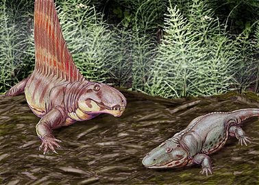
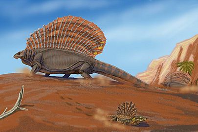
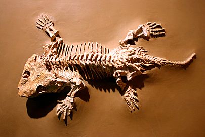
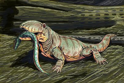
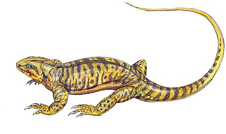
Even though these animals are not found in the Coyote Butte Limestone, they lived during the same Early Permian period in North America and other parts of the world. They give us an idea of what life was like back then.
-
A drawing of Dimetrodon (a sail-backed reptile) and Eryops (an amphibian) from the Permian period in Texas.
-
A drawing of Platyhystrix (small, foreground) and Edaphosaurus (large, sail-backed) from Early Permian Texas.
 | Misty Copeland |
 | Raven Wilkinson |
 | Debra Austin |
 | Aesha Ash |


