Darjeeling facts for kids
Quick facts for kids
Darjeeling
|
|
|---|---|
|
Town
|
|
|
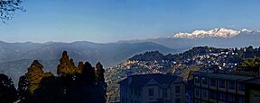
Left to right from top: Darjeeling with Kangchenjunga, the world's third-highest mountain, rising behind it; a Darjeeling Himalayan Railway train steaming to the main train station; a tea garden, or tea plantation
|
|
| Country | India |
| State | West Bengal |
| District | Darjeeling |
| Settled | Leased in 1835 from Tsugphud Namgyal, the Chogyal of the Kingdom of Sikkim, and annexed in 1849. Municipality, 1 July 1850. |
| Founded by | British East India Company, during Company rule in India |
| Government | |
| • Type | Municipality |
| • Body | Darjeeling Municipality |
| Area | |
| • Total | 7.43 km2 (2.87 sq mi) |
| Elevation | 2,045 m (6,709 ft) |
| Population
(2011)
|
|
| • Total | 118,805 |
| • Density | 15,990/km2 (41,400/sq mi) |
| Languages | |
| • Official | Bengali and Nepali |
| Time zone | UTC+5:30 (IST) |
Darjeeling is a city in the northern part of West Bengal, a state in India. It sits high up in the Eastern Himalayas, about 2,045 meters (6,709 feet) above sea level. This city is famous for its beautiful views, especially of Kangchenjunga, the world's third-highest mountain.
In the early 1800s, the British discovered Darjeeling. They thought it would be a great place for their officials and soldiers to escape the summer heat. They leased the land from the Kingdom of Sikkim and later took full control. The British also started growing tea here, which became a huge success. Many workers, mostly from Nepal, came to clear forests and work on the tea farms.
Over time, Darjeeling grew. Schools were built for British children. A special narrow-gauge mountain railway, the Darjeeling Himalayan Railway, was built to bring people and tea in and out. After India became independent in 1947, the British left. Wealthy Indians bought their homes and tea gardens.
Today, many people in Darjeeling are descendants of those early workers. Their main language is Nepali. The city's economy relies mostly on the tea industry and tourism. However, Darjeeling faces challenges like deforestation, water shortages, and crowded streets. Many young people leave to find jobs elsewhere.
Darjeeling has a rich and mixed culture because so many different groups of people live there. The local food often includes fermented dishes. Tourists have loved visiting Darjeeling for a long time. In 1999, the Darjeeling Himalayan Railway became a World Heritage Site by UNESCO. In 2005, Darjeeling tea got a special protection called a geographical indication to help its brand and the region that produces it.
Contents
- What's in a Name? The Meaning of Darjeeling
- Darjeeling's Story: A Journey Through Time
- Darjeeling's Landscape: Mountains and Rivers
- Weather and Nature in Darjeeling
- Plants and Animals of Darjeeling
- Who Lives in Darjeeling?
- How Darjeeling is Governed
- Darjeeling's Economy: Tea and Tourists
- Services and Facilities
- Getting Around Darjeeling
- Darjeeling's Unique Culture
- Learning in Darjeeling
- See also
What's in a Name? The Meaning of Darjeeling
The name Darjeeling comes from the Lepcha people, who first lived here. They called it Dorje-ling, which means "Place of the Thunderbolt." Another idea is that it comes from the Tibetan words Dorje ling, meaning "Land of Dorje," referring to the vajra, a special weapon of the Hindu god Indra.
Darjeeling's Story: A Journey Through Time
How Darjeeling Began (1780-1835)
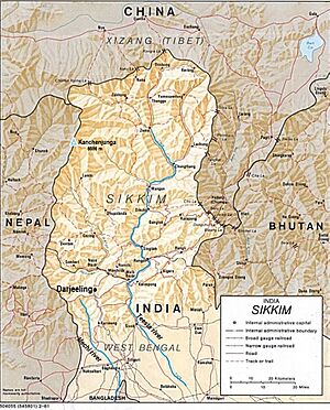
Darjeeling is located in the Eastern Himalayas, between the Mechi and Teesta rivers. In the 1700s, this area was a border region that different kingdoms wanted to control. The Kingdom of Sikkim ruled it for most of that century. Later, the Gurkha kingdom of Nepal took over Darjeeling.
The British East India Company became interested in Darjeeling in the early 1800s. At that time, the main people living there were the Lepcha and Limbu. After the British defeated the Gurkhas in a war (1814-1816), Nepal had to give Darjeeling back to Sikkim.
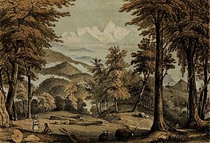
In 1829, two British officials, Captain George Lloyd and J. W. Grant, were exploring the area. They saw a beautiful mountain ridge and thought it would be a perfect place for a health resort for the British. Lord William Bentinck, the Governor-General of India, agreed with their idea.
British Rule and Tea Gardens (1835-1947)
In 1835, the East India Company leased a piece of land in Darjeeling from the Chogyal (ruler) of Sikkim. They started clearing forests and building homes. In 1839, a doctor named Archibald Campbell became the "superintendent" of Darjeeling. He oversaw the building of public places like a hotel and a courthouse.
To build the resort, many workers were needed. The British offered good wages and housing, which was better than the forced labor in nearby kingdoms. Tens of thousands of people, mostly from Nepal, came to Darjeeling. A road called the Hill Cart Road was built to connect Darjeeling to Siliguri at the base of the hills.
In 1833, the East India Company lost its special rights to trade tea with China. So, they decided to grow tea in India. Superintendent Campbell started experimenting with tea plants in Darjeeling in 1840, and it worked very well! European planters bought large areas of land and turned them into tea gardens.
The arrival of so many workers caused problems with the nearby kingdoms. In 1849, two British officials were briefly held captive. The British used this event to take over even more land from Sikkim.
Darjeeling officially became a municipality (a town with its own local government) in 1850. It quickly became a popular "hill station," a cool retreat for British officials. By the late 1800s, a special narrow-gauge railway, the Darjeeling Himalayan Railway, was built. This made it much easier to travel to Darjeeling from Calcutta (now Kolkata), the capital of British India.
Darjeeling also became known for its schools. Many British families sent their children there for education. Famous schools like St Paul's (for boys) and Loreto Convent (for girls) were established. These schools were mostly for British children, with very few Indian students allowed until after World War I.
By 1945, as British rule was ending, many Nepali-speaking people in Darjeeling, called Indian Gorkhas, still didn't have full rights. They were often at the bottom of the economic ladder. Many had fought for the British in World War II, but their situation didn't improve much.
Darjeeling in Independent India (1947 Onwards)
After India gained independence in 1947, Darjeeling became part of the state of West Bengal. Many British people left, and wealthy Indians bought their homes. This created some tension with the local Indian Gorkha population, who felt left out. They wanted their own Nepali-speaking state, but the government didn't agree. However, the Nepali language was later recognized for official use in Nepali-speaking parts of Bengal.
Darjeeling also became home to many Sherpas, who are famous for their climbing skills. Many Western climbers came to Darjeeling to plan their Himalayan expeditions. One of the most famous Sherpas, Tenzing Norgay, who was one of the first two people to reach the top of Mount Everest, lived in Darjeeling. He later helped set up the Himalayan Mountaineering Institute here.
After Tibet was taken over by China in the 1950s, many Tibetans came to India as refugees. Some settled in Darjeeling, and a Tibetan Refugee Self Help Centre was set up in 1959 to help them.
In 1975, the Kingdom of Sikkim, north of Darjeeling, became a state of India. This made the Gorkhas in Darjeeling wonder why their calls for a separate state were not heard, especially since many people in Sikkim also spoke Nepali. This led to the Gorkhaland movement, where people protested for their own state. There was some violence, but eventually, an agreement was reached. In 1988, the Darjeeling Gorkha Hill Council (DGHC) was created to give the region some self-governance.
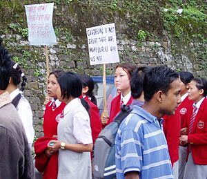
In 1992, the Nepali language was officially recognized in the Constitution of India. Even so, the demand for a separate state continued. More protests happened in 2008 and 2013. In 2017, there were several months of strikes and violence, but the movement eventually split.
Darjeeling's Landscape: Mountains and Rivers
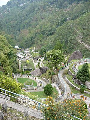
Darjeeling town is located on the Darjeeling–Jalapahar mountain range. This range is shaped like a 'Y'. The world's third-highest peak, Kangchenjunga, is about 74 kilometers (46 miles) north and can be seen clearly on sunny days.
The Darjeeling hills were formed by huge forces when the Indian tectonic plate pushed under the Eurasian plate. This process has crushed and fractured the rocks, making them weaker. This means the area is prone to landslides, especially during heavy rains. Deforestation and poor construction can make these landslides worse.
The main river in the Darjeeling region is the Teesta. It starts from a glacier in Sikkim and flows south, eventually joining the Brahmaputra river in Bangladesh. The area is also in a seismic zone, meaning it's at risk of earthquakes. Residents in lower-income areas worry about how unplanned buildings might collapse during a big earthquake.
Weather and Nature in Darjeeling
Darjeeling's Climate
Darjeeling has a mild, cool climate. Most of its rain, about 80% of the yearly total, falls between June and September during the monsoon of South Asia. Very little rain falls from December to March. Because Darjeeling is so high up, it has higher levels of UV radiation compared to lower areas.
| Climate data for Darjeeling, elevation 2,128 m (6,982 ft), (1991–2020, extremes 1901–2012) | |||||||||||||
|---|---|---|---|---|---|---|---|---|---|---|---|---|---|
| Month | Jan | Feb | Mar | Apr | May | Jun | Jul | Aug | Sep | Oct | Nov | Dec | Year |
| Record high °C (°F) | 19.0 (66.2) |
19.2 (66.6) |
24.0 (75.2) |
27.0 (80.6) |
25.7 (78.3) |
27.7 (81.9) |
28.0 (82.4) |
28.5 (83.3) |
27.5 (81.5) |
26.0 (78.8) |
24.5 (76.1) |
20.0 (68.0) |
28.5 (83.3) |
| Mean daily maximum °C (°F) | 11.1 (52.0) |
12.4 (54.3) |
15.9 (60.6) |
18.6 (65.5) |
19.3 (66.7) |
19.8 (67.6) |
19.5 (67.1) |
19.9 (67.8) |
19.5 (67.1) |
19.4 (66.9) |
17.2 (63.0) |
13.7 (56.7) |
17.3 (63.1) |
| Mean daily minimum °C (°F) | 1.7 (35.1) |
3.1 (37.6) |
6.0 (42.8) |
9.0 (48.2) |
10.8 (51.4) |
12.8 (55.0) |
13.4 (56.1) |
13.5 (56.3) |
12.7 (54.9) |
9.9 (49.8) |
6.2 (43.2) |
3.5 (38.3) |
8.8 (47.8) |
| Record low °C (°F) | −7.2 (19.0) |
−6.4 (20.5) |
−4.8 (23.4) |
0.0 (32.0) |
1.4 (34.5) |
6.6 (43.9) |
3.9 (39.0) |
8.0 (46.4) |
6.2 (43.2) |
3.2 (37.8) |
−4.4 (24.1) |
−4.6 (23.7) |
−7.2 (19.0) |
| Average rainfall mm (inches) | 10.8 (0.43) |
11.4 (0.45) |
26.4 (1.04) |
89.0 (3.50) |
160.3 (6.31) |
419.1 (16.50) |
648.5 (25.53) |
529.8 (20.86) |
385.2 (15.17) |
78.8 (3.10) |
11.2 (0.44) |
2.8 (0.11) |
2,373.3 (93.44) |
| Average rainy days | 0.9 | 1.2 | 2.6 | 6.7 | 10.2 | 17.9 | 23.4 | 22.0 | 16.1 | 3.9 | 0.6 | 0.7 | 106.1 |
| Average relative humidity (%) (at 17:30 IST) | 82 | 78 | 79 | 82 | 90 | 94 | 95 | 94 | 92 | 84 | 78 | 80 | 86 |
| Mean monthly sunshine hours | 167.4 | 139.8 | 145.7 | 147.0 | 151.9 | 72.0 | 77.5 | 102.3 | 96.0 | 167.4 | 189.0 | 189.1 | 1,645.1 |
| Mean daily sunshine hours | 5.4 | 5.0 | 4.7 | 4.9 | 4.9 | 2.4 | 2.5 | 3.3 | 3.2 | 5.4 | 6.3 | 6.1 | 4.5 |
| Average ultraviolet index | 5 | 6 | 9 | 11 | 13 | 15 | 15 | 14 | 12 | 9 | 6 | 4 | 10 |
| Source 1: India Meteorological Department UV Index | |||||||||||||
| Source 2: Deutscher Wetterdienst (sun 1891–1990) | |||||||||||||
Environmental Challenges
Darjeeling's average temperature has gone up by 4°C since the early 1900s, which is twice the global average. Rainfall has also decreased. The town gets its water from natural springs and two artificial lakes called the Senchal Lakes. However, these water sources are shrinking.
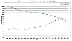
This is happening because Darjeeling's population has grown a lot, and there's been a lot of deforestation. Forests and pastures have shrunk, while cultivated land has increased. This affects the soil and water supply. Uncontrolled building, especially tall buildings on unstable slopes, also causes problems and can lead to landslides.
Plants and Animals of Darjeeling
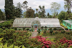
Darjeeling is part of the Eastern Himalayan region, which is rich in wildlife. The forests around Darjeeling have trees like sal and oak, and many rare orchids. The Lloyd's Botanical Garden protects different plant species. The Padmaja Naidu Himalayan Zoological Park works to save and breed endangered Himalayan animals.
However, Darjeeling's forests are shrinking due to the demand for wood and pollution from vehicles. The area is home to various birds, small mammals like civets and mongooses, and larger animals like Himalayan black bears and red pandas. The zoo has a special program to help red pandas. You can also find unique creatures like the Himalayan newt and a rare type of dragonfly here.
Who Lives in Darjeeling?
In 2011, Darjeeling municipality had about 118,805 people. More than half were females. Most people in Darjeeling can read and write, with a literacy rate of 93.9%. About 22.4% of the population belongs to scheduled tribes and 7.7% to scheduled castes, which are groups recognized by the Indian Constitution for special support.
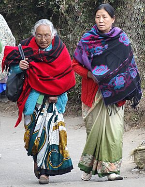
Most people in Darjeeling are Indian Gorkhas, who are Nepali-speaking people from India. There are also smaller groups like Lepchas, Bhutias, and Tibetans. People in Darjeeling follow different religions:
- Hinduism (66.5%)
- Buddhism (23.9%)
- Christianity (5.1%)
- Islam (3.9%)
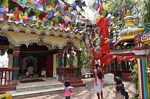
The Mahakal Temple is a holy place for both Hindus and Buddhists. Many Buddhist monasteries, called gompas, are also found here, like the Ghoom Monastery.
Because many different groups live closely together, Darjeeling has a unique culture that mixes traditions. Many young people, especially those with higher education, are moving out of Darjeeling to find jobs in bigger cities like Delhi or Kolkata. They sometimes face discrimination because of their appearance.
How Darjeeling is Governed
The Darjeeling Municipality is very old, started in 1850. It's run by a board of councillors led by a chairperson. The town is divided into 32 wards, which are like electoral districts.
The size of the town was reduced in 2011 to about 7.43 square kilometers (2.87 square miles). By 2016, the town was surrounded by tea gardens and forest land, so it couldn't easily expand.
Some parts of Darjeeling, especially wards 15, 19, 20, 21, 22, 24, and 25, are considered the main areas with most businesses and schools. Other wards, like 1, 2, 13, 14, 27, 31, and 32, are less developed and have more slums.
Since 1988, the Gorkha-dominated hill areas of Darjeeling district have had some self-governance. This was first under the Darjeeling Gorkha Hill Council (DGHC) and then, from 2012, under the Gorkhaland Territorial Administration (GTA). The GTA manages local affairs like education and land, but cannot make laws or collect taxes.
Darjeeling town is part of the Darjeeling Assembly constituency for state elections and the Darjeeling parliamentary constituency for national elections.
Darjeeling's Economy: Tea and Tourists
Darjeeling's economy mainly depends on tea production and tourism.
Tea Production
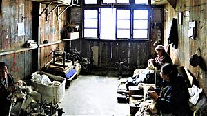
Darjeeling tea is grown on plantations where women carefully pick a few leaves from each tea bush. In winter, the bushes are pruned to help them grow better. In the factories, men use machines to process the tea leaves.
After India became independent, Indian owners bought many of the tea estates from the British. The workers, mostly from Nepal, continued to live and work on these estates. They are often given homes on the plantation, which they maintain.
In 2017, a Darjeeling tea garden worker earned about 144.60 Indian Rupees per day, plus benefits like food and fuel. This was less than what tea workers earned in some southern Indian states, even though Darjeeling tea sells for a higher price. About 60% of the tea plantation jobs in Darjeeling are held by women.
Darjeeling tea is produced in two main forms:
- Orthodox tea looks like twisted, dried green leaves. This type is mostly made in the Darjeeling sub-division and is often exported, making it some of the world's most expensive tea.
- Crush, Tear, Curl (CTC) tea is made by machines that turn the leaves into tiny, hard pellets. This type is cheaper and is often boiled with milk and sugar, making India a nation of tea drinkers.
The area used for growing Darjeeling tea has changed over the years. It increased until 1990 but then dropped. This decline was partly due to India's economic changes in the 1990s, which made tea less profitable for some owners.
Tourism in Darjeeling
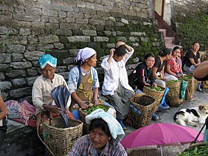
Darjeeling has two main tourist seasons: September to November and April to May. Most tourists are from India. The Chowrasta is a popular spot for shopping and gathering. Many tourists also visit the tea plantations. Some old bungalows on the plantations have been turned into fancy hotels.
Darjeeling has been a popular tourist spot since the 1860s. After India's economy opened up in 1991, tourism became more affordable, making Darjeeling a destination for many more people. Between 2009 and 2014, the number of tourists visiting Darjeeling ranged from about 243,000 to 488,000 each year. Most of these were Indian tourists.
The Darjeeling Himalayan Railway (DHR), also known as the "Toy Train," is a big tourist attraction. This narrow-gauge railway travels 88 kilometers (55 miles) from Siliguri. It moves slowly, pulled by steam locomotives, giving tourists a feel of old-time travel. In 1999, the DHR was declared a World Heritage Site by UNESCO.
While tourism is important, it mostly affects a small part of the town. This means it doesn't create enough jobs for everyone in Darjeeling, leading to high unemployment.
Services and Facilities
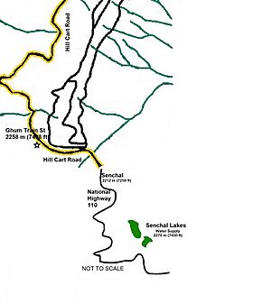
Darjeeling gets its water from natural springs in the Senchal Wildlife Sanctuary, about 11 kilometers (7 miles) away. The water is collected and then piped to the town after being cleaned. However, the water pipes are old and need repair, leading to a lot of water loss.
The water system was designed for a much smaller population. With the city's growth, there's a big shortage of water. Many residents have to buy water from private sellers, who deliver it in tankers or carts.
Darjeeling produces about 30 to 50 metric tonnes of solid waste every day. This waste is often dumped in open areas, which causes problems.
In 1897, Darjeeling was the first town in India to get electricity from hydroelectricity, which is power generated from water. Today, electricity comes from other sources.
Getting Around Darjeeling
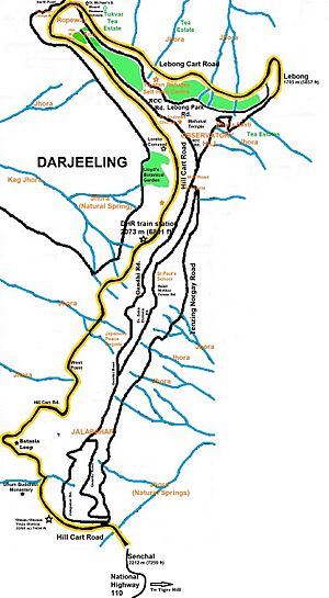
Darjeeling has two main roads: Hill Cart Road and Lebong Cart Road. Most of the roads are narrow, between 6 and 7 meters (20-23 feet) wide. About half of Darjeeling's roads are paved and can be used by vehicles. Illegal parking makes the roads even more crowded.
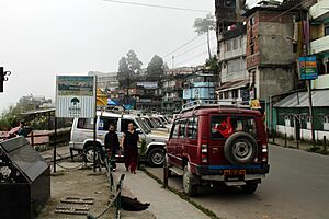
Darjeeling doesn't have a public bus system. Most people walk or use shared taxis. These taxis often drop off and pick up passengers in the main shopping area, causing traffic and pollution. In 2015, the local government tried to introduce battery-powered taxis to reduce pollution, but they didn't work well on the steep streets and were removed.
You can reach Darjeeling by road from Siliguri, which is about 77 kilometers (48 miles) away. Roads and railways can sometimes be blocked during the monsoon season due to landslides. The closest airport is Bagdogra Airport, about 90 kilometers (56 miles) from Darjeeling.
Darjeeling's Unique Culture
Darjeeling's culture is very diverse, with many different ethnic groups mixing and creating new traditions.
People celebrate many festivals, including Dashain, Tihar (Diwali), Holi, and Christmas. Some groups, like Tibetans and Lepchas, follow Tibetan Buddhism and celebrate festivals like Losar.
Popular Hindu gods include Durga, Kali, and Shiva. The Mahakal Temple is a holy place for both Hindus and Buddhists. There are also several Buddhist monasteries, or gompas, that hold ancient Buddhist writings. A Peace Pagoda was built in 1992 by a Japanese Buddhist group.
The Darjeeling Carnival is a ten-day event that celebrates the region's music and culture. Darjeeling also has a strong literary culture, especially in the Nepali language. Western music has been popular in Darjeeling for a long time, and many early Nepali hotel bands came from here.
Football is the most popular sport in Darjeeling. People often play with a special ball made of rubber bands, called Chungi, on the steep streets.
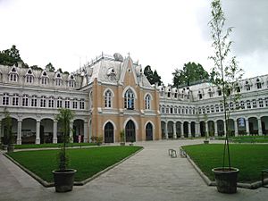
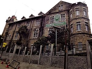
Darjeeling's architecture shows its colonial past, with many old cottages, Gothic churches, and famous institutions.
Delicious Darjeeling Food
in a roadside stall]] The food in Darjeeling is similar to other parts of the Darjeeling hills. People traditionally start their day with tea, sometimes butter tea made with butter and salt. The main meals are usually eaten twice a day and consist of cooked rice, dal (lentil soup), cooked vegetables, and fermented foods like yogurt (dahi) or hard cheese (chhurpi). This meal is often called bhat-dal-tharkari-achar.
Some people, especially Bhutia and Lepcha, also eat thukpa noodles in soup. While rice is the main staple, roti (wheat bread) is also popular in urban areas. Goyang, a fermented wild plant, is also eaten.
Certain foods are important for festivals. Sel roti, a fried doughnut-like pastry, is eaten during Gorkha festivals. Dahi is used in ceremonies. Alcoholic drinks like tongba (made from millet) are also part of celebrations and rituals.
Most Gorkhas eat chicken, mutton, buffalo, and pork, but beef is usually avoided except by some groups like Tamang and Sherpa. Many families prepare their own fermented foods at home. Meals are often eaten by hand, sitting on bamboo mats in the kitchen.
A very popular food in Darjeeling is the momo, a steamed dumpling filled with meat or vegetables, served with soup. Wai-Wai noodles, originally from Nepal, are also a favorite snack.
Learning in Darjeeling
Darjeeling has several well-known schools that were first set up for British children in the 1800s. These schools, like St Joseph's (North Point), St Paul's, Mount Hermon, and Loreto Convent, offer high-quality English-medium education. They attract students from far away.
North Point and Loreto also have colleges, St. Joseph's College and Loreto College. Along with the Darjeeling Government College, these are the main colleges in Darjeeling. They are all connected to the University of North Bengal.
While private schools are expensive, some middle-class families send their children there for better opportunities. Colleges have also seen more students from rural areas. However, local colleges might not offer the same professional training as those in bigger cities, so some students leave Darjeeling after high school.
In 2003-2004, there were over 16,000 students in primary schools, over 5,000 in higher-secondary schools, and over 3,800 in colleges. However, many students don't go to college because they feel there aren't enough job opportunities in Darjeeling that match their degrees. The government college is more affordable but often lacks good facilities and enough teachers.
The water shortage in Darjeeling especially affects girls in government schools. Many schools don't have proper toilets or water for hygiene, which can make it hard for girls to attend school, especially during menstruation.
Most tea plantations only offer basic primary school education. So, many tea garden workers have fewer chances for higher education. Some families try to earn more money by raising animals or opening small shops so their children can go to private schools in nearby towns, where English is taught, hoping for better job prospects. The Nepali language was accepted as a teaching language in primary schools in Darjeeling district in 1935.
See also
 In Spanish: Darjeeling para niños
 | Tommie Smith |
 | Simone Manuel |
 | Shani Davis |
 | Simone Biles |
 | Alice Coachman |


