Dollywaggon Pike facts for kids
Quick facts for kids Dollywaggon Pike |
|
|---|---|
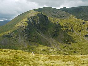
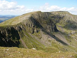
Dollywaggon Pike, seen from Deepdale Hause
|
|
| Highest point | |
| Elevation | 858 m (2,815 ft) |
| Prominence | 50 m (164 ft) |
| Parent peak | Helvellyn |
| Listing | Hewitt, Nuttall, Wainwright |
| Geography | |
| Location | Cumbria, England |
| Parent range | Lake District, Eastern Fells |
| OS grid | NY346130 |
| Topo map | OS Landranger 90, Explorer OL5 |
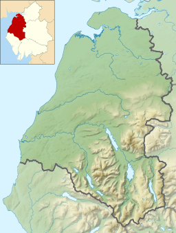
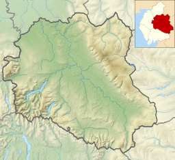
Dollywaggon Pike is a cool mountain, or "fell," found in England's famous Lake District. It's part of the main line of mountains in the Helvellyn range, which is in the Eastern Fells. This mountain stands tall between two beautiful lakes, Thirlmere and Ullswater.
Contents
What's in a Name?
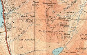
Have you ever wondered about mountain names? Dollywaggon Pike has an interesting one! You might see its name spelled "Dollywaggon" on some maps and "Dollywagon" on others. The people who make the official maps, the Ordnance Survey, use both spellings.
But most writers, like the famous Lakeland author Alfred Wainwright, prefer "Dollywaggon Pike." Some experts think the name comes from an old language called Old Norse. In Old Norse, "dolgr" means 'fiend' or 'giant,' and "veginn" means 'lifted.' So, it could mean something like 'Giant's Lifted Peak'!
Mountain Shape and Features
The Helvellyn mountain range stretches for about 7 miles from north to south. It stays high, mostly above 2,000 feet (600 meters), for its whole length. Dollywaggon Pike is the most southern mountain on this main ridge. Just north of it is Nethermost Pike. There's even a smaller peak called High Crag between them.
Many guidebooks consider High Crag to be part of Nethermost Pike. South of Dollywaggon Pike, you'll find a dip in the land with a lake called Grisedale Tarn. Beyond that, other mountains like Seat Sandal and Fairfield rise up.
West Side vs. East Side
Dollywaggon Pike looks very different depending on which side you see it from. The western side has mostly grassy slopes that go down towards Dunmail Raise. It's pretty smooth, except for a wide, stony path made by many hikers over the years.
But the eastern side is much more rugged! It's full of rocks, boulders, and loose stones. It looks wild and untamed.
Water Flow and Old Mines
The western side is called Willie Wife Moor. Two streams, Birkside Gill and Raise Beck, flow down this side. Raise Beck used to flow south to a lake called Grasmere. But in 1884, it was changed to flow north into Thirlmere, which is now a reservoir.
This change made Dollywaggon Pike special. Its water could reach the sea in three different places! Birkside Gill's water goes to the Irish Sea. Raise Beck's water (when it flows both ways) goes to Morecambe Bay. And water from the eastern side goes to Ullswater and then to the Solway Firth.
You can also find old mine tunnels on the western side, near Birkside Gill. People dug for copper here between 1840 and 1866.
On the eastern side, you'll see lots of rock. A long valley called Grisedale runs northeast towards Ullswater. This valley has several smaller valleys that drop down from the Helvellyn range.
Ruthwaite Cove and Cock Cove
To the northeast of Dollywaggon Pike is Ruthwaite Cove. This is a bowl-shaped hollow surrounded by cliffs. Today, it has a climbing hut called Ruthwaite Lodge. But long ago, it was a busy mining spot. Miners looked for lead here, possibly as early as the 1500s! The last time they worked these mines was in 1880.
East of Dollywaggon Pike is another bowl-shaped hollow called Cock Cove. It has impressive cliffs like Falcon Crag.
The Tongue and Grisedale Tarn
Between these two coves, Dollywaggon Pike has a cool, rocky ridge called The Tongue. This narrow ridge climbs up to the summit with many rocky steps. At the bottom of The Tongue is Spout Crag, which makes hikers take a little detour.
North of Dollywaggon Pike, the ridge gets narrower before climbing up to Nethermost Pike. To the south, the land curves around Cock Cove and then slopes down to Grisedale Tarn. This is a good-sized mountain lake, about 110 feet (34 meters) deep. It's home to brown trout, perch, and eels. The water from Grisedale Tarn flows into Ullswater.
Reaching the Top
The Tongue offers a fantastic, though long, way to climb Dollywaggon Pike if you start from Patterdale. You can also reach the mountain from the Grasmere area by going past Grisedale Tarn. Climbing the western slopes is easier but not as exciting.
Once you reach the top, you'll find a small grassy area with a pile of stones, called a cairn. From here, the views are amazing, especially towards the east!
 | Selma Burke |
 | Pauline Powell Burns |
 | Frederick J. Brown |
 | Robert Blackburn |


