
Fair Isle facts for kids
| Gaelic name | Fara |
|---|---|
| Norse name | Friðarøy/Friðarey |
| Meaning of name | "fair island" or possibly "far-off isle" or "sheep isle". The Norse form Friðarey means literally "calm/peaceful isle" or "island (ey) of tranquility (frið(u)r)". |
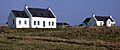
 Fair Isle viewed from the west. |
|
| OS grid reference | HZ209717 |
| Coordinates | 59°32′28″N 1°37′23″W / 59.541°N 1.623°W |
| Physical geography | |
| Island group | Shetland |
| Area | 768 ha (1,900 acres) |
| Area rank | 61 |
| Highest elevation | Ward Hill 217 m (712 ft) |
| Administration | |
| Sovereign state | United Kingdom |
| Country | Scotland |
| Council area | Shetland Islands Council |
| Demographics | |
| Population | 65 |
| Population density | 7.16/km2 (18.5/sq mi) |
| Largest settlement | Stonybreck |
 |
|
| The view eastwards towards the Fair Isle North Lighthouse | |
| Location | Fair Isle Shetland Scotland |
|---|---|
| Coordinates | 59°33′08″N 1°36′34″W / 59.552142°N 1.609519°W |
| Year first constructed | 1892 |
| Automated | 1983 |
| Construction | masonry tower |
| Tower shape | cylindrical tower with balcony and lantern |
| Markings / pattern | white tower, black lantern, ochre trim |
| Height | 14 m (46 ft) |
| Focal height | 80 m (260 ft) |
| Intensity | 204,000 cd |
| Range | 22 nmi (41 km) |
| Characteristic | Fl (2) W 30s. |
| Fog signal | 3 blasts every 45 s |
| Admiralty number | A3756 |
| NGA number | 3316 |
| ARLHS number | SCO-078 |
 |
|
| Fair Isle South light | |
| Location | Fair Isle Shetland Scotland |
|---|---|
| Coordinates | 59°30′50″N 1°39′09″W / 59.513906°N 1.652611°W |
| Year first constructed | 1892 |
| Automated | 1998 |
| Construction | masonry tower |
| Tower shape | cylindrical tower with balcony and lantern |
| Markings / pattern | white tower, black lantern, ochre trim |
| Height | 26 m (85 ft) |
| Focal height | 32 m (105 ft) |
| Range | 22 nmi (41 km) |
| Fog signal | 2 blasts every 60 s |
| Admiralty number | A3750 |
| NGA number | 3312 |
| ARLHS number | SCO-078 |
Fair Isle is a small island in northern Scotland, part of Shetland. It's located about halfway between mainland Shetland and Orkney. This island is famous for its special knitting style and its important bird observatory. Since 1954, the National Trust for Scotland has owned Fair Isle, helping to protect its unique environment.
Contents
Exploring Fair Isle's Geography

Fair Isle is known as the most remote inhabited island in the United Kingdom. It's part of the Dunrossness area in Shetland. The island is about 4.8 kilometers (3 miles) long and 2.4 kilometers (1.5 miles) wide. Its total area is around 8 square kilometers (3 square miles). This makes it the tenth largest island in the Shetland group. The island is so well-known that it even has a British Sea Area named after it.
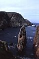
Most people on Fair Isle live in crofts (small farms) in the southern part of the island. The northern half is mostly rocky moorland. The western coast has tall cliffs that reach up to 200 meters (656 feet) high. The highest point on the island is Ward Hill, which is 217 meters (712 feet) tall. On the eastern side, there's a nearly separate piece of land called Sheep Rock, rising to 132 meters (433 feet).
Fair Isle's Rich History

People have lived on Fair Isle since the Neolithic (New Stone Age) period. This is amazing because the island doesn't have many natural resources. However, it's surrounded by waters rich in fish. There are also two Iron Age sites found here. One is an old fort at Landberg, and the other is a house foundation under an early Christian settlement at Kirkigeo.
Most of the island's place names come from the Norse people who settled the Northern Isles after the 9th century. By then, the croft lands had already been used for hundreds of years.
From the 9th to the 15th centuries, Fair Isle was owned by Norway. In 1469, Shetland and Orkney became part of Scotland. This happened when the King of Denmark's daughter, Margaret, married James III of Scotland.
Shipwrecks and Island Life
On August 20, 1588, a ship from the Spanish Armada, called El Gran Grifón, crashed near Stroms Hellier. About 300 sailors had to live with the islanders for six weeks. The shipwreck was found in 1970. Later, in 1877, a large Canadian sailing ship named Black Watch also wrecked on Fair Isle.

The National Trust for Scotland bought Fair Isle in 1954 from George Waterston. He was the person who started the bird observatory. Back then, many homes didn't have electricity or running water. The number of people living on the island was getting smaller.
The population of Fair Isle has slowly gone down from about 400 people in 1900. In 2015, there were around 55 permanent residents. Most of them were crofters, meaning they farmed small plots of land. By April 2021, the population was 48. Fair Isle became the first place in the UK where all adults had received the COVID-19 vaccine.
The island has 14 scheduled monuments. These range from the very first signs of human life to the remains of a Second World War radar station. The two automated lighthouses on the island are also protected as listed buildings.
Fair Isle is important for modern communication too. It has high-tech relay stations that send TV, radio, phone, and military signals. These links connect Shetland, Orkney, and the Scottish mainland. This continues the island's long history of being a signal station. In 1976, old World War Two radar buildings were used to house new equipment for color TV broadcasts.
Fair Isle's Role in Wartime
During the Second World War, the Royal Air Force built a radar station on Ward Hill. You can still see the ruined buildings and Nissen huts there today. There's also a disused cable railway that used to carry supplies up the hill.
On January 17, 1941, a German bomber crashed on the island. It was a Heinkel He 111 plane used for weather checks. British Hawker Hurricane fighters damaged its engines. The pilot crash-landed to avoid falling into the sea. Two crew members died and were buried in the island's churchyard. The three survivors were held by the islanders until they could be taken off.
The South Lighthouse was also attacked during the war. In 1941, the wife of an assistant keeper was killed, and their daughter was hurt. In 1942, another keeper's wife and daughter also died in a raid.
On July 22, 1941, a Spitfire plane crash-landed on Fair Isle. The pilot, F/O M.D.S Hood, was returning from a mission over Norway. The plane was later fixed and flew again, and the pilot survived the war.
Fair Isle's Economy and Jobs
Over many centuries, Fair Isle has been owned by different people. It has strong trading links with Northern Europe. The Fair Isle Haa, a traditional trading post, shows these connections. Rent was often paid to landlords with butter, cloth, and fish oil.
Fishing has always been a key industry for the islanders. In 1702, the Dutch and French fought a naval battle near the island because of the valuable herring fisheries.
Fair Isle is also famous for its woollen jumpers. The unique knitting style is a very important way for women on the island to earn money. For men, crofting (small-scale farming) is the main activity.
In January 2004, Fair Isle was recognized as a Fairtrade Island. This means it supports fair prices and good working conditions for its producers.
Amazing Bird Life on Fair Isle
Fair Isle is a fantastic place for birds! Many rare bird species have been seen here. At least 27 species recorded on the island were the first of their kind ever seen in Britain. It's probably the best place in western Europe to spot shy Siberian birds like the Pechora pipit or lanceolated warbler.
For example, in 2015, rare birds found on the island included the pallid harrier and several types of warblers like the arctic warbler. The island is also home to a special kind of Eurasian wren, called the Fair Isle wren. This wren is found only on Fair Isle.
Fair Isle Bird Observatory
A special bird observatory was started on Fair Isle in 1948 by George Waterston. Because the island is so important for bird migration, the observatory also provided most of the accommodation for visitors. It was unique because it offered catered meals, not just hostel-style rooms.
In 2010, a new observatory building was constructed. This wooden lodge cost £4 million and could host about 30 guests. Sadly, this building was destroyed by fire on March 10, 2019. Luckily, all the observatory's important bird records had been saved digitally. Rebuilding the observatory is estimated to cost £7.4 million.
Life and Services on Fair Isle

Fair Isle has a few essential services. Other than the Bird Observatory's restaurant and small bar, there are no other pubs or restaurants. The island has one shop and one school. There's also a community hall for meetings and social events. There is no police station on the island. The main police station is in Lerwick.
You can get to Fair Isle by ferry or by plane. The Good Shepherd IV ferry takes passengers from Grutness on Shetland Mainland. A small nine-seat plane also flies from Tingwall Airport near Lerwick.
Electricity Supply
Fair Isle is not connected to the main power grid of Great Britain. The Fair Isle Electricity Company provides power. Since October 2018, the island has had electricity 24 hours a day. This is thanks to a £3.5 million project that installed three wind turbines, along with solar panels and batteries. Before this, power came from diesel generators and two wind turbines.
Communication Services
Fair Isle has mobile phone service from Vodafone and O2. In April 2019, EE also turned on a 4G antenna on the island. This helps islanders stay connected to the rest of the world.
Emergency Services
Fair Isle has a fire station with one fire engine. It's staffed by local volunteers who are trained as a retained fire crew. This volunteer fire brigade was formed in 1996 and later became part of the national Scottish Fire and Rescue Service. A purpose-built fire station was opened in 2013.
There is also a small Coastguard cliff-rescue team on the island. Like the fire service, the Coastguard team is made up of local volunteers. They were the first British Coastguard unit to use a quad ATV (all-terrain vehicle) for rescues.
For medical care, Fair Isle has a community nurse. In emergencies, the nurse provides first aid. Patients who need more serious help are usually taken to Shetland Mainland by helicopter air ambulance.
Getting Around Fair Isle
Air Travel

Fair Isle Airport offers flights to Tingwall Airport near Lerwick and weekly flights to Sumburgh Airport on Shetland Mainland. Private planes also use the airport. There's a small terminal building, but other facilities are limited. The island's fire service provides fire safety at the airport.
There are also helipads at both the North and South Fair Isle lighthouses. These are used by the Northern Lighthouse Board and Coastguard helicopters.
Sea Travel
Fair Isle has two main natural harbors, a north harbor and a south harbor. They are protected by the headland of Bu Ness. The north harbor is the main place for goods, supplies, and mail to arrive and leave the island. The ferry Good Shepherd IV travels between Fair Isle north harbor and Grutness on Shetland Mainland. In the summer, the ferry also sails from Lerwick every two weeks.
Roads
A road connects the populated areas of the island, running along its entire length.
Education on Fair Isle
Fair Isle has one primary school with two classrooms. It has a full-time head teacher and a part-time assistant teacher. The number of students changes, but it's usually between 5 and 10. As of early 2020, there were 4 pupils. Older students who are secondary school age usually go to school off the island. They live in dorms on Shetland Mainland and come home during holidays.
Religion on Fair Isle
Christianity is the main organized religion on Fair Isle. There are two churches: one Methodist and one Church of Scotland (Presbyterian). The Methodist Church has a local minister who works with a full-time minister on Shetland Mainland. The Methodist Church building was built in 1886.
The Church of Scotland church was built in 1892. The minister for this church also serves other nearby parishes.
Fair Isle's Climate
Fair Isle has an oceanic climate, which means it has cool summers and mild winters. This is because it's far from any large landmass. Fair Isle has the smallest temperature range of any weather station in the British Isles. This means the difference between its highest and lowest temperatures ever recorded is very small. For example, its highest temperature ever recorded since 1951 is 20.2°C (68.4°F), and its lowest is -5.6°C (21.9°F).
Even though it's often in the path of Atlantic storms, the rainfall is less than 1000 mm (39 inches) per year. This is because there isn't much heavy rain during spring and summer.
Protecting Fair Isle's Nature
Most of Fair Isle is protected by NatureScot. It is a Site of Special Scientific Interest (SSSI) and a Special Area of Conservation (SCA). The island and its surrounding waters are also a Special Protection Area (SPA) because of the important bird species that live there.
In 2016, the seas around Fair Isle became a Marine Protected Area (MPA). This MPA is special because it's used for "Demonstration and Research." Its goals include:
- Watching seabirds and other marine animals.
- Studying what affects these animal populations.
- Developing sustainable fishing for shellfish.
- Researching local fisheries to understand fish types and numbers.
- Using this research to create plans for sustainable fishing.
Images for kids
-
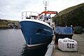
Good Shepherd IV at Fair Isle
-
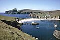
North Haven, Fair Isle, 1974
-
Da Sherriff
-
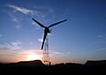
100 kW Aerogenerator, Fair Isle
-

Fair Isle fire station
-

Inside Fair Isle Kirk
-
Fair Isle - Croft houses


See also
 In Spanish: Isla Fair para niños
