Georgetown (Washington, D.C facts for kids
|
Georgetown Historic District
|
|
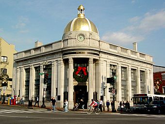
PNC Bank at M Street & Wisconsin Avenue, NW
|
|
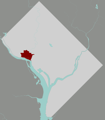
Map of Washington, D.C., with Georgetown highlighted in maroon.
|
|
| Location | Roughly bounded by Whitehaven Street, Rock Creek Park, the Potomac River, and the Georgetown University campus |
|---|---|
| Area | 750 acres (300 ha) |
| NRHP reference No. | 67000025 |
Quick facts for kids Significant dates |
|
| Added to NRHP | May 28, 1967 |
| Designated NHLD | May 28, 1967 |
Georgetown is a famous and historic neighborhood in Washington, D.C.. It's located in the northwest part of the city, right along the Potomac River. Georgetown is known for its shops, restaurants, and fun places to visit.
This area was founded way back in 1751, in what was then the Province of Maryland. It was a busy port city even before Washington, D.C., was created! For many years, Georgetown was its own separate town. But in 1871, it became part of the larger District of Columbia. Later, in 1895, Georgetown's streets were even renamed to match the street names in Washington, D.C.
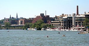
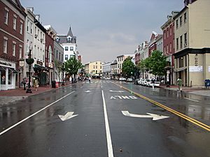
Today, the main shopping and entertainment areas are around Wisconsin Avenue and M Street. Here you'll find fancy stores, cafes, and places to eat. There are also waterfront restaurants at Washington Harbour on K Street.
Georgetown is also home to Georgetown University and many important buildings. These include the Volta Bureau and the Old Stone House, which is the oldest building in Washington, D.C., that hasn't changed much. Many countries also have their embassies here, like France, Sweden, and Ukraine.
Contents
History
Early Beginnings
Georgetown is located on a special spot called the "fall line." This meant it was the farthest point up the Potomac River that large ships could travel. Back in 1632, an English fur trader named Henry Fleet found a Native American village here. It was called Tohoga, and it belonged to the Nacotchtank people. The area was then part of the English colony of Maryland.
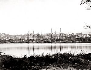
Around 1745, a merchant named George Gordon built a tobacco inspection house by the river. This spot was already a trading post for tobacco. Soon, more buildings, warehouses, and docks were built around it. Georgetown quickly grew into a busy port. It helped Maryland trade and ship its goods.
In 1751, Maryland's government bought 60 acres of land from George Gordon and George Beall. They paid £280 for it. The town was officially surveyed in 1752. Some people think Georgetown was named after King George II of Great Britain. Others believe it was named after its founders, George Gordon and George Beall.
Many churches were built in Georgetown during these early years. The first was a Lutheran church in 1769. Later, Presbyterian, Catholic, and Episcopal churches were also built. Banks and newspapers also started up, showing how much the town was growing. The first newspaper, the Republican Weekly Ledger, began in 1790.
Popular places to gather were taverns like City Tavern and Union Tavern. City Tavern is still around today as a private club.
Becoming Part of the Capital
George Washington often visited Georgetown. He made many land deals here to create the new Federal City, which would become Washington, D.C. A key person in these deals was Benjamin Stoddert, a local merchant.
In 1791, Stoddert and other landowners agreed to give land to the federal government. This happened at a dinner in Georgetown. After the new capital was established, Georgetown became an independent town within the larger District of Columbia. It had its own local government, just like the City of Washington.
The 19th Century
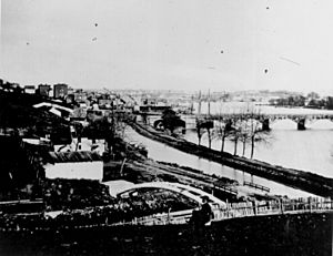
By the 1820s, the Potomac River became too shallow for large ships to reach Georgetown easily. So, in 1828, construction began on the Chesapeake & Ohio Canal (C&O Canal). This canal was meant to connect Georgetown to Harpers Ferry. It was a race against the new Baltimore & Ohio Railroad, which was much faster. The canal eventually reached Cumberland, Maryland, but it was never very profitable.
Even so, the canal helped Georgetown's economy. In the 1820s and 1830s, Georgetown was a major shipping hub. Tobacco and other goods moved between the canal and river ships. Salt from Europe and sugar from the West Indies were also imported. Later, coal and flour industries grew, using the canal for cheap power. In 1862, a horse-drawn streetcar line started on M Street, making it easier to travel between Georgetown and Washington.
In 1871, the separate governments of Georgetown and Washington were officially ended by Congress. All government power went to the District of Columbia. Then, in 1895, Georgetown's streets were renamed to match Washington's street system.
By the late 1800s, industries like flour milling in Georgetown began to decline. The canals and waterways kept filling with dirt, making shipping harder. After a big flood in 1890, the C&O Canal struggled even more. Georgetown's waterfront became more industrial, with many warehouses and small homes that lacked modern facilities. Shipping trade almost disappeared. Because of this, many older homes in Georgetown were preserved, as they weren't torn down for new development.
The 20th Century
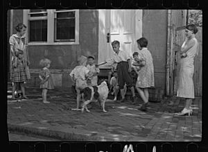
In 1915, the Buffalo Bridge (on Q Street) opened, connecting Georgetown to the rest of Washington, D.C. Soon, large apartment buildings started to appear. In the 1920s, people began working to protect Georgetown's historic look. They used new zoning laws to limit new construction. A 1933 study suggested ways to preserve the neighborhood.
The C&O Canal stopped operating in 1924. After a major flood in 1936, the canal was sold to the National Park Service. Georgetown's waterfront remained industrial for a while, with lumber yards, cement works, and flour mills. In 1949, the city built the Whitehurst Freeway, an elevated highway over K Street. This allowed drivers to bypass Georgetown when coming from the Key Bridge into downtown.
In 1950, a law called Public Law 808 was passed. This law created the "Old Georgetown" historic district. It meant that any changes, demolitions, or new buildings in the area had to be approved by the United States Commission of Fine Arts. This helped protect Georgetown's unique character.
In 1967, the Georgetown Historic District was officially added to the U.S. National Register of Historic Places.
Georgetown Today
Today, Georgetown is a popular place to live for many politicians and people who work in government. Its waterfront area was updated in 2003, and now has nice hotels and restaurants. Georgetown's main shopping streets are always busy with tourists and local shoppers. You can find many unique stores and boutiques here.
Geography
Georgetown is bordered by the Potomac River to the south and Rock Creek to the east. To the north are the neighborhoods of Burleith and Glover Park. Georgetown University is on the western side. Much of Georgetown is surrounded by parks and green spaces. These areas protect the neighborhood from nearby development and offer places for recreation. Rock Creek Park, Oak Hill Cemetery, Montrose Park, and Dumbarton Oaks are all along the north and east edges of Georgetown.
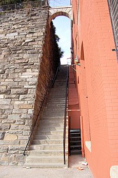
The neighborhood sits on hills overlooking the Potomac River. This means some streets running north-south are quite steep. The famous "Exorcist steps" connect M Street to Prospect Street because of this hilly land.
The main shopping areas are M Street and Wisconsin Avenue. Their fashion stores attract many visitors. The Washington Harbour complex on K Street has outdoor bars and restaurants, great for watching boat races. Between M and K Streets is the historic Chesapeake and Ohio Canal. Today, only tour boats use it, and its nearby trails are popular for walking and jogging.
People and History
In the 1850s, Georgetown had a large African-American population, including both enslaved and free people. Enslaved labor was used to build many new structures in Washington and on tobacco farms in Maryland and Virginia. Slave trading began in Georgetown in 1760 and continued until the mid-1800s, when it was banned. Congress officially ended slavery in Washington and Georgetown on April 16, 1862.
After the American Civil War, many African Americans moved to Georgetown. They built a strong community there. In 1800, about a third of Georgetown's population was African-American. A key part of this history is the Mount Zion United Methodist Church. It is the oldest African-American church in Washington. Before this church was built, free blacks and enslaved people had to sit in a crowded balcony at another church. The Mount Zion Cemetery also offered free burials for African Americans in Washington.
Education
Schools in Georgetown
Over the years, Georgetown's wealth led to the creation of many good schools. One of the first was the Columbian Academy, founded in 1781.
Today, private schools in Georgetown include Georgetown Visitation Preparatory School. Nearby is Georgetown Day School. Georgetown Preparatory School started in Georgetown but moved outside the neighborhood in 1915.
Public schools in the area are run by District of Columbia Public Schools. These include Hyde-Addison Elementary School. For older students, Hardy Middle School and Wilson High School serve Georgetown. The Duke Ellington School of the Arts, a public magnet school, is also in the community.
Georgetown University
The main campus of Georgetown University is on the western edge of the neighborhood. Father John Carroll founded this Jesuit private university in 1789. The school faced financial challenges early on, but it grew a lot after the American Civil War.
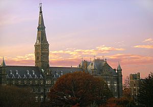
As of 2007, the university had over 6,800 undergraduate students and nearly 4,500 graduate students. The main campus is over 102 acres and has 58 buildings. Most buildings have a collegiate Gothic or Georgian brick style. The campus has fountains, gardens, and open areas. Healy Hall, built from 1877 to 1879, is a beautiful building and a National Historic Landmark.
Public Libraries
The District of Columbia Public Library has the Georgetown Neighborhood Library. It first opened in 1935. An earlier public library in Georgetown was started in 1867 by George Peabody.
The current library building was badly damaged by a fire in 2007. It then had a big renovation and reopened in 2010. It now has a special third floor that holds old collections from the original Peabody Library. This area is a great place to research Georgetown's history.
Getting Around Georgetown
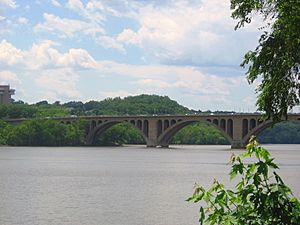
Georgetown's location below the "fall line" of the Potomac River made it important for transportation. The Aqueduct Bridge (and later the Francis Scott Key Bridge) connected Georgetown to Virginia. Before the bridge, a ferry service carried people across the river. In 1788, a bridge was built over Rock Creek to connect M Street with the Federal City.
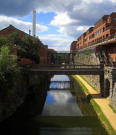
Georgetown was also where the Alexandria Canal and the Chesapeake and Ohio Canal met. The C&O Canal, which started in Georgetown in 1829, operated until 1924. Wisconsin Avenue follows an old road used for rolling tobacco barrels from Maryland. The oldest bridge in the city, the sandstone bridge that carries Wisconsin Avenue over the C&O Canal, was built in 1831. It was restored and reopened in 2007.
In the past, streetcar lines connected Georgetown to other areas. These lines ended in 1962. The Baltimore and Ohio Railroad also built a train line to Georgetown, which was used to ship coal until 1985. This old railway path is now the Capital Crescent Trail, a popular trail for walking and biking.
There is no Metro subway station directly in Georgetown. Some people didn't want one, but also, building a tunnel under the Potomac River to Georgetown would be very difficult due to the steep hills. The closest Metro stations are about a mile away: Rosslyn (across the Key Bridge in Arlington), Foggy Bottom-GWU, and Dupont Circle. Georgetown is served by several Metrobuses and the DC Circulator bus.
Historic Landmarks
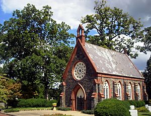
Georgetown is full of historic places, including:
- Canal Square Building: This building was once home to The Tabulating Machine Company, which later became IBM.
- The City Tavern Club: Built in 1796, it's the oldest commercial building in Washington, D.C.
- The Chesapeake and Ohio Canal: Begun in 1829, it's a famous waterway.
- Dumbarton Oaks: This historic estate was where the United Nations charter was first planned in 1944.
- Evermay: A beautiful home built in 1801.
- The Forrest-Marbury House: Here, George Washington met with landowners to get land for Washington, D.C. Today, it's the Embassy of Ukraine.
- Georgetown Lutheran Church: The first church in Georgetown, dating back to 1769.
- Georgetown Presbyterian Church: Established in 1780.
- Healy Hall: On Georgetown's campus, this building is a National Historic Landmark.
- Mount Zion United Methodist Church and Mount Zion Cemetery: Important sites for African-American history.
- The Oak Hill Cemetery: A historic cemetery with a beautiful Gothic Revival chapel. Abraham Lincoln's son Willie is buried here.
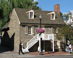
- The Old Stone House: Built in 1765, it's the oldest original building in Washington, D.C.
- Tudor Place: A historic estate with beautiful gardens.
- The Volta Laboratory and Bureau: Created by Alexander Graham Bell for his research.
Famous People Who Lived Here
Many famous people have called Georgetown home:
- Thomas Jefferson lived in Georgetown when he was Vice President.
- Francis Scott Key, who wrote "The Star-Spangled Banner", lived on M Street. He was inspired to write the song after witnessing the bombardment of Fort McHenry during the War of 1812.
- Alexander Graham Bell, who invented the telephone, moved to Georgetown. He created the Volta Laboratory here.
- John F. Kennedy lived in Georgetown in the 1950s as a Congressman and Senator. He left his townhouse on N Street to go to his presidential inauguration in 1961.
- Pulitzer Prize-winning author Herman Wouk lived here while writing his famous novels about World War II.
- Hollywood actress Elizabeth Taylor lived in Georgetown in the 1970s and early 80s.
Some current famous residents include:
- Secretary of State John Kerry
- Former Washington Post Editor Ben Bradlee
- Washington Post reporter Bob Woodward
- Former Secretary of State Madeleine Albright
Georgetown in Movies
Georgetown has been featured in many movies:
- The Exorcist (1973) was set and partly filmed here. The famous "Exorcist steps" are at the end of 36th Street NW.
- St. Elmo's Fire (1985) was set in Georgetown.
- No Way Out (1987) showed a fake Georgetown Metro stop, as there isn't one in real life.
- Other movies filmed here include Dave (1993), True Lies (1994), Enemy of the State (1998), and Wedding Crashers (2005).
 |
Burleith | Montrose Park | Kalorama |  |
| Foxhall | Dupont Circle West End |
|||
| Potomac River | Foggy Bottom |


