Hatay Province facts for kids
Quick facts for kids
Hatay Province
Hatay ili
|
||
|---|---|---|
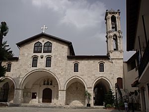
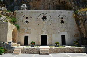
St. Paul's Church, Antakya
|
||
|
||
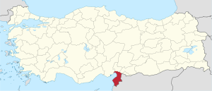
Location of Hatay Province in Turkey
|
||
| Country | Turkey | |
| Region | Mediterranean | |
| Subregion | Hatay | |
| Largest City | Antakya | |
| Provincial seat | Antakya | |
| Largest city | Antakya | |
| Area | ||
| • Total | 5,524 km2 (2,133 sq mi) | |
| Population
(end 2022)
|
||
| • Total | 1,686,043 | |
| • Density | 305.221/km2 (790.52/sq mi) | |
| Area code(s) | 0326 | |
| ISO 3166 code | TR-31 | |
| Vehicle registration | 31 | |
Hatay Province is the southernmost province in Turkey. It is located along the eastern coast of the Levantine Sea. Hatay borders Syria to its south and east. It also borders other Turkish provinces like Adana and Gaziantep.
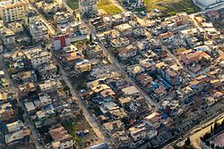
The province is partly in Çukurova, a large fertile plain. Its main city is Antakya, which was known as ancient Antioch. Hatay is one of the few Turkish provinces not named after its capital city. The second-largest city in Hatay is İskenderun.
Contents
History of Hatay Province
Ancient Times
People have lived in Hatay since the early Bronze Age. It was once part of the Akkadian Empire and later the Kingdom of Yamhad. Over time, different groups ruled the area, including the Hittites and Neo-Hittite peoples.
The region was also controlled by the Assyrians, Neo-Babylonians, and Persians. Later, it became a major center of the Seleucid Empire, a Greek kingdom. The city of Antioch became very important during the Roman Empire.
Famous old sites in Hatay include Alalakh and Antioch.
Medieval Period
In 638, the area was conquered by the Rashidun Caliphate. It then came under the control of different Arab dynasties. In 969, the Byzantine Empire recaptured Antioch.
Later, in 1084, the Seljuk Turks took control. In 1098, Crusaders captured parts of Hatay, making it the center of the Principality of Antioch. The Armenian Kingdom of Cilicia also controlled much of Hatay and allied with the Mongols.
The Mameluks then captured Hatay in 1268, but it was later taken by Timur (Tamerlane) in the 15th century.
The Sanjak of Alexandretta
When the Ottoman Empire took control in 1516, the area was known as the Sanjak of Alexandretta. A sanjak was like a governorate.
After World War I, the Ottoman Empire was defeated. Hatay was then given to France as part of the French Mandate of Syria. This was agreed upon in the Treaty of Sèvres. However, the Turkish War of Independence followed, and the new Republic of Turkey was created.
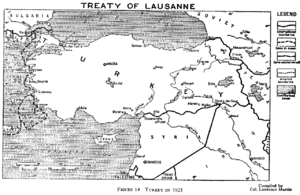
The Treaty of Lausanne later confirmed Alexandretta was part of Syria. But a special agreement in 1921 made the Sanjak of Alexandretta autonomous, meaning it could govern itself. In 1921, out of 220,000 people, about 87,000 were Turks. The population also included Arabs, Jews, Syriacs, Kurds, and Armenians.
In 1925, Hatay was directly linked to the French Mandate of Syria, but it still had special administrative status.
Mustafa Kemal Atatürk, the founder of Turkey, believed Hatay should be part of Turkey. He argued that most of its people were Turks. However, French estimates showed a more mixed population, with Arabs making up 46% and Turks 39%.
In 1937, the League of Nations helped arrange for the sanjak to become autonomous. It was "distinct but not separated" from the French Mandate of Syria.
Hatay State and Joining Turkey
From September 7, 1938, to June 29, 1939, Hatay was an independent country called the Hatay State. It was also known as the Republic of Hatay.
On June 29, 1939, Hatay officially became a Turkish province after a referendum (a public vote). This vote was controversial. Turkey moved many Turks who were originally from Hatay back to the province so they could vote.
Syrian President Hashim al-Atassi resigned because he disagreed with France allowing Hatay to join Turkey. He believed it went against a treaty.
After Hatay joined Turkey, some areas from other provinces were added to it. Many people chose to leave Hatay and move to Syria or Lebanon. This included almost half of the Sunni Arabs, many Armenians, and some Alawites and Arab Christians. Many Armenians had previously fled to Syria to escape the Armenian genocide.
The Turkish–Syrian Dispute
For a long time, Hatay was considered part of Syria. In Ottoman times, it was part of the Vilayet of Aleppo in Ottoman Syria. After World War I, the League of Nations gave the Sanjak of Alexandretta to Syria under French control.
In 1936, Turkey complained to the League of Nations. Turkey claimed that the rights of the Turkish people in the region were not being respected. Even though the Treaty of Lausanne confirmed Alexandretta as Syrian territory, it was given a special status because it had many Turkish residents.
In 1937, Atatürk made an agreement with France for Alexandretta to become an independent state. In 1939, this state, called the Republic of Hatay, joined Turkey. Syria strongly disagreed with this.
Syria believes that France illegally gave Hatay to Turkey. Syria still considers Hatay part of its own territory and shows it as such on its maps. Syrians call this land Liwa' aliskenderun.
However, in the 2000s, relations between Turkey and Syria improved. Syrian President Bashar al Assad lessened tensions over Hatay. In 2005, discussions between the two countries began. Syria agreed to stop demanding Hatay's return as a condition to end disagreements. However, Syria never officially gave up its claim.
In 2009, Turkey and Syria lifted visa requirements, allowing people to travel freely between the two countries. This helped families divided by the border to visit each other.
The Syrian Civil War started in 2011. This caused tensions between Turkey and Syria to rise again. Syrian media began to discuss Hatay's history and its annexation by Turkey. However, the Syrian government has not officially brought up the issue of Hatay's sovereignty.
2023 Turkey–Syria Earthquake
Hatay Province was severely damaged by the 2023 Turkey–Syria earthquake. Many people died and were injured in the province. Thousands of buildings collapsed or were heavily damaged. The cities of Antakya, Kırıkhan, and İskenderun were the most affected.
Geography of Hatay
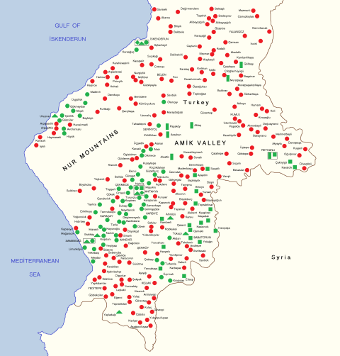
Hatay's landscape includes mountains, plains, and plateaus. The Nur Mountains run from north to south. The highest peak is Mığırtepe, at 2,240 meters.
The Orontes River flows through Hatay from Lebanon and Syria. It joins other rivers like the Karasu and Afrin. The Orontes then flows into the Mediterranean Sea. The Amik Valley used to have a lake, but it was drained in the 1970s. Now, Amik is a large agricultural area.
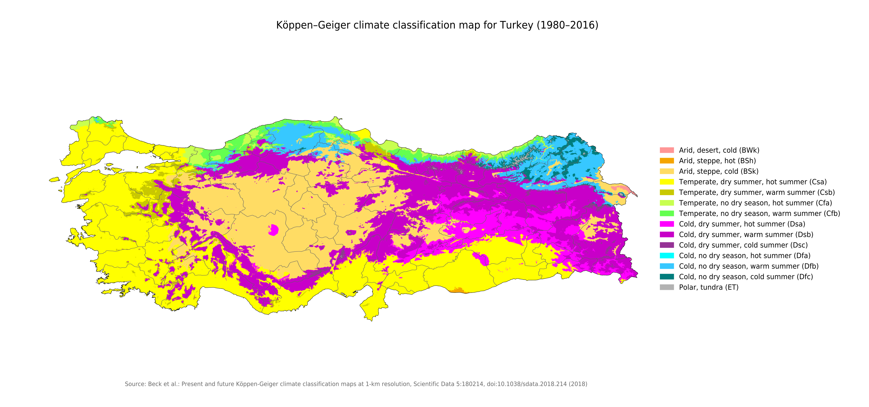
Hatay has a typical Mediterranean climate. This means it has warm, wet winters and hot, dry summers. The mountains inland are drier than the coast. Hatay also has some mineral deposits. İskenderun has Turkey's largest iron and steel plant.
Climate in Hatay
Hatay has a humid Mediterranean climate. This means it has very hot, long, and dry summers. The winters are cool and rainy.
| Climate data for Hatay (1991–2020, extremes 1940–2020) | |||||||||||||
|---|---|---|---|---|---|---|---|---|---|---|---|---|---|
| Month | Jan | Feb | Mar | Apr | May | Jun | Jul | Aug | Sep | Oct | Nov | Dec | Year |
| Record high °C (°F) | 20.5 (68.9) |
26.6 (79.9) |
30.5 (86.9) |
37.5 (99.5) |
42.5 (108.5) |
43.2 (109.8) |
44.6 (112.3) |
43.9 (111.0) |
43.5 (110.3) |
39.2 (102.6) |
32.5 (90.5) |
25.1 (77.2) |
44.6 (112.3) |
| Mean daily maximum °C (°F) | 12.5 (54.5) |
14.9 (58.8) |
19.0 (66.2) |
23.0 (73.4) |
27.0 (80.6) |
29.7 (85.5) |
31.6 (88.9) |
32.5 (90.5) |
31.4 (88.5) |
28.2 (82.8) |
20.3 (68.5) |
13.9 (57.0) |
23.7 (74.7) |
| Daily mean °C (°F) | 8.2 (46.8) |
9.9 (49.8) |
13.6 (56.5) |
17.4 (63.3) |
21.6 (70.9) |
25.1 (77.2) |
27.6 (81.7) |
28.3 (82.9) |
26.1 (79.0) |
21.5 (70.7) |
14.3 (57.7) |
9.5 (49.1) |
18.6 (65.5) |
| Mean daily minimum °C (°F) | 5.0 (41.0) |
5.9 (42.6) |
9.1 (48.4) |
12.6 (54.7) |
16.9 (62.4) |
21.3 (70.3) |
24.4 (75.9) |
25.2 (77.4) |
21.7 (71.1) |
16.2 (61.2) |
9.8 (49.6) |
6.2 (43.2) |
14.5 (58.1) |
| Record low °C (°F) | −11.8 (10.8) |
−6.8 (19.8) |
−4.2 (24.4) |
1.5 (34.7) |
7.7 (45.9) |
11.6 (52.9) |
15.9 (60.6) |
15.4 (59.7) |
7.9 (46.2) |
2.3 (36.1) |
−3.0 (26.6) |
−6.6 (20.1) |
−11.8 (10.8) |
| Average precipitation mm (inches) | 179.5 (7.07) |
162.0 (6.38) |
145.1 (5.71) |
108.4 (4.27) |
89.8 (3.54) |
20.3 (0.80) |
8.1 (0.32) |
5.4 (0.21) |
61.7 (2.43) |
56.0 (2.20) |
99.2 (3.91) |
188.7 (7.43) |
1,124.2 (44.26) |
| Average precipitation days | 13.57 | 12.07 | 11.20 | 9.73 | 5.67 | 1.83 | 0.80 | 0.80 | 4.33 | 7.70 | 8.03 | 11.40 | 87.1 |
| Mean monthly sunshine hours | 105.4 | 130.0 | 186.0 | 219.0 | 282.1 | 327.0 | 341.0 | 319.3 | 273.0 | 217.0 | 156.0 | 102.3 | 2,658.1 |
| Mean daily sunshine hours | 3.4 | 4.6 | 6.0 | 7.3 | 9.1 | 10.9 | 11.0 | 10.3 | 9.1 | 7.0 | 5.2 | 3.3 | 7.3 |
| Source: Turkish State Meteorological Service | |||||||||||||
Districts of Hatay
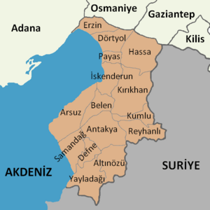
Hatay province is divided into 15 districts. Here are some of them with their populations from 2022:
- Altınözü (60,344)
- Antakya (399,045)
- Arsuz (101,233)
- Belen (34,449)
- Defne (165,494)
- Dörtyol (128,941)
- Erzin (41,558)
- Hassa (56,675)
- İskenderun (251,686)
- Kırıkhan (121,028)
- Kumlu (13,333)
- Payas (43,919)
- Reyhanlı (108,092)
- Samandağ (123,447)
- Yayladağı (36,803)
People and Culture
Population and Languages
Most people in Hatay follow Islam, either the Alawi branch or Sunni Islam. There are also smaller groups like Syriac Orthodox, Syriac Catholic, Maronite, Antiochian Greek, and Armenian communities. The village of Vakıflı is Turkey's last rural Armenian community.
Arabic is still widely spoken in Hatay. This is because the province has kept much of its traditional culture. In 2005, a "Hatay Meeting of Civilisations" event was held to celebrate this cultural mix.
Since the Syrian Civil War, many Syrian refugees have moved to Hatay. In 2016, there were over 400,000 Syrian refugees living in the province.
As of 2016, many Arabic speakers in Hatay believe the use of Arabic is decreasing.
Population Growth
| Historical population | ||
|---|---|---|
| Year | Pop. | ±% p.a. |
| 1940 | 246,138 | — |
| 1950 | 296,799 | +1.89% |
| 1960 | 441,209 | +4.04% |
| 1970 | 591,064 | +2.97% |
| 1980 | 856,271 | +3.78% |
| 1990 | 1,109,754 | +2.63% |
| 2000 | 1,253,726 | +1.23% |
| 2010 | 1,480,571 | +1.68% |
| 2020 | 1,659,320 | +1.15% |
| 2021 | 1,670,712 | +0.69% |
| 2022 | 1,686,043 | +0.92% |
| Source:Turkstat | ||
Education and Transport
Mustafa Kemal University is a newer university in Hatay. It was founded in İskenderun and Antakya in 1992.
Hatay Province is served by Hatay Airport. You can also travel around the province using inter-city buses.
Delicious Cuisine
Hatay's warm climate allows it to grow tropical crops like sweet potato and sugar cane. These are used in local dishes.
Some famous dishes from Hatay include:
- Künefe: a sweet pastry with syrup and shredded dough.
- Sıhılmahsi: squash cooked with onions and tomato paste.
- Baba ghanoush: a dip made from eggplant and tahini.
- Hummus: a dip made from chickpeas and tahini.
Special spice and herb mixes are also popular. You can find pastes like muhammara (walnut and spice paste) and Za'atar (thyme and parsley paste). Local animal products include spicy meatballs called köfte (oruk) and spicy sun-dried cheese called surke.
Pomegranate syrup (nar ekşisi) is a popular salad dressing in Hatay.
Famous Landmarks
Hatay has many interesting places to visit:
- Hatay Archaeology Museum in Antakya: It has the world's second-largest collection of Roman mosaics.
- Habib-i Najjar Mosque: This mosque was built on an old pagan temple. Two saints are buried here, and Muslims visit their graves.
- Church of St Peter: This church is carved into a rock in Antakya. It is a Christian pilgrimage site.
- Gündüz cinema: This building was once the parliament of the Republic of Hatay.
- Titus Tunnel of Vespasian: Located in Samandağı, this was a water channel built in the 2nd century.
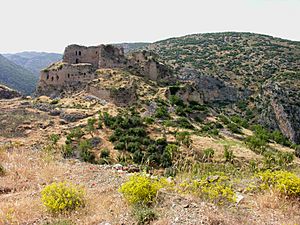
- Castles: There are many castles, including Koz Castle, Bakras Castle, and Payas Castle.
Hatay in Films
- The movie Indiana Jones and the Last Crusade features Hatay. In the film, it is where the Holy Grail is supposedly found. The movie shows a fictional Sultan of Hatay.
- The Turkish film Propaganda (1999) shows how the Turkish-Syrian border was created in 1948. It explores how this divided villages and families.
- The 2001 film Şelale was filmed in Hatay by local director Semir Aslanyürek.
Notable People from Hatay
- Mehmet Aksoy – a sculptor born in Antakya in 1939.
- Gökhan Zan – a footballer who played for Beşiktaş and Galatasaray. He was born in Antakya in 1981.
- Selçuk İnan – a footballer who played for Trabzonspor and Galatasaray. He was born in İskenderun in 1985.
- İsmail Köybaşı – a footballer who played for Beşiktaş and Fenerbahçe. He was born in İskenderun in 1989.
- Yasin Özdenak – a retired footballer for Galatasaray. He was born in İskenderun in 1948.
- Selami Şahin – a musician, composer, and actor. He was born in Yayladağı in 1948.
See also
 In Spanish: Provincia de Hatay para niños
- Baku–Supsa Pipeline
- Baku–Tbilisi–Ceyhan pipeline
- Çukurova
- Harbiye
- Kışlak
- List of populated places in Hatay Province
- Payas
 | Emma Amos |
 | Edward Mitchell Bannister |
 | Larry D. Alexander |
 | Ernie Barnes |


