History of Christchurch, Dorset facts for kids
Christchurch is a town located in Dorset, England. It sits right on the English Channel coast, next to Bournemouth and close to the New Forest. Long ago, it was part of Hampshire, but in 1974, it joined Dorset.
This town has been around since 650 AD! Because it was so close to the Cotentin Peninsula in France, it was a very important trading port. This also made it a possible target during big wars like the Napoleonic Wars and Second World War.
Christchurch is built where the River Avon and River Stour meet. It was first called Twynham, which means "the settlement between two rivers." The name Christchurch came later, after a large church (a priory) was built in 1094. In Saxon times, its harbour was one of England's busiest. The town became a special Royal area and a fortified town (a burgh). Throughout its history, Christchurch has seen many exciting events, including battles between Saxons, and fights between Royalists and Parliamentarians during the English Civil War. Even smugglers and tax officers had clashes here in the 1700s!
Today, Christchurch is a popular place for tourists, with about one and a half million visitors every year.
Contents
Christchurch's Early History
Saxon Times: The First Settlements
Around 650 AD, St Birinus, a very important religious leader, sent people to spread Christianity in the area. A small village on Hengistbury Head wasn't good for this job. It was too far from the busy port where traders came and went.
Instead, they found a better spot. It was a raised piece of land between the River Avon and River Stour. This area was perfect because it was high and dry, easy to defend with water on three sides, and close to where people could cross the rivers. There was also plenty of fresh water from the rivers and wells.
The town was first called Twynham, meaning "between two rivers." This name is still used today for the town's central school. In the Domesday Book, a famous survey from 1086, Christchurch is listed as Twynham with 47 households.
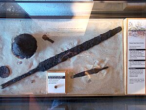
In 1977 and 1978, archaeologists dug in the Bargates area. They found an old Anglo-Saxon cemetery from the 6th or 7th century. It had graves of 34 warriors! They found many early Saxon metal objects, showing that people lived here much earlier than thought.
During Saxon times, the harbour was very important because ships could easily reach it from Europe. They could even travel up the River Avon all the way to Salisbury. Alfred the Great thought Twynham was so important that he made it a burgh (a fortified town) in the late 800s. This was to protect it from Danes who might invade.
The Anglo-Saxon Chronicle, an old historical record, tells us that in 901 AD, Aethelwold, a cousin of Alfred the Great, captured the town's defenses. Even though Aethelwold was later defeated, Edward the Elder decided to make the town even stronger.
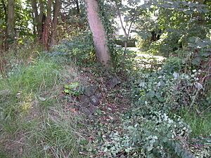
Parts of the old Saxon town wall were found in the early 1970s during archaeological digs. The wall was made of earth with stone on the outside. It probably had a wooden top for fighting and a fence. The town's gate stood at the north end until it was removed in 1744. The main road into town, Bargates, got its name from this gate.
The Priory Church: A Place of Miracles
In 1094, a powerful minister of King William II, named Ranulf Flambard, started building a large church (a priory). It was built on the same spot as an earlier mission church.
Local stories say that Flambard first wanted to build the church on nearby St. Catherines Hill. But overnight, all the building materials mysteriously moved to where the priory stands today! This "miracle" is said to be one reason why the town became known as Christchurch.
On November 28, 1539, the priory was closed down by the King. The monastic buildings were quickly pulled down. The King even planned to destroy the church itself. But the townspeople, with help from the last prior, asked him to save it. On October 23, 1540, the King gave the church and its churchyard to the people of Christchurch to use as their parish church forever. King James I confirmed this in 1612.
We are lucky that the Christchurch Priory cartulary (a collection of over 1,300 old documents) survived. It tells us a lot about the Priory and events from the Middle Ages.
The Priory church we see today was built over many centuries. The main part (nave) and side sections (transepts) are Norman, with thick columns and round arches. The lady chapel is from the 14th century and has a more Perpendicular style. The large choir was rebuilt even later, in the 16th century.
The Priory is famous for its Miraculous Beam, which attracts visitors from all over the world. From the time of King Edward I, men in the town had to practice archery after church on Sundays. This happened on a piece of land next to the church. This archery practice continued until Tudor times.
The Castle: A Stronghold Through History
In the early 1100s, Christchurch became the main town of a feudal barony. King Henry I gave it to Richard de Redvers. The castle was first built as a wooden fort on a mound (a motte and bailey). Its placement even changed the layout of nearby streets.
After Richard died, the castle went to his son, Baldwin de Redvers. Baldwin supported Empress Matilda in her claim to the throne against King Stephen during a time of civil war called The Anarchy. Around 1147, Baldwin went on a religious journey. While he was away, a commander named Walter de Pinkney captured the castle. He caused a lot of trouble locally. The townspeople eventually ambushed and killed him in the churchyard. The castle was then taken back for Baldwin. It's likely that Baldwin built the stone tower (keep) and the house (Constable's House) after he returned safely.
The castle saw more action during the Civil War (1642–1651). The Parliamentarians took control of the castle in 1644. The Royalists then tried to capture it for three days. They even knocked down houses to set up their cannons. But the Royalists couldn't take the castle. Oliver Cromwell, fearing such a strong fort, ordered it to be destroyed in 1652.
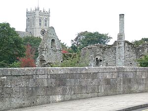
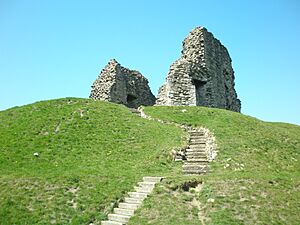
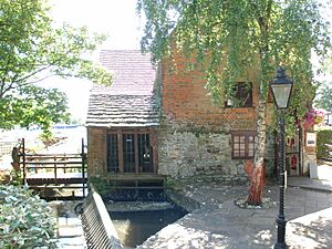
Today, the castle grounds have a bowling green and gardens. The damaged tower (keep) still stands on its steep mound, with steps for visitors. Much of the stone Constable's House, built around 1160, also survived Cromwell's order. It has a rare Norman chimney and a toilet tower (garderobe) over the nearby stream. It also had a small dock, allowing direct access to the storeroom from the stream.
Records show that King John visited Christchurch seven times between 1199 and 1216. We don't know why, but he might have been hunting in the nearby New Forest. He probably stayed at the Constable's House, as it was the only place grand enough for a king in town.
The Leper Hospital: Helping Those in Need
During the time of King Edward II, a hospital for people with leprosy was built on land given to the Priory monks by King Ethelred. Over time, the hospital received more land and also cared for people who were very ill.
After the monasteries were closed, the hospital and its lands went to the lord of the manor. Later, control passed to the town's mayor and leaders. As leprosy became less common, the hospital's purpose changed to help the poor in other ways. The charity still exists today, helping many residents each year and supporting other charities.
The English Civil War in Christchurch
In 1644, about 2,000 Roundhead cavalry soldiers, led by Sir William Waller, surprised Royalist troops in Christchurch. They captured 100 horsemen and 400 foot soldiers without a fight. Waller's men even kept their horses in the Great Choir of the Priory church. You can still see marks on the pews where the horses chewed them!
In September 1644, Christchurch had to help pay for Hurst Castle. Waller was also ordered to gather 1100 horses for the war. Even though the horses were paid for, losing so many would have hurt local farming.
In 1645, the Roundheads, now led by Major Phillip Lower, were chased away by a large group of Royalist cavalry, led by Lord Goring. However, Goring's force wasn't strong enough to hold the town, so they left. This allowed Lower's troops to return.
A few days later, Goring came back with a larger force of about 1000 men. Lower only had 200 men, but he had strengthened the town's defenses. He even pulled down some buildings to give his guns a clearer shot. Despite this, the Royalists took over the town, pushing the defenders back into the castle and the church. Since Goring didn't have big enough weapons to destroy these strong buildings, the attackers started a siege.
However, after a few days, Goring heard that more Parliamentarian soldiers were coming from Lymington. Having already lost many men, he decided to retreat. Christchurch remained in Parliamentarian hands until the end of the war. Major Lower was promoted and became Governor of Winchester. In 1650, the castle's cannons were removed, and the keep was damaged. The castle walls were also pulled down and used to fill the ditch. The battle for Christchurch must have been quite big, as many cannonballs and weapons were later found in the millstream.
Christchurch in the 1700s and 1800s
Big Plans for the Harbour
Until about 1735, boats up to 25 tons could travel up the River Avon all the way to Salisbury. In 1535, King Henry VIII even ordered that all fish traps be removed because they blocked the river. The hardest part of the journey was getting into Christchurch harbour, which had constantly moving sandbars.
In 1665, Edward Hyde, Earl of Clarendon, bought the rights to the Manor of Christchurch. He had big plans to improve trade. He decided to fix the harbour entrance by cutting a new one through the sand at Hengistbury Head. He ordered a report that said this would help big ships be built there using wood from the New Forest. It also suggested building a fort on the headland to make the harbour almost impossible to attack.
He also wanted to deepen the River Avon for larger ships, but this never happened. Still, Hyde started work on the new entrance, laying down large ironstone rocks. These rocks, now called Clarendon's Rocks, can still be seen at low tide. However, the new entrance kept filling with sand. In 1703, a huge storm hit, damaging the new entrance and filling it with sand. This seemed to be the end of the project. Over the next 150 years, many other plans were suggested, but none were ever built.
The Battle of Mudeford: Smugglers vs. Customs
Christchurch's sheltered harbour and easy access to nearby towns made it a popular spot for smugglers. This led to a famous fight called "The Battle of Mudeford" in 1784, between Customs & Excise officers and the smugglers.
In July of that year, the largest amount of illegal goods ever was brought ashore at Mudeford Haven. Three hundred men, 100 carts, and 400 horses were involved! The cargo included 6,000 barrels of spirits and 30 tons of tea. Customs officers watched, but they were too few to stop it.
Soon, more customs ships arrived, including a Royal Navy ship (HMS Orestes). The three ships sailed into the harbour. A long gunfight followed, and a Royal Navy officer, William Allen, was killed. The smugglers escaped with their goods but lost their ships, which were captured.
A search for the smugglers began, and three men were arrested. One, George Coombes, was tried and executed for Allen's murder. The owner of the smuggler ships, John Streeter, was sent to Winchester prison but escaped and fled to the Channel Islands. He later returned during the Napoleonic Wars under an amnesty.
Workhouses and Helping the Poor
Workhouses started in the 1600s as a way for towns to reduce the cost of helping the poor. The Workhouse Test Act of 1723 meant that anyone asking for help might have to go into a workhouse and do work, often without pay. This was called "indoor relief."
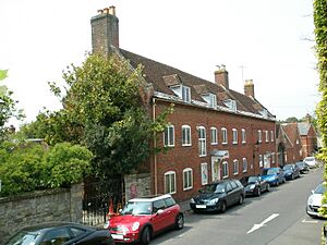
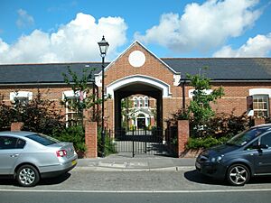
Many towns, including Christchurch, built workhouses in the 1700s. The first one in Christchurch was built in Quay Road in 1768. When the workhouse moved to a bigger building in Fairmile in 1881, the Quay Road property was bought by the Druitt family. They were wealthy lawyers who loved history. The Druitt family turned the old workhouse into a museum, which opened as The Red House Museum in 1951. The Druitt family also left a building in the High Street to be used as a library, along with all their books and papers.
James Druitt, who was mayor five times, helped stop ironstone mining at Hengistbury Head. The second workhouse in Fairmile became Christchurch Hospital in 1948, after the Welfare State was created. Much of that site was turned into housing in 1995.
Schooling: Learning in Christchurch
The first state schools in Christchurch appeared in the early 1800s. The earliest school in town was founded around 1140, but it disappeared when the monasteries were closed. Later, a free school was set up in St. Michael's Loft in the Priory. In 1662, it became a grammar school. In 1828, it became a private school. It closed in 1869 when more schools became available.
There were also private schools for those who could pay, like Christchurch School in Purewell, which opened in 1827. It was described as "an upper middle class, modern school."
The first National School opened in the High Street in 1829 on land given by Sir George Henry Rose. In 1831, 354 students were reported there. These buildings were sold in 1866, and a new school was built in Wick Lane, with 490 students. Another school opened around the same time, connected to the Congregational Church. It expanded in 1880 to hold 400 students but closed in 1926 when Clarendon Road Junior School opened. A new technical school started in 1898. Classes were held in different buildings until new classrooms were added to the Town Hall in 1903. They taught subjects like bookkeeping, math, languages, and art.
In 1930, Twynham School was built. It was the town's only secondary school until Highcliffe opened in 1963.
Services and Transport: Connecting the Town
The railway arrived in Christchurch in 1847. However, the first station, Christchurch Road, was at Holmsley, and passengers had to take a bus the rest of the way. A station was built in the town in 1862, connected by a branch line from Ringwood. Christchurch joined the main railway line in 1883, and a new station was built. The branch line to Ringwood closed in 1935.
The arrival of railways changed sea trade. More goods came by train and less by sea. By 1906, sea trade had almost stopped. In 1908, Christchurch Council rebuilt the Town Quay. It became a hub for pleasure boat companies serving tourists. The last trade ship to leave the Town Quay was a gravel barge in 1938. However, Mudeford still has a working quay today.
A gas works was built in 1853, and gas replaced oil for street lighting. Electricity took over in 1930, even though a power station had opened in 1903.
In 1873, over 300 acres of common land were enclosed. This area, north of the town, had prevented expansion. After this land was enclosed, the town's population grew a lot. Between 1871 and 1891, the population increased by about 225% to almost 15,000. The second workhouse, the Drill Hall, both Clarendon Road schools, and a police station were all built on this old land. Most of it was used for housing. Today, only about 10 acres remain as the town's recreation ground, but the name lives on in places like Portfield Hall and Road.
Christchurch in the 1900s
Modern Services and Transport
Work on the town's sewage system began in 1902. Before this, drinking water was often dirty, causing diseases like smallpox and cholera. Beer became very popular, and brewing was a big business. In 1855, Christchurch had 6 breweries, 16 inns, and 26 alehouses, even though the population was less than 4,000.
A power station was built in 1903 to power the public trams. It used coal and water from the River Avon. The power station produced 500 volts of direct current. Even when the boilers were shut down at night, there was enough power to light the town. In 1940, it joined the national grid. Today, the power station is a museum and a protected building. It is one of the most complete buildings of its kind.
Trams ran from 1905 to 1936, when they were replaced by trolleybuses. The last trolleybus ran in 1969. Tuckton Bridge, first built in 1883 as a wooden bridge, had to be rebuilt in 1905 to hold the weight of the trams. The main road out of town was also widened by knocking down buildings on the west side, though many were rebuilt further back.
In 1926, Surrey Flying Services started offering short flights from fields near Somerford Road. In 1930, Francis F. Fisher rented another field, and by 1933, his company had flown over 19,000 passengers. In the same year, Sir Alan Cobham's Air Circus put on a show there, with about 8,000 people watching. In 1934, Fisher got permission to build an aerodrome (airport) on the site. On March 9, 1944, the airfield was taken over by the US Air Force.
In 1954, the runway was rebuilt to handle heavier planes. This was done using a special technique of mixing concrete with the existing soil. Between 1962 and 1966, the airfield was not used. Today, the area has houses and industrial estates.
In August 1941, another airfield opened at Hurn. During the war, it was home to many aircraft, including Spitfires and Wellingtons. By late 1942, it became a base for American squadrons. Towards the end of the war, it became the UK's only intercontinental airport for a few years, until Heathrow Airport opened. Bournemouth International Airport, as it became known, was within Christchurch's boundaries.
The last 100 years have seen a lot of development in Christchurch, with many new houses. A big change was the building of the bypass in 1958. Before that, the High Street was the main road to and from London and Southampton. The main road in and out of town, previously Bargates, changed when Barrack Road was widened to four lanes in 1960. An alternative plan at the time was to knock down the entire east side of the High Street to create a very wide road.
World War II: Protecting Christchurch
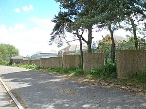
During the Second World War, Christchurch was again made strong against a possible invasion. Many pillboxes (small concrete forts), gun placements, and tank traps were built around the town. This made Christchurch an "anti-tank island." The idea was that if the German army invaded from Cherbourg, they wouldn't be able to connect their forces from east to west if Christchurch could hold out.
A line of tank traps and two pillboxes were built north of the town, between the two rivers. Pillboxes were also built on islands near the town bridge, covering the Avon, and near Tuckton bridge, covering the Stour. The harbour entrance was protected by two pillboxes: one at the end of the quay and a much larger one at Sandhills, which also covered the beach. The beach was mined and protected with barbed wire. Roads leading to the beach were blocked with more anti-tank devices. The eastern approaches to the town and the railway line were also guarded with pillboxes.
In front of the northern defense line, there was a single brick pillbox, which would have been manned by the local home guard. Several pillboxes were also built to protect the airfield. Some of these defenses are still standing today, including pillboxes at Tuckton Bridge and Mudeford Wood. Part of the anti-tank "hedgehog" defense has even been named an ancient monument.
Archaeology: Digging Up the Past
Many archaeological digs have happened in and around Christchurch. Between 1971 and 1973, these digs mainly focused on finding the path of the town's old defenses. They found many ironstone rocks and confirmed that there was a wooden fence (palisade). When buildings near the trolley bus terminal were knocked down in 1974, the site was dug up. They found remains of medieval buildings, including walls and a flagstone entrance. Several medieval arrowheads were also found.
When a supermarket and new car park were built in 1977, more archaeological digging took place. This revealed two Bronze Age burial mounds and a 6th-century Saxon graveyard with 34 graves. Some of the items found, like spears, shield parts, and knives, are on display in the Red House Museum.
In 2002, a detailed survey of the castle mound and grounds was done. In 2005, permission was given to take small core samples around the base of the mound. Before work on the King's Arms hotel in 2006, a test trench was dug in the car park. No remains of the town walls or important items were found there. However, it was discovered that the ground had been built up by 2 meters, filling in an old winding stream, before the current straight mill stream was created.
Christchurch's Industries
For many years, tourism has been the main part of Christchurch's economy, bringing in over £76 million each year. The town started to attract tourists after King George III visited in the 1790s. The number of visitors grew even more after the railways arrived in the early 1860s. Better trains and buses, and a general increase in living standards, meant that by 1914, Christchurch was a well-known holiday spot. The growth of Bournemouth also brought many visitors to Christchurch, though the town remained a popular resort on its own. Visitor numbers increased in the 1920s, and in the late 1950s, a holiday camp was built on the quay. In 1961, it became a "Pontin's" holiday camp, which later closed and is now housing and a hotel.
Many farms, factories, and boatyards have been replaced by houses. But Christchurch was once an important trading port and thrived because of its industries and manufacturing.
Fishing and farming have always been part of the local economy. Christchurch still has a small commercial fishing fleet today. Some of the fish, lobsters, crabs, and shellfish caught end up on the stall at Mudeford Quay. During the season, nets are used to catch salmon in the Run. Christchurch was once famous for its salmon, and the weather vane on top of the Priory shows this. However, the fishing industry has declined, and much farmland has become housing. Many farms like Wick Lane Farm and Purewell Farm have disappeared since World War II. Some farms still exist on the edge of town, but most have lost land to new buildings.
In 1568, Christchurch was known for making frieze cloth. This was a coarse woolen cloth used mainly for overcoats. It's thought that Knapp Mill, on the Avon, helped in its production. Knapp Mill, mentioned in the Domesday Book, was originally a corn mill. It burned down in 1760 and was rebuilt as a corn mill. In 1895, it became a pumping station.
Boatbuilding: Crafting Vessels for the Water
Boat building is another industry with a long history in Christchurch. George Holloway, a successful businessman, started his career building boats on Mudeford Spit. Some boatyards have closed, like Tom Lack's Catalac Catamarans and Robert Ives. But many boatyards are still open, including Elkins, Strides, and Purbrook-Rossiter, who have been building yachts and dinghies since 1938. Bob Hoare even built Olympic gold medal-winning dinghies in his own garden!
Elkins built many yachts, including the Vertues. When people wanted fewer wooden boats, they started making molds for fiberglass boats there. Between 1976 and 1981, Fletcher Sports Boats built fast power boats and yachts at the same site.
In 1929, a boat was built with a special way of moving, because the harbour wasn't very deep. To work in shallow water, a boat needs propellers that don't stick out much below the hull. The Hotchkiss Propulsion System was a new idea where water was pulled in and pushed out the back. This "cone propulsion" is still used today in a more advanced form. Many boats built for the harbour had a "slipper stern," a special back shape that helped reduce the disturbance from the propeller.
During WWII, the boatyard that became Elkins was used by the Admiralty. It made over 200 special boats, including motor cutters and landing craft. Purbrook-Rossiter also stopped their usual work to make whalers and lifeboats. By the end of the 1980s, only a few boatbuilders remained from over 200 years of boatbuilding history.
The Fusee Chain Industry: Tiny Parts for Watches
In 1790, Robert Cox started making fusee chains in workshops in the High Street. These tiny chains were used in the gears of watches. The work was incredibly detailed; the chains were only about a hundredth of an inch thick! Because of this, children as young as nine, from the local workhouse (now the Red House Museum), were hired to make them. The children were paid very little for a 70-hour week. From 1802, they were taught to read for 10 minutes each morning and afternoon.
Making the chains involved several steps. Figure-eight links were punched from steel sheets and put together like a bicycle chain. Rivets held the links together, and hooks were attached to each end. The whole chain was filed smooth, polished, and hardened in hot oil. Because the work was so fine, often thinner than a piece of thread, a magnifying glass was needed. Workers also used a glass globe filled with water in front of a candle, with a mirror behind it, to increase the light.
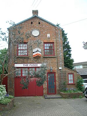
By 1793, Robert Cox had a monopoly on chain production in Britain. He supplied watch, clock, and chronometer makers across the country. Production grew, and in 1845, William Hart opened a similar factory in Bargates. It was built with a clever design: 74 feet long but only 18 feet wide, with very large windows on both sides to let in the most natural light.
At its peak, there were three fusee factories in Christchurch and many people making chains from their homes. By 1855, over 500 people were making these chains at home. Then, in 1875, changes in watch design meant the chains were no longer needed, and the factories closed. Hart was also a taxidermist and had a large collection of stuffed animals, many of which are now in the Red House Museum. His factory still stands today and is a protected building.
Smuggling: Secret Trade in Christchurch
For many years, smuggling was one of Christchurch's most profitable "industries." Many townspeople were involved, including respected figures like doctors, priests, bankers, and merchants. Even the mayor was sometimes involved! John Cook and Samuel Hookey, both known smugglers, became mayors. One famous smuggler, Sophie Dawes, later became a French Baroness.
Christchurch was popular with smugglers for several reasons. First, the only land routes into town were across two bridges. One was often out of use, and the other could easily be blocked, giving smugglers time to escape. Second, it was close to the Cotentin Peninsula in France, but not so close that customs boats could watch both coasts at once. In good weather, the coast of France is visible from Kent, but a boat crossing to Dorset would be out of sight for almost half the journey. This allowed them to claim they came from another port or were just fishing.
The beaches around Christchurch were sandy and gently sloping, so boats could be brought ashore without damage. Although the town was remote from its neighbors, cut off by heathland and forest, the roads inland were good. Plus, the two rivers offered alternative routes for illegal goods, as water transport was faster and cheaper than land transport back then.
Finally, there was the harbour itself. The entrance, called the Run, was a narrow channel that needed extreme care to navigate. Entering the harbour was made even harder by sandbanks that could shift overnight. For the smugglers, who were mostly professional and experienced sailors, the harbour entrance was an open gate. But for the less skilled sailors on the customs boats, who didn't know the local area, the Run was a barrier they feared to cross.
Another notable female smuggler was Hannah Seller, who ran the Ship in Distress pub. A channel in the harbour, now filled with sand, was named after her (Mother Sillar's Channel). This channel used to lead to the back of her pub, making it a convenient "trade" route. Next door to the pub was a tobacco and snuff factory owned by John Streeter, who had been jailed for his part in the Battle of Mudeford. Not surprisingly, many deliveries came at night, and other local tobacco traders complained they couldn't compete with Streeter.
Smuggling was such a big business in the 1700s and 1800s that a lot of wealth was made. Much of this money was later given to the poor as charitable gifts. One sailor, Ellis Coffin, left a house and a shop (now Lloyds bank) to the town. The money from these properties was to be given to the poor.
Iron Ore Mining: Changing the Landscape
George Holloway was already a successful businessman, building boats and trading, when in 1847 he asked for permission to remove the ironstone doggers (large rocks) at the foot of Hengistbury Head. Holloway owned a small fleet of windjammers that brought coal from Southampton to the town quay. He needed something heavy for the return journey and saw that he could make a good profit by shipping the ironstone.
By 1852, he had removed all the loose rocks and started digging into the base of the cliffs. This business was so profitable that Holloway cut a channel between the harbour and the cliffs where he was mining. This allowed him to bring his ships closer and speed up the process. This channel is still visible today, as are the ponds he built to provide water for his cart horses. Between 1856 and 1864, over 52,000 tons of ironstone were removed, with 13,000 tons in one year alone.
The damage George Holloway was doing to Hengistbury Head and the coastline became clear, and local opposition grew. There was also a dispute about whether he had broken the terms of his lease. Even so, by the time he was stopped in 1867, a third of the Head had been removed or lost due to increased erosion. His mine had almost cut through to the sea on the other side. Removing the ironstone rocks on the sea side of the Head caused the Spit at the Harbour entrance to grow longer, reaching Steamer Point by 1890. A long groyne (a structure to prevent erosion) had to be built to replace the missing rocks and stop the erosion. In 1930, after Christchurch Council refused to buy it, Hengistbury Head was sold to Bournemouth for £25,000.
Military and Electronics: Christchurch's Modern Role
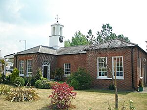
Christchurch has a long connection with the military and the Ministry of Defence. Barracks were built by Lord Tregonwell in 1794 to house troops defending the south coast from a possible French invasion. Once this threat passed, they were used by mounted troops who patrolled the coast to fight smuggling. Parts of the original barracks still exist, including the guard house, stables, and officers' mess.
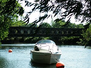
The Barracks later (1919) became the Military Experimental Engineering Establishment (MEXE). Here, Sir Donald Bailey designed and built his famous Bailey bridge. The success of the Bailey Bridge is clear from its production numbers. Between 1942 and 1945, over 490,000 tons of Bailey Bridge were made. It's estimated that if all the panels made during World War II were put together, they would reach from Christchurch to Leningrad (now St. Petersburg). In 1970, MEXE merged with another group and later closed in 1994. The site became a housing estate and retail park in 1997.
Between 1948 and 1980, the Signals Research and Development Establishment (SRDE) was based in Christchurch. Two giant "radomes" (domes for radar equipment) were built at Steamer Point to house satellite tracking equipment. When several Ministry of Defence groups merged in 1979, SRDE became the Royal Signals and Radar Establishment (RSRE). A year later, RSRE moved, and the site was leased to Plessey Defence Systems, who built the widely used Ptarmigan radio. British Aerospace now shares the site with the Spectrum Group.
In 1940, the British government built a factory at Christchurch airfield. Airspeed used it until 1948, when De Havilland took over. Aircraft like the Horsa, Mosquito, and Sea Vixen were made here. Also, some Spitfires were changed into Seafires. By 1954, over 2000 people worked there.
The factory closed in 1962. Part of it is still owned by the Crown and used for document storage. In 1963, the other part became Shand Kydd, a famous wallpaper company. Shand Kydd closed in 1980. The last Sea Vixen made at Christchurch stood for many years at the entrance to the Airfield Industrial Estate. It was later moved to the aviation museum at RAF Tangmere and restored.
Cecil Gardner had already made a name for himself making radios and transformers from a small factory in Southbourne. In 1939, he moved into a purpose-built factory in Somerford Road, Christchurch. He soon had a lot of business making transformers for American pilots who needed to convert British electricity to their voltage, and lighting transformers for air raid shelters. Gardner's also won contracts with the Telecommunications Research Establishment and the Ministry of Aircraft Production. After the war, contracts from the Admiralty and the Atomic Energy Research Establishment helped the business grow. Gardner's soon employed about 300 people. Gardner's helped the local economy not just as a major employer, but also by attracting other companies to the area, like Penny and Giles, who came to use the skilled local workforce. The factory closed in the late 1990s, partly due to an increase in cheaper imported goods.


