
Hodnet facts for kids
Quick facts for kids Hodnet |
|
|---|---|
 Forner monumental portico standing as a Hodnet landmark |
|

Hodnet
|
|
| Population | 1,534 (2011) |
| OS grid reference | SJ613286 |
| Civil parish |
|
| Unitary authority |
|
| Ceremonial county | |
| Region | |
| Country | England |
| Sovereign state | United Kingdom |
| Post town | Market Drayton |
| Postcode district | TF9 |
| Dialling code | 01630 |
| Police | West Mercia |
| Fire | Shropshire |
| Ambulance | West Midlands |
| EU Parliament | West Midlands |
| UK Parliament |
|
Hodnet (/hɒdnɪt/ HOD-nit) is a charming village and civil parish located in Shropshire, England. It's about 5.7 miles (9.2 km) north-east of the town of Market Drayton. In 2011, about 1,534 people lived in the parish. Hodnet is known for its interesting history and beautiful countryside.
Contents
A Glimpse into Hodnet's Past
Early Discoveries
Archaeologists found signs of a Bronze Age burial site when building a new road in 2002. This shows people lived here a very long time ago!
From Anglo-Saxons to Castles
Hodnet was an important Anglo-Saxon village called Odenet. It even had a chapel! After William the Conqueror took over England in 1066, the land belonged to Roger de Montgomery. Hodnet is even mentioned in the famous Domesday Book, a huge survey from 1086.
Around 1082, Baldwin de Hodenet built a motte and bailey castle here. This timber castle was later rebuilt with stone in 1196. Sadly, it was burned down in 1264. In the mid-1200s, Odo de Hodnet was given permission to hold a weekly fair and an annual market. This helped the village grow, especially near the 12th-century church.
Hodnet Hall's Story
For 250 years, the Vernon family lived at Hodnet. In 1752, the estate passed to the Heber family, whose descendants still own it today. The original Hodnet Old Hall was a timber-framed manor house. It was surrounded by a large park, which was shown on maps as early as the late 1500s.
The old hall was taken down in 1870. A new hall was built in the Elizabethan style. The beautiful gardens were created in the 1920s. During both World Wars, the hall was used as a hospital for soldiers recovering from injuries. In World War II, there was even an airfield on the grounds!
How Hodnet is Governed
Local Government History
Hodnet was once the meeting place for an Anglo-Saxon "hundred," which was a type of local area. This system continued even after the Norman Conquest. The village's 17th-century Hundred House was named after this history. Later, Hodnet's hundred court joined with another area called North Bradford.
Hodnet was also the center of a large church area. This area included several smaller places like Peplow and Wollerton. Since 1895, Hodnet has had its own parish council. This council helps make decisions for the local community.
Modern Governance
Today, Shropshire Council is in charge of local government services in Hodnet. This council is a Unitary authority, meaning it handles most local services. Hodnet is also part of the North Shropshire parliamentary constituency. This means people in Hodnet vote for a Member of Parliament (MP) to represent them in the national government.
Hodnet's Location and Landscape
Hodnet is located on the A53 road, which connects Shrewsbury to Newcastle-under-Lyme. The old parish covered a large area of fertile farmland. The ground beneath Hodnet is made of red Bridgnorth Sandstone. This is covered by glacial till, which creates a gently rolling landscape. The River Tern flows through a flat flood plain nearby.
In the past, people dug for marl (a type of soil) to use as fertilizer. The holes left behind are now called marl pits and have become homes for various wildlife.
Getting Around Hodnet
Roads and Bypass
A new road called the Hodnet bypass opened in 2003. This four-mile section of the A53 cost £14 million to build. It helps traffic avoid the village's narrow streets, making it safer and quieter for residents.
Train History
Hodnet used to have a train station on the Wellington and Market Drayton Railway. This line opened in 1867. However, not enough people used it, so it closed for passengers in 1963 and for freight four years later.
Bus Services
Today, Hodnet is served by the 64 bus route. This bus, run by Arriva Midlands North, travels between Shrewsbury and Market Drayton. Some 64 bus services even continue on to Hanley in Staffordshire.
| Bus operator | Route | Destination(s) | Notes |
|---|---|---|---|
| Arriva Midlands North | 64 | Shrewsbury → Shawbury → Hodnet → Tern Hill → Market Drayton | Some services continue to Hanley via Newcastle-under-Lyme. |
Important Landmarks
The old motte and bailey castle is a scheduled monument. This means it's a very important historical site that is protected. It's located in the grounds of Hodnet Old Hall, within Hodnet Park. This park still has parts of a medieval deer park.
Hawkstone Hall is another important building near the village. It was once the home of the Viscounts Hill.
Places of Worship

St Luke's Church is very old, with parts of its Norman nave still remaining. It was made bigger in the 14th century, and its unique octagonal tower is from that time. The church was repaired in 1846. It has beautiful stained glass windows, including one that shows the evangelists. The church is also connected to the legend of the Holy Grail from Arthurian stories.
Local Businesses and Services
Hodnet has a few local businesses that serve the community. You can find two shops and a pub called the Bear at Hodnet. There is also a florist and a crockery shop in the village.
Education in Hodnet
Hodnet Primary School provides education for younger children. It has 177 pupils and is supported by Shropshire County Council. However, there are no secondary schools in the village, so older students usually travel to nearby towns for their education.
Famous People from Hodnet
Hodnet has been home to several notable people throughout history:
-
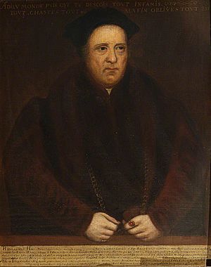
- Sir Rowland Hill (around 1495–1561) was the first Protestant Lord Mayor of London. He was a merchant and helped with the translation of the Geneva Bible.
-
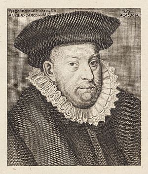 Sir Thomas Bromley who presided over the trial of Mary, Queen of Scots
 - Sir Thomas Bromley was an important lawyer and judge during the time of Queen Elizabeth I. He became the Lord Chancellor.
- Elizabeth Wriothesley, Countess of Southampton (1572–1655) was a lady-in-waiting to Queen Elizabeth I. She was married to Shakespeare's patron, and some people think she might have inspired the 'Dark Lady' in Shakespeare's sonnets or even Juliet in Romeo and Juliet.
- Reginald Heber (1783–1826) was a hymn writer who served as the Rector of Hodnet. He later became the Bishop of Calcutta.
- Mary Cholmondeley (1859–1925) was an English novelist who lived in Hodnet for many years.
- Tim Brookshaw (1929–1981) was a famous English National Hunt jockey and horse trainer. He is buried in Hodnet churchyard.
_School_-_Sir_Rowland_Hill_(1492%5E%E2%80%931561)_-_609006_-_National_Trust.jpg)


Sports in Hodnet
Cricket
Hodnet has a cricket club called Hodnet and Peplow CC. Their first team plays in the Rollinson Smith Shropshire Cricket League Division 3.
Football
Hodnet has a history of football clubs. FC Hodnet was formed in 2007 and quickly won the Shropshire Alliance football league. They then played in the Shropshire County Premier Football League, which later became the Mercian Regional Football League. In 2010, they were promoted to the Premier Division. The team even won the Premier Division Cup in 2011! FC Hodnet stopped playing at the end of the 2016–17 season.
Another club, Hodnet Social Football Club, played in the Telford Sunday League until 2012.
Hodnet FC was re-formed in 2018. They now play in the new Shropshire County Football League Premier Division, which is part of the English football league system.
