Kardinya, Western Australia facts for kids
Quick facts for kids KardinyaPerth, Western Australia |
|||||||||||||||
|---|---|---|---|---|---|---|---|---|---|---|---|---|---|---|---|
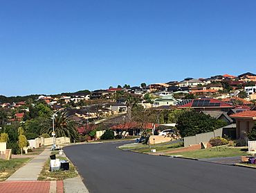
Houses in Kardinya
|
|||||||||||||||
| Postcode(s) | 6163 | ||||||||||||||
| Area | 4.38 km2 (1.7 sq mi) | ||||||||||||||
| Location | 12 km (7 mi) from Perth | ||||||||||||||
| LGA(s) | City of Melville | ||||||||||||||
| State electorate(s) | Willagee, Bateman | ||||||||||||||
| Federal Division(s) | Fremantle, Tangney | ||||||||||||||
|
|||||||||||||||
Kardinya is a suburb located about 13 kilometers (8 miles) south-southwest of Perth, the capital city of Western Australia. It's part of the City of Melville local government area. Kardinya is mostly a residential area with many single-family detached homes. It also has a shopping center and other shops in the middle, plus a small industrial area in the northwest. About 8,730 people live in Kardinya.
Before British settlers arrived, the land was home to the Beeliar group of the Whadjuk Noongar people. Kardinya wasn't very interesting to Europeans at first because it was far from rivers and not good for farming. In 1870, land was given to Pensioner Guards, who were British army veterans. They used the land for farms. Later, a large part of the area became a pine tree plantation. Kardinya officially became a suburb on June 16, 1961. Most of the houses in Kardinya were built between 1967 and the early 1980s.
Today, Kardinya has places like Kardinya Primary School, North Lake Senior Campus, Kardinya Park Shopping Centre, and Morris Buzacott Reserve. This reserve is home to several sports clubs. Two main roads, South Street and North Lake Road, cross through the suburb. Transperth buses also run here, mostly connecting to Murdoch railway station on the Mandurah railway line.
Contents
History of Kardinya
Early Days: Before British Settlement
For about 40,000 years before British people arrived, the land where Kardinya is now was home to the Beeliar group of the Whadjuk Noongar people. They lived in a large area from the Swan River down to Mangles Bay and east to the Darling Scarp. Even though no specific Aboriginal sites have been found in Kardinya itself (because it doesn't have wetlands), the Beeliar people would have traveled through this area.
British Arrival and Early Land Use
When the British started the Swan River Colony in 1829, they weren't interested in Kardinya. Early settlements were built along the Swan and Canning rivers because these were the main ways to travel. Also, Kardinya's soil wasn't good for the crops and fruit trees people grew back then.
In 1870, fourteen smaller pieces of land in Kardinya were given to Pensioner Guards. These were British army veterans who had finished their service or were injured. They came to Western Australia on ships carrying convicts. Their job was to help keep law and order in the colony. To encourage them to stay, they were given land. They had to live on this land for seven years to own it. Convicts were made to clear the land for them. Many of these lots were still owned by the Pensioner Guards' families at the start of World War I.
In the early 1900s, two important roads were built: South Street and North Lake Road. At first, these were just sandy tracks. After World War I, they were improved with planks. The land given to Pensioner Guards was used for pig farms, chicken farms, and vineyards.
Pine Plantations and University Land
In 1904, a large area of land around the Pensioner Guard lots was set aside for the University of Western Australia (UWA). The university didn't use the land directly. However, in 1922, they asked the Forests Department to protect it from people illegally cutting down trees.
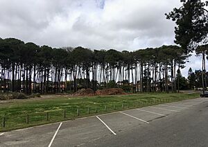
In 1924, local residents asked if part of this land could be used for a pine tree plantation. UWA and the Forests Department agreed. In 1926, about 945 acres (382 hectares) were cleared and planted mostly with pinus pinaster, also known as maritime pine. A house for the plantation staff and a fire lookout tower were built. The plantation was first called the Applecross Pine Plantation. In 1946, it was renamed the Somerville Pine Plantation. Many streets in Kardinya today are named after important people from UWA.
The pine trees started to be harvested in the late 1950s. By the 1960s, the trees were being completely cut down because Kardinya was planned for housing. This finished in 1975. The university then sold most of the land to developers. Some trees were left standing, and you can still see them around the suburb today.
How Kardinya Became a Suburb
The area was first going to be named Ellis. But in 1955, "Kardinya" was suggested as a street name. "Kardinya" is an Aboriginal word. Some say it means "sunrise," while others say it means "place of the Karda" (a type of goanna). Residents voted, and almost everyone chose Kardinya. The suburb was officially named Kardinya on June 16, 1961.
In 1958, some residents wanted to divide their land into smaller blocks for houses. But others wanted to keep the area's rural feel, so the request was denied. Plans for housing development in Kardinya's northeast began in 1960. The first building approval was given on October 5, 1967, and building started. The southeast part was developed in the 1970s, followed by the southwest.
North Lake Senior High School opened in 1973. A shopping center opened in 1976. Kardinya Primary School opened in 1977. A group called the Kardinya Precinct Committee (KPC) was formed in the early 1970s. This group, later renamed the Kardinya Residents Association, helped plan schools, shops, bus routes, and community services. Development of the northeast part of Kardinya finished in the 1980s.
In recent years, many of the older houses from the 1960s and 1970s have been taken down. The land is then divided into smaller blocks for new homes.
Geography and Nature of Kardinya
Kardinya is about 13 kilometers (8 miles) south-southwest of Perth's city center. It's also about 6 kilometers (4 miles) east of the Indian Ocean. The suburb covers an area of 4.38 square kilometers (1.69 sq mi). Its borders are Garling Street, North Lake Road, and Somerville Boulevard to the north. To the east are Prescott Drive, South Street, and Windelya Way. To the south are Farrington Road, North Lake Road, and Winterfold Road. A power line marks the western boundary.
Kardinya sits mostly on Spearwood dunes, which are hills of sand formed about 40,000 years ago. These dunes have brown sand over yellow soil, with Tamala Limestone underneath. A small part of the eastern edge is on Bassendean dunes, which have white to grey sands. These dunes are part of the larger Swan Coastal Plain. While Kardinya doesn't have natural wetlands, North Lake is right next to its eastern side.
Plants and Animals
The original plants in this area were mostly Eucalyptus gomphocephala (tuart) trees. There were also Eucalyptus marginata (jarrah), Corymbia calophylla (marri), and different types of Banksia and Casuarinaceae (sheoak) trees. Smaller plants included black wattles, stinkwoods, zamias, and grass trees. No rare plant species are known to have been here.
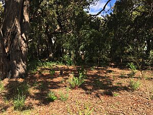
Most of the original plants were cleared in the 1920s for the pine plantation. A small area of natural bushland remains at Harold Field Reserve. However, this area has many weeds that make it hard for small native plants to grow.
Many common weeds in the area were brought here on purpose, like Arctotheca calendula (capeweed). Other weeds were brought by accident, such as Eragrostis curvula (African lovegrass) and Romulea rosea (Guildford grass).
People of Kardinya (Demographics)
Kardinya's population has slightly decreased from 2001 to 2016. In the 2016 Australian census, 8,730 people lived here. The median age was 41, which is a bit older than the average for Western Australia and Australia.
Most households in Kardinya are families (75.7%). About 19.5% are single-person households. Most homes (2,772 out of 3,197) are detached houses. Many homes (57.6%) have four or more bedrooms. The average number of people living in a household is 2.6. A high number of homes (42.9%) are owned outright, meaning they have no mortgage.
In 2016, the median weekly income for individuals was $676. For families, it was $1,981. The most common jobs for Kardinya residents were professionals (like doctors or teachers), office workers, and tradespeople. Many people worked in hospitals, primary education, cafes, and universities. About 27.7% of residents had a bachelor's degree or higher.
The most common backgrounds for Kardinya residents were English, Australian, Chinese, Italian, and Irish. Most residents (58.7%) were born in Australia. Other common birthplaces included England, Malaysia, and Italy. The most common religions were Catholic, no religion, and Anglican.
Shops, Parks, and Community Places
In the past, people in Kardinya had to travel to Fremantle or Applecross to buy groceries and other things. The first small shop opened in the 1940s at the corner of North Lake Road and South Street. It sold groceries and petrol. In the 1970s, a proper petrol station opened nearby, and it's still there today. North Lake Road was moved about 400 meters (437 yards) west in the 1970s. The old road is now called Gilbertson Road.
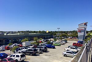
Construction on a shopping center began in 1975 and it opened in 1976. It was greatly expanded in 1999 and named Kardinya Park. Today, it has a Coles supermarket and a Kmart store. There's also an Australia Post office and bank branches. Next to the shopping center is an Aldi supermarket and the Kardinya Tavern, a popular local pub. The only other businesses in Kardinya are a small group of shops and a light industrial area in the northeast.
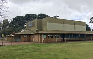
The biggest park in Kardinya is Morris Buzacott Reserve. It was named in 1977 after Morris Nutter Buzacott, who was involved with the local council. It's about 20 hectares (49 acres) in size. The Applecross Hockey Club (now Melville City Hockey Club) moved here in 1979. The Kardinya Tennis Club and the Kardinya Junior Football Club also use the reserve. In 1979, a group started pushing for a community center to be built here. After a lot of effort, the Melville City Council approved it in 1985. The center was finished in 1986 and opened in 1987.
A bowling club was formed in 1988. In 1994, the Fremantle CBC Amateur Football Club moved to the reserve. The community center was expanded in 1994 with funding from the government and the council. Today, the community center is used by football clubs, a tee-ball club, and a tennis club. The original hockey building is now also used by a cricket club.
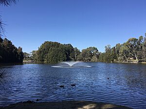
Another large park is Frederick Baldwin Park. It was renamed in 1983 after J.F. Baldwin, a former council member. It's in the northwest of Kardinya, covering about 10 hectares (25 acres). It has a lake, a grassy area, a playground, and a community center. Most other parks in Kardinya are named after former members of the local council or other important local figures.
Education in Kardinya
Kardinya has two schools: Kardinya Primary School and North Lake Senior Campus.
Kardinya Primary School
Before Kardinya had its own schools, students went to Bibra Lake State School or Carawatha Primary School in Willagee. They would walk, cycle, or even ride horses to get there.
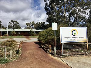
As more houses were built in the 1970s, a local school was needed. Residents asked the government to build a school in Kardinya. A site was chosen, and construction began in August 1976. Kardinya Primary School opened in February 1977. It wasn't fully finished at first, but it had 37 pre-primary students and 214 students in years 1 to 4, with eight teachers. On the first day, parents formed a group to support the school. They chose yellow, green, and blue as the school colors. The school motto, "Rise Above All," was chosen from a competition.
Work continued on the school, adding a library, car park, bike racks, and sports facilities. The school used the nearby Windelya Reserve (now Morris Buzacott Reserve) for sports while its own facilities were being built. More classrooms were added as needed. The school officially opened on August 15, 1979. By 1980, it had 77 pre-primary students and 426 students in years 1 to 7. All construction was finished that year. Student numbers peaked in 1982 with 491 students.
In 1984, a parent's committee was formed, which led to a school council in 1987. Kardinya Primary School became an Independent Public School in 2017, which meant it got a school board. As of 2021, the school has about 349 students in total.
North Lake Senior Campus
Before North Lake Senior Campus, high school students from Kardinya went to schools like Fremantle Boys' School or Fremantle Girls' School. They would cycle or catch buses to get there. In 1960, Melville Senior High School opened, which was much closer.
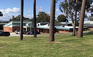
North Lake Senior High School opened in Kardinya on February 4, 1973. It was Kardinya's first high school. It was originally going to be called Kardinya High School. But the name was changed to show that it served students from surrounding suburbs too. In 1973, it had 165 students in Year Eight and Nine. When it opened, it had an administration building, science and math classrooms, a canteen, a gym, and a library. More facilities were built later. The school was officially opened on March 29, 1979.
Student numbers reached their highest in 1983 with 935 students. After that, numbers slowly went down. By 1995, the school had fewer than 400 students. So, the Department of Education changed the school to only serve Year 11 and 12 students. This was a new idea for public schools in Western Australia. The school was then renamed North Lake Senior Campus.
How Kardinya is Governed
Local Government
Kardinya is part of the City of Melville local government area. From 1871, it was part of the Fremantle Road District. In 1901, the East Fremantle Road District was created, which later became the Melville Road District. This district became the Shire of Melville in 1961, then the Town of Melville in 1962, and finally the City of Melville in 1968.
The suburb is in the City of Melville's Bateman–Kardinya–Murdoch ward. Local elections are held every two years in October. Councillors are elected for four-year terms.
State Government
For the Western Australian Legislative Assembly (the lower house of the state parliament), Kardinya is divided into two parts. The area south of South Street and west of North Lake Road is in the electoral district of Willagee. The rest of Kardinya is in the electoral district of Bateman. Both of these districts are part of the South Metropolitan Region for the Western Australian Legislative Council (the upper house). The southwest of Kardinya tends to vote for the Australian Labor Party, while the northeast tends to vote for the Liberal Party.
|
|
|
|
||||||||||||||||||||||||||||||||||||||||||||||||||||||||||||||||||||||||
Federal Government
For the Australian federal parliament, Kardinya is also divided. The area south of South Street and west of North Lake Road is in the Division of Fremantle. The rest is in the Division of Tangney.
|
|
|
|
|
||||||||||||||||||||||||||||||||||||||||||||||||||||||||||||||||||||||||||||||||||||||||||
Getting Around Kardinya (Transport)
In 2016, most Kardinya residents (74.7%) drove to work. About 9.9% used public transport.
Roads
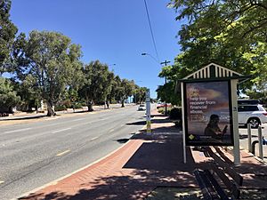
Kardinya is crossed by two main roads: South Street (running east-west) and North Lake Road (running north-south). Both are wide, six-lane roads. North Lake Road used to be in a different spot, but it was moved in 1975. The old road is now called Gilbertson Road.
If you head east on South Street, you can reach Murdoch University, two hospitals (St John of God Murdoch Hospital and Fiona Stanley Hospital), Murdoch railway station, the Kwinana Freeway, and Roe Highway. The Kwinana Freeway is the main road to Perth's city center. You can also get to the freeway by heading east on Farrington Road, which runs along Kardinya's southern border. Heading west on South Street takes you to Fremantle and Stock Road, a major north-south route. Heading north on North Lake Road leads to Leach Highway and Canning Highway. Heading south on North Lake Road takes you to Cockburn Central and Armadale Road. Other important roads in Kardinya include Winterfold Road, Garling Street, and Somerville Boulevard.
Public Transport
Transperth bus services run through Kardinya. These include routes 115, 503, 504, 511, 512, 513, 998, and 999. Most of these routes connect to Murdoch railway station, which is about 4 kilometers (2.5 miles) east of Kardinya. This station is on the Mandurah railway line.
Route 115 is a limited-stop service that travels between Hamilton Hill and Elizabeth Quay bus station in Perth's city center. It goes through the middle of Kardinya. Routes 503 and 504 travel between Murdoch railway station and Bull Creek railway station. Route 511 goes between Murdoch railway station and Fremantle railway station. Route 512 travels between Murdoch railway station and Spearwood. Route 513 goes between Murdoch railway station and Fremantle railway station.
 | Lonnie Johnson |
 | Granville Woods |
 | Lewis Howard Latimer |
 | James West |


