Kishwaukee River facts for kids
Quick facts for kids Kishwaukee River |
|
|---|---|
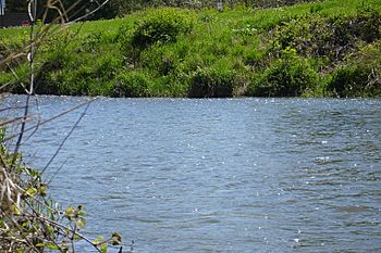
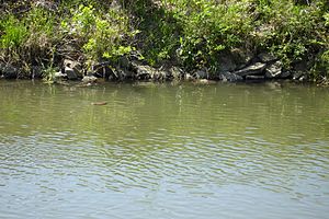
Kishwaukee River in DeKalb, Illinois, May 2006
|
|
| Country | United States |
| Physical characteristics | |
| Main source | Cropsey Moraine, south of Woodstock, Illinois 42°17′45″N 88°26′52″W / 42.29583°N 88.44778°W |
| River mouth | Rock River west of New Milford, Illinois 682 ft (208 m) 42°11′10″N 89°07′52″W / 42.18611°N 89.13111°W |
| Length | 63.4 mi (102.0 km) |
| Basin features | |
| Basin size | 1257 sq mi |
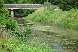
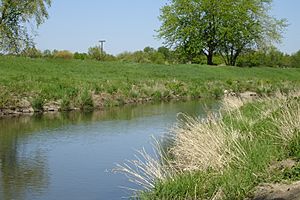
The Kishwaukee River, often called The Kish, is a 63.4-mile-long (102.0 km) river in Illinois, USA. It flows into the Rock River. The name "Kishwaukee" comes from the Potawatomi language. It means "river of the sycamore trees."
Contents
Where the Kishwaukee River Flows
The Kishwaukee River starts near Woodstock and flows to Rockford, Illinois. There, it joins the Rock River. The river begins close to Route 47 and Route 14 in Woodstock. This part is known as the North Branch or Main Branch. It is usually about 50 feet (15 m) wide. It gets wider and deeper as it nears the Boone County line.
The South Branch of the Kishwaukee River begins near Shabbona. It flows north to Genoa. Then it turns west and joins the North Branch near Cherry Valley. The South Branch is about 55 feet (17 m) wide.
The Kishwaukee River basin covers several counties. These include McHenry, Boone, Kane, DeKalb, Ogle, and Winnebago Counties. Farmland makes up about two-thirds of this area.
History of the Kishwaukee River
People have used the Kishwaukee River for thousands of years. Native Americans first used it for travel and trade. They also got water from it for their homes. The name "Kishwaukee" means "river of the sycamore" in the Potawatomi language. The Potawatomi people used large sycamore trees from the river valley to make canoes. The river also marks the northernmost natural area where sycamore trees grow.
Native Americans arrived in this area after the last ice age ended. Near where the Kishwaukee meets the Rock River, there are ancient earth mounds. These mounds were built by the Mississippian people around 900 CE. Other mounds are from the Upper Mississippian period, around 1400 CE. Different Native American tribes lived here later, including the Potawatomi and Mascouten. French explorers met the Mascouten people around 1655.
Protecting the River: Past Challenges
The river's health has been affected by factories and large farms in the area. Waste from these places can harm the river.
In 1988, a large amount of hog waste spilled into the Kishwaukee River. This happened when a pipe broke at a farm near Sycamore. The spill damaged aquatic life for about 37.2 miles (59.9 km) of the river. The Illinois Department of Natural Resources (IDNR) reported that about 70,000 fish died. Aquatic plants, insects, and other creatures were also harmed.
The city of DeKalb has seen many fish kills on the river. Since 1954, more than half of the reported fish kills happened near DeKalb.
Another notable fish kill happened in 1984. Reports showed it was linked to a canning factory in DeKalb. A faulty pipe at the Del Monte facility caused this incident. Del Monte later paid the state for the lost fish. They also took steps to prevent future problems. These events show how important it is to protect our rivers from pollution.
River Levels and Floods
The United States Geological Survey (USGS) has four stations along the Kishwaukee River. These stations work with the National Weather Service. They collect important data about the river's water levels. This includes how high the water gets during floods. The stations are in DeKalb, Fairdale, Belvidere, and Rockford.
Flood stages are different at each station. In DeKalb, a flood starts at 10 feet (3 m). A moderate flood is at 11 feet, and a major flood is at 12.5 feet (3.8 m). In Belvidere, a major flood is at 12 feet (4 m). In Perryville, near the river's mouth, a major flood is at 22 feet (7 m).
Biggest Floods Recorded
Here are some of the highest water levels recorded:
- Belvidere:
- February 20, 1994: 14.19 feet (4.33 m)
- June 14, 1999: 13.97 feet (4.26 m)
- DeKalb:
- July 2, 1983: 15.80 feet (4.8 m) (the highest ever recorded)
- August 24, 2007: 15.34 feet (4.68 m)
- Perryville:
- July 18, 1996: 23.54 feet (7.17 m) (the highest ever recorded)
The 2007 Flood
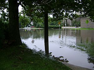
On August 24, 2007, the Kishwaukee River in DeKalb, Illinois reached 15.27 feet (4.65 m). This caused major flooding. It was only the second time the river had risen above 15 feet (5 m) since records began.
How the Land Was Formed
The area around the Kishwaukee River was shaped by glaciers. Long ago, huge sheets of ice moved across the land. These glaciers left behind large, rounded rocks. Locals called these "hard heads." They were used to build barns and wells.
Two main ice sheets covered the Kishwaukee basin in the past. The first, the Illinoian glacier, was here about 300,000 to 125,000 years ago. The second, the Wisconsinan glacier, came about 25,000 to 13,500 years ago. It covered most of the older glacial deposits.
The end moraines are ridges that show where the edge of a glacier once stood. The Marengo Moraine is one example. It's a ridge that runs north to south in McHenry County. It shows how the glacier shaped the land.
Smaller Rivers and Streams
Many smaller rivers and streams flow into the Kishwaukee River. These are called tributaries. Major ones include Piscasaw Creek, Rush Creek, Beaver Creek, and Killbuck Creek. There are also two separate streams named South Branch Kishwaukee River. Other tributaries are Mokeler Creek, Bessie Creek, Lawrence Creek, Owens Creek, and Coon Creek.
Wildlife of the Kishwaukee River
The Kishwaukee River is a "Class A" stream. This means it has clear water where many types of fish can live. The Illinois Department of Natural Resources (IDNR) checks fish populations and pollution. A Class A rating means many fish species that don't like muddy water live there. The Kishwaukee River area is home to 28 species that are endangered, threatened, or on a watch list.
Plants Along the River
Many different plants grow along the Kishwaukee River. These include burr oaks, lady's slippers, lousewort, trilliums, and trout lilies. Skunk cabbage blooms early in the year. Goldenrods and gentians bloom in late fall. About 1,070 plant species are found in the Kishwaukee Basin. This is about 34% of all native vascular plants in Illinois. As of 1997, 14 of these plants were endangered in Illinois. Another 14 were threatened. The prairie bush clover is a federally threatened species found here.
However, invasive species are a problem. About 21% of the plants in the area are foreign species. Canada thistle has been a concern since 1922. Local officials even hired people to remove these plants.
The plants along the Kishwaukee Basin today are much less than they used to be. In 1820, before European settlers arrived, about 74% of the river area was forest or prairie. This included Savanna, blacksoil and gravel prairies, and wetlands. By 1997, these numbers had dropped.
Mammals Near the River
Animals like rabbits, woodchucks, and skunks are common along the river. White-tailed deer are also plentiful. Shrews are tiny, fierce mammals. Four of Illinois' six shrew species live around the Kishwaukee River. The tiny pygmy shrew is very rare in Illinois. But they have been found along the Kishwaukee, suggesting they might be more common here.
River Otters Return
Before 1987, river otters were not seen in the Kishwaukee River. This was because the area had few trees. As farms grew, more trees were planted along the riverbanks. This created good homes for otters. Today, the Kishwaukee River is a suitable habitat for them.
By 1997, river otters were seen along the South Branch Kishwaukee River. Otters like places with tree cover, quiet water, and good water quality. They also need places to build dens and minimal human disturbance.
Amphibians and Reptiles
Twelve types of amphibians and 21 types of reptiles live along the river. This is about 30% of Illinois' amphibians and 34% of its reptiles. While no species are currently endangered here, the state-endangered eastern Massasauga snake once lived in the river basin.
Birds of the Kishwaukee
The bird population along the Kishwaukee is typical for a farming area. Of the 299 bird species in Illinois, at least 262 can be found near the Kishwaukee River. About 135 species have nested here at some point. The wetlands along the Kishwaukee are great places for birds. Places like Exner Marsh and Kloemphen Marsh in McHenry County are home to great blue herons, pied-billed grebes, and the state-endangered yellow-headed blackbird and osprey. Several Bald Eagles also hunt and nest near Rockford.
Parks and Conservation Areas
Many parks and natural areas protect the Kishwaukee River. These places allow people to enjoy nature and help keep the river healthy.
Boone County Parks
In Boone County, the Boone County Conservation District manages Kishwaukee Bottoms. This area includes several conservation sites. Anderson Bend, Distillery, and LIB are all along the river west of Belvidere. These areas have plants and animals typical of northern Illinois river bottoms. Silver maple, sycamore, and willow trees grow along the shores. Wetlands in lower areas are home to turtles, frogs, and beavers. Waterfowl and wading birds are also common.
Kishwaukee Bottoms has 547 acres (2.2 km2) of wild land. It has hiking and skiing trails that total about 7.6 miles (12.2 km). These trails go through prairies, woodlands, and wetlands.
DeKalb County Parks
The DeKalb County Forest Preserve District runs several forest preserves along the Kishwaukee River. MacQueen Forest Preserve and the 300-acre (1.2 km2) Potawatomi Forest Preserve are next to each other. They are on the north side of the South Branch. On the south side, there is a nearly 600-acre (2.4 km2) preserve set aside by the state. In total, MacQueen and Potawatomi preserves cover over 900 acres (3.6 km2) and 3.2 miles (5.1 km) of the Kishwaukee River. These areas are for public use and are actively conserved.
Kishwaukee River State Fish and Wildlife Area
In 2000, the state of Illinois bought 570 acres (2.3 km2) of land along the Kishwaukee River in DeKalb County. This land was bought using funds from the Illinois Open Land Trust. It was opened to the public as the Kishwaukee River State Fish and Wildlife Area.
Winnebago County Parks
The Winnebago County Forest Preserve District manages Kishwaukee River Forest Preserve. This 145-acre (0.6 km2) preserve was acquired in 1927. It offers canoe access, 1.5 miles (2.4 km) of hiking trails, and fishing. It also has a 30-acre (120,000 m2) oak woods site. This oak woods is an Illinois Natural Area Inventory site, known for its natural quality. Other preserves in Winnebago County include Oak Ridge, Deer Run, and Blackhawk Springs.
The Rockford Park District operates the 334-acre (1.4 km2) Seth B. Atwood Park. The Village of Cherry Valley also owns and operates the 96-acre (0.4 km2) Baumann Park.
Working to Preserve the River
The Kishwaukee River Ecosystem Partnership was started in 1996. This group works to protect the river's natural resources.
Friends of the Kishwaukee River was founded in 2012. This non-profit group aims to care for the river and its lands. They work to restore and preserve its natural beauty. They also encourage safe recreation and protect the river from harm. Their goal is to help the community appreciate this beautiful natural area.
See also
- Intensive pig farming
- List of Illinois rivers
 | Chris Smalls |
 | Fred Hampton |
 | Ralph Abernathy |


