Lake Allison facts for kids
Quick facts for kids Lake Allison |
|
|---|---|
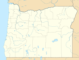
| Location | Willamette Valley, Oregon |
| Coordinates | 45°N 123°W / 45°N 123°W |
| Type | Temporary lake (formed periodically from 12,000 to 15,000 years BP) |
| Primary inflows | Glacial Lake Missoula |
| Basin countries | United States |
| Max. length | 111 mi (179 km) |
| Max. width | 31 mi (50 km) |
| Surface area | 3,000 sq mi (7,800 km2) |
| Average depth | 200 ft (61 m) |
| Max. depth | 400 ft (120 m) |
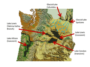
Imagine a giant, temporary lake that appeared and disappeared long ago! Lake Allison was one such lake in the Willamette Valley of Oregon. It formed many times between 15,000 and 13,000 BC. This happened because of huge floods called the Missoula Floods. Lake Allison is why the Willamette Valley has such rich, fertile soil today.
How Lake Allison Formed
The Willamette Valley has very rich soil. This is largely thanks to some of the biggest freshwater floods ever recorded. These floods started in Lake Missoula in Montana. This was about 12,000 to 15,000 years ago, during the Pleistocene Ice Age.
The massive floods flowed through eastern Washington. They carried a lot of fertile soil with them. This soil traveled down through the Columbia River Gorge. A narrow spot near Kalama, Washington, slowed the water down. This caused the water to back up and flood the Willamette Valley.
The valley was flooded to a depth of 300 to 400 feet (91 to 122 meters) above sea level. The water reached as far south as Eugene. The Willamette Valley experienced many floods during the last ice age. There might have been as many as 100 floods. Each flood was separated by hundreds of years.
If floods this deep happened today, only the very tops of some hills in Portland would be visible. These include the West Hills, Mount Tabor, and Mount Scott. Some tall buildings like the U.S. Bancorp Tower would also stick out.
Towns like Newberg (175 feet high) and Oregon City (138 feet high) would be underwater. McMinnville (157 feet high) and Salem (154 feet high) would also be submerged. Corvallis (235 feet high) would be mostly covered. Eugene (430 feet high) would likely stay above the floodwaters.
Eventually, the lake would drain away. It left behind 180 to 200 feet (55 to 61 meters) of layered soil. This rich soil covers the Tualatin, Yamhill, and Willamette valleys.
Who Named Lake Allison?
Geologists named this ancient lake after Oregon State University geologist Ira S. Allison. He was a very important scientist. In 1953, he was the first to connect the Willamette Valley's silt soil to similar soils. These soils were found at the former lakebed of Lake Lewis in eastern Washington.
In the 1930s, Allison also found hundreds of large rocks that didn't belong in the area. These are called glacial erratics. They were carried by the floods on giant icebergs. These rocks formed a ring around the lower hills of the Willamette Valley. One famous example is the Bellevue Erratic. You can see it off Highway 18 west of McMinnville.
 | Jessica Watkins |
 | Robert Henry Lawrence Jr. |
 | Mae Jemison |
 | Sian Proctor |
 | Guion Bluford |


