Linn County, Iowa facts for kids
Quick facts for kids
Linn County
|
|||
|---|---|---|---|

|
|||
|
|||

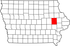
Location within the U.S. state of Iowa
|
|||
 Iowa's location within the U.S. |
|||
| Country | |||
| State | |||
| Founded | 1839 | ||
| Named for | Lewis Linn | ||
| Seat | Cedar Rapids | ||
| Largest city | Cedar Rapids | ||
| Area | |||
| • Total | 725 sq mi (1,880 km2) | ||
| • Land | 717 sq mi (1,860 km2) | ||
| • Water | 7.6 sq mi (20 km2) 1.1% | ||
| Population
(2020)
|
|||
| • Total | 230,299 | ||
| • Density | 317.65/sq mi (122.65/km2) | ||
| Time zone | UTC−6 (Central) | ||
| • Summer (DST) | UTC−5 (CDT) | ||
| Congressional district | 2nd | ||
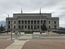
Linn County is a place in the state of Iowa, USA. It's like a big neighborhood or district. In 2020, about 230,299 people lived here, making it the second-biggest county in Iowa by population. The main city, or "county seat," where the government offices are, is Cedar Rapids. Linn County got its name from Senator Lewis F. Linn from Missouri. It's also part of the larger Cedar Rapids city area.
Contents
History of Linn County
Before settlers from Europe arrived, the Sac and Fox Native American tribes lived in the area that is now Linn County. Historians say that these groups got along well. Native Americans traded food and animal furs with the new settlers for other goods.
Linn County was officially created on December 21, 1837. At first, it was part of the Wisconsin Territory. Then, on July 4, 1838, it became part of the new Iowa Territory. The county was fully set up by the first lawmakers of the Iowa Territory on January 15, 1839.
The first main town, or county seat, was chosen along Indian Creek. It was named Marion after Francis Marion, a famous general from the Revolutionary War.
By 1855, people started talking about moving the county seat to Cedar Rapids. This city was growing very fast southwest of Marion. But it took a long time for this to happen. Finally, on November 6, 1919, enough people voted to move the county seat to Cedar Rapids.
In 1859, the first train tracks were built through Cedar Rapids. This helped the city and the whole county become a major center for business in eastern Iowa.
Linn County has also faced some challenges. Parts of the county were damaged by big floods from the Cedar River in June 2008. More recently, in August 2020, a very strong storm called a derecho caused a lot of damage across the area.
Geography and Travel
Linn County covers a total area of about 725 square miles. Most of this (717 square miles) is land, and a small part (7.6 square miles) is water.
Main Roads
Many important roads run through Linn County, helping people travel around. These include:
 Interstate 380
 Iowa Highway 27
 U.S. Highway 30
 U.S. Highway 151
 U.S. Highway 218
 Iowa Highway 1
 Iowa Highway 13
Public Transportation
For getting around without a car, Linn County has:
- 380 Express
- Cedar Rapids Transit
Neighboring Counties
Linn County shares borders with several other counties:
- Benton County (to the west)
- Buchanan County (to the northwest)
- Cedar County (to the southeast)
- Delaware County (to the northeast)
- Iowa County (to the southwest)
- Johnson County (to the south)
- Jones County (to the east)
Population Information
| Historical population | |||
|---|---|---|---|
| Census | Pop. | %± | |
| 1850 | 5,444 | — | |
| 1860 | 18,947 | 248.0% | |
| 1870 | 31,080 | 64.0% | |
| 1880 | 37,237 | 19.8% | |
| 1890 | 45,303 | 21.7% | |
| 1900 | 55,392 | 22.3% | |
| 1910 | 60,720 | 9.6% | |
| 1920 | 74,004 | 21.9% | |
| 1930 | 82,336 | 11.3% | |
| 1940 | 89,142 | 8.3% | |
| 1950 | 104,274 | 17.0% | |
| 1960 | 136,899 | 31.3% | |
| 1970 | 163,213 | 19.2% | |
| 1980 | 169,775 | 4.0% | |
| 1990 | 168,767 | −0.6% | |
| 2000 | 191,701 | 13.6% | |
| 2010 | 211,226 | 10.2% | |
| 2020 | 230,299 | 9.0% | |
| 2023 (est.) | 228,972 | 8.4% | |
| U.S. Decennial Census 1790–1960 1900–1990 1990–2000 2010–2019 |
|||
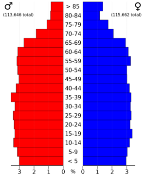
Every ten years, the United States counts its population in a process called the census. This helps us understand how many people live in different areas and what they are like.
2020 Census Details

In the 2020 census, Linn County had 230,299 people. This means there were about 317 people living in each square mile. Most people (94.04%) said they belonged to one race. About 78.91% were White (not Hispanic), 7.14% were Black, and 3.87% were Hispanic. Other groups included Asian, Native American, and Pacific Islander people. About 7.28% of people were from other races or more than one race.
There were 101,230 homes or housing units in the county, and 94,751 of them were lived in.
2010 Census Details
The 2010 census counted 211,226 people in Linn County. At that time, there were about 294 people per square mile. There were 92,251 housing units, with 86,134 of them being occupied.
Communities in Linn County
Linn County has many different cities, towns, and smaller communities.
Cities
Unincorporated Communities
These are smaller places that are not officially cities or towns.
Ghost Towns
A ghost town is a place that used to be a community but is now empty or abandoned.
Townships
Townships are smaller areas within a county, often used for local government or land division.
- Bertram
- Boulder
- Brown
- Buffalo
- Clinton
- College
- Fairfax
- Fayette
- Franklin
- Grant
- Jackson
- Linn
- Maine
- Marion
- Monroe
- Otter Creek
- Putnam
- Spring Grove
- Washington
City Populations (2020 Census)
This table shows how many people live in the different cities and towns in Linn County, based on the 2020 census.
† county seat
| Rank | City/Town/etc. | Municipal type | Population (2020 Census) |
|---|---|---|---|
| 1 | † Cedar Rapids | City | 137,710 |
| 2 | Marion | City | 41,535 |
| 3 | Hiawatha | City | 7,183 |
| 4 | Mount Vernon | City | 4,527 |
| 5 | Robins | City | 3,353 |
| 6 | Fairfax | City | 2,828 |
| 7 | Center Point | City | 2,579 |
| 8 | Ely | City | 2,328 |
| 9 | Lisbon | City | 2,233 |
| 10 | Palo | City | 1,407 |
| 11 | Walford (partially in Benton County) | City | 1,366 |
| 12 | Central City | City | 1,264 |
| 13 | Springville | City | 1,154 |
| 14 | Coggon | City | 701 |
| 15 | Walker | City | 688 |
| 16 | Alburnett | City | 675 |
| 17 | Bertram | City | 269 |
| 18 | Prairieburg | City | 160 |
See also
 In Spanish: Condado de Linn (Iowa) para niños
 | Selma Burke |
 | Pauline Powell Burns |
 | Frederick J. Brown |
 | Robert Blackburn |


