
List of local nature reserves in Berkshire facts for kids
.jpg)
Local nature reserves (LNRs) in England are special places for nature. Local councils create these areas to protect wildlife and important natural features. They are like nature's own safe zones! Councils must look after these sites, either by owning them or by working with the owners. They can also make special rules, called byelaws, to help keep these places safe and healthy for plants and animals.
As of January 2020, there are 41 LNRs in Berkshire. Some of these places are even more special. Five are also Sites of Special Scientific Interest (SSSI), meaning they are important for their wildlife or geology across the whole country. Two are Special Areas of Conservation (SAC), which are important for nature across Europe. Four of these reserves are looked after by the Berkshire, Buckinghamshire and Oxfordshire Wildlife Trust, a charity that helps protect nature.
Berkshire is a county in South East England. It shares its borders with Hampshire and Surrey to the south, Greater London to the east, Wiltshire to the west, and Buckinghamshire and Oxfordshire to the north. Berkshire has lovely landscapes, with parts in the valleys of the Thames river and its smaller river, the River Kennet. In the west, you can find rolling chalk hills. More than 860,000 people live here. Berkshire is no longer run by one big county council. Instead, it has six smaller local councils that manage different areas. These are Bracknell Forest, Reading, Slough, West Berkshire, Windsor and Maidenhead, and Wokingham.
Contents
What Do These Letters Mean?
Sometimes you'll see special letters used to describe nature reserves. Here's what they mean:
- BBOWT = Berkshire, Buckinghamshire and Oxfordshire Wildlife Trust: This is a charity that works to protect wildlife and wild places in Berkshire and nearby counties.
- SAC = Special Area of Conservation: These are important nature sites across Europe. They protect special habitats and species.
- SSSI = Site of Special Scientific Interest: These are the best sites for wildlife and geology in the UK. They are protected by law.
Exploring Berkshire's Local Nature Reserves
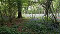
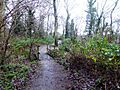
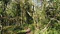
Berkshire is home to many amazing Local Nature Reserves, each with its own unique features and wildlife. These sites protect different types of habitats, from ancient woodlands to lakes and marshy areas. They are vital for keeping nature healthy in the county.
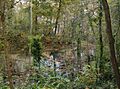
Woodlands and Forests
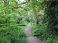
Many LNRs in Berkshire are woodlands, which are home to a huge variety of trees, plants, and animals.
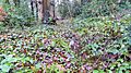
- Alder Moors in Woodley is an old woodland named after its many alder trees. You can also find ash and willow trees here. In spring, the ground is covered with marsh marigolds, primroses, and anemones.
- Ambarrow Court in Sandhurst was once part of a large estate. It has ancient woods, birch and hazel trees that are coppiced (cut back to encourage new growth), marshes, ponds, and a meadow. Look out for noctule bats, glow worms, and stag beetles.
- Bisham Woods near Cookham is a very special place. It's a SAC and an SSSI. This broadleaf woodland has one of the richest collections of ground plants in Berkshire, with lots of dog's mercury and ivy. It's also home to rare snail species that like chalky soils.
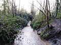
- Blundells Copse in Reading is another ancient woodland with a stream running through it. You might spot bats, hedgehogs, muntjac deer, and frogs. Plants like opposite leaved golden saxifrage and marsh marigold grow here.
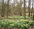
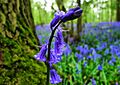
- Cocksherd Wood in Slough is an ancient wood with many different trees like field maple, wild cherry, birch, oak, hazel, and beech. In April, it's famous for its beautiful display of bluebells.
- Farley Copse in Bracknell is an old woodland with wood anemones and dog violets. Its pond is home to large red damselflies and broad-bodied chaser dragonflies.
- Jock's Copse, Temple Copse, and Tinkers Copse in Binfield are ancient woods, mainly with oak and hazel. They are home to badgers, roe deer, Eurasian bullfinches, and all three types of British woodpecker.
- Pearman's Copse in Lower Earley is an ancient wood with ash, hazel, and oak trees. It even has old boundary banks and ditches from long ago.
- Piggy Wood in Warfield has a stream where you can see damselflies and dragonflies in summer. Plants like wood anemone and marsh marigold grow here.
- Round Copse in Reading is a dense wood with many birds, including all three British woodpecker species, Eurasian nuthatches, and Eurasian treecreepers.
- Whitegrove Copse in Warfield is an ancient coppiced woodland. You can find plants like ragged robin and the wild service tree, and birds such as bullfinches and chiffchaff.
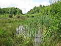
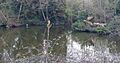
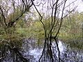
Lakes, Ponds, and Wetlands
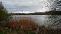
These LNRs protect important water habitats and the creatures that live in and around them.
- Ali's Pond in Sonning is a small pond that is home to over 40 types of water plants and 18 kinds of dragonfly. You might also see great crested newts, harvest mice, and stag beetles here.
- Arthur Jacob Nature Reserve in Horton has four old gravel pits that have been turned into lagoons for wildlife. They have islands and areas planted with trees, shrubs, and wildflowers.
- Englemere Pond in Ascot is a large pond surrounded by marshland. It's an SSSI and is important for plants like common reed, bog mosses, and sundew. Many birds, like sedge warblers and common reed bunting, breed here.
- Haymill Valley in Slough is managed by the BBOWT. It has woodlands with bluebells and reedbeds with yellow iris. Butterflies like orange-tips and holly blues flutter around.
- Heath Lake in Crowthorne is an SSSI and is unique because it's the only acid lake in Berkshire with its original plants, like alternate water-milfoil. The banks are marshy and home to special plants.
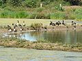
- Hosehill Lake in Theale is also managed by BBOWT. This lake is a haven for water birds, including northern lapwings and great crested grebes. Wild Exmoor ponies graze its wildflower meadows, which are full of butterflies and moths.
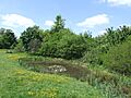
- Lavells Lake in Woodley is part of Dinton Pastures Country Park. It was once a gravel pit but is now managed to attract many different birds.
- Longmoor Bog in Finchampstead is an SSSI and is mostly carr woodland (wet woodland). It has deep peat and is important for insects like the bog bush cricket and silver-studded blue butterfly.
- Maiden Erlegh Lakes in Earley has lakes and ancient woodlands. It even has a special platform for terns to nest and a sculpture called The Duck and the World.
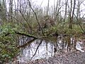
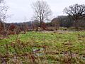
- The Marshes in Swallowfield was once a horse paddock. It has been planted with native trees and shrubs, and a pond with a boardwalk was built in a wet woodland area.
- Swallowfield Meadow is a small site with different habitats like grassland, woodland, and seasonal ponds. It's home to the endangered water vole.
- Thatcham Reedbeds is a very important site, being both a SAC and an SSSI, and managed by BBOWT. It's nationally important for its reed beds and fen habitats. It's also home to rare snails and birds like the Cetti's warbler.
Parks and Commons
Some LNRs are part of larger parks or common land, offering a mix of managed green spaces and wilder areas.
- Braywick Park in Maidenhead was once a quarry. It now has parkland and areas managed for wildlife, including grassland, woodland, and a pond.
- Herschel Park in Slough is a park with flowers, mammals, and birds. It also offers a great view of Windsor Castle.
- Highwood in Woodley was part of a large estate. Its old arboretum (a collection of trees) has exotic trees like giant redwoods and monkey puzzles. You might see common kingfishers and great spotted woodpeckers here.
- Holt Copse & Joel Park in Wokingham is mostly woodland, some of it very old. It has a large roost for noctule bats.
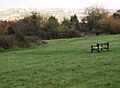
- McIlroy Park in Reading has views over the River Thames. It features an old sunken track called Gypsy Lane, lined with beech trees. Most of the park is grassland, but it also has ancient woodland and old chalk quarries.
- Ockwells Park in Maidenhead is the nature reserve part of a bigger park. It has paths and a nature trail through woodlands, meadows, and copses.
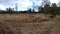
- Padworth Common in Burghfield Common is managed by BBOWT. It's mainly heathland, but also has grassland, wet areas, ponds, and oak and pine woodland. It's a great place to see heathland birds like Dartford warblers and European nightjars, and many dragonflies.
- Sutherland Grange in Windsor has a special hay meadow with many different flowers and grasses. These plants attract insects, which then provide food for birds in the hedges and trees.
Images for kids
-
Alder Moors
-
Ali's Pond
-
Ambarrow Court
-
Arthur Jacob Nature Reserve
-
Bisham Woods
-
Blundells Copse
-
Bradnam Wood
-
Braywick Park
-
Carpenter's Wood
-
Clayfield Copse
-
Cocksherd Wood
-
Edgbarrow Woods
-
Englemere Pond
-
Farley Copse
-
The Gullet
-
Hayley Green Wood
-
Haymill Valley
-
Heath Lake
-
Herschel Park
-
Highwood
-
Holt Copse
-
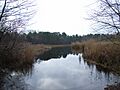
Hosehill Lake
-
Jock's Copse
-
Lavells Lake
-
Longmoor Bog
-
Lousehill Copse
-
Maiden Erlegh Lakes
-
The Marshes
-
McIlroy Park
-
Ockwells Park
-
Padworth Common
-
Park Wood and Goulding's Wood
-
Pearman's Copse
-
Piggy Wood
-
Round Copse
-
Sutherland Grange
-
Swallowfield Meadow
-
Temple Copse
-
Thatcham Reedbeds
-
Tinkers Copse
-
Whitegrove Copse
.jpg)


_cropped.jpg)
.jpg)
.jpg)
.jpg)

.jpg)


.jpg)
.jpg)
.jpg)
.jpg)

.jpg)
.jpg)


.jpg)


.jpg)

.jpg)

.jpg)

.jpg)

_(15142881791).jpg)

.jpg)

.jpg)
.jpg)
See also
- List of Sites of Special Scientific Interest in Berkshire
- Berkshire, Buckinghamshire and Oxfordshire Wildlife Trust
