List of places of worship in Tunbridge Wells (borough) facts for kids
The area of Tunbridge Wells in Kent, England, has almost 130 places where people currently or used to worship. This area is mostly countryside, but it also includes the busy town of Royal Tunbridge Wells and its nearby areas like Southborough, Pembury and Langton Green. Many churches and chapels are in the main town, along with two places of worship for non-Christian faiths. In the villages and small communities, you'll find old parish churches and smaller chapels for different Christian groups.
Today, 87 places of worship are still in use. They serve many Christian groups, as well as followers of Islam and the Subud movement. Another 37 buildings used to be places of worship but are now used for other things.
Most people in Tunbridge Wells consider themselves Christian. There are many Church of England churches, which is the official church of England. You can find them in tiny villages like Tudeley and Frittenden, older areas like High Brooms, and newer neighborhoods. Some Anglican churches are even shared with other Christian groups. There are also several churches for Baptists and Roman Catholics. Other Christian groups like Brethren, Christian Scientists, the Church of Christ, Latter-day Saints, Quakers, and The Salvation Army also have places to worship.
English Heritage has given "listed status" to 43 places of worship in the borough. This means they are special buildings with important history or design. There are three levels of listed status: Grade I (most important), Grade II* (very important), and Grade II (special interest). As of 2001, Tunbridge Wells had 26 Grade I buildings, 128 Grade II* buildings, and 2,066 Grade II buildings.
Contents
Exploring Tunbridge Wells' Places of Worship
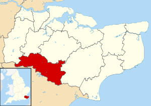
The Tunbridge Wells area covers about 33,133 hectares (81,870 acres) in southwest Kent, next to East Sussex. In 2011, about 115,200 people lived here. Just over half lived in the main towns of Royal Tunbridge Wells and Southborough. Other larger villages include Cranbrook, Goudhurst, Lamberhurst, Paddock Wood, and Pembury. The rest of the area is mostly the Weald, a hilly and green countryside.
Christianity first came to England through Kent in 597 AD. Many churches in this part of Kent were built after the Norman conquest in the late 1000s. Many parish churches from the 1100s are still standing. These often have a main hall (nave) and a smaller area for the altar (chancel). You can see examples in small villages like Bidborough and Capel. Churches in bigger villages like Cranbrook and Hawkhurst were built between the 1200s and 1400s, replacing older ones.
A lot of new churches were built during the Victorian era (1837-1901). This was because many old churches were falling apart, and the population was growing. Famous architects like Decimus Burton designed churches like Holy Trinity in Royal Tunbridge Wells. Other notable churches include Christ Church at Kilndown, known for its beautiful design, and Holy Trinity at Sissinghurst. As Southborough grew, four Anglican churches were built there between 1830 and 1886. A new Anglican church was also built in Royal Tunbridge Wells after World War II for a new housing area.
Many Protestant Nonconformist groups, who were not part of the Church of England, also built chapels in Kent, especially in the 1800s. Methodism was very popular, with many chapels built. Baptists and Congregationalists also built many places of worship. Today, only a few Methodist chapels are still in use, but many former ones can be found in villages.
Calvinism, a type of Protestantism, was also strong in rural Kent. Many Strict Baptist chapels, which are often small and plain with Biblical names like Ebenezer or Providence, still exist. The United Reformed Church, which came from the Congregational Church, also has several churches. In Royal Tunbridge Wells, a large Congregational church closed as the group decided to use fewer, bigger churches. Brethren groups have always had many meeting rooms in the Tunbridge Wells area, with some new ones built since the 1980s.
Roman Catholic churches are found in several villages and in Royal Tunbridge Wells. Most were built after World War II. The large St Augustine's Church in Royal Tunbridge Wells (1965) replaced an older, important building from 1837–38 that was later taken down for new shops. In some places, Catholics first met in private homes before building their own churches.
Who Worships Where: Religious Groups
In 2001, a survey showed that out of 104,030 people in Tunbridge Wells:
- 75.03% said they were Christian. This was higher than the average for England (71.74%).
- 0.57% were Muslim.
- 0.26% were Buddhist.
- 0.19% were Hindu.
- 0.17% were Jewish.
- 0.04% were Sikh.
- 0.31% followed another religion.
- 16.02% said they had no religion. This was also higher than the national average (14.59%).
- 7.41% did not say their religion.
Compared to England as a whole, there were fewer Muslims, Hindus, Sikhs, and Jewish people in Tunbridge Wells.
How Churches are Organized
Anglican Churches
Most Anglican churches in the borough belong to the Archdeaconry of Tonbridge, which is part of the Diocese of Rochester. The main church for this area is Rochester Cathedral. The archdeaconry is split into smaller areas called deaneries. For example, churches in Ashurst, Bidborough, Groombridge, and Speldhurst are in the Tunbridge Wells Deanery. This deanery also includes all 16 churches in the Royal Tunbridge Wells and Southborough towns.
Other Anglican churches in the area, such as those in Benenden, Cranbrook, and Hawkhurst, are part of the Weald Deanery. This deanery is in the Archdeaconry of Maidstone, which is part of the Diocese of Canterbury. The main church for the Diocese of Canterbury is Canterbury Cathedral.
Roman Catholic Churches
The nine Roman Catholic churches in the borough are part of the Archdiocese of Southwark. The main church for this archdiocese is St George's Cathedral in London. The churches in Paddock Wood, Pembury, Royal Tunbridge Wells, and Southborough are in the Tunbridge Wells Deanery. Churches in Goudhurst, Hawkhurst, and Horsmonden are in the Maidstone Deanery, as is the church in Cranbrook and its smaller Mass Centre in Benenden.
Baptist Churches
Many Baptist churches in southeast England are part of the South Eastern Baptist Association. This group organizes its churches into networks. For example, the churches in Hawkhurst and Sandhurst are in the South Kent Network. Those in Pembury and Royal Tunbridge Wells (Upper Grosvenor Road) are in the Tonbridge Network. This network also includes Paddock Wood Baptist Church and Speldhurst Chapel.
There are also several Strict and Reformed Baptist churches in the borough. Cranbrook, Lamberhurst, Matfield, and Southborough each have one. Royal Tunbridge Wells has two: the old Hanover Chapel and the newer Pantiles Baptist Church. Most of these are part of the Gospel Standard movement, except for Southborough and Pantiles chapel, which belongs to GraceNet UK.
Methodist Churches
As of 2010, St John's Methodist Church in Southborough and Horsmonden Methodist Church were part of the Tunbridge Wells Methodist Circuit. This circuit is within the Methodist South East District. Other Methodist churches in the area, like Vale Royal Methodist Church in Royal Tunbridge Wells and the churches at Hawkhurst and Sandhurst, have since closed.
Congregational Federation Churches
Cranbrook Congregational Church and Iden Green Congregational Church are part of the Congregational Federation. This group is made up of independent Congregational churches in Great Britain. The Federation was formed in 1972 when many Congregational churches joined with other groups to create the United Reformed Church. Some churches chose to stay independent and joined the Congregational Federation instead. As of January 2021, there were 235 churches in this Federation.
Current Places of Worship
| Name | Image | Location | Denomination/ Affiliation |
Grade | Notes | Refs |
|---|---|---|---|---|---|---|
| St Martin of Tours Church |  |
Ashurst 51°07′49″N 0°09′12″E / 51.1302°N 0.1532°E |
Anglican | I | This church has a 14th/15th-century look, even after many Victorian updates. It has a pretty wooden bell-tower and a porch from 1621. | |
| St George's Church |  |
Benenden 51°03′54″N 0°34′46″E / 51.0649°N 0.5795°E |
Anglican | II* | This old church was fixed up in 1862 in a Gothic style. It's a large, handsome building, partly rebuilt after lightning hit it in 1672. | |
| Benenden Catholic Chapel |  |
Benenden 51°04′24″N 0°34′48″E / 51.0732°N 0.5801°E |
Roman Catholic | – | This chapel has always been connected to the Cranbrook Catholic church. It serves as a smaller Mass centre. | |
| St Lawrence's Church |  |
Bidborough 51°10′00″N 0°14′14″E / 51.1667°N 0.2372°E |
Anglican | II* | This small church from the Norman era sits high above the village. Parts were added in the 1200s and 1876. | |
| All Saints Church |  |
Brenchley 51°09′00″N 0°24′01″E / 51.1500°N 0.4003°E |
Anglican | I | Mostly from the 1200s and 1300s, this large church has a strong, stepped tower with a small turret. Many old memorials are inside. | |
| St Mark's Church | 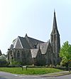 |
Broadwater Down, Royal Tunbridge Wells 51°06′57″N 0°15′06″E / 51.1158°N 0.2516°E |
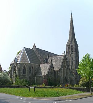
Anglican | II* | This unique stone church was finished in 1866. It has a tall spire with special decorations. | |
| Broadmead Church |  |
Broadwater Down, Royal Tunbridge Wells 51°07′03″N 0°15′01″E / 51.1176°N 0.2503°E |
Evangelical | – | This church, built in 1981, started from a Sunday School in the 1960s. It can hold 70 people. | |
| St Dunstan's Church |  |
Cranbrook 51°05′50″N 0°32′11″E / 51.0973°N 0.5363°E |
Anglican | I | This church, built over many years in the medieval period, has a tall nave and a short tower. It was restored in 1863. | |
| Cranbrook Strict Baptist Chapel |  |
Cranbrook 51°05′43″N 0°32′16″E / 51.0953°N 0.5378°E |
Baptist | II | This simple wooden chapel is the only Strict Baptist chapel left in the village centre. It has arched windows and a single gravestone outside. | |
| Cranbrook Congregational Church | 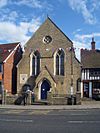 |
Cranbrook 51°05′46″N 0°32′05″E / 51.0962°N 0.5346°E |
Congregational Federation | II | Built in 1857, this yellow brick church has a Gothic style with a front porch and a small rose window. It remains independent. | |
| St Theodore's Church |  |
Cranbrook 51°05′39″N 0°31′41″E / 51.0943°N 0.5281°E |
Roman Catholic | – | This church was founded in 1935 in a house and got its permanent building in 1958. | |
| St James's Church | 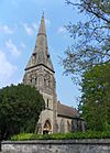 |
Ferndale, Royal Tunbridge Wells 51°08′08″N 0°16′25″E / 51.1356°N 0.2735°E |
Anglican | II | This stone church, built in 1860–62, cost £6,000. It has a tall-spired tower and an apse (rounded end) at the chancel. | |
| Church of Jesus Christ of Latter-day Saints |  |
Ferndale, Royal Tunbridge Wells 51°08′23″N 0°17′01″E / 51.1396°N 0.2837°E |
Latter-day Saint | – | This building was registered for marriages in June 1989. | |
| Five Oak Green United Church |  |
Five Oak Green 51°10′53″N 0°21′42″E / 51.1815°N 0.3618°E |
Anglican/United Reformed Church | – | This building, originally a Congregational chapel from 1925, became a "united church" in 1985, bringing two congregations together. | |
| The Meeting Hall |  |
Five Oak Green 51°11′15″N 0°21′48″E / 51.1876°N 0.3633°E |
Brethren | – | This large meeting hall opened in 2013, replacing a smaller, overcrowded one in Royal Tunbridge Wells. | |
| St Mary's Church |  |
Frittenden 51°08′21″N 0°35′26″E / 51.1391°N 0.5905°E |
Anglican | II* | This church was badly damaged by fire in 1790. It was largely rebuilt in 1846–48 and had a spire-topped tower added later. | |
| St Mary's Church |  |
Goudhurst 51°06′49″N 0°27′42″E / 51.1137°N 0.4616°E |
Anglican | I | This large 13th-century church has a mix of old and new styles. It gained a Classical/Gothic tower in the 1630s. | |
| Church of the Sacred Heart |  |
Goudhurst 51°06′56″N 0°28′11″E / 51.1156°N 0.4697°E |
Roman Catholic | – | This brick and tile chapel was built in 1882 for a "Home for Cripples" nearby. | |
| St John the Baptist's Chapel |  |
Groombridge 51°07′05″N 0°11′08″E / 51.1180°N 0.1856°E |
Anglican | I | Built as a private chapel in 1625, this simple Gothic chapel of red brick is now the local Anglican church. | |
| Hawkenbury United Reformed Church |  |
Hawkenbury 51°07′35″N 0°16′52″E / 51.1264°N 0.2810°E |
United Reformed Church | – | This simple red-brick church was designed in 1899 and has been extended twice. | |
| St Laurence's Church | Hawkhurst 51°02′15″N 0°30′12″E / 51.0376°N 0.5032°E |
Anglican | I | This large, strong church from the 1300s is far from the village centre. It was restored in the 1850s. | ||
| Hawkhurst Baptist Church |  |
Hawkhurst 51°03′00″N 0°30′33″E / 51.0501°N 0.5091°E |
Baptist | – | This large brick and stone Gothic Revival chapel was built in 1892–93 for £1,620. | |
| St Barnabas' Church |  |
Hawkhurst 51°02′56″N 0°30′24″E / 51.0488°N 0.5066°E |
Roman Catholic | – | This Roman Catholic church is one of three in the Goudhurst, Hawkhurst, and Horsmonden parish. | |
| St Matthew's Church |  |
High Brooms 51°09′02″N 0°16′27″E / 51.1506°N 0.2743°E |
Anglican | – | This red-brick church, built in 1902, quickly became its own parish. It started as a mission church. | |
| Tunbridge Wells Church of Christ |  |
High Brooms 51°08′52″N 0°16′31″E / 51.1477°N 0.2752°E |
Church of Christ | – | This modern building is used for worship by the Church of Christ. | |
| New Covenant Church | 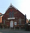 |
High Brooms 51°09′06″N 0°16′20″E / 51.1516°N 0.2723°E |
Evangelical | – | This building started as a Methodist chapel in 1898 and is now an Evangelical church. | |
| St Margaret's Church |  |
Horsmonden 51°07′01″N 0°25′59″E / 51.1170°N 0.4330°E |
Anglican | I | This early 14th-century church is far from the village. It has a 15th-century tower and large windows. | |
| Horsmonden Methodist Church |  |
Horsmonden 51°08′23″N 0°25′37″E / 51.1398°N 0.4269°E |
Methodist | – | This church, built in 1965, was originally for Plymouth Brethren. The first Methodist chapel was demolished in 1969. | |
| All Saints Church |  |
Horsmonden 51°08′49″N 0°26′11″E / 51.1470°N 0.4363°E |
Roman Catholic | II | This Gothic Revival church from 1869 was originally Anglican. It closed in 1970 and was bought and reopened by the Catholic Church in 1972. | |
| Iden Green Congregational Church |  |
Iden Green, Benenden 51°03′27″N 0°34′26″E / 51.0575°N 0.5740°E |
Congregational Federation | – | This brick building from 1953 replaced a war-damaged chapel nearby. | |
| Christ Church | 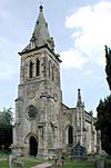 |
Kilndown 51°05′27″N 0°25′37″E / 51.0908°N 0.4270°E |
Anglican | I | This Gothic Revival church, started in 1839, is known for its rich interior decorations and fittings. It was repaired after bomb damage in wartime. | |
| St Mary's Church |  |
Lamberhurst 51°06′18″N 0°23′45″E / 51.1051°N 0.3957°E |
Anglican | I | This 14th-century church has a Perpendicular Gothic tower and some 17th-century features. | |
| Lamberhurst Strict Baptist Chapel |  |
Lamberhurst 51°05′56″N 0°23′23″E / 51.0989°N 0.3898°E |
Baptist | II | This chapel was rebuilt in 1851 in a Neoclassical style with round-arched windows and a pediment. | |
| All Saints Church |  |
Langton Green 51°07′55″N 0°12′17″E / 51.1319°N 0.2047°E |
Anglican | II* | This stone church from 1864–66 has aisles and a bellcote. It has rich internal decorations, including stained glass. | |
| St Luke's Church |  |
Matfield 51°09′09″N 0°22′16″E / 51.1526°N 0.3711°E |
Anglican | II | This small stone church has a single aisle, a spire-topped bell-turret, and a gabled porch. | |
| Ebenezer Strict Baptist Chapel |  |
Matfield 51°09′10″N 0°22′22″E / 51.1528°N 0.3728°E |
Baptist | – | This Strict Baptist chapel was registered for marriages in 1937, replacing an older building. | |
| Church of King Charles the Martyr |  |
Mount Sion, Royal Tunbridge Wells 51°07′36″N 0°15′33″E / 51.1267°N 0.2593°E |
Anglican | I | Famous for its detailed plaster ceilings, this chapel was built between 1676 and 1690. | |
| Christ Church Centre |  |
Mount Sion, Royal Tunbridge Wells 51°07′44″N 0°15′46″E / 51.1288°N 0.2629°E |
Anglican | – | The first church here was built in 1836–41. It was replaced by this combined church and shop building in the 1990s. | |
| First Church of Christ, Scientist |  |
Mount Sion, Royal Tunbridge Wells 51°07′30″N 0°15′27″E / 51.1251°N 0.2574°E |
Christian Scientist | – | This group moved to this new building in 1959 after selling their original circular church. | |
| St Andrew's Church | 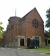 |
Paddock Wood 51°10′35″N 0°23′07″E / 51.1763°N 0.3852°E |
Anglican/Methodist | – | This church, built in 1953, replaced one bombed in the war. It is shared by Anglican and Methodist groups. | |
| Paddock Wood Christian Fellowship |  |
Paddock Wood 51°10′47″N 0°23′05″E / 51.1797°N 0.3847°E |
Assemblies of God | – | Founded in 1958, this Pentecostalist church building dates from 1960. | |
| St Justus' Church |  |
Paddock Wood 51°10′46″N 0°23′03″E / 51.1795°N 0.3841°E |
Roman Catholic | – | The first Catholic church here was built in 1950. A larger building opened in 1981, and the old one became the church hall. | |
| St Peter's Old Church |  |
Pembury 51°09′46″N 0°19′31″E / 51.1628°N 0.3253°E |
Anglican | I | This old stone church is isolated from modern Pembury. It combines Norman and 14th-century features. | |
| St Peter's Upper Church |  |
Pembury 51°08′31″N 0°19′23″E / 51.1420°N 0.3231°E |
Anglican | II* | This church was built in 1846–47 in a more central location than the old parish church. It's in a Perpendicular Gothic Revival style. | |
| Pembury Baptist Church |  |
Pembury 51°08′51″N 0°19′41″E / 51.1475°N 0.3280°E |
Baptist | – | This red-brick building, designed in 1887, was once shared with Congregationalists before becoming solely Baptist. | |
| St Anselm's Church |  |
Pembury 51°08′43″N 0°19′25″E / 51.1452°N 0.3236°E |
Roman Catholic | – | A temporary chapel was used here from 1964 until a permanent church was built in 1980. | |
| St Barnabas' Church |  |
Royal Tunbridge Wells 51°08′19″N 0°16′11″E / 51.1385°N 0.2697°E |
Anglican | II | This large red-brick and stone church was built between 1889 and 1893. A tower was planned but never built. | |
| St John's Church |  |
Royal Tunbridge Wells 51°08′25″N 0°15′40″E / 51.1403°N 0.2611°E |
Anglican | II | This stone church from 1858 has been extended several times. It features stained glass by C.E. Kempe. | |
| St Luke's Church | 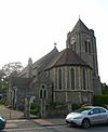 |
Royal Tunbridge Wells 51°08′41″N 0°16′08″E / 51.1448°N 0.2690°E |
Anglican/Russian Orthodox | – | This church, built in 1910, is also used occasionally by a Russian Orthodox group. | |
| St Peter's Church |  |
Royal Tunbridge Wells 51°07′49″N 0°16′31″E / 51.1304°N 0.2754°E |
Anglican | – | This spire-topped stone church was built in 1874–75 and later had a north aisle added. | |
| Hanover Strict Baptist Chapel | 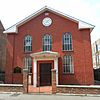 |
Royal Tunbridge Wells 51°08′08″N 0°15′44″E / 51.1356°N 0.2622°E |
Baptist | II | This red-brick Classical-style building opened in 1834 and was "reconstructed" in 1883. | |
| Pantiles Baptist Church |  |
Royal Tunbridge Wells 51°07′07″N 0°15′37″E / 51.1187°N 0.2604°E |
Baptist | – | This church was formed in 1984 when two Baptist congregations joined together. It opened in 1995. | |
| Tunbridge Wells Baptist Church | 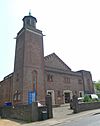 |
Royal Tunbridge Wells 51°08′12″N 0°15′52″E / 51.1366°N 0.2644°E |
Baptist | – | This brick building from 1938 replaced a more expensive Baptist Tabernacle from 1883. | |
| Culverden Evangelical Church | 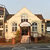 |
Royal Tunbridge Wells 51°08′16″N 0°15′43″E / 51.1379°N 0.2619°E |
Brethren | – | This chapel, built in 1923, is used by Open Brethren. It was registered for marriages in 1927. | |
| Hill Street Brethren | 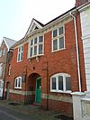 |
Royal Tunbridge Wells 51°08′14″N 0°16′00″E / 51.1372°N 0.2668°E |
Brethren | – | This brick building opened in 1904 as a Methodist mission chapel. Brethren acquired it in 1934. | |
| York Road Christian Assembly | 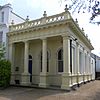 |
Royal Tunbridge Wells 51°08′00″N 0°15′37″E / 51.1332°N 0.2604°E |
Brethren | – | This Classical-style meeting room dates from about 1891. | |
| Tunbridge Wells Christian Fellowship | 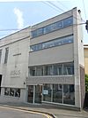 |
Royal Tunbridge Wells 51°08′07″N 0°15′44″E / 51.1352°N 0.2623°E |
Assemblies of God | – | The Christian Centre is home to this Pentecostalist group. | |
| Commercial Road Church of Christ | 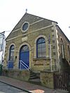 |
Royal Tunbridge Wells 51°08′15″N 0°16′10″E / 51.1376°N 0.2694°E |
Church of Christ | – | This chapel, built in 1877, was originally for the Disciples of Christ and later passed to the Church of Christ. | |
| Calvary Church | 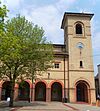 |
Royal Tunbridge Wells 51°08′07″N 0°16′03″E / 51.1354°N 0.2676°E |
Evangelical | – | This church is part of the Royal Victoria Place shopping centre. It replaced an older chapel. | |
| En-Noor Mosque (Tunbridge Wells Islamic Cultural Centre) | 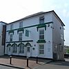 |
Royal Tunbridge Wells 51°08′11″N 0°16′08″E / 51.1363°N 0.2689°E |
Muslim | – | This building on Camden Road is a mosque and community centre for Muslims, including a school. | |
| Friends Meeting House | 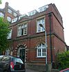 |
Royal Tunbridge Wells 51°08′14″N 0°15′45″E / 51.1372°N 0.2624°E |
Quaker | – | This red-brick building from 1894 is the only purpose-built 19th-century Quaker place of worship in Kent. | |
| St Augustine's Church |  |
Royal Tunbridge Wells 51°07′54″N 0°16′01″E / 51.1317°N 0.2669°E |
Roman Catholic | – | This large church, completed in 1965, replaced an older Classical-style building from 1837–38. | |
| Salvation Army Citadel |  |
Royal Tunbridge Wells 51°07′53″N 0°16′25″E / 51.1315°N 0.2737°E |
Salvation Army | – | This citadel, opened in 1970, replaced an older, ornate building from 1886. | |
| Subud House |  |
Royal Tunbridge Wells 51°08′30″N 0°15′32″E / 51.1418°N 0.2588°E |
Subud | – | This building was registered in 1987 for the Subud group, a religious movement from Indonesia. | |
| Tunbridge Wells United Reformed Church |  |
Royal Tunbridge Wells 51°08′12″N 0°15′42″E / 51.1368°N 0.2617°E |
United Reformed Church/Methodist | – | This Gothic Revival church from 1899 was originally a Free Baptist church. It is now United Reformed and shared with Methodists. | |
| St Paul's Church |  |
Rusthall 51°07′51″N 0°14′15″E / 51.1308°N 0.2376°E |
Anglican | II | This stone church, built in 1849–50, has a central tower. Its churchyard has many expensive tombstones. | |
| St Paul's Church Centre |  |
Rusthall 51°08′07″N 0°13′53″E / 51.1353°N 0.2313°E |
Anglican | – | This Gothic Revival brick building from 1887 has always been a mission church for St Paul's parish church. | |
| Rusthall Evangelical Church |  |
Rusthall 51°08′21″N 0°13′47″E / 51.1391°N 0.2297°E |
Evangelical | – | This church, founded in 1913 as the Ebenezer Mission Hall, was registered under its current name in 1993. | |
| Rusthall United Reformed Church |  |
Rusthall 51°08′07″N 0°13′49″E / 51.1354°N 0.2304°E |
United Reformed Church | – | This larger church was built in 1902 and acquired by the Congregational church in 1967. | |
| St Nicholas' Church |  |
Sandhurst 51°01′02″N 0°33′05″E / 51.0173°N 0.5514°E |
Anglican | II* | This large church has some 13th and 14th-century parts, including an impressive tower. It was heavily restored in 1875. | |
| St Nicholas' Mission Church |  |
Sandhurst 51°01′33″N 0°33′49″E / 51.0258°N 0.5636°E |
Anglican | – | This small mission chapel is in the centre of Sandhurst village. | |
| Sandhurst Baptist Chapel |  |
Sandhurst 51°01′22″N 0°35′09″E / 51.0227°N 0.5857°E |
Baptist | II | This large red-brick chapel from 1853 has unique white brick pilasters and a columned gallery inside. | |
| St Philip the Evangelist's Church |  |
Sherwood, Royal Tunbridge Wells 51°08′42″N 0°16′57″E / 51.1449°N 0.2826°E |
Anglican | – | This church started as a "church plant" in 1964 and got its own parish in 2004. | |
| Brethren Meeting Room |  |
Sherwood, Royal Tunbridge Wells 51°08′54″N 0°17′06″E / 51.1484°N 0.2849°E |
Brethren | – | This converted house, registered for marriages in 1995, can hold 120 worshippers. | |
| Holy Trinity Church | 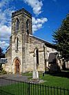 |
Sissinghurst 51°06′32″N 0°33′49″E / 51.1090°N 0.5635°E |
Anglican | II | Designed in 1838, this church was so expensive to build that it bankrupted its builder. | |
| Christ Church |  |
Southborough 51°09′27″N 0°15′18″E / 51.1576°N 0.2551°E |
Anglican | II | This Gothic Revival church, started in 1870, was not finished until 1889 and cost £2,400. | |
| St Peter's Church | 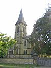 |
Southborough 51°09′45″N 0°15′07″E / 51.1626°N 0.2519°E |
Anglican | II | The parish church of Southborough dates from 1830–31 and was designed by Decimus Burton. It was extended in 1866 and 1883. | |
| St Thomas's Church |  |
Southborough 51°09′44″N 0°15′27″E / 51.1622°N 0.2576°E |
Anglican | II | This Gothic Revival church was designed in 1860–61 and has a bellcote. | |
| Bethel Chapel | 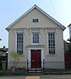 |
Southborough 51°09′21″N 0°15′32″E / 51.1559°N 0.2590°E |
Baptist | – | This simple Classical chapel has been used continuously by Strict Baptists since 1882. | |
| New Life Church |  |
Southborough 51°09′12″N 0°15′13″E / 51.1533°N 0.2536°E |
Evangelical | – | This church, part of the Newfrontiers movement, received its marriage license in 2000. | |
| Kingdom Hall | 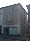 |
Southborough 51°09′26″N 0°15′35″E / 51.1571°N 0.2597°E |
Jehovah's Witnesses | – | This Kingdom Hall is located in a shop unit and is used by Jehovah's Witnesses congregations. | |
| St John's Methodist Church |  |
Southborough 51°09′36″N 0°15′25″E / 51.1601°N 0.2570°E |
Methodist | – | This is the third Methodist chapel on this site, with the current building dating from 1936. | |
| St Dunstan's Church | 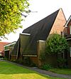 |
Southborough 51°09′38″N 0°15′24″E / 51.1605°N 0.2567°E |
Roman Catholic | – | This Roman Catholic church was licensed for marriages in 1963. | |
| St Mary the Virgin's Church |  |
Speldhurst 51°09′04″N 0°13′12″E / 51.1511°N 0.2199°E |
Anglican | II* | This church, built in 1870–71, is the third on the site. An older church was destroyed by lightning. | |
| Speldhurst Chapel |  |
Speldhurst 51°09′11″N 0°13′07″E / 51.1531°N 0.2186°E |
Baptist | – | This small chapel is managed by Tonbridge Baptist Church and was updated in 2011 for better access. | |
| All Saints Church |  |
Tudeley 51°11′12″N 0°18′50″E / 51.1866°N 0.3138°E |
Anglican | I | This medieval church has been renovated several times. It is famous for its unique stained glass windows by Marc Chagall. |
Former Places of Worship
| Name | Image | Location | Denomination/ Affiliation |
Grade | Notes | Refs |
|---|---|---|---|---|---|---|
| Brenchley Methodist Church | Brenchley 51°09′15″N 0°23′59″E / 51.1542°N 0.3998°E |
Methodist | – | This brick building, dating from 1839, has been a house since it closed in 1964. | ||
| Broomhill Mission Church |  |
Broomhill Bank, Speldhurst 51°08′36″N 0°14′09″E / 51.1434°N 0.2359°E |
Anglican | – | This small stone chapel from 1878 became a business around World War II. It still has its small spire. | |
| St Thomas a Becket's Church |  |
Capel 51°10′36″N 0°20′32″E / 51.1766°N 0.3423°E |
Anglican | I | Mostly Norman, this former church has old wall paintings. It closed in 1986 and is now cared for by a trust. | |
| Providence Chapel |  |
Cranbrook 51°05′45″N 0°32′10″E / 51.0959°N 0.5361°E |
Baptist | II* | This unique chapel from 1795 is now unused. It has a seven-sided front and galleries inside. | |
| Providence Chapel |  |
Curtisden Green 51°08′15″N 0°29′05″E / 51.1375°N 0.4846°E |
Baptist | – | This "model village chapel" was built for Baptists in 1878 and is now a house. | |
| St Margaret's Church |  |
East End, Benenden 51°05′11″N 0°36′50″E / 51.0865°N 0.6138°E |
Anglican | – | Built as a private chapel in 1892, it later served as a hospital chapel. | |
| St Luke's Mission Church |  |
Five Oak Green 51°11′00″N 0°21′29″E / 51.1834°N 0.3580°E |
Anglican | – | This brick mission chapel was redeveloped for housing after the congregation moved. | |
| Capel Congregational Chapel | 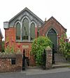 |
Five Oak Green 51°11′03″N 0°21′30″E / 51.1843°N 0.3584°E |
Congregational | – | This chapel, built in 1869, is now a house. It closed because railway noise affected services. | |
| Providence Chapel |  |
Frittenden 51°08′24″N 0°35′47″E / 51.1400°N 0.5965°E |
Baptist | II | This one-story chapel is now a house. It has red-brick walls and a gabled roof. | |
| Frittenden Bethel Chapel |  |
Frittenden 51°08′17″N 0°36′06″E / 51.1381°N 0.6017°E |
Assemblies of God | – | This small building, used by the Assemblies of God, is now a cottage. | |
| Goudhurst Methodist Chapel |  |
Goudhurst 51°06′55″N 0°27′38″E / 51.1152°N 0.4605°E |
Methodist | – | This red-brick building from 1878 closed in the early 2000s. | |
| Goudhurst Primitive Methodist Chapel |  |
Goudhurst 51°06′54″N 0°28′07″E / 51.1149°N 0.4687°E |
Methodist | – | This simple brick chapel, built in the mid-1800s, became a house after closing in the 1930s. | |
| All Saints Church |  |
Hawkhurst 51°02′49″N 0°30′45″E / 51.0469°N 0.5124°E |
Anglican | II | This church, built in 1861, closed in the 1990s. It has since been converted into private apartments. | |
| Ebenezer Strict Baptist Chapel | Hawkhurst 51°02′52″N 0°30′35″E / 51.0479°N 0.5097°E |
Baptist | – | This Strict Baptist chapel, built in 1872–73, closed permanently in the late 20th century. | ||
| Hawkhurst Methodist Church |  |
Hawkhurst 51°02′40″N 0°30′31″E / 51.0445°N 0.5085°E |
Methodist | – | This Gothic-style brick chapel closed in 2010. | |
| Holden Park Gospel Hall | 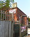 |
Southborough 51°09′19″N 0°15′23″E / 51.1554°N 0.2564°E |
Brethren | – | This Brethren meeting room was licensed for marriages in 1985 but closed in 2012. | |
| Horsmonden Baptist Chapel | Horsmonden 51°09′38″N 0°26′48″E / 51.1605°N 0.4467°E |
Baptist | – | This brick building was used as a church from 1889 to 1971 and is now a house. | ||
| Kilndown Wesleyan Chapel | Kilndown 51°05′22″N 0°25′32″E / 51.0895°N 0.4255°E |
Methodist | – | This simple brick building from 1885 is now a shop and house. | ||
| Lamberhurst Methodist Church |  |
Lamberhurst 51°05′54″N 0°23′22″E / 51.0983°N 0.3895°E |
Methodist | – | This building, which was both a school and a chapel, dates from 1882. | |
| Primitive Methodist (Ranters) Chapel |  |
Lamberhurst 51°05′54″N 0°23′23″E / 51.0984°N 0.3898°E |
Methodist | – | This small building, originally for Primitive Methodists, is now a garage. | |
| Langton Wesleyan Chapel |  |
Langton Green 51°07′54″N 0°12′41″E / 51.1316°N 0.2113°E |
Methodist | – | This brick chapel from 1871 closed in the 1940s and became a cottage. | |
| Rehoboth Baptist Chapel |  |
Mount Sion, Royal Tunbridge Wells 51°07′36″N 0°15′36″E / 51.1267°N 0.2601°E |
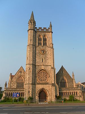
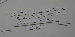
Baptist | – | This Classical-style chapel from 1851 was used for worship until the 1980s and is now a commercial building. | |
| Kingdom Hall |  |
Mount Sion, Royal Tunbridge Wells 51°07′38″N 0°15′35″E / 51.1273°N 0.2597°E |
Jehovah's Witnesses | – | This part of a former hotel was used by Jehovah's Witnesses between 1945 and 1956. | |
| Vale Royal Methodist Church | 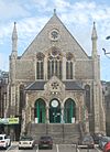 |
Mount Sion, Royal Tunbridge Wells 51°07′43″N 0°15′42″E / 51.1287°N 0.2616°E |
Methodist | – | This expensive church from 1872–73 closed in 2015. Its congregation now shares another church. | |
| Mount Sion Chapel |  |
Mount Sion, Royal Tunbridge Wells 51°07′38″N 0°15′41″E / 51.1273°N 0.2615°E |
Presbyterian | – | This chapel, opened in 1720, is now an office. | |
| Paddock Wood Wesleyan Chapel |  |
Paddock Wood 51°10′45″N 0°23′14″E / 51.1793°N 0.3873°E |
Methodist | – | This red-brick chapel from 1888 was shared by Anglicans and Methodists before it was sold. | |
| Pembury Wesleyan Church | 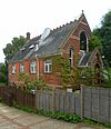 |
Pembury 51°08′29″N 0°19′37″E / 51.1414°N 0.3269°E |
Methodist | – | This Gothic Revival chapel from 1884 closed in 1967. It was later used by the Subud movement and is now a house. | |
| Mount Pleasant Congregational Church |  |
Royal Tunbridge Wells 51°08′01″N 0°15′47″E / 51.1335°N 0.2630°E |
Congregational | II* | This large Classical-style chapel, built in 1845–48, was later sold and turned into shops. | |
| Albion Road Congregational Church | 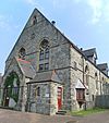 |
Royal Tunbridge Wells 51°08′18″N 0°16′16″E / 51.1383°N 0.2711°E |
Congregational | – | This Gothic Revival chapel from 1873 was used for worship until about 1929 and had many uses after that. | |
| Bible Mission Hall |  |
Royal Tunbridge Wells 51°08′27″N 0°15′28″E / 51.1409°N 0.2579°E |
Non-denominational | – | This building from 1873 became a parish hall, a studio, and later a Red Cross hall. | |
| Grosvenor Mission |  |
Royal Tunbridge Wells 51°08′12″N 0°15′46″E / 51.1367°N 0.2627°E |
Non-denominational | – | This hall was used for worship for a short time in the mid-1900s and is now used for business. | |
| Holy Trinity Church | 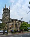 |
Royal Tunbridge Wells 51°07′58″N 0°15′44″E / 51.1328°N 0.2622°E |
Anglican | II* | This church, built in 1827–29, was the town's first parish church. It closed in the 1970s and was saved from demolition to become a theatre. | |
| Christian Science Church |  |
Royal Tunbridge Wells 51°08′44″N 0°15′36″E / 51.1455°N 0.2601°E |
Christian Scientist | – | This unique circular concrete building served as a church from 1931 to 1959 before becoming offices. | |
| Down Lane Primitive Methodist Chapel | 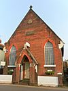 |
Royal Tunbridge Wells 51°08′30″N 0°15′33″E / 51.1416°N 0.2593°E |
Methodist | – | This brick building from 1874 has been used by different groups and is now an antiques shop. | |
| Chapel | Sandhurst 51°01′31″N 0°33′31″E / 51.0253°N 0.5587°E |
II | This 18th-century former chapel, made of wood and brick, is now a storehouse. | |||
| Collins Memorial Methodist Chapel | 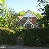 |
Sandhurst 51°01′35″N 0°33′57″E / 51.0265°N 0.5657°E |
Methodist | – | This building was built for Wesleyan Methodist worship and is now a house. | |
| Sissinghurst Methodist Church |  |
Sissinghurst 51°06′32″N 0°33′41″E / 51.1089°N 0.5615°E |
Methodist | – | This red and white brick chapel closed in the 1970s and became a house in 1981. | |
| Jehovah Jireh Baptist Church |  |
Walnut Tree, Brenchley 51°09′04″N 0°22′53″E / 51.1511°N 0.3815°E |
Baptist | II | Little is known about this wooden chapel, built in the early 1900s in an older Gothic Revival style. |
 | Isaac Myers |
 | D. Hamilton Jackson |
 | A. Philip Randolph |


