Manasquan, New Jersey facts for kids
Quick facts for kids
Manasquan, New Jersey
|
||
|---|---|---|
|
Borough
|
||
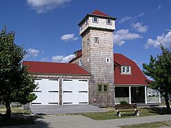
The Squan Beach Life-Saving Station
|
||
|
||
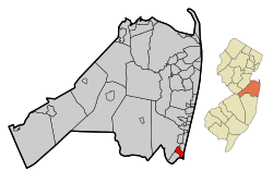
Location of Manasquan in Monmouth County highlighted in red (left). Inset map: Location of Manasquan County in New Jersey highlighted in orange (right).
|
||
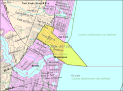
Census Bureau map of Manasquan, New Jersey
|
||
| Country | ||
| State | ||
| County | Monmouth | |
| Incorporated | December 30, 1887 | |
| Government | ||
| • Type | Borough | |
| • Body | Borough Council | |
| Area | ||
| • Total | 2.52 sq mi (6.54 km2) | |
| • Land | 1.38 sq mi (3.57 km2) | |
| • Water | 1.15 sq mi (2.97 km2) 45.26% | |
| Area rank | 373rd of 565 in state 24th of 53 in county |
|
| Elevation | 3 ft (0.9 m) | |
| Population
(2020)
|
||
| • Total | 5,938 | |
| • Estimate
(2023)
|
5,877 | |
| • Rank | 349th of 565 in state 29th of 53 in county |
|
| • Density | 4,302.9/sq mi (1,661.4/km2) | |
| • Density rank | 143rd of 565 in state 14th of 53 in county |
|
| Time zone | UTC−05:00 (Eastern (EST)) | |
| • Summer (DST) | UTC−04:00 (Eastern (EDT)) | |
| ZIP Code |
08736
|
|
| Area code(s) | 732 | |
| FIPS code | 3402543050 | |
| GNIS feature ID | 0885289 | |
| Website | ||
Manasquan (pronounced man-ə-SKWAHN) is a small town, called a borough, in Monmouth County, New Jersey. It's located right on the Jersey Shore, which is a popular coastal area. In 2020, about 5,938 people lived here.
The name Manasquan comes from the Lenape Native American language. It means "Place to Gather Grass or Reeds." Other ideas for the name's meaning include "stream of the island of squaws" or "island door." The town was officially formed on December 30, 1887. In 2008, New Jersey Monthly magazine said Manasquan was the 22nd best place to live in New Jersey.
Contents
Manasquan's Location and Surroundings
Manasquan is a small borough covering about 2.5 square miles (6.5 square kilometers). A good part of this area, about 1.15 square miles, is water.
The borough shares its borders with several other towns. In Monmouth County, it borders Brielle, Sea Girt, and Wall Township. It also borders Point Pleasant Beach in Ocean County.
Manasquan's Weather
Manasquan has a humid subtropical climate. This means it has warm, humid summers and mild winters. Average temperatures range from about 32°F (0°C) in January to 75°F (24°C) in July.
In summer, a cool sea breeze often blows in the afternoons. However, it can sometimes get very hot and humid. Winters can be very cold and windy. The area usually gets about 18 to 24 inches (45 to 60 cm) of snow each year. February is typically the snowiest month.
| Climate data for Manasquan Beach, NJ (1981–2010 Averages) | |||||||||||||
|---|---|---|---|---|---|---|---|---|---|---|---|---|---|
| Month | Jan | Feb | Mar | Apr | May | Jun | Jul | Aug | Sep | Oct | Nov | Dec | Year |
| Mean daily maximum °F (°C) | 39.9 (4.4) |
42.6 (5.9) |
49.1 (9.5) |
58.7 (14.8) |
68.5 (20.3) |
77.6 (25.3) |
83.2 (28.4) |
81.9 (27.7) |
75.7 (24.3) |
65.1 (18.4) |
55.1 (12.8) |
45.1 (7.3) |
62.0 (16.7) |
| Daily mean °F (°C) | 32.4 (0.2) |
34.7 (1.5) |
40.9 (4.9) |
50.3 (10.2) |
60.0 (15.6) |
69.4 (20.8) |
75.1 (23.9) |
74.0 (23.3) |
67.4 (19.7) |
56.3 (13.5) |
47.1 (8.4) |
37.5 (3.1) |
53.8 (12.1) |
| Mean daily minimum °F (°C) | 24.9 (−3.9) |
26.7 (−2.9) |
32.7 (0.4) |
41.9 (5.5) |
51.5 (10.8) |
61.2 (16.2) |
67.0 (19.4) |
66.0 (18.9) |
59.0 (15.0) |
47.3 (8.5) |
39.0 (3.9) |
30.0 (−1.1) |
45.7 (7.6) |
| Average precipitation inches (mm) | 3.66 (93) |
3.12 (79) |
4.19 (106) |
4.00 (102) |
3.45 (88) |
3.65 (93) |
4.72 (120) |
4.44 (113) |
3.44 (87) |
3.74 (95) |
4.05 (103) |
4.04 (103) |
46.50 (1,181) |
| Average relative humidity (%) | 64.9 | 62.0 | 60.8 | 62.1 | 65.7 | 70.3 | 69.2 | 71.2 | 71.1 | 69.6 | 67.8 | 65.8 | 66.7 |
| Average dew point °F (°C) | 21.9 (−5.6) |
23.0 (−5.0) |
28.4 (−2.0) |
37.8 (3.2) |
48.5 (9.2) |
59.3 (15.2) |
64.3 (17.9) |
64.1 (17.8) |
57.7 (14.3) |
46.5 (8.1) |
37.0 (2.8) |
27.1 (−2.7) |
43.1 (6.2) |
| Source: PRISM | |||||||||||||
| Climate data for Sandy Hook, NJ Ocean Water Temperature (25 N Manasquan) | |||||||||||||
|---|---|---|---|---|---|---|---|---|---|---|---|---|---|
| Month | Jan | Feb | Mar | Apr | May | Jun | Jul | Aug | Sep | Oct | Nov | Dec | Year |
| Daily mean °F (°C) | 37 (3) |
36 (2) |
40 (4) |
46 (8) |
55 (13) |
62 (17) |
69 (21) |
72 (22) |
68 (20) |
59 (15) |
51 (11) |
43 (6) |
53 (12) |
| Source: NOAA | |||||||||||||
Manasquan's Natural Environment
Manasquan is located in an area that would naturally have an Appalachian Oak forest. This means the original natural plant life would be mostly Hardwood trees, especially oak trees.
Manasquan's Population Over Time
| Historical population | |||
|---|---|---|---|
| Census | Pop. | %± | |
| 1890 | 1,506 | — | |
| 1900 | 1,500 | −0.4% | |
| 1910 | 1,582 | 5.5% | |
| 1920 | 1,705 | 7.8% | |
| 1930 | 2,320 | 36.1% | |
| 1940 | 2,340 | 0.9% | |
| 1950 | 3,178 | 35.8% | |
| 1960 | 4,022 | 26.6% | |
| 1970 | 4,971 | 23.6% | |
| 1980 | 5,354 | 7.7% | |
| 1990 | 5,369 | 0.3% | |
| 2000 | 6,310 | 17.5% | |
| 2010 | 5,897 | −6.5% | |
| 2020 | 5,938 | 0.7% | |
| 2023 (est.) | 5,877 | −0.3% | |
| Population sources: 1890–1920 1890 1890–1910 1910–1930 1940–2000 2000 2010 2020 |
|||
In 2010, Manasquan had 5,897 people living there. Most residents were White (96.07%). About 7.02% of the population was Hispanic or Latino. The average age of people in Manasquan was 43.5 years old.
Life in Manasquan
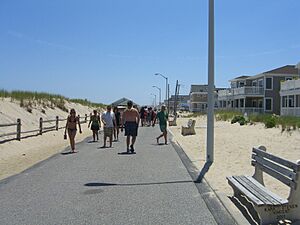
Because Manasquan is on the Atlantic Ocean, its population grows a lot in the summer. Many tourists come to enjoy the beach.
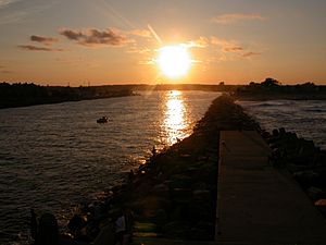
The Manasquan Inlet is a great spot for surfers. The jetty (a long wall built into the water) helps create good waves. The Manasquan Inlet also marks the northern end of the Intracoastal Waterway, which is like a highway for boats along the coast.
Manasquan has a charming downtown area with many local shops. The Algonquin Arts Theatre is a historic place built in 1938. It used to be a movie theater but now hosts live shows and movies all year.
The town has changed over time. Many old beach bungalows have been replaced by bigger homes. This has made Manasquan more of a year-round community.
A fun event in Manasquan is the Firemans' Fair. It happens every July or August and helps raise money for the local volunteer fire company. This fair has been a tradition since 1974.
Getting Around Manasquan
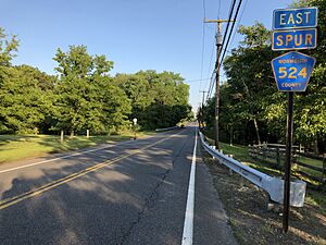
The main road that goes through Manasquan is Route 71. The Garden State Parkway is a major highway nearby.
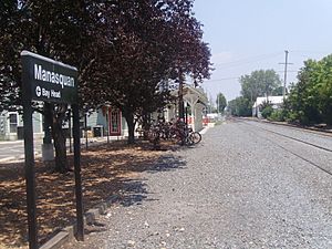
For public transportation, NJ Transit offers train service at the Manasquan station. You can take a train on the North Jersey Coast Line south to towns like Point Pleasant Beach or north to places like Newark and even Penn Station in Midtown Manhattan, New York City. NJ Transit also has bus routes connecting Manasquan to Philadelphia and providing local service.
Education in Manasquan
The Manasquan Public Schools system serves students from kindergarten all the way through twelfth grade. In the 2022–23 school year, about 1,470 students attended the two schools in the district.
- Manasquan Elementary School: This school has about 499 students in grades K-8.
- Manasquan High School: This high school has about 948 students in grades 9-12.
Students from several nearby towns also attend Manasquan High School. These towns include Avon-by-the-Sea, Belmar, Brielle, Lake Como, Sea Girt, Spring Lake, and Spring Lake Heights. The two public school buildings are across the street from each other on Broad Street.
There was also a Roman Catholic school called St. Denis School, which served students from pre-school through 8th grade. However, it closed at the end of the 2014–2015 school year because fewer students were attending.
Famous People from Manasquan
Many interesting people have lived in or are connected to Manasquan:
- Doris Burke (born 1965), a well-known basketball analyst for ESPN.
- Jack Nicholson (born 1937), a famous actor, director, and writer.
- Christie Rampone (born 1975), who was the captain of the United States women's national soccer team.
- Alex Skuby (born 1972), an actor known for his role on the TV show King of Queens.
See also
 In Spanish: Manasquan para niños


