
Marina del Rey, California facts for kids
Quick facts for kids
Marina del Rey, California
|
|
|---|---|

A north-to-east view from a boat slip in Marina del Rey's Basin E; Marina City Club is the left-most building, with the Ritz-Carlton Marina del Rey second from left. The photo depicts the original wood and canvas docks at Wayfarer Marina, which were replaced in 2019 by new concrete docks.
|
|

Location within Los Angeles County
|
|

Marina del Rey, California
Location in the Los Angeles metropolitan area

Marina del Rey, California
Location in California

Marina del Rey, California
Location in the United States
|
|
| Country | |
| State | |
| County | |
| Area | |
| • Total | 1.455 sq mi (3.768 km2) |
| • Land | 0.860 sq mi (2.226 km2) |
| • Water | 0.595 sq mi (1.541 km2) 40.91% |
| Elevation | 0 ft (0 m) |
| Population
(2020)
|
|
| • Total | 11,373 |
| • Density | 7,816.5/sq mi (3,018.3/km2) |
| Time zone | UTC-8 (Pacific (PST)) |
| • Summer (DST) | UTC-7 (PDT) |
| ZIP codes |
90291–90292, 90295
|
| Area code | 310/424 |
| FIPS code | 06-45806 |
| GNIS feature ID | 1852255 |

Marina del Rey (Spanish for "Marina of the King") is a cool seaside community in Los Angeles County, California. It has a huge harbor that is a major spot for boating and water fun in the Greater Los Angeles area. This port is North America's largest man-made small-craft harbor, home to about 5,000 boats.
It's a popular place for tourists to enjoy both land and water activities. You can rent paddleboards and kayaks, go on dining cruises, or charter a yacht. On land, there are bicycle paths and walking paths along the waterfront. It's also great for birdwatching. You might even spot California sea lions and harbor seals. Sometimes, dolphins and whales visit the deeper parts of the harbor.
This Westside area is about 4 miles south of Santa Monica. It's also about 4 miles north of Los Angeles International Airport. Downtown Los Angeles is about 12.5 miles to the west-southwest.
The harbor is owned by Los Angeles County. It is managed by the Department of Beaches and Harbors (DBH). However, state and federal governments help protect its waters. In 1997, the Los Angeles Times called the harbor "perhaps the county's most valuable resource." In 2020, about 11,373 people lived here. The United States Census Bureau calls Marina del Rey a census-designated place (CDP). The local area with the 90292 ZIP code is much larger. It includes parts of nearby Los Angeles, like Del Rey. Many people in this ZIP code feel they live in Marina del Rey, even if they are outside the official CDP boundaries.
Contents
History of Marina del Rey
How the Harbor Was Formed
Before it became a harbor, Marina del Rey was a salt marsh. Fresh water from Ballona Creek flowed into it. The Tongva people used to live here. They traveled the waters in special plank boats called te'aats. They would paddle to the Channel Islands. Fishing and gathering shellfish were common activities. The village of Guashna was a big trading center.
In the mid-1800s, Moye C. Wicks thought about making the estuary (where the river meets the sea) into a commercial port. He started a company in 1888 to develop the area. But the company went out of business three years later. The area then became popular for duck hunters and birdwatchers. Burton W. Chace, a local leader, called the area "mud flats." Today, we would call it an estuary and wetland.
Early Port Ideas
Louis Mesmer and Moye Wicks created Port Ballona. They later sold it to Moses Sherman. In 1902, Sherman bought 1,000 acres around the Ballona lagoon. He and Clark renamed the land "Del Rey." Port Ballona then became Playa Del Rey. A railway line, which later became the Santa Fe Railway, served the port. A streetcar line also connected the port to downtown Los Angeles.
In 1916, the U.S. Army Corps of Engineers looked at building a commercial harbor again. But they decided it wasn't practical. In 1936, the U.S. Congress asked them to look again. This time, the Army Corps of Engineers said it was a good idea. However, the Marina del Rey plan lost out to San Pedro. Funding went to the Port of Los Angeles instead.
Building the Marina
In 1949, the US Army Corps of Engineers proposed a big plan. It was for a marina with space for over 8,000 small boats. In 1954, President Eisenhower approved a law to study the marina as a federal project. After seven years of discussions, a new law officially named the area Marina del Rey. This law allowed the project to move forward.
Construction began soon after. In 1962–1963, a winter storm almost ruined the marina. It caused millions of dollars in damage to the marina and the boats there. A plan was made to build a breakwater at the harbor's entrance. The Los Angeles County Board of Supervisors approved $2.1 million for it. On April 10, 1965, Marina del Rey was officially opened. The total cost for the marina was $36.25 million.
Los Angeles County then offered leases for the harbor's development. Developers could lease land for 60 years. Abraham M. Lurie was the biggest leaseholder. He built three hotels, two apartment complexes, 1,000 boat slips, and many shops and restaurants. He eventually had financial problems and sold part of his interest.
Geography of Marina del Rey
Marina del Rey is in Los Angeles County. It is southeast of Venice and north of Playa del Rey. It is located near the mouth of Ballona Creek. The harbor is about 4 miles north of Los Angeles International Airport.
The harbor and the community of Marina del Rey are surrounded by the city of Los Angeles. Some beach homes west of the harbor are in Los Angeles city limits. But they share the same ZIP code as Marina del Rey. This coastal area is called the Marina Peninsula. The street Via Dolce marks the boundary between Los Angeles and Marina del Rey.
Marina del Rey covers about 1.5 square miles. About 0.9 square miles is land, and 0.6 square miles is water. This means about 40.91% of the area is water.
One of the tallest buildings near Marina del Rey is "The Admiralty High-Rise" (AHR). It's actually just across the border in Los Angeles. AHR is a large complex with three buildings: The Azzura, The Regatta, and The Cove. It is about 170 feet tall and has 20 floors. It can house about 2,500 people in 800 condominiums. This is almost 30% of Marina del Rey's population. AHR is bright green-aquamarine. It was built in 2003. The Cove building was a main filming location for the movie Skyline (2010).
The harbor has many types of docks for boats. These include pleasure boats, large ferry boats to Catalina Island, and whale watching boats. There are also commercial fishing boats, harbor cruise ships, and boats for the US Coast Guard, LA County Fire Department, and Sheriff Department. The harbor is surrounded by tall condos, hotels, apartments, shops, and restaurants.
The area is also home to the University of Southern California Information Sciences Institute. You can also find the UCLA Marina Aquatic Center and the Loyola Marymount University boathouse here. The Polynesian double-hulled canoe Hōkūleʻa visited Marina del Rey in October 2023. This was part of its four-year journey around the Pacific Ocean.
The Marina Freeway (State Route 90) is 3 miles long. It connects Marina del Rey directly to Interstate 405 and nearby Culver City.
The area codes for Marina del Rey are 310 and 424. Its ZIP code is 90292.
Climate and Weather
| Climate data for Marina del Rey, California | |||||||||||||
|---|---|---|---|---|---|---|---|---|---|---|---|---|---|
| Month | Jan | Feb | Mar | Apr | May | Jun | Jul | Aug | Sep | Oct | Nov | Dec | Year |
| Mean daily maximum °F (°C) | 67 (19) |
66 (19) |
67 (19) |
69 (21) |
70 (21) |
72 (22) |
75 (24) |
76 (24) |
76 (24) |
74 (23) |
70 (21) |
66 (19) |
70.6 (21.4) |
| Mean daily minimum °F (°C) | 49 (9) |
50 (10) |
53 (12) |
55 (13) |
58 (14) |
61 (16) |
64 (18) |
64 (18) |
63 (17) |
59 (15) |
54 (12) |
49 (9) |
56.5 (13.6) |
| Average precipitation inches (mm) | 3.19 (81) |
3.25 (83) |
2.66 (68) |
0.58 (15) |
0.26 (6.6) |
0.04 (1.0) |
0.02 (0.51) |
0.07 (1.8) |
0.08 (2.0) |
0.33 (8.4) |
0.94 (24) |
1.90 (48) |
13.32 (338) |
| Source: IDcide | |||||||||||||
People Living in Marina del Rey
| Historical population | |||
|---|---|---|---|
| Census | Pop. | %± | |
| 1980 | 8,065 | — | |
| 1990 | 7,431 | −7.9% | |
| 2000 | 8,176 | 10.0% | |
| 2010 | 8,866 | 8.4% | |
| 2020 | 11,373 | 28.3% | |
| sources: | |||
In 2010, Marina del Rey had 8,866 people. Most (80%) were White. About 8% were Asian, and 8% were Hispanic or Latino. About 5% were African American. The average household income was $95,248. About 9.9% of the people lived below the poverty line.
Economy and Jobs
Technology Companies
- Mobalytics is an American Esports company in Marina del Rey. It helps competitive gamers by providing data and analysis.
Fun Things to Do and See
Places to Visit
- California Yacht Club
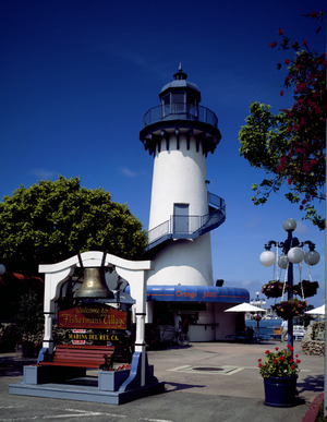
- Fisherman's Village
- Lloyd Taber Marina del Rey Library
- Pacific Mariners Yacht Club
- UCLA Marina Aquatic Center
Libraries for Kids
The County of Los Angeles Public Library runs the Lloyd Taber-Marina del Rey Library. This library has a special collection of books about boats and the sea. The Abbot Kinney Memorial Branch of the Los Angeles Public Library is in nearby Venice.
Parks and Outdoor Spaces
- Burton Chace Park hosts fun community events. These include the Marina del Rey Summer Concert Series and the Marina del Rey Holiday Boat Parade.
- Yvonne B. Burke Park was renamed in 2009. It honors Los Angeles County Supervisor Yvonne Brathwaite Burke. This long, narrow park was built on an old railway path.
- Marvin Braude Bike Trail goes through Burke Park. It leads to Oxford Basin, a wildlife area with a walking loop. Nearby Ballona Lagoon on Marina Peninsula also has a walking loop and places to watch wildlife.
- Aubrey E. Austin Park is a very small park.
- Marina Beach, also called Mother’s Beach, has a playground right on the sand.
- Area A of the Ballona Wetlands Ecological Reserve is open to the public on certain days. It is located next to Fiji Way.

- Marina Del Rey Wetland Park is a 0.75-acre park and wildlife area. It is part of the Ballona watershed ecosystem. This tidal salt marsh was fixed up in 2017 by L.A. County. They restored the wetland and added walking paths, viewing areas, and signs. The park is at 4390 Via Marina. Public parking is available in lot 11 at Via Marina and Panay Way. The park is managed by the Los Angeles County Department of Beaches and Harbors.
- Harold L. Edgington Memorial Park is a small green space. It is at Admiralty Way and Panay Way. The park honors Harold L. Edgington. He was a Los Angeles County Harbor Patrolman who died while on duty in 1979.

Education in Marina del Rey
Marina del Rey is part of the Los Angeles Unified School District. There are no schools directly in Marina del Rey itself. Students from Marina del Rey go to Anchorage Street Elementary (now Westside Global Awareness Magnet School) or Coeur d'Alene Avenue Elementary School. They then attend Marina del Rey Middle School and Venice High School.
Local Services and Transportation
Safety and Emergency Services
The Los Angeles County Sheriff's Department (LASD) has a local office in Marina del Rey. Before 1985, the Los Angeles County Harbor Patrol handled law enforcement. They later joined the Sheriff's Department.
The Los Angeles County Fire Department (LACFD) serves Marina del Rey. Their Station #110 is at 4433 Admiralty Way. The Los Angeles County Department of Health Services also has an office here.
Getting Around Marina del Rey
The Marina Expressway, California State Route 90, ends at Lincoln Boulevard. It connects Marina del Rey to Culver City. A water shuttle service called the WaterBus runs on weekends and holidays during the summer.
Bus shuttle services also operate on the roads within the marina. They connect to nearby places like Playa Vista and the Venice Pier.
Street Layout
Washington Boulevard is to the northwest of the Marina. The Pacific Ocean is to the southwest. Ballona Creek is to the southeast. Lincoln Boulevard is to the northeast. Admiralty Way is to the north.
Marina del Rey has two main parts: the harbor area and the suburban area. The harbor area has eight basins. These are separated by six strips of land, each with at least one street. Going clockwise from the northeast, these streets are: Bali Way, Mindanao Way, Fiji Way, Bora Bora Way, Tahiti Way, Marquesas Way, Panay Way, and Palawan Way. Many of these streets lead to Via Marina or Washington Boulevard. Admiralty Way forms a curve north of the harbor.
The suburban area is next to Marina del Rey in Los Angeles. It is bordered by Admiralty Way, Washington Boulevard, and Lincoln Boulevard. This area has many homes and apartments. Real estate agents often call it the "Golden Triangle."

Famous People from Marina del Rey
- Sasha Gabor (1945 – 2008), actor
- Lucia Berlin (1936 – 2004), writer
- Tony Todd (1954 – 2024), actor
See also
 In Spanish: Marina del Rey (California) para niños
