Montezuma County, Colorado facts for kids
Quick facts for kids
Montezuma County
|
||
|---|---|---|
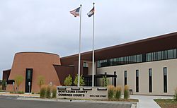
The Montezuma County Combined Courts building in Cortez
|
||
|
||
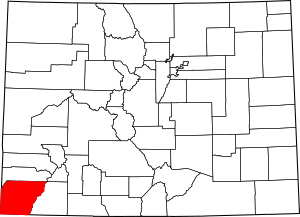
Location within the U.S. state of Colorado
|
||
 Colorado's location within the U.S. |
||
| Country | ||
| State | ||
| Founded | April 16, 1889 | |
| Named for | Moctezuma II | |
| Seat | Cortez | |
| Largest city | Cortez | |
| Area | ||
| • Total | 2,040 sq mi (5,300 km2) | |
| • Land | 2,030 sq mi (5,300 km2) | |
| • Water | 11 sq mi (30 km2) 0.5%% | |
| Population
(2020)
|
||
| • Total | 25,849 | |
| • Density | 13/sq mi (5/km2) | |
| Time zone | UTC−7 (Mountain) | |
| • Summer (DST) | UTC−6 (MDT) | |
| Congressional district | 3rd | |
Montezuma County is a county in the southwest corner of Colorado, a state in the United States. In 2020, about 25,849 people lived there. The main town and county seat is Cortez.
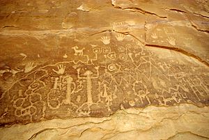
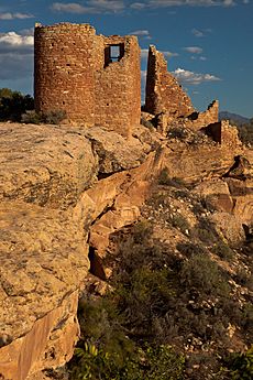
This county is famous for its many ancient Native American structures. You can find these amazing sites in places like Mesa Verde National Park, Canyons of the Ancients National Monument, and Hovenweep National Monument. Montezuma County is also home to most of the Ute Mountain Indian Reservation. This is where the Ute Mountain Ute Tribe lives, and their main office is in Towaoc.
Contents
History of Montezuma County
People have lived in Montezuma County since about 600 AD. Around the 1100s, it's thought that about 100,000 people lived here. That's four times more than today! But between 1200 and 1300, almost all the towns were left empty.
After that, different groups like the Ute and Navajo tribes used the area. New settlements began in the 1870s. Montezuma County was officially created in April 1889. It was named after Moctezuma II, an emperor of the Aztec Empire in Mexico. People at the time thought the old buildings in Mesa Verde National Park were built by the Aztecs.
Geography and Nature
Montezuma County covers about 2,040 square miles. Most of this area is land, with a small part being water.
The county has many different types of land. About one-third is tribal land, belonging to Native American tribes. Another third is federal land, managed by groups like the National Park Service. The last third is private or state/county land.
The elevation changes a lot, from about 6,000 feet to over 13,200 feet. This means you can find everything from high desert areas to cold, high-mountain regions. The county has McPhee Reservoir, which is the second-largest reservoir in Colorado. There are also many other reservoirs and lakes.
A lot of the land is used for farming, growing crops and raising animals like cattle and sheep. The county is served by major roads like U.S. Highway 160 and U.S. Highway 491. You can also fly into the Cortez Municipal Airport.
Neighboring Counties
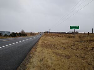
Montezuma County shares borders with several other counties:
- Dolores County to the north
- San Juan County to the northeast
- La Plata County to the east
- San Juan County, New Mexico to the south
- Apache County, Arizona to the southwest
- San Juan County, Utah to the west
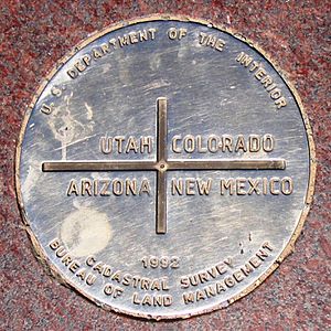
Montezuma County is special because it touches three different counties that all have the same name: San Juan County in Colorado, New Mexico, and Utah. This spot is part of the famous Four Corners Monument.
Main Roads
 U.S. Highway 160
 U.S. Highway 491 (used to be US 666)
 State Highway 41
 State Highway 145
 State Highway 184
Protected Natural Areas
Montezuma County has many beautiful protected areas:
- Calico National Recreation Trail
- Canyons of the Ancients National Monument (part)
- Highline Loop National Recreation Trail
- Hovenweep National Monument (part)
- Lowry Ruin National Historic Landmark
- Mesa Verde National Park
- Mesa Verde Wilderness
- Old Spanish National Historic Trail
- Petroglyph Point National Recreation Trail
- San Juan National Forest
- Yucca House National Monument
State Parks and Other Areas
- Mancos State Park
- McPhee Reservoir
Trails and Scenic Drives
- Great Parks Bicycle Route
- San Juan Skyway
- Trail of the Ancients
- Western Express Bicycle Route
People of Montezuma County
| Historical population | |||
|---|---|---|---|
| Census | Pop. | %± | |
| 1890 | 1,529 | — | |
| 1900 | 3,058 | 100.0% | |
| 1910 | 5,029 | 64.5% | |
| 1920 | 6,260 | 24.5% | |
| 1930 | 7,798 | 24.6% | |
| 1940 | 10,463 | 34.2% | |
| 1950 | 9,991 | −4.5% | |
| 1960 | 14,024 | 40.4% | |
| 1970 | 12,952 | −7.6% | |
| 1980 | 16,510 | 27.5% | |
| 1990 | 18,762 | 13.6% | |
| 2000 | 23,830 | 27.0% | |
| 2010 | 25,535 | 7.2% | |
| 2020 | 25,849 | 1.2% | |
| 2023 (est.) | 26,531 | 3.9% | |
| U.S. Decennial Census 1790-1960 1900-1990 1990-2000 2010-2020 |
|||
In 2020, the population of Montezuma County was 25,849 people. The population has grown steadily over the years, as you can see in the table above.
In 2000, about 27.5% of the people were under 18 years old. The average age was 38 years.
Towns and Communities
City
Towns
Census-Designated Places
These are areas that are like towns but are not officially incorporated as cities or towns.
Other Unincorporated Places
These are smaller communities that are not officially part of a city or town.
See also
 In Spanish: Condado de Montezuma para niños


