
National Register of Historic Places listings in northern New Castle County, Delaware facts for kids
This article is about the amazing historic places in northern New Castle County, Delaware! These special spots are listed on the National Register of Historic Places. It's like a hall of fame for buildings, areas, and objects that are important to American history and culture.
This list covers places in New Castle County north of the Chesapeake & Delaware Canal but does not include the city of Wilmington. There are 223 such places listed here, and five of them are even more special, called National Historic Landmarks! You can see where these places are on a map if their coordinates are included.
Contents
What is the National Register of Historic Places?
The National Register of Historic Places is the official list of the nation's historic places worth saving. It's managed by the National Park Service. When a place is added to this list, it means it's important for its history, architecture, or how it connects to famous people or events. Listing a place helps protect it and makes people more aware of its value.
Why are these places important?
These historic places tell us stories about the past. They show us how people lived, worked, and built things long ago. By protecting them, we can learn from history and keep these important parts of our heritage for future generations to enjoy.
Historic Homes and Buildings
Many of the places on the list are old houses and buildings that have seen a lot of history!
Homes with a Story
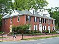
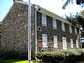
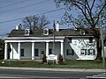
- The Amstel House in New Castle is a beautiful old home built in the 1730s. It's a great example of early American architecture.
- The Jacob Broom House near Wilmington is a National Historic Landmark. Jacob Broom was one of the people who signed the U.S. Constitution! This house is a very important piece of American history.
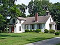
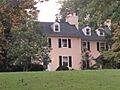
- Buena Vista in New Castle is a grand estate that now serves as a retreat center for the State of Delaware. It's a large, impressive building with a long history.
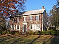
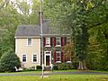
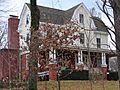
- The Charles Allen House in Christiana is another historic home, showing us how people lived in the area many years ago.
- The Darley House in Claymont is a notable historic home that stands out for its unique design and past.
- The Glebe House in New Castle is a historic building that once served as a home for a church minister.
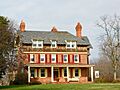
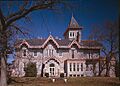
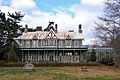
- The Lesley-Travers Mansion in New Castle is a large, elegant house that tells us about the wealthy families who lived there.
- Lombardy Hall in Wilmington is a National Historic Landmark. It was once the home of Gunning Bedford Jr., another signer of the U.S. Constitution!
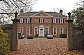
- The George Read II House in New Castle is also a National Historic Landmark. George Read II was the son of another signer of the Constitution, and his house is a stunning example of Georgian architecture.
- The Stonum house in New Castle is a National Historic Landmark known for its unique style and historical importance.
- The Sutton House in St. Georges is a charming historic home that adds to the character of the town.
- Swanwyck in New Castle is a historic estate with beautiful grounds and a rich past.
- The William Talley House in Wilmington is another example of a well-preserved historic home in the area.
- The Edward R. Wilson House in Newark is a historic residence that contributes to the town's architectural heritage.
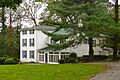
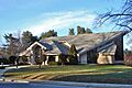
- The Wright House in Newark is special because it's the University of Delaware president's house, showing its connection to the university's history.
Fire Stations and Public Buildings
- The Aetna Hose, Hook and Ladder Company Fire Station No. 1 and Fire Station No. 2 in Newark are historic fire stations. They show how fire protection has changed over time.
- The Bank of Newark Building and the Newark Opera House are important old buildings in Newark, showing what the town looked like long ago.
- The Newark Passenger Station is a historic train station in Newark, now home to the Newark History Museum. It reminds us of the early days of train travel.
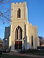
- The New Castle County Court House in New Castle is a National Historic Landmark and part of the First State National Historical Park. It's where important legal decisions were made long ago.
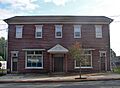
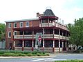
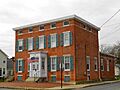
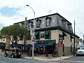
- The Newport National Bank in Newport is a historic building that shows the town's past as a center for business.
- The Wilmington Trust Company Bank in Newark is another example of a historic financial building.
Historic Districts and Areas
Some places are important not just for one building, but for a whole area! These are called historic districts.
- The Aiken's Tavern Historic District in Glasgow is an area that tells the story of an old tavern and the community around it.
- The Ardens Historic District and the Village of Arden in Arden are unique communities known for their special history and architecture.
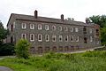
- The Auburn Mills Historic District in Yorklyn includes old mills and buildings that show how industries used to operate.
- The Brandywine Powder Mills District in Wilmington is part of the Hagley Museum. It's where the famous DuPont Company started making gunpowder!
- The Breck's Mill Area in Wilmington is another historic district with old mills and buildings along the Brandywine Creek.
- The Centreville Historic District in Centreville is a charming area with many historic homes and buildings.
- The Christiana Historic District in Christiana preserves the historic center of this old town.
- The Coffee Run Mission Site in Hockessin is a historic area with a church and cemetery.
- The Cooch's Bridge Historic District near Newark is famous for a Revolutionary War battle that happened there.
- The Delaware City Historic District in Delaware City includes many historic buildings along the Delaware River and canals.
- The Eastburn-Jeanes Lime Kilns Historic District near Newark shows where lime was produced long ago, an important industry.
- The Fell Historic District in Wilmington is a historic area with unique architecture.
- The Garrett Snuff Mills Historic District in Yorklyn includes old buildings where snuff (a type of tobacco) was made.
- The Graves Mill Historic District in Ashland is another area with historic mills and related buildings.
- The Greenbank Historic Area in Marshallton includes old mills and homes, showing the area's industrial past.
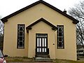
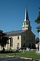
- The Hockessin Friends Meetinghouse in Hockessin is a historic Quaker meetinghouse, a place of worship for the Quakers.
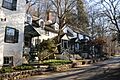
- The Montchanin Historic District in Montchanin is a charming village with historic buildings.
- The Mount Cuba Historic District in Mount Cuba is another historic village area.
- The New Castle Historic District in New Castle is a very large and important historic area, recognized as a National Historic Landmark District. It has many colonial-era buildings and streets.
- The North Saint Georges Historic District in St. Georges preserves the historic heart of the town.
- The Old College Historic District on the University of Delaware campus in Newark includes some of the oldest and most beautiful buildings of the university.
- The Rockland Historic District in Rockland is a historic area along the Brandywine Creek.
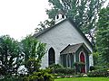
- The St. Joseph's on the Brandywine in Greenville is a historic church and its surrounding area.
- The Wilmington and Western Railroad in Greenbank is a historic railroad line that still operates scenic train rides today!
- The Winterthur Museum and Gardens in Winterthur is a huge historic estate with beautiful gardens and a museum of American decorative arts. It's a very special place.
- The Wooddale Historic District in Wooddale is another area with historic buildings and a unique character.
Other Interesting Historic Places
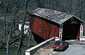
- The Ashland Covered Bridge in Ashland is a beautiful old wooden bridge. Covered bridges are rare and very special!
- The Eastern Lock of the Chesapeake and Delaware Canal in Delaware City is a historic part of the important canal that connects the Chesapeake Bay and the Delaware River.
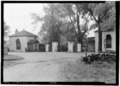
- Fort Delaware on Pea Patch Island in the Delaware River is a historic fort that was used during the Civil War as a prison. You can visit it by ferry!
- The Fort DuPont Historic District in Delaware City was once a military fort and is now a state park and health center.
- The Garrett Snuff Mill in Yorklyn is a historic mill that was part of a major industry.
- The Iron Hill School No. 112C in Newark is an old schoolhouse that is now the Iron Hill Museum. It teaches us about education in the past.
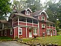
- The Lum's Mill House in Kirkwood is located within Lums Pond State Park, connecting history with nature.
- The Marcus Hook Range Rear Light in Wilmington is a historic lighthouse that helped guide ships on the Delaware River.
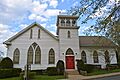
- The Red Clay Creek Presbyterian Church in Newport is a historic church with a long history in the community.
- Rockwood in Wilmington is a beautiful historic estate that is now a New Castle County park, open for everyone to enjoy.
- The St. James Episcopal Church, Mill Creek in Stanton is a historic church that has served its community for many years.
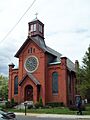
- The Welsh Tract Baptist Church in Newark is one of the oldest Baptist churches in the United States!
- The White Clay Creek Presbyterian Church in Newark is another historic church that has been a part of the community for a long time.
- The Wooddale Bridge in Wooddale is a historic bridge over Red Clay Creek.
Images for kids
-
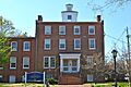
The Academy of Newark, part of the University of Delaware.
-
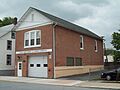
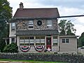
Aetna Hose, Hook and Ladder Company Fire Station No. 1 in Newark.
-
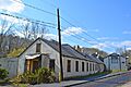
Aiken's Tavern Historic District in Glasgow.
-
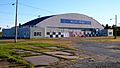
Air Service, Inc. Hangar at Bellanca Airfield.
-
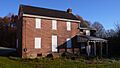
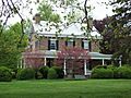
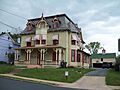
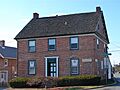
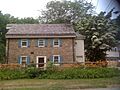
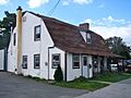
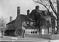
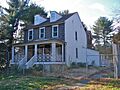
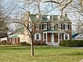
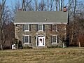
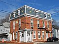
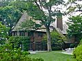
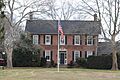
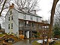
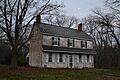
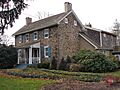
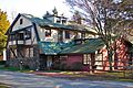
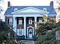
The Charles Allen House in Christiana.
-
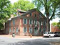
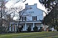
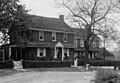
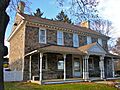
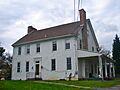
The historic Amstel House in New Castle.
-
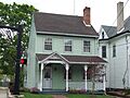
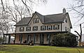
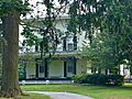
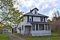
The Anderson House in Newark.
-
Archmere Academy in Claymont.
-
The Ardens Historic District in Arden.
-
The James Armor House near Wilmington.
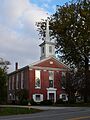
-
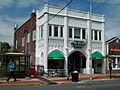
Armstrong Lodge No. 26, A.F. & A.M. in Newport.
-
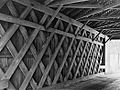
The Ashland Covered Bridge.
-
Auburn Mills Historic District in Yorklyn.
-
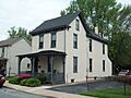
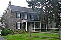
The Baily House in Newark.
-
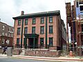
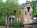
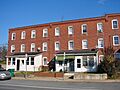
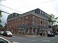
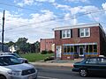
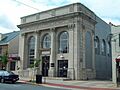
The Bank of Newark Building.
-
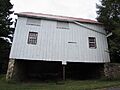
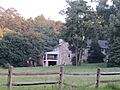
The Bartley-Tweed Farm.
-
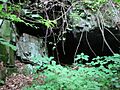
Beaver Valley Rock Shelter Site.
-
The Bell Farmhouse in Newark.
-
Belmont Hall in Newark, part of the University of Delaware.
-
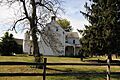
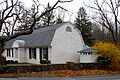
Bloomfield in St. Georges.
-
Blue Hen Farm in Newark.
-
Brandywine Manufacturers Sunday School.
-
Brandywine Powder Mills District, part of Hagley Museum.
-
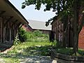
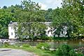
Breck's Mill Area.
-
Brindley Farm.
-
The Jacob Broom House.
-
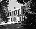
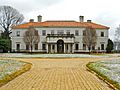
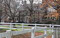
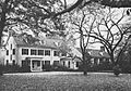
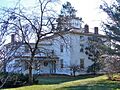
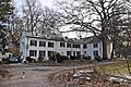
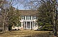
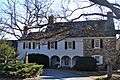
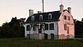
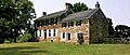
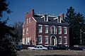
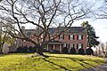
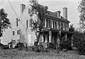
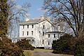
Buena Vista in New Castle.
-
Building at 28-34½ Academy Street in Newark.
-
Building at 140 W. Main Street in Newark.
-
Building at 34 Choate Street in Newark.
-
John Carney Agricultural Complex.
-
The Carpenter-Lippincott House.
-
The Stuart Randall & Pricilla Kellogg Carswell House.
-
The W. Casperson House.
-
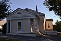
Centre Meeting and Schoolhouse.
-
Centreville Historic District.
-
The Chambers House (Hopkins Bridge Road) in Newark.
-
The Chambers House (College Avenue) in Newark.
-
The Joseph Chandler House.
-
Chelsea in Delaware City.
-
Christiana Historic District.
-
The Abner Cloud House.
-
The Cloud-Reese House.
-
Clyde Farm Site.
-
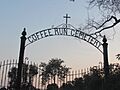
Coffee Run Mission Site.
-
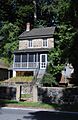
The Collison House in Newport.
-
Cooch's Bridge Historic District.
-
Correll's Farm and Lawn Supply.
-
The Curtis Mansion in Newark.
-
Curtis Paper Mill Workers' Houses.
-
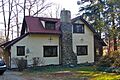
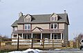
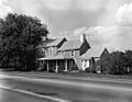
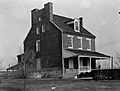
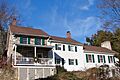
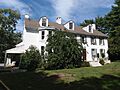
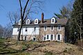
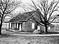
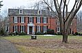
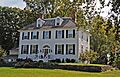
The Darley House in Claymont.
-
Joseph Dean & Son Woolen Mill.
-
Deer Park Farm in Newark.
-
The Deer Park Hotel in Newark.
-
Delaware Boundary Markers.
-
Delaware City Historic District.
-
The S. P. Dixon Farm.
-
Dragon Run Farm.
-
The David Eastburn Farm.
-
The J. Eastburn Barn.
-
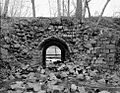
Eastburn-Jeanes Lime Kilns Historic District.
-

Eastern Lock of the Chesapeake and Delaware Canal.
-
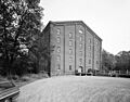
Eleutherian Mills, part of Hagley Museum.
-
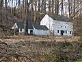
The England House and Mill.
-
The George Evans House in Newark.
-
The John Evans House in Newark.
-
The Exchange Building in Newark.
-
Fairview in Delaware City.
-
Fell Historic District.
-
The Robert Ferguson House.
-
The Andrew Fisher House.
-
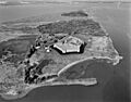
Fort Delaware on Pea Patch Island.
-
Fort DuPont Historic District.
-
The Galloway-Walker House in Newport.
-
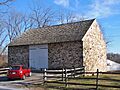
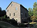
Garrett Snuff Mill.
-
Garrett Snuff Mills Historic District.
-
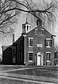
The Glebe House in New Castle.
-
Glynrich.
-
The Robert Graham House.
-
Granite Mansion in Newark.
-
The Grantham-Edwards-McComb House.
-
Graves Mill Historic District.
-
The Green Mansion in Newark.
-
Greenbank Historic Area.
-
The Hale-Byrnes House.
-

Head of Christiana United Presbyterian Church.
-
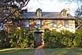
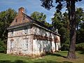
The Hermitage in New Castle.
-
The Hersey-Duncan House.
-
The William Hicklen House.
-
Hickman Blacksmith Shop and House.
-
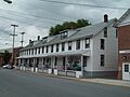
Hickman Row in Claymont.
-
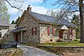
Hockessin Friends Meetinghouse.
-
The Holladay-Harrington House.
-
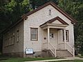
Iron Hill School No. 112C.
-
Ivyside Farm.
-
The Johnson-Morris House.
-
The William Julius "Judy" Johnson House.
-
The Thomas Justis House.
-
The Justis-Jones House.
-
The Andrew Kerr House.
-
Killgore Hall and Joseph Killgore House in Newport.
-
La Grange in Glasgow.
-
Laurel in Wilmington.
-
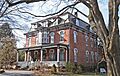
The Lesley-Travers Mansion.
-
The John Lewden House.
-
The Charles and Edith Liedlich House.
-
Linden Hill in St. Georges.
-
The J. Lindsay Barn.
-
The Samuel Lindsey House.
-
Lobdell Estate, Minquadale Home.
-
Lombardy Hall.
-
Louviers in Wilmington.
-
Lower Louviers and Chicken Alley.
-
Lum's Mill House.
-
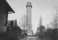
Marcus Hook Range Rear Light.
-
Marshallton United Methodist Church.
-
The J. Mason Farm.
-
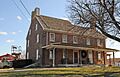
The McCoy House in Kirkwood.
-
The J. McDaniel Farm.
-
The J. McIntyre Farm.
-
The Meeteer House.
-
Memorial Hall at the University of Delaware.
-
Merestone.
-

Mermaid Tavern in Newark.
-

The Meteer Store House.
-
Mill Creek Friends Meetinghouse.
-
Montchanin Historic District.
-
The Montgomery House.
-
The William Morgan Farm.
-
The James Morrow House.
-
Mount Cuba Center.
-
Mount Cuba Historic District.
-
Mount Lebanon Methodist Episcopal Church.
-
Mount Pleasant Methodist Episcopal Church and Parsonage.
-
Mt. Airy School No. 27.
-
Naaman's Creek School (Claymont Stone School).
-
New Castle and Frenchtown Railroad Right-of-Way.
-
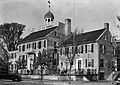
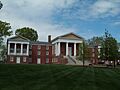
New Castle County Court House.
-
New Castle Historic District.
-
New Castle Ice Piers.
-
The Newark Opera House.
-
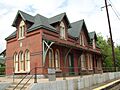
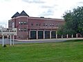
The Newark Passenger Station.
-
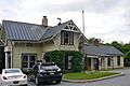
Newport National Bank.
-
Newport Railroad Station.
-
North Saint Georges Historic District.
-
Old Cann Mansion House.
-
Old College Historic District.
-
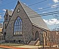
Old First Presbyterian Church in Newark.
-
Old Fort Church.
-
Old Newark Comprehensive School.
-
Old Post Office in Kirkwood.
-
Ott's Chapel.
-
Owl's Nest Country Place.
-
Penn Farm of the Trustees of the New Castle Common.
-
Thomas Phillips Mill Complex.
-
The T. Pierson Farm.
-
Point Farm.
-
Poplar Hall.
-
Public School No. 111-C.
-
Public School No. 29.
-
The Joshua Pyle House and Wagon Barn.
-
The George Read II House.
-
Red Clay Creek Presbyterian Church.
-
Rhodes Pharmacy.
-
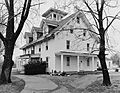
The Robinson House in Claymont.
-
Rockland Historic District.
-
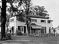
Rockwood Museum and Park.
-
Rosemont.
-
The Rotheram Mill House.
-
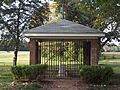
St. Georges Cemetery Caretaker's House.
-
St. Georges Presbyterian Church.
-
St. James Episcopal Church, Mill Creek.
-
St. John the Baptist Roman Catholic Church in Newark.
-
St. Joseph's on the Brandywine.
-
St. Thomas Episcopal Church in Newark.
-
The Charles Springer Tavern.
-
Springer Farm in Hockessin.
-
The Springer-Cranston House.
-
The State Theater in Newark.
-
The James Steel House.
-
The James Stewart House.
-
The James Stewart, Jr., House.
-
The J. Stinson Farm.
-
Stockton-Montmorency.
-
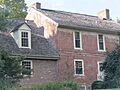
Stonum.
-
Strand Millas and Rock Spring.
-
The Sutton House in St. Georges.
-
Swanwyck.
-
The William Talley House.
-
The Joseph Tatnall House.
-
The John C. Vansant House.
-
Vernacular Frame House.
-
The Village of Arden.
-

The R. Walker Barn.
-
Walker's Mill and Walker's Bank.
-
Walnut Green School.
-
The Lewis Weldin House.
-
Welsh Tract Baptist Church.
-
Wesley M.E. Church.
-
White Clay Creek Presbyterian Church.
-
White Hall.
-
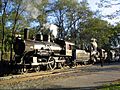
Wilmington and Western Railroad.
-
Wilmington Trust Company Bank.
-
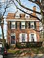
The Edward R. Wilson House.
-
Winterthur Museum and Gardens.
-
The Woman's Club of Newport.
-
The Wooddale Bridge.
-
Wooddale Historic District.
-
Woodstock.
-
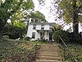
The Wright House in Newark.
-
The William Young House.


.jpg)


.jpg)


.jpg)


.jpg)


.jpg)


.jpg)


