Neighborhoods of Tulsa, Oklahoma facts for kids
Tulsa is the second-largest city in Oklahoma, a state in the United States. Because it's a big city, Tulsa has many different neighborhoods, each with its own unique feel and history.
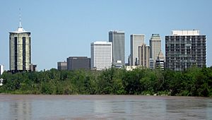
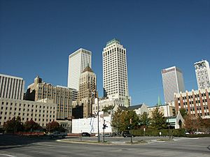
Downtown Tulsa is the heart of the city, covering about 1.4 square miles (3.6 square kilometers). It's surrounded by major highways. This area is Tulsa's main business and financial center. There's a big effort to bring more visitors here, especially to see the old, beautiful buildings. Many of Tulsa's big event places are downtown, like the Tulsa Performing Arts Center, the Tulsa Convention Center, and the BOK Center. Some cool spots downtown include the Blue Dome District, the Brady Arts District, the "Oil Capital Historic District," the Greenwood Historical District, and ONEOK Field, where the Tulsa Drillers baseball team plays.
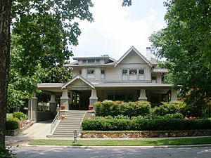
The older, mostly residential part of the city is called Midtown. It has fancy neighborhoods built in the early 1900s with different styles of architecture. You'll find the University of Tulsa, the Swan Lake neighborhood, the Philbrook Museum, and popular shopping areas like Utica Square, Cherry Street, and Brookside here. The southern part of Tulsa has grown a lot since the 1970s. It has many homes and shops. This area includes one of Oklahoma's biggest shopping malls, Woodland Hills Mall, plus Southern Hills Country Club and Oral Roberts University.
East of Highway 169 and north of 61st Street, you'll find a mix of cultures, with large Asian and Mexican communities. Much of the city's factories are also in this eastern part.
Areas of Tulsa west of the Arkansas River are known as West Tulsa. This part of town has big parks, nature areas, and large oil refineries. The northern part of the city is home to OSU-Tulsa, Gilcrease Museum, Tulsa International Airport, the Tulsa Zoo, the Tulsa Air and Space Museum, and Mohawk Park, which is one of the biggest city parks in the U.S.
Contents
- Downtown Tulsa: The City's Center
- Blue Dome District: Fun and History
- East Village: A Growing Community
- Oil Capital Historic District: A Look Back at Tulsa's Past
- Uptown: River Views and Historic Hotels
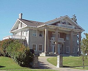
- Buena Vista Park Historic District: Old Homes and Green Spaces
- The Pearl District: A Revived Area
- Riverview Historic District: Riverside Living
- Midtown Tulsa: Classic Homes and Parks
- Arkansas River Parks: Outdoor Fun by the River
- Cherry Street: Shops, Art, and History
- Maple Ridge and Sunset Terrace: Mansions and Grand Boulevards
- Brookside: Upscale Shopping and Dining
- Lortondale: Mid-Century Modern Homes
- Ranch Acres: Post-War Charm
- Patrick Henry: Spacious Ranch Homes
- Highland and Whiteside Park Area: Parks and Schools
- Kendall-Whittier: Historic and Diverse
- Swan Lake Historic District: A Beautiful Neighborhood
- Terwilleger Heights: Grand Homes and Gardens
- Renaissance: A Mix of Styles
- Florence Park & Florence Park South: Rediscovered Gems
- White City: A Historic Residential Area
- Northside Tulsa: History and Nature
- "Black Wall Street:" The Greenwood Historical District
- The Arts District: Culture and Entertainment
- Brady Heights Historic District: Early Tulsa Homes
- North Cheyenne Historic District: Commercial History
- Owen Park: A Historic Neighborhood
- Gilcrease Museum: Western and Native American Art
- Phoenix District: A Revitalized Area
- Southside Tulsa: Modern Living and Big Attractions
- Eastside Tulsa: Suburban Feel and Route 66
- Westside Tulsa: Industrial Roots and Natural Beauty
Downtown Tulsa: The City's Center
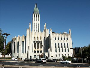
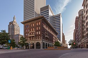
Tulsa has many buildings from the 1920s and 1930s, when oil made the city rich. These include Art Deco buildings like Boston Avenue Methodist Church and Tulsa Union Depot. Famous buildings like the Philtower and Philcade Building were built by Waite Phillips. Other important downtown buildings include the Exchange Bank Building, the Cosden Building (now Mid-Continent Tower), and the Mayo Hotel. Tulsa was even called "Terra Cotta City" for a while because of its unique buildings. In 2010, the main downtown area was named the Oil Capital Historic District because of its history.
Downtown Tulsa is in the northwest part of the city and is circled by a highway called the Inner Dispersal Loop. Many tall office buildings are downtown. The BOK Tower is 667 feet (203 meters) tall. It was the tallest building in the "plains states" (Oklahoma, Kansas, Nebraska, North Dakota, and South Dakota) until 2012. The same architect, Minoru Yamasaki, designed the BOK Tower and the original World Trade Center in New York City.
The Tulsa Performing Arts Center is a large building downtown. It was also designed by Minoru Yamasaki. It has five theaters and a large hall. Over 250,000 people visit it each year to see shows from Tulsa's music and theater groups, like the Tulsa Ballet and Tulsa Symphony Orchestra.
In 2005, Tulsa started building a huge event center called the BOK Center. It has 19,199 seats and opened in 2008.
Blue Dome District: Fun and History
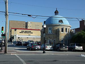
The Blue Dome District is a fun area downtown, known for its unique domed building at Second Street and Elgin Avenue. This building was built in 1924 as a Gulf Oil gas station. Today, it's an information center for the district.
East Village: A Growing Community
East Village covers 115 acres (47 hectares) just inside the inner highway loop. This area has cool places like a martini bar, art studios, hair salons, and lofts. A very important part of this neighborhood is the Dennis R. Neill Equality Center, which is a large community center that welcomes everyone. More restaurants, homes, and shops are being planned for this area.
Oil Capital Historic District: A Look Back at Tulsa's Past
The Oil Capital Historic District was added to the National Register of Historic Places in 2010. It includes many of the old downtown office buildings built during the 1920s and 1930s, when Tulsa was a major oil center.
Uptown: River Views and Historic Hotels
Uptown is just south of Downtown. The Riverview area stretches along the east bank of the Arkansas River. The bar district at 18th and South Boston is very popular. The Ambassador Hotel, built in 1929 for visiting business people, is now a special hotel. It's listed on the National Register of Historic Places listings in Tulsa County, Oklahoma.
Buena Vista Park Historic District: Old Homes and Green Spaces
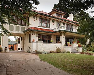
The Buena Vista Park neighborhood started in 1908. It's now a historic district listed on the U.S. National Register of Historic Places (NRHP). The district covers 5 acres (2 hectares) and has important architecture from 1913 to 1933. One of its famous homes is the James Alexander Veasey House.
The Pearl District: A Revived Area
The Pearl District is becoming a lively cultural spot just east of downtown. It used to be run-down, but now it's being restored with new businesses, including bars, restaurants, offices, and homes. The city has worked to make it a walkable area with a mix of uses. It's next to Centennial Park.
The Tulsa Fire Alarm Building in this district is being turned into a museum to honor Tulsa's firefighters. The Pearl District also has The Church Studio, a former church that musician Leon Russell turned into a recording studio. This studio was important for the "Tulsa Sound" music style in the 1970s.
Riverview Historic District: Riverside Living
The Riverview district is known for its houses and apartment buildings built between 1911 and 1938. The name comes from Riverview Elementary School, which used to be there. Several buildings in this area are also listed on the National Register of Historic Places, like the McBirney Mansion and the Clinton-Hardy House.
Midtown Tulsa: Classic Homes and Parks
Midtown is a mostly residential area in the middle of the city. It has many homes built from the early 1900s to the 1950s, showing different American architectural styles. You'll find schools like Bishop Kelley and Edison Preparatory School here. Woodward Park in Midtown is famous for its beautiful azaleas and gardens, making it a great place for photography and picnics. Other popular parks include Swan Lake and Zink Park.
Utica Square, Tulsa's first shopping center outside downtown, is an upscale outdoor mall with local shops and national stores. Next to Utica Square is Temple Israel, a Jewish temple, and Cascia Hall Preparatory School, a school known from the House of Night book series.
Other big shopping centers in Midtown include the Promenade Mall and Ranch Acres. OU-Tulsa is also located on the southern edge of Midtown.
In northeast Midtown, Expo Square is home to several Tulsa landmarks. It has the Art Deco Expo Square Pavilion and the Quick Trip Expo Center, which is the largest building in the world with a clear span (no columns inside). In front of the Expo Center stands the Golden Driller, a 76-foot (23-meter) tall statue built in 1966 to remind everyone of Tulsa's oil history.
Arkansas River Parks: Outdoor Fun by the River
Tulsa has almost 40 miles (64 kilometers) of river shoreline along the Arkansas River. River Parks covers more than 20 miles (32 kilometers) of this area, with trails, picnic spots, and playgrounds. You can go fishing, rowing, kayaking, disc golf, hiking, biking, and horseback riding here.
During warmer months, the river hosts concerts, festivals, and the state's largest free fireworks show on the Fourth of July. Tulsa's Oktoberfest, one of the oldest and largest in the U.S., is held at the festival park on the river's west bank.
Cherry Street: Shops, Art, and History
The Cherry Street District is a lively area near downtown in northern Midtown. It's named after 15th Street, which was called "Cherry Street" a long time ago. This area is known for its many local restaurants, unique shops, art galleries, and antique stores.
The 1400 block of South Quaker Avenue has five historic houses from the early 1920s. The most famous is the McGregor House, designed by Bruce Goff when he was just 15 years old. Cherry Street is surrounded by four of Tulsa's historic districts: Swan Lake, North Maple Ridge, Gillette, and Yorktown.
Maple Ridge and Sunset Terrace: Mansions and Grand Boulevards
The Maple Ridge Historic District is just south of downtown. It has "Black Gold Row," where oil barons built their huge mansions in the 1920s. Harwelden Mansion is located here.
Sunset Terrace is next to Maple Ridge and has many mansions built in the 1920s and 1930s. It's crossed by Woodward Boulevard, a grand street that connects Maple Ridge to Brookside.
Brookside: Upscale Shopping and Dining
Brookside is another popular shopping and entertainment district in Midtown. It stretches from the Arkansas River east to Lewis Avenue and south to 51st Street. South Peoria, between 31st and I-44, is a busy area with upscale shops, boutiques, art galleries, and over 35 restaurants and nightspots. Scenic Riverside Drive and River Parks are also popular parts of Brookside.
Lortondale: Mid-Century Modern Homes
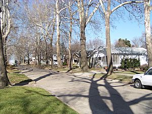
Lortondale is a neighborhood with modern homes built in the 1950s. These houses have low-pitch roofs and clean lines, typical of the Mid-Century Modern style. It was the first housing development in Tulsa with a community pool, and all homes had central heating and air conditioning.
Ranch Acres: Post-War Charm
Ranch Acres is a historic neighborhood added to the National Register of Historic Places in 2007. It's a great example of a neighborhood with ranch-style homes built after World War II. It's mainly located between 31st and 41st Streets along South Harvard.
Patrick Henry: Spacious Ranch Homes
The Patrick Henry Neighborhood was built in the 1950s and 1960s. It has ranch-style homes known for their open layouts and large yards. Many of these homes were featured in "Parade of Homes" tours, showing off new and modern designs.
Highland and Whiteside Park Area: Parks and Schools
This area is named after its two large neighborhood parks. The homes here are mostly ranch-style, some with Mid-Century Modern designs. It includes the University of Oklahoma's Tulsa Schusterman campus and several shopping areas.
Kendall-Whittier: Historic and Diverse
East of downtown is Tulsa's oldest suburban shopping area, known for its red brick buildings. The historic Circle Cinema, an artsy movie theater, is here. The Kendall-Whittier area is popular with Tulsa's growing Hispanic community. Just east of this area is the University of Tulsa.
Swan Lake Historic District: A Beautiful Neighborhood
Swan Lake is a historic district known for its many different styles of houses and apartment buildings built in the 1920s and 1930s. The lake was originally a place for cattle to drink and later an amusement park.
Terwilleger Heights: Grand Homes and Gardens
Terwilleger Heights is located south and west of Utica Square. It has grand and smaller homes from the early 1930s, winding streets, and is next to the Philbrook Museum of Art and Woodward Park, which has the Tulsa Rose Garden.
Renaissance: A Mix of Styles
The Renaissance neighborhood has a mix of 1920s bungalows and 1930s revival-style houses, along with newer homes. Many University of Tulsa students have lived on the east side of Delaware Avenue in this area.
Florence Park & Florence Park South: Rediscovered Gems
Florence Park & Florence Park South neighborhoods have a great mix of 1920s and 1930s houses, mostly in revival styles. These were some of the first Midtown Tulsa neighborhoods to become popular again after people moved to the suburbs in the 1960s and 70s.
White City: A Historic Residential Area
White City is a residential neighborhood in Midtown, Tulsa, Oklahoma. It was added to the National Register of Historic Places in 2001 and includes many historic buildings and two parks.
Northside Tulsa: History and Nature
Tulsa's north side was first added to the city in 1904. It's home to a large part of Tulsa's African-American community and working-class families. Booker T. Washington High School, once a school for African-American students during segregation, is now a top magnet school. Northeast of downtown, near Tulsa International Airport, you'll find Mohawk Park, which includes the Tulsa Zoo, the Oxley Nature Center, and the Tulsa Air and Space Museum. This area also has a large American Airlines maintenance facility, which is one of Tulsa's biggest employers.
"Black Wall Street:" The Greenwood Historical District
The Greenwood Historical District is just north of downtown. It was once a very wealthy African-American community, known as Black Wall Street. In 1921, many businesses and homes here were burned during the terrible Tulsa Race Massacre, a very sad event in U.S. history. Laws passed in 2001 helped to rebuild Greenwood. Today, it has the Greenwood Cultural Center, the Tulsa Race Massacre Memorial, and the John Hope Franklin Center for Reconciliation. Oklahoma State University - Tulsa and Langston University are also in this district, along with the Greenwood Rising History Center.
The Arts District: Culture and Entertainment
The Arts District is located north of the main business area. It's one of Tulsa's oldest parts, with many two-story brick warehouses.
The Tulsa Theater, built between 1912 and 1914, was first called "Convention Hall." It was also one of the places where African Americans were held after the 1921 Tulsa Race Riot. Today, it's still used for many concerts and shows.
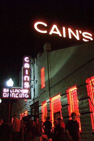
North of The Tulsa Theater is the Cain's Ballroom, which used to be the garage of the Brady family and the home of Bob Wills and his band, the Texas Playboys. The district also has many art galleries, restaurants, bars, and dance clubs. It's a diverse and welcoming area.
Today, The Arts District is a very lively part of Tulsa, with restaurants, clubs, museums, and businesses. It's a great example of city living. The area got a big boost in 2012 with the opening of Guthrie Green, a public garden and outdoor stage. Guthrie Green quickly became a popular spot for community events, live music, and a farmers market.
The district and its main street were originally named after W. Tate Brady, an early Tulsa businessman. However, because of his involvement with the Ku Klux Klan in the 1920s, residents wanted the name changed. In 2013, the City Council voted to keep the street name but officially honor Civil War photographer Mathew Brady instead.
Brady Heights Historic District: Early Tulsa Homes
Brady Heights is a historic district in Tulsa, named for early resident W. Tate Brady. From the early days of Oklahoma until the 1920s, Brady Heights was a very fashionable part of north Tulsa. Young business and oil men owned homes here.
North Cheyenne Historic District: Commercial History
The North Cheyenne Historic District was a commercial and industrial area that grew in the early 1900s. It was added to the National Register of Historic Places in 2010 because of its importance in business.
Owen Park: A Historic Neighborhood
The Owen Park neighborhood has a long history, dating back to the early 1800s. A monument in Tulsa's Owen Park marks where the lands of the Osage, Creek, and Cherokee nations met. The first American settler, Chauncey Owen, lived here. Owen Park is a historic neighborhood with old mansions and Craftsman-style homes. It's very close to the Arts District and downtown Tulsa.
Gilcrease Museum: Western and Native American Art
Northwest of downtown, on the Osage Indian Reservation, is the Gilcrease Museum. Many consider it to have one of the best collections of Western American and American Indian art in the world. Thomas Gilcrease, a member of the Creek nation, became very rich when oil was found on his land. He used his wealth to buy art and opened a gallery in 1949. He later gave his art collection, building, and land to the City of Tulsa.
Phoenix District: A Revitalized Area
The Phoenix District is a newly named area on the north side. It's home to the OU Physicians Wayman Tisdale Specialty Clinic.
Southside Tulsa: Modern Living and Big Attractions
Tulsa's south side is generally south of the Skelly Bypass (I-44). It borders the cities of Bixby to the south, Jenks to the west, and Broken Arrow to the east. Many new, fancy homes and apartments have been built here. Land is becoming scarce, so development is spreading to nearby Jenks, Bixby, and Broken Arrow. As more wealthy people have moved in, businesses that cater to them have also opened.
The city's largest car dealerships are along S. Memorial Dr. The Riverwalk Crossing Shopping Center], just across the river in Jenks, has a movie theater, nice restaurants, and shops. Nearby is the Oklahoma Aquarium, the only one in Oklahoma. It has local freshwater fish and many saltwater animals, including sharks. It also has the Karl and Beverly White National Fishing Tackle Museum, with over 20,000 antique fishing items.
St. Francis Hospital, one of the largest in Oklahoma, is located at 61st and Yale. The upscale Braeswood neighborhood is in this area. Another group of healthcare facilities is around South 91st and Mingo.
Woodland Hills Mall, the largest mall in Oklahoma, is the main attraction on the 71st Street corridor. There are many dining and shopping options around the mall. The 4-star John Q. Hammonds Renaissance Hotel is also here, near US 169, a major highway. This highway connects to the Creek Turnpike, a toll road that forms a loop around southern Tulsa and its suburbs.
The schools in this area are some of the biggest in the state, including Jenks and Union High School. Tulsa Public School's Memorial High School and the private Holland Hall are also here. Jenks and Union High Schools are known for their excellent football teams and their big rivalry. Tulsa Community College, the largest 2-year school in Oklahoma, has its Southeast campus here.
Parks in the area include LaFortune Park, with two public golf courses, playgrounds, a swimming pool, and a jogging trail. Hunter Park has a disc golf course, jogging trail, playground, and fishing pond. The Riverparks also extend south to 101st Street.
Some of the largest and most important churches in the country are in this part of Tulsa, including Victory Christian, Kirk of the Hills Presbyterian, Asbury United Methodist, South Tulsa Baptist, and Grace Church.
Southeast Tulsa: Growing and Connected
Southeast Tulsa is generally south of 41st St S and east of S Sheridan Rd, extending to the Bixby and Broken Arrow city limits. Union Schools serve most residents, with some areas served by Tulsa Public Schools and Broken Arrow Public Schools. This area has neighborhood parks, soccer fields, sports fields, and public pools. There are many company offices and businesses here. Southeast Tulsa offers a wide variety of shopping and dining. It has easy access to major highways, making it quick to drive to downtown, Midtown, Southside, Westside, the Airport, and nearby cities like Broken Arrow, Owasso, Bixby, and Jenks. Homes here were built from the early 1970s to today.
The historic community of Alsuma, Oklahoma is in this area. Alsuma was added to Tulsa in 1966 and is now considered a ghost town.
Southern Hills: Exclusive Living and Golf
Southern Hills is a fancy neighborhood on the south side, centered around the Southern Hills Country Club at 61st and Lewis. Southern Hills Country Club has hosted 13 major golf championships, including four U.S. Opens. Many of the original homes in this neighborhood are large ranch-style houses.
Eastside Tulsa: Suburban Feel and Route 66
Tulsa's east side is a suburban-style area roughly east of Sheridan Road, north of 41st St S, and south of Tulsa International Airport. Most homes were built in the 1950s, 1960s, and 1970s. Attractions here include McClure Park, known for its disc golf course, the Carl Smith Athletic Complex, and the popular Admiral Twin Drive-In movie theater. A large part of Route 66 also runs through Tulsa's east side. Areas in the Union and Broken Arrow School districts are attracting people who want a suburban life within the city. Mayo Demonstration Academy, a magnet school, is here, along with Eastgate Metroplex and East Central High School. This area also has many hotels.
East Tulsa is home to growing Mexican-American and Vietnamese-American communities.
Redbud Valley Nature Preserve is also located in this part of the city.
Westside Tulsa: Industrial Roots and Natural Beauty
West Tulsa communities within the city limits include Red Fork, Carbondale, Garden City, and Turkey Mountain. Other communities considered part of the west side, but in Creek County, are Oakhurst, Oakridge, and Allen-Bowden.
West Tulsa reminds us of Tulsa's oil-rich past. Two oil refineries still operate on the west bank of the river. This large industrial area gives way to wooded and hilly neighborhoods. The classic Art Deco Webster High School is here, as is the popular train-themed Ollie's Station Restaurant, next to the Tulsa rail yard. Other schools in West Tulsa include Berryhill High School. Parts of Route 66 pass through the west side.
The Riverparks system on the riverbank includes the Riverwest Festival Park, with its floating stage overlooking downtown. Riverwest hosts popular events like Tulsa's Oktoberfest, one of the largest in North America, and the Gatesway Balloon Festival.
Tulsa's west side is also home to The Oaks Country Club, one of Tulsa's three main country clubs, and Inverness Village, a large retirement community. Camp Loughridge, a Christian Summer Camp, operates on 186 acres (75 hectares) of land in West Tulsa.
 | Jessica Watkins |
 | Robert Henry Lawrence Jr. |
 | Mae Jemison |
 | Sian Proctor |
 | Guion Bluford |


