
New Providence, New Jersey facts for kids
Quick facts for kids
New Providence, New Jersey
|
||
|---|---|---|
|
Borough
|
||

Centennial Park in Downtown New Providence
|
||
|
||

Location of New Providence in Union County, New Jersey. Inset: Location of Union County in New Jersey.
|
||

Census Bureau map of New Providence, New Jersey
|
||

New Providence, New Jersey
Location in Union County, New Jersey

New Providence, New Jersey
Location in New Jersey

New Providence, New Jersey
Location in the United States
|
||
| Country | ||
| State | ||
| County | Union | |
| Incorporated | March 14, 1899 | |
| Government | ||
| • Type | Borough | |
| • Body | Borough Council | |
| Area | ||
| • Total | 3.71 sq mi (9.61 km2) | |
| • Land | 3.69 sq mi (9.55 km2) | |
| • Water | 0.02 sq mi (0.05 km2) 0.57% | |
| Area rank | 307th of 565 in state 14th of 21 in county |
|
| Elevation | 217 ft (66 m) | |
| Population
(2020)
|
||
| • Total | 13,650 | |
| • Estimate
(2023)
|
13,488 | |
| • Rank | 188th of 565 in state 15th of 21 in county |
|
| • Density | 3,701.2/sq mi (1,429.0/km2) | |
| • Density rank | 182nd of 565 in state 16th of 21 in county |
|
| Time zone | UTC−05:00 (Eastern (EST)) | |
| • Summer (DST) | UTC−04:00 (Eastern (EDT)) | |
| ZIP Code |
07974
|
|
| Area code(s) | 908 and 973 | |
| FIPS code | 3403951810 | |
| GNIS feature ID | 0885321 | |

New Providence is a small town, also called a borough, located in Union County, New Jersey. It sits on the edge of the county, right next to the Passaic River. This river also forms the border with Morris County.
In 2020, about 13,650 people lived in New Providence. This was a jump of over 1,400 people since 2010! A big part of the Murray Hill area is also found here. New Providence is special because more than 9% of its land is protected parkland, which means lots of green spaces to enjoy. You can also get around easily with NJ Transit trains, which have stations in New Providence and Murray Hill.
Contents
A Look Back at New Providence's History
The story of New Providence began way back in 1664. That's when James, Duke of York, bought the land from the Lenape Native Americans. The first European settlers arrived in 1720. They were a group called Puritans, and they created the first lasting settlement here.
From "Turkey Town" to New Providence
This early settlement was first known as "Turkey" or "Turkey Town." This was because there were many wild turkeys in the area. In 1737, a Presbyterian Church was built, which became a very important place for the community.
Something amazing happened in 1759. The church's balcony collapsed, but no one was seriously hurt! People believed this was a divine intervention or a sign from above. Because of this, the residents decided to change the town's name to New Providence.
Famous Visitors and Local Legends
Local stories say that George Washington, a very famous American leader, once spent a night in a home here. That house is still standing today! There's also a stream in town called Salt Brook. The legend says it got its name when the villagers dumped their salt supply into the brook. They did this to stop British soldiers from taking it during the war. Even though the British never actually came to this area, the name stuck! Salt Brook flows through the town, starting near the Salt Brook Elementary School.
How New Providence Became a Borough
Over time, the area grew. In 1794, a larger area called Springfield Township was formed. This included what is now New Providence. Later, in 1809, New Providence Township was created from parts of Springfield Township. This new township included Summit, New Providence, and Berkeley Heights.
Then, in 1869, Summit decided to become its own separate township. On March 14, 1899, New Providence also became its own separate town, known as a borough. This was part of a trend called Boroughitis in New Jersey. Many communities were becoming smaller, self-governing boroughs because new state laws made it a good idea financially. After New Providence became a borough, the remaining New Providence Township was renamed Berkeley Heights in 1951.
In the early 1900s, growing roses was a big part of the local economy. The 2011 movie Win Win was set at New Providence High School. It was written by two former students from the school, Tom McCarthy and Joe Tiboni.
Famous Spots in Town
New Providence has several interesting places to visit and learn about.
- Nokia Bell Labs: This famous research center is in the Murray Hill part of New Providence. Scientists here helped create many important technologies. These include radio astronomy, the transistor (a key part of electronics), the laser, and the photovoltaic cell (which turns sunlight into electricity). Many Nobel Prizes have been given for work done at this facility!
- The Presbyterian Church: This is a large, white, historic church right in the middle of town.
- The Village Shopping Center: This is a main shopping center in downtown New Providence.
- Our Lady of Peace: This is a Roman Catholic church and school. Every spring, the school's parking lot hosts the OLP fair. It's a fun event with rides, games, food, and an indoor auction.
- The Salt Box Museum: Located at 1350 Springfield Avenue, this museum is an old farmhouse from the 1700s. It is owned by the New Providence Historical Society.
.jpg)
New Providence's Location and Nature
New Providence covers about 3.71 square miles (9.61 square kilometers). Most of this area is land, with a small amount of water.
The borough is next to Berkeley Heights to the southwest and south. To the east, it borders Summit. Across the Passaic River to the north, you'll find Chatham Township in Morris County.
New Providence sits on the western side of Second Watchung Mountain. Several small streams, mostly branches of Salt Brook, flow through the area. These streams meet in the center of town and then flow into the Passaic River. Along the river, you can find the Passaic River Parkway.
Over nine percent of New Providence's land is protected parkland. Most of this land is wooded and next to the Passaic River. The county and the borough both own parts of this beautiful parkland. There are also several borough-owned parks, like Veterans Memorial Park, Lions Park, and Clearwater Park.
Education in New Providence

The New Providence School District provides public education for students from pre-kindergarten all the way through twelfth grade. The district has four schools:
- Allen W. Roberts Elementary School (PreK–6)
- Salt Brook Elementary School (K–6)
- New Providence Middle School (7–8)
- New Providence High School (9–12)
The middle school and high school share the same building and some facilities like art rooms, gyms, and the auditorium.
In 2007–08, New Providence Middle School received the National Blue Ribbon School Award of Excellence. This is a very high award for schools in the United States. The high school has also been recognized as a top public high school in New Jersey.
There is also a private school, The Academy of Our Lady of Peace. It serves students from Pre-K–3 through Grade 8. This school was also recognized as an Exemplary High Performing School in 2017.
Getting Around New Providence
New Providence has many roads that help people get around. The main road through the borough is County Route 512, also known as Springfield Avenue.
Public Transportation Options

You can catch a train on the NJ Transit Gladstone Branch at the New Providence station or Murray Hill station. These trains can take you to Hoboken Terminal or even directly to Penn Station in Midtown Manhattan during certain times. If you're not going to Manhattan, you can connect to other trains at Summit or Newark Broad Street.
New Jersey Transit also offers local bus service on the 986 route. For those traveling to New York City during rush hour, Lakeland Bus Lines offers service from stops along Springfield Avenue to New York's Port Authority Bus Terminal.
If you need to fly, Newark Liberty International Airport is about 16 miles east of New Providence.
Local Businesses
Some companies have their main offices in New Providence. These include the publishers Martindale-Hubbell and R. R. Bowker.
Community Fun
People and businesses in New Providence often work together to organize fun activities for the community. For example, in 2017, the town held its first Carved Pumpkin Contest. They also organized Scarecrow Contests in 2016 and 2017.
Notable People from New Providence
Many interesting people have lived in or are connected to New Providence:
- Mike Ferguson (born 1970), a politician who served in the U.S. House of Representatives.
- Jeff Grob, the drummer for the 1970s rock band Looking Glass, grew up here and still lives in New Providence.
- Syd Kitson (born 1958), a former professional American football player for the Green Bay Packers and Dallas Cowboys.
- Tom McCarthy (born 1966), an actor and director. He won an Academy Award for Best Original Screenplay for co-writing Up and for writing Spotlight, which also won Best Picture.
- Rat Skates (born 1961), a filmmaker, writer, and musician. He was a founding member and original drummer of the thrash metal band Overkill.
- D. D. Verni (born 1961), the bass player and a founding member of the thrash metal band Overkill.
Images for kids
-
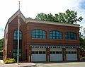
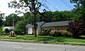
New Providence Volunteer EMS building
-
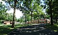
The Morris Union Jointure Commission
-
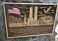
9/11 memorial
-
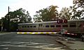
A commuter train
-
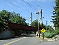
Train trestle
-
The football field
-
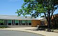
The middle and high schools
-
Library
-
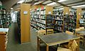
Inside the library
-
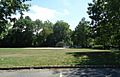
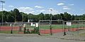
Athletic fields
-
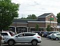
Shopping center


See also
 In Spanish: New Providence (Nueva Jersey) para niños
