New Town, Edinburgh facts for kids
| UNESCO World Heritage Site | |
|---|---|

New Town, seen looking south from the air
|
|
| Location | Edinburgh, Scotland |
| Part of | Old and New Towns of Edinburgh |
| Criteria | Cultural: (ii)(iv) |
| Inscription | 1995 (19th Session) |
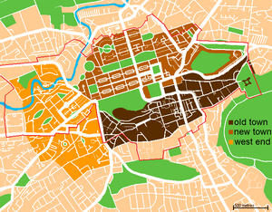
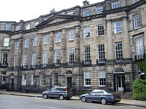
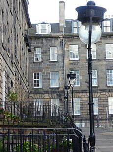
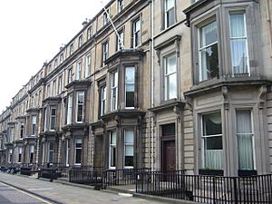
The New Town is a central part of Edinburgh, the capital city of Scotland. It was built in different stages between 1767 and about 1850. This area still has many of its original buildings, which are in the neo-classical and Georgian styles.
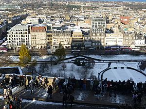
Its most famous street is Princes Street. This street faces Edinburgh Castle and the Old Town. Between them is a valley that used to be a polluted lake called the Nor Loch. The New Town, along with the West End and the Old Town, became a UNESCO World Heritage Site in 1995. This means it is a very important place that should be protected. The area is also known for its beautiful New Town Gardens.
Contents
Why the New Town Was Built
The idea for a New Town first came up in the late 1600s. The Duke of Albany and York, who later became King James VII and II, thought it would be good to expand the city northwards. He even offered land for this purpose. However, he lost his throne in 1688, so the plan was put on hold.
Later, the leaders of Edinburgh decided to build the New Town. This was because the Old Town was very crowded. Many wealthy people were starting to leave Edinburgh for London. The city wanted to keep its important citizens.
Edinburgh was also part of the Age of Enlightenment. This was a time when people focused on new ideas and progress. The old city buildings did not suit the modern ideas of the time.
The city's leader, Lord Provost George Drummond, helped extend the city's boundary. This included the fields north of the Nor Loch. This lake was very dirty, so a plan was made to drain it. This process was finished by 1817.
To reach the new land, two crossing points were built. The North Bridge was finished in 1772. The Earthen Mound started as a pile of dirt from the New Town's construction. Today, The Mound is a well-known landmark.
As the New Town grew, richer people moved from the crowded Old Town. They left their small homes for grand new Georgian houses on wide streets. However, working-class people and the poor mostly stayed in the Old Town.
The First New Town
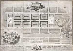
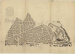
In 1766, a competition was held to design the new area. A 26-year-old architect named James Craig won. He designed a simple grid pattern. It had a main street along the ridge, connecting two garden squares.
There were two other main roads lower down, to the north and south. Smaller streets were placed between them. Several mews (lanes for stables) were built behind the large homes. Three north-south streets completed the grid.
Craig's first plan might have looked like the Union Flag. But a simpler design was chosen. This design still showed British patriotism in its street names.
Naming the Streets
The main street was named George Street, after King George III. Queen Street to the north was named after his wife. The street to the south was first called St. Giles Street, after Edinburgh's patron saint.
St Andrew Square and St. George's Square were named to celebrate the union of Scotland and England. Smaller streets continued this theme. Thistle Street (for Scotland's national flower) was between George Street and Queen Street. Rose Street (for England's flower) was between George Street and Princes Street.
King George did not like the name St. Giles Street. So, it was renamed Prince's Street, after his oldest son. St. George's Square became Charlotte Square, named after the Queen. This avoided confusion with an existing George Square.
The western parts of Thistle Street were renamed Hill Street and Young Street. The three cross streets were named Castle Street (for the view of the castle), Frederick Street (after the King's second son), and Hanover Street (after the King's family, the House of Hanover).
Building the New Town
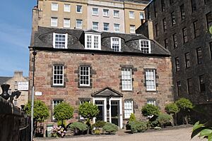
Building the New Town faced some challenges at first. The new area was open and windy, so people were not eager to build there. The city offered a special payment to the first builder. John Young received this payment. He built Thistle Court in 1767, which are the oldest buildings still standing in the New Town.
Soon, more construction began in the east, starting with St. Andrew Square. Craig had planned for two large churches at the ends of George Street. However, at St Andrew Square, Sir Lawrence Dundas owned the land. He decided to build a grand house there instead.
This house, called Dundas House, was finished in 1774. Today, it is the main office for the Royal Bank of Scotland. Because of this, St. Andrew's Church had to be built on George Street instead.

The first New Town was mostly finished by 1820. This was when Charlotte Square was completed. It was designed by Robert Adam and was the only part of the New Town designed by one architect. The north side of Charlotte Square includes Bute House. This is the official home of the First Minister of Scotland.
Some small areas were not built right away. In 1885, the Scottish National Portrait Gallery was built on a previously open garden area of Queen Street.
The New Town was planned mostly for homes and offices. But shops quickly opened on Princes Street. Over time, many houses on Princes Street were replaced by larger shops. Today, most of Queen Street, Thistle Street, and parts of George Street still have their original 18th-century buildings.
Sadly, some wealthy people who lived in the New Town had connections to slavery. They made money from the slave trade or owned slave plantations. This means that some of the New Town's grand buildings were partly funded by profits from the enslavement of African people.
Northern, or Second, New Town
After 1800, the success of the first New Town led to even bigger plans. The 'Northern New Town' (also called the Second New Town) aimed to extend Edinburgh further north. This development happened mostly between 1800 and 1830.
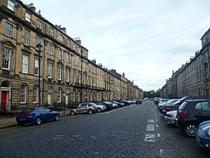
The new streets followed the grid pattern of the first New Town. Streets like Dundas Street and Great King Street stretched almost a kilometer north. Great King Street was a central avenue. It ended at Drummond Place to the east and Royal Circus to the west.
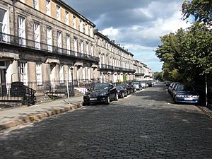
Many parts of the Second New Town are still exactly as they were built. Large houses were usually on the east-west streets. Blocks of flats (called tenements in Scotland) were along the north-south streets. Shops were generally on the ground floors of the wider north-south streets.
To the west of the original New Town, Shandwick Place started in 1805. The painter Henry Raeburn bought land in the northwest and began developing it in 1813. He named Ann Street after his wife.
In 1822, the Earl of Moray planned to develop his land between Charlotte Square and the Water of Leith. This area, now called the Moray Estate, became very popular with Scottish noble families and rich lawyers. It is still one of the city's wealthiest areas today.
Eastern, or Third, New Town
To expand the New Town to the east, the city built the elegant Regent Bridge. It was finished in 1819. This bridge made it much easier to get to Calton Hill from Princes Street.
Even before the bridge was built, Edinburgh was planning the Eastern New Town. This area would stretch from Calton Hill north towards Leith. Many architects offered ideas for the design.
The commissioners chose William Henry Playfair. He was appointed in 1818 and created a plan in 1819. Playfair's designs aimed to make a New Town even grander than Craig's.
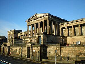
Streets like Regent Terrace, Carlton Terrace, and Royal Terrace were built on Calton Hill. Hillside Crescent and nearby streets were also built. However, the development further north towards Leith was never completed. On the south side of Calton Hill, monuments were built, as well as the Royal High School.
Other Additions
Some smaller developments began in Canonmills in the 1820s. But they were not finished at that time. For many years, a tannery (a place that processes animal hides) in Silvermills stopped building nearby.
After the 1830s, building slowed down. But after Thomas Telford’s Dean Bridge was finished in 1831, some developments were built in the Dean Estate. These included the Dean Orphanage (now the Dean Gallery) and Daniel Stewart's College.
In the 1800s, Edinburgh's second railway built a tunnel under the New Town. This tunnel connected Scotland Street with Canal Street (now part of Waverley Station). After it closed, the tunnel was used to grow mushrooms. During World War 2, it was an air raid shelter.
Changes Over Time
In the 1960s, there was a plan to build an elevated walkway along Princes Street. This plan would have meant tearing down the entire street. It was not popular and was stopped in 1982. However, seven buildings were removed before the plan was abandoned.
The St James Square area was also demolished in the 1960s. This was to make way for the St James Shopping Centre. This area had many tenement buildings (blocks of flats). Most of them were considered unfit to live in.
Bellevue House, built in 1775, was a grand building by Robert Adam. It was demolished in the 1840s because the Scotland Street railway tunnel was built underneath it.
Culture and Shopping
The New Town is home to important cultural buildings. These include the National Gallery of Scotland and the Royal Scottish Academy Building. Both were designed by Playfair and are next to each other on The Mound. The Scottish National Portrait Gallery is on Queen Street.
Other famous buildings are the Assembly Rooms on George Street and the Balmoral Hotel. The Balmoral Hotel has a tall clock tower above Waverley Station. The Scott Monument is also a well-known landmark.
The Cockburn Association works hard to protect the New Town's beautiful architecture.
The New Town has Edinburgh's main shopping streets. Princes Street has many well-known shops. George Street, which used to be a financial center, now has many modern bars. Multrees Walk has designer shops like Harvey Nichols.
The St. James Centre was an indoor mall built in 1970. It was demolished and reopened in 2021 as the St James Quarter. Near Waverley Station is Waverley Market. It has many popular stores and restaurants like Game, Costa, and McDonald's.
Famous People Who Lived Here
See also
 In Spanish: Ciudad nueva de Edimburgo para niños
 | Jewel Prestage |
 | Ella Baker |
 | Fannie Lou Hamer |


