
Oglethorpe County, Georgia facts for kids
Quick facts for kids
Oglethorpe County
|
|||
|---|---|---|---|

Oglethorpe County Courthouse
|
|||
|
|||

Location within the U.S. state of Georgia
|
|||
 Georgia's location within the U.S. |
|||
| Country | |||
| State | |||
| Founded | December 19, 1795 | ||
| Named for | James Oglethorpe | ||
| Seat | Lexington | ||
| Largest city | Crawford | ||
| Area | |||
| • Total | 442 sq mi (1,140 km2) | ||
| • Land | 439 sq mi (1,140 km2) | ||
| • Water | 3.0 sq mi (8 km2) 0.7%% | ||
| Population
(2020)
|
|||
| • Total | 14,825 | ||
| • Density | 34/sq mi (13/km2) | ||
| Time zone | UTC−5 (Eastern) | ||
| • Summer (DST) | UTC−4 (EDT) | ||
| Congressional district | 10th | ||


Oglethorpe County is a county located in the northeastern part of the U.S. state of Georgia. In 2020, about 14,825 people lived there. The main town, or county seat, is Lexington.
This county is part of the Athens-Clarke County area. It is also included in the larger Atlanta-Athens-Clarke County area. Oglethorpe County is the biggest county in Northeast Georgia.
Contents
History of Oglethorpe County
Oglethorpe County was once a large area of land. It was given up by the Muscogee and Cherokee Native American groups. This happened in a treaty with the Colony of Georgia in 1773.
The county itself was officially started on December 19, 1793. It is named after General James Oglethorpe. He was the person who founded the colony of Georgia.
Geography and Rivers
The U.S. Census Bureau says the county covers about 442 square miles. Most of this area, 439 square miles, is land. Only a small part, about 3.0 square miles, is water.
Most of Oglethorpe County is in the Broad River area. This river flows into the Savannah River. A small part of the western county is in the Oconee River area. This river flows into the Altamaha River. There is also a small southern part of the county near the Little River. This river also flows into the Savannah River.
Main Roads in Oglethorpe County
 U.S. Route 78
 State Route 10
 State Route 22
 State Route 77
Neighboring Counties
Oglethorpe County shares borders with several other counties:
- Elbert (to the northeast)
- Wilkes (to the east)
- Taliaferro (to the southeast)
- Greene (to the south)
- Oconee (to the west)
- Clarke (to the west)
- Madison (to the north)
Parks and Forests
- Oconee National Forest (part of it is in the county)
- Watson Mill Bridge State Park (part of it is in the county)
Towns and Communities
Here are some of the towns and communities located in Oglethorpe County:
Population Changes Over Time
| Historical population | |||
|---|---|---|---|
| Census | Pop. | %± | |
| 1800 | 9,780 | — | |
| 1810 | 12,297 | 25.7% | |
| 1820 | 14,046 | 14.2% | |
| 1830 | 13,618 | −3.0% | |
| 1840 | 10,868 | −20.2% | |
| 1850 | 12,259 | 12.8% | |
| 1860 | 11,549 | −5.8% | |
| 1870 | 11,782 | 2.0% | |
| 1880 | 15,400 | 30.7% | |
| 1890 | 16,951 | 10.1% | |
| 1900 | 17,881 | 5.5% | |
| 1910 | 18,680 | 4.5% | |
| 1920 | 20,287 | 8.6% | |
| 1930 | 12,927 | −36.3% | |
| 1940 | 12,430 | −3.8% | |
| 1950 | 9,958 | −19.9% | |
| 1960 | 7,926 | −20.4% | |
| 1970 | 7,598 | −4.1% | |
| 1980 | 8,929 | 17.5% | |
| 1990 | 9,763 | 9.3% | |
| 2000 | 12,635 | 29.4% | |
| 2010 | 14,899 | 17.9% | |
| 2020 | 14,825 | −0.5% | |
| 2023 (est.) | 15,754 | 5.7% | |
| U.S. Decennial Census 1790-1880 1890-1910 1920-1930 1930-1940 1940-1950 1960-1980 1980-2000 2010 |
|||
| Race | Num. | Perc. |
|---|---|---|
| White | 10,903 | 73.54% |
| Black or African American | 2,248 | 15.16% |
| Native American | 40 | 0.27% |
| Asian | 134 | 0.9% |
| Pacific Islander | 5 | 0.03% |
| Other/Mixed | 626 | 4.22% |
| Hispanic or Latino | 869 | 5.86% |
In 2020, there were 14,825 people living in Oglethorpe County. These people lived in 5,651 households, and 3,711 of these were families.
Education in Oglethorpe County
The county has its own school system. It is called the Oglethorpe County School District.
Fun Activities and Recreation
There are many fun things to do in Oglethorpe County:
- You can go white water rafting on the Broad and South Fork Broad Rivers.
- There is a park for ATV and motor bike riding.
- People enjoy hunting for Whitetail deer, Turkey, and Rabbit during hunting season.
- You can explore historic districts and antique stores in Lexington.
- The county also has farms that offer agritourism. You can find fresh local produce there.
In 2016, the Oglethorpe County Recreation Department won awards. It was named the District 7 and State Agency of the Year. This was for counties with populations under 20,000.
Transportation in the County
Major Highways
- U.S. Route 78
- State Route 10
- State Route 22
- State Route 77
Walking and Biking
There are not many places to walk or bike easily in the county.
Famous People from Oglethorpe County
Many notable people have connections to Oglethorpe County:
- Nathan Crawford Barnett: He was a member of the Georgia House of Representatives. He also served as the Georgia Secretary of State for over 30 years. He grew up in Lexington.
- William H. Crawford (1772–1834): He was a U.S. Minister to France. He also served as U.S. Secretary of War and U.S. Secretary of the Treasury.
- George R. Gilmer (1790–1859): He was the Governor of Georgia two times.
- Meriwether Lewis (1774–1809): He was a leader of the famous Lewis and Clark Expedition.
- Wilson Lumpkin (1783–1870): He also served as Governor of Georgia.
- Joseph H. Lumpkin (1799–1867): He was the first Chief Justice of the Georgia Supreme Court. He also helped start the Lumpkin Law School.
- George Mathews (1739–1812): He was a hero of the American Revolution. He was also Governor of Georgia twice.
- Kenny Rogers: A famous country music singer.
Images for kids
-
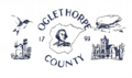
The flag of Oglethorpe County.
-

The logo of Oglethorpe County.
-
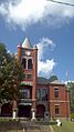
The Oglethorpe County Courthouse.
See also
 In Spanish: Condado de Oglethorpe para niños
