Orford, New Hampshire facts for kids
Quick facts for kids
Orford, New Hampshire
|
|
|---|---|
|
Town
|
|
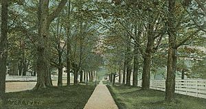
The Mall c. 1906
|
|
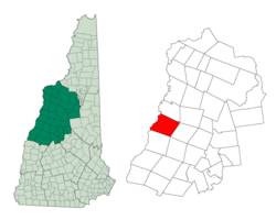
Location in Grafton County, New Hampshire
|
|
| Country | United States |
| State | New Hampshire |
| County | Grafton |
| Incorporated | 1761 |
| Villages |
|
| Area | |
| • Total | 47.9 sq mi (124.1 km2) |
| • Land | 46.5 sq mi (120.4 km2) |
| • Water | 1.4 sq mi (3.6 km2) 2.93% |
| Elevation | 407 ft (124 m) |
| Population
(2020)
|
|
| • Total | 1,237 |
| • Density | 27/sq mi (10.3/km2) |
| Time zone | UTC-5 (Eastern) |
| • Summer (DST) | UTC-4 (Eastern) |
| ZIP code |
03777
|
| Area code(s) | 603 |
| FIPS code | 33-58500 |
| GNIS feature ID | 0873693 |
Orford is a small town in Grafton County, New Hampshire, United States. It is located along the Connecticut River. In 2020, about 1,237 people lived there. The famous Appalachian Trail also goes through the eastern part of the town.
Contents
History of Orford
Orford was first called "Number Seven." This was because it was one of seven fort towns along the Connecticut River. In 1761, Governor Benning Wentworth officially made Orford a town. He named it after Robert Walpole, who was the first prime minister of Great Britain.
The first settlers, Daniel Cross and his wife, arrived in 1765. By 1859, Orford had over 1,400 people. Most of them worked in agriculture, which means farming. The town also had many factories. These included places that made leather, chairs, and wood products.
Samuel Morey's Invention
An early resident was General Israel Morey. His son, Samuel Morey, was a clever inventor. Samuel found a way to separate hydrogen from oxygen in water. This discovery helped create the first marine steam engine.
In 1793, Samuel Morey showed off his invention on the river in Orford. He was the first person to use a paddlewheel to move a steamboat. This was a big step forward for travel on water.
Orford's Beauty and Architecture
The famous author Washington Irving visited Orford in 1832. He said it was one of the most beautiful villages he had ever seen. He felt that nature had made it a truly charming place.
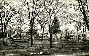
Orford is also known for its beautiful old homes. There are seven early houses built on an area called The Ridge. A professor from Dartmouth College said these houses are the best group of Federal-style homes in the United States. They were built between 1773 and 1839.
Geography of Orford
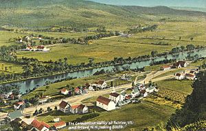
Orford covers about 124 square kilometers (48 square miles) of land and water. Most of this area is land. The Connecticut River forms the western border of the town. This river also separates New Hampshire from Vermont.
Most of Orford's water flows into the Connecticut River. Some parts in the northeast drain into the Baker River. This river then flows into the Merrimack River.
Town Centers and Mountains
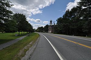
Orford has two main areas where people live. The main village, also called Orford, is along the Connecticut River. This is where the town's schools and post office are located.
The town hall is in a smaller village called Orfordville. This village is a few miles east of the river.
The highest point in Orford is Mount Cube. Its top is about 887 meters (2,909 feet) above sea level. Part of Smarts Mountain is also in Orford. Its summit is in the nearby town of Lyme.
There are also two camps, Merriwood and Moosilauke, located on Upper Baker Pond in Orford.
Population Information
| Historical population | |||
|---|---|---|---|
| Census | Pop. | %± | |
| 1790 | 540 | — | |
| 1800 | 988 | 83.0% | |
| 1810 | 1,265 | 28.0% | |
| 1820 | 1,568 | 24.0% | |
| 1830 | 1,829 | 16.6% | |
| 1840 | 1,707 | −6.7% | |
| 1850 | 1,406 | −17.6% | |
| 1860 | 1,255 | −10.7% | |
| 1870 | 1,119 | −10.8% | |
| 1880 | 1,050 | −6.2% | |
| 1890 | 916 | −12.8% | |
| 1900 | 890 | −2.8% | |
| 1910 | 799 | −10.2% | |
| 1920 | 661 | −17.3% | |
| 1930 | 636 | −3.8% | |
| 1940 | 701 | 10.2% | |
| 1950 | 726 | 3.6% | |
| 1960 | 667 | −8.1% | |
| 1970 | 793 | 18.9% | |
| 1980 | 928 | 17.0% | |
| 1990 | 1,008 | 8.6% | |
| 2000 | 1,091 | 8.2% | |
| 2010 | 1,237 | 13.4% | |
| 2020 | 1,237 | 0.0% | |
| U.S. Decennial Census | |||
In 2000, there were 1,091 people living in Orford. These people lived in 470 households. About 308 of these households were families.
Around 26.6% of households had children under 18 living with them. More than half of the households (55.5%) were married couples. About 27.4% of all households had only one person living there.
The population was spread out by age. About 21.9% were under 18 years old. Around 29.8% were between 25 and 44 years old. The median age in the town was 40 years.
Education
Students in Orford attend schools that are part of the Rivendell Interstate School District.
Notable People from Orford
Many interesting people have connections to Orford:
- Deborah Arnie Arnesen (born 1953), a political commentator.
- Daniel Doan (1914–1993), a writer and hiking enthusiast.
- Milton Friedman (1912–2006), a Nobel Prize-winning economist. He was a very important economist of the 20th century.
- Charles R. Jackson (1903–1968), a writer.
- Ben Lovejoy (born 1984), a professional ice hockey player. He played for the Pittsburgh Penguins.
- Gilman Marston (1811–1890), a US senator and congressman. He was also a US Army general.
- Samuel Morey (1762–1843), a famous inventor.
- Jameson Parker (born 1947), an actor.
- Fanny Huntington Runnells Poole (1863–1940), a writer and book reviewer.
- Meldrim Thomson, Jr. (1912–2001), who was the 73rd governor of New Hampshire.
- Jeduthun Wilcox (1768–1838), a US congressman.
- Leonard Wilcox (1799–1850), a US senator.
See also
 In Spanish: Orford (Nuevo Hampshire) para niños
 | Misty Copeland |
 | Raven Wilkinson |
 | Debra Austin |
 | Aesha Ash |


