
Owyhee County, Idaho facts for kids
Quick facts for kids
Owyhee County
|
||
|---|---|---|

Reynolds Creek Experimental Watershed in the Owyhee Mountains about 50 miles southwest of Boise.
|
||
|
||

Location within the U.S. state of Idaho
|
||
 Idaho's location within the U.S. |
||
| Country | ||
| State | ||
| Founded | December 31, 1863 | |
| Named for | lost Hawaiian trappers | |
| Seat | Murphy | |
| Largest city | Homedale | |
| Area | ||
| • Total | 7,697 sq mi (19,940 km2) | |
| • Land | 7,666 sq mi (19,850 km2) | |
| • Water | 31 sq mi (80 km2) 0.4% | |
| Population
(2020)
|
||
| • Total | 11,913 | |
| • Estimate
(2023)
|
12,722 |
|
| • Density | 1.54775/sq mi (0.59759/km2) | |
| Time zone | UTC−7 (Mountain) | |
| • Summer (DST) | UTC−6 (MDT) | |
| Congressional district | 1st | |

Owyhee County is a county in the southwestern part of Idaho. In 2020, about 11,913 people lived there. The main town, or county seat, is Murphy. The biggest city is Homedale.
Owyhee County is the second-largest county in Idaho by land area. It is part of the Boise metropolitan area. Part of the Duck Valley Indian Reservation is in Owyhee County. This reservation also goes into Nevada. Most people of the Shoshone-Paiute Tribe live on the Nevada side. Their main center is in Owyhee, Nevada.
Contents
History of Owyhee County
For thousands of years, the Western Shoshone, Northern Paiute, and Bannock peoples lived in this area. Later, European settlers arrived. They wanted land and resources. This led to conflicts, and the native peoples were moved to reservations.
How Owyhee County Was Formed
Owyhee County was the first county created by the Idaho Territory Legislature. This happened on December 31, 1863. Other counties like Boise and Nez Perce were formed earlier. But Idaho Territory did not officially recognize them until February 1864.
The first county seat was Ruby City. In 1867, it moved to nearby Silver City.
Changing Borders and Mining Boom
When Owyhee County was first made, it covered a large area. It was all of Idaho Territory south of the Snake River. In January 1864, Oneida County was formed from its eastern part. Later, in 1879, Cassia County took more land in the east.
Owyhee County's early history is linked to mining. Gold and silver were found here. Towns like Silver City and Ruby City grew very fast. In the 1880s, Owyhee County was one of the most populated places in Idaho. Today, it has fewer people.
Native American Reservations
Miners and settlers wanted more land. So, in 1877, the government made a treaty with the Western Shoshone. This created the Duck Valley Indian Reservation. It is in Owyhee County and also in Nevada. In 1886, the reservation grew to include Northern Paiute people. In the 1900s, these tribes joined together. Most of their people live on the Nevada side of the reservation.
Railroads in Owyhee County
Two railroad lines came into Owyhee County. The first was the Boise Nampa & Owyhee Railroad. It started building in 1896 from Nampa, Idaho. It reached Murphy, Idaho, in 1899. This line later became known as the Murphy Branch line. Passenger trains stopped running to Murphy in 1942. The railroad stopped using the Murphy part of the line in 1947. Trucks and highways became more common for travel. The last train left Melba in 1994.
The second railroad line was the Oregon Shortline Railroad. It built south from Nyssa, Oregon, starting in 1911. It reached Homedale, Idaho, in 1912. In 1922, it was extended to Marsing, Idaho. This helped transport farm goods. By the 1990s, fewer goods were shipped by train. The tracks were removed in 1998.
Modern Boundaries
Owyhee County got its current borders in 1930. A vote approved moving some land near Glenns Ferry to Elmore County. In 1934, the county seat moved from Silver City to Murphy. Silver City was almost empty by then. Today, both Silver City and Ruby City are ghost towns. They are reminders of the old mining days.
Why is it Called Owyhee?
The name "Owyhee" comes from an old way of saying "Hawaii". In 1778, Captain James Cook found the Hawaiian Islands. He called the people there "Owyhees." These Native Hawaiians were strong and good at sailing. Many of them worked on European and American ships. They sailed to the American Northwest coast. Some worked in the fur trade along the Columbia River.
In 1819, three Native Hawaiians joined an expedition to the Snake River area. They left the main group in the winter of 1819–1820. They wanted to explore the unknown land that is now the Owyhee River and mountains. They disappeared and were never seen again. To honor them, British fur traders started calling the area "Owyhee." The name has stayed ever since.
Geography of Owyhee County
Owyhee County covers about 7,697 square miles. Most of this is land, with a small part being water. It is the second-largest county in Idaho by area.
Landscape and Rivers
Most of the county is a high desert. It has lots of sagebrush and basalt canyons. The Owyhee Mountains are in the west. Hayden Peak is the highest point, at 8,403 feet above sea level. The lowest point is where the Snake River leaves the county. It is just above 2,000 feet at the Oregon border.
The Snake River forms most of the county's northern border. The Bruneau River flows north from Nevada through the eastern part of the county. The Owyhee River starts in the southwest. It flows west into Oregon and then joins the Snake River.
Nearby Counties
- Canyon County – north
- Ada County – north
- Elmore County – north
- Twin Falls County – east
- Elko County, Nevada – south
- Humboldt County, Nevada – southwest
- Malheur County, Oregon – west
Protected Natural Areas
Owyhee County has several protected natural areas. These places help keep nature safe.
- Big Jacks Creek Wilderness
- Bruneau - Jarbidge Rivers Wilderness
- Deer Flat National Wildlife Refuge (part)
- Little Jacks Creek Wilderness
- North Fork Owyhee Wilderness
- Owyhee River Wilderness
- Pole Creek Wilderness
- Snake River Birds of Prey National Conservation Area (part)
People of Owyhee County
| Historical population | |||
|---|---|---|---|
| Census | Pop. | %± | |
| 1870 | 1,713 | — | |
| 1880 | 1,426 | −16.8% | |
| 1890 | 2,021 | 41.7% | |
| 1900 | 3,804 | 88.2% | |
| 1910 | 4,044 | 6.3% | |
| 1920 | 4,694 | 16.1% | |
| 1930 | 4,103 | −12.6% | |
| 1940 | 5,652 | 37.8% | |
| 1950 | 6,307 | 11.6% | |
| 1960 | 6,375 | 1.1% | |
| 1970 | 6,422 | 0.7% | |
| 1980 | 8,272 | 28.8% | |
| 1990 | 8,392 | 1.5% | |
| 2000 | 10,644 | 26.8% | |
| 2010 | 11,526 | 8.3% | |
| 2020 | 11,913 | 3.4% | |
| 2023 (est.) | 12,722 | 10.4% | |
| U.S. Decennial Census 1790–1960 1900–1990 1990–2000 2010, 2020 |
|||
In 2010, there were 11,526 people living in Owyhee County. There were 4,076 households. About 76% of the people were white. About 4.3% were American Indian. People of Hispanic or Latino origin made up 25.8% of the population.
About 36.9% of households had children under 18. The average household had 2.79 people. The average age of people in the county was 36 years old.
Local Media
- The Owyhee Avalanche County newspaper
Communities in Owyhee County
Cities
Census-designated places
Unincorporated communities
- Claytonia
- Murphy Hot Springs
- Oreana
- Reynolds
- Riddle
Ghost towns
Education in Owyhee County
Several School districts serve Owyhee County:
- Bruneau-Grand View Joint School District 365
- Castleford School District 417
- Glenns Ferry Joint School District 192
- Homedale Joint School District 370
- Marsing Joint School District 363
- Melba Joint School District 136
- Pleasant Valley Elementary School District 364
- Three Creek Joint Elementary School District 416
Parts of the county are in the service area for College of Western Idaho. Other parts are in the service area for College of Southern Idaho.
Healthcare
The Southwest Idaho Health District provides healthcare services for the county.
Gallery
-
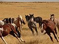
Wild Horses of Saylor Creek
-

Snake River Birds of Prey National Conservation Area


See also
 In Spanish: Condado de Owyhee para niños
