Poynton facts for kids
Quick facts for kids Poynton |
|
|---|---|
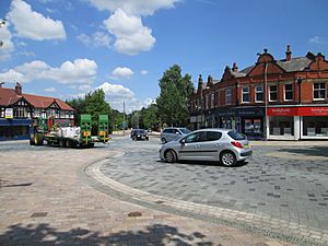 Poynton shared space town centre, remodelled in 2011 |
|
| Area | 13.1 km2 (5.1 sq mi) |
| Population | 14,260 (2011 census) |
| • Density | 1,089/km2 (2,820/sq mi) |
| OS grid reference | SJ925835 |
| • London | 152 mi (245 km) |
| Civil parish |
|
| Unitary authority |
|
| Ceremonial county | |
| Region | |
| Country | England |
| Sovereign state | United Kingdom |
| Post town | STOCKPORT |
| Postcode district | SK12 |
| Dialling code | 01625 |
| Police | Cheshire |
| Fire | Cheshire |
| Ambulance | North West |
| EU Parliament | North West England |
| UK Parliament |
|
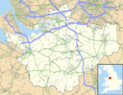
Poynton is a town in Cheshire, England. It is part of the civil parish of Poynton-with-Worth. The town is located on the eastern edge of the Cheshire Plain. It is about 11 kilometres (7 miles) south-east of Manchester. It is also 7 kilometres (4 miles) north of Macclesfield and 5 kilometres (3 miles) south of Stockport.
Poynton was first mentioned as a "manor" (a large estate) in 1289. For centuries, coal was mined here, starting in the 1500s. The coal mines were owned by the Lords Vernon from 1832 until they closed in 1935. They were the biggest coal mines in Cheshire. As the town grew, it needed better ways to transport goods and people. This happened when the Macclesfield Canal was built through Poynton in 1831. Later, railways arrived with the Manchester and Birmingham Railway in 1845 and the Macclesfield, Bollington and Marple Railway in 1869. In recent times, Poynton has become a popular place for people who work in Manchester to live. Since 1945, the number of people living in Poynton has almost tripled. In 2011, the population was 14,260.
Contents
History of Poynton
Poynton is not mentioned in the famous Domesday Book from 1086. The first time we hear about the manor of Poynton was in the 1200s. At that time, it was held by the Poutrells family and then by the de Stockeports. They were the lords of Stockport. The Warren family took over the manor in 1382. They owned it until 1801. After that, the Lords Vernon owned the estate until it was finally sold in 1920.
Coal was discovered in Poynton in the 1500s. The first record of coal mining here is from 1589. At first, coal was dug from the surface or from shallow shafts. Later, deeper shafts were dug using waterwheels and then steam engines to pump out water and lift the coal. The Poynton Collieries (coal mines) were very large. The coal was transported using canals, new roads, and railways. In 1832, Lord Vernon decided to manage the mines himself.
The mines had good transport links to places like Manchester, where cotton mills needed a lot of coal. However, when the price of coal dropped in 1861, many workers lost their jobs. A new shaft called the Lawrance Pit was dug in 1885, which helped increase coal production again. But the costs of running the mines kept going up. The Poynton Collieries finally closed on 30 August 1935. About 250 men lost their jobs. Today, the Anson Colliery site is home to the Anson Engine Museum. Other old mine shafts have been sealed off.
The Macclesfield Canal was planned in 1765, but building only started in 1826. It was designed by Thomas Telford and finished in 1831. The canal helped transport coal from Poynton to Macclesfield. It also made the canal journey from Manchester to London shorter by about 25 kilometres (15 miles).
Sir George Warren helped build a new main road (called a turnpike road) from Manchester through Poynton to Sandon, Staffordshire. This road is now part of the A51 road. The Manchester and Birmingham Railway opened a line through Poynton in 1845. This line is now part of the main railway line between London and Manchester. Another railway, the Macclesfield, Bollington and Marple Railway, opened in 1869. It had stations at Higher Poynton and Middlewood. This line closed in 1970 and is now a walking and cycling path called the Middlewood Way.
In the late 1700s, the Pickford family started their transport business in Poynton. Their main office was at The Birches Farm. The business grew, and Pickfords is now a very well-known moving company in the United Kingdom.
From the 1870s onwards, more and more houses were built. Poynton slowly became a "commuter town." This means people live in Poynton but travel to work in bigger cities like Manchester. After World War II, many new housing estates were built. The population of Poynton has grown from 5,000 to almost 15,000 since 1945.
How Poynton is Governed
Poynton is governed by different levels of local government. From 1974 to 2009, it had three levels: the parish council of Poynton-with-Worth, Macclesfield Borough Council, and Cheshire County Council. In 2009, the Parish Council decided to become a Town Council and elect a Mayor. This created the Poynton with Worth Town Council.
Since 2009, Cheshire East Council has been in charge of the responsibilities that the borough and county councils used to have.
Poynton is represented on Cheshire East Council by four councillors. These councillors are elected from two areas called electoral wards: Poynton West and Pott Shrigley and Poynton East and Adlington. All four councillors are currently from the Conservative Party. Poynton is also part of the Macclesfield Constituency for the UK Parliament. This means people in Poynton vote for an MP (Member of Parliament) to represent them in the national government. The current MP for Macclesfield is Tim Roca from the Labour Party.
Geography of Poynton
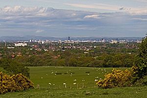
Poynton is located between the Norbury Brook and the Poynton Brook. It is at the very eastern edge of the Cheshire Plain. The land in Poynton is between 88 metres (289 feet) and 190 metres (623 feet) above sea level. The town is about 17 kilometres (11 miles) south-east of Manchester. It is also close to Manchester Airport.
The western part of Poynton is mostly residential, meaning it has many homes. This area is separated from nearby towns like Hazel Grove and Bramhall by the North Cheshire Green Belt. This is a protected area of open land. To the south of the town are two business parks. The eastern side of Poynton is more rural, bordering the old deer park of Lyme Hall. The A6 main road passes north of Poynton. The Macclesfield Canal runs north to south on the eastern side of the town.
Poynton sits on top of a geological feature called the Red Rock Fault. This fault causes the ground to drop about 200 metres (656 feet) to the west. This brings different types of rock to the surface. The lower ground in Poynton is covered by glacial till. This is a mix of clay, sand, and rocks left behind by melting ice sheets from the last ice age.
 |
Bramhall | Stockport Hazel Grove |
High Lane Disley |
 |
| Woodford Wilmslow |
Lyme Park | |||
| Mottram St Andrew | Adlington Macclesfield |
Climate
| Climate data for Woodford (88 m elevation) 1981–2010 | |||||||||||||
|---|---|---|---|---|---|---|---|---|---|---|---|---|---|
| Month | Jan | Feb | Mar | Apr | May | Jun | Jul | Aug | Sep | Oct | Nov | Dec | Year |
| Mean daily maximum °C (°F) | 6.9 (44.4) |
7.2 (45.0) |
9.7 (49.5) |
12.3 (54.1) |
15.9 (60.6) |
18.4 (65.1) |
20.2 (68.4) |
20.1 (68.2) |
17.4 (63.3) |
13.5 (56.3) |
9.6 (49.3) |
7.1 (44.8) |
13.2 (55.8) |
| Mean daily minimum °C (°F) | 0.8 (33.4) |
1.0 (33.8) |
2.4 (36.3) |
3.6 (38.5) |
6.7 (44.1) |
9.0 (48.2) |
11.7 (53.1) |
11.3 (52.3) |
9.2 (48.6) |
6.7 (44.1) |
3.0 (37.4) |
0.6 (33.1) |
5.5 (41.9) |
| Average rainfall mm (inches) | 81.5 (3.21) |
51.5 (2.03) |
58.6 (2.31) |
61.4 (2.42) |
54.8 (2.16) |
64.5 (2.54) |
67.3 (2.65) |
79.4 (3.13) |
79.6 (3.13) |
98.8 (3.89) |
79.9 (3.15) |
89.8 (3.54) |
867.1 (34.14) |
| Average rainy days (≥ 1.0 mm) | 15.8 | 11.0 | 12.8 | 11.8 | 10.9 | 9.7 | 11.7 | 12.8 | 12.1 | 14.4 | 14.4 | 14.4 | 151.7 |
| Mean monthly sunshine hours | 43.8 | 69.8 | 97.7 | 137.1 | 185.9 | 163.7 | 171.7 | 161.6 | 133.3 | 89.7 | 63.7 | 54.6 | 1,372.6 |
| Source: Met Office | |||||||||||||
People of Poynton (Demography)
In 2011, the population of Poynton with Worth was 14,260 people. Most people (98%) were white. About 1.1% were Asian, and 0.5% were of mixed race. In terms of religion, 70.4% were Christian, and 21.5% said they had no religion. About 59.7% of adults over 16 were married.
Culture and Community
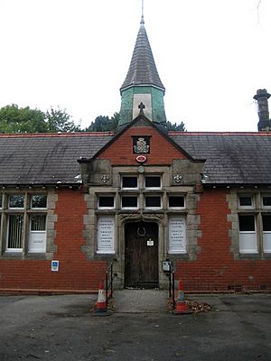
The Poynton Co-op was started in 1862. It was an independent store until 1992. Many groups like Friendly Societies and Burial Clubs helped people in the community. The Methodist Chapel opened in 1847, followed by other churches. These churches, along with St George's Church, were important social centres in the village. The first school was opened by Lord Vernon in 1838. This building is now the Poynton Youth and Community Centre.
The Poynton Show is a big event held every August bank holiday weekend. It started in 1885 as a farming show. Today, it has grown much larger, with stunt riding, aerobatics, a fairground, and many exhibitions.
The St George's Singers is a large choir that started in 1956. They have performed in many countries and often attract over 200 singers to their annual Singing Day. The Vernon Building Society (Poynton) Brass Band began in the Poynton coal-mining community. The Vernon family, who owned the mines, supported the band. Records show the band has been around for over 160 years!
Poynton has two Anglican churches: St Martin's in Higher Poynton and St George's in the town centre. St George's Church was built in 1859 and has a tall steeple added in 1884. Both churches have active groups for all ages, including youth and children's groups.
Poynton is twinned with Érd in Hungary. Since 2016, it is also twinned with Haybes in France.
Important Landmarks
Sir George Warren bought the Worth estate in 1792. Worth Hall, which is now flats, was once the home of the Downes family. Several grand houses were built in Poynton Park over time, but each one was later pulled down. The last one, Poynton Towers, was demolished in the 1930s.
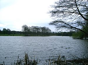
The beautiful lake, known as Poynton Pool, was created in the 1760s by Sir George Warren. He built a dam across a small river to form the lake. This dam also served as the base for a main road.
Poynton Coppice is a special local nature reserve. Other important landmarks include St George's Church, which has the town's war memorial in its churchyard. The sites of the old Park Colliery and Anson Pit are also important historical landmarks.
Transport in Poynton
Waterways
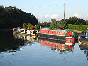
The Macclesfield Canal was first suggested in 1765, but building didn't start until 1826. It was finished in 1831. This canal connects the Peak Forest Canal in Marple with the Trent and Mersey Canal near Kidsgrove. It is part of the Cheshire Ring of canals. The canal's path was chosen to go near the Poynton Collieries so coal could be easily transported to places like Macclesfield. It also made the canal journey from Manchester to London 25 kilometres (15 miles) shorter.
Railway
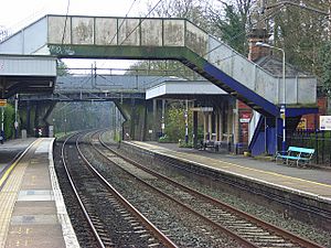
The Manchester and Birmingham Railway opened a line through Poynton in 1845. This line is now part of the main railway route between London and Manchester. Poynton railway station has trains going north to Stockport and Manchester Piccadilly. Trains also go south to Macclesfield and Stoke-on-Trent. Trains usually run once an hour in both directions, with more trains during busy times.
The Macclesfield, Bollington and Marple Railway opened in 1869. It had stations at Higher Poynton and Middlewood. This railway line closed in 1970. It was later turned into a path for walking and cycling called the Middlewood Way. This path was opened in 1985.
Roads
Poynton is located south of the A6 road. This was a popular route between London and Manchester in the past. In 1760, Sir George Warren helped create a new main road (a turnpike) through Poynton. This road is now known as the A523 or London Road. Later, the A5149 Chester Road was built, connecting Poynton to Wilmslow. The town is also close to the M60 motorway at Stockport and the M56 motorway near Manchester Airport.
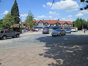
In December 2011, the roads in the centre of Poynton were changed. A new type of junction was built where Chester Road/Park Lane and London Road meet. This is called a "double roundel." It is similar to a roundabout. This new design helps reduce traffic and makes it safer for people to cross the road. It uses different coloured and textured stones to separate traffic from walking areas. This design allows pedestrians to cross anywhere they feel safe. The town says that local businesses have seen more customers, and traffic jams have been reduced. This project cost £4 million.
Buses
Cheshire East Council helps organise public transport in the area. The 391/392 bus services run between Stockport and Macclesfield. They operate every two hours from Monday to Saturday.
Media
Local news and TV shows for Poynton are provided by BBC North West and ITV Granada.
Poynton is served by several local radio stations:
- BBC Radio Manchester
- Heart North West
- Smooth North West
- Greatest Hits Radio Manchester & The North West
- XS Manchester
- Canalside Radio, a local station from Macclesfield.
The local newspapers for the town are the Poynton Post and the regional Manchester Evening News.
Education
Education in Poynton is managed by Cheshire East Council. Some parents choose to send their children to schools in nearby Stockport.
Poynton has five primary schools and Poynton High School. After finishing secondary school, students can continue their education at Poynton High School's sixth form. They can also go to colleges nearby like Aquinas College, Marple College, or Macclesfield College.
Famous People from Poynton

- James Meunier (1885–1957) was born in Poynton. He played both cricket and football.
- Leslie Wood (1920–1994), an artist and illustrator, lived in Poynton.
- Alan Beith (born 1943 in Poynton) was an MP (Member of Parliament) for Berwick-upon-Tweed from 1973 to 2015.
- Stephen Oake (1963–2003) was a police officer born in Poynton. He was sadly killed while trying to arrest a suspected terrorist.
- Graham Evans, Baron Evans of Rainow (born 1963 in Poynton) was an MP for Weaver Vale and is now a member of the House of Lords.
- Luis Troyano (1971–2020), a finalist on The Great British Bake Off in 2014, lived in Poynton.
- Reuben Singh (born 1976 in Poynton) is an entrepreneur who became well known for his "Miss Attitude" shops.
- Dame Sarah Storey (born 1977) is a famous cyclist and former swimmer. She has won many gold medals at the Paralympic Games. The post box outside Poynton High School was painted gold to celebrate her wins.
- Andrew Stephenson (born 1981) was a Conservative Party politician and MP. He went to Poynton High School.
- Sophie Thornhill (born 1996) is a visually impaired cyclist who competes in para-cycling events.
- Jimmy Murphy (1910–1989) was a former Wales football manager and assistant to Matt Busby at Manchester United. He moved to Poynton after retiring.
See also
 In Spanish: Poynton para niños
 | Emma Amos |
 | Edward Mitchell Bannister |
 | Larry D. Alexander |
 | Ernie Barnes |


