
Qu'Appelle River facts for kids
Quick facts for kids Qu'Appelle River |
|
|---|---|

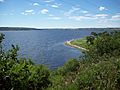
Qu'Appelle Valley panorama
|
|

The Red River drainage basin, with the Qu'Appelle River highlighted
|
|
| Country | Canada |
| Provinces | |
| Physical characteristics | |
| Main source | Lake Diefenbaker at Qu'Appelle River Dam, Saskatchewan. 550 m (1,800 ft) 50°58′30″N 106°26′02″W / 50.97500°N 106.43389°W |
| River mouth | Assiniboine River near St. Lazare, Manitoba. 400 m (1,300 ft) 50°26′38″N 101°19′11″W / 50.44389°N 101.31972°W |
| Length | 430 km (270 mi) |
| Basin features | |
| River system | Red River drainage basin |
| Basin size | 51,000 km2 (20,000 sq mi) |
The Qu'Appelle River is a Canadian river that flows 430 kilometres (270 mi) (about 267 miles) east. It starts from Lake Diefenbaker in southwestern Saskatchewan. The river then joins the Assiniboine River in Manitoba, near the village of St. Lazare.
A lot of the water in the Qu'Appelle River today comes from the South Saskatchewan River. This is because of the Qu'Appelle River Dam and Gardiner Dam built upstream. These dams help control and increase the water flow.
The Qu'Appelle Valley has two main watersheds. A watershed is an area of land where all the water drains into a single river or lake.
- Lower Qu'Appelle River Watershed: This area is in southeastern Saskatchewan. It covers about 17,800 square kilometres (6,900 sq mi) (about 6,870 square miles). The river flows through six big lakes here: Pasqua, Echo, Mission, Katepwa, Crooked, and Round Lakes.
- Upper Qu'Appelle River and Wascana Creek Watershed: This watershed is about 14,143 square kilometres (5,461 sq mi) (about 5,460 square miles). It gets water from several smaller rivers and creeks. Two main lakes in this area are Buffalo Pound Lake and Eyebrow Lake.
Contents
- About the Qu'Appelle River
- River History
- Communities in the Valley
- Qu'Appelle Valley Environment
- Water Management
- Historical Land Uses
- Modern Land Uses
- Recreation and Environment
- Industrial Land Uses
- Fish Species
- Gallery
- Images for kids
- See also
About the Qu'Appelle River
The Qu'Appelle River flows through several important lakes in southeast Saskatchewan:
- Eyebrow Lake and Buffalo Pound Lake are north of Moose Jaw. Buffalo Pound Lake provides drinking water to Moose Jaw, Regina, and a potash mine.
- The Fishing Lakes (Muscowpetung, Pasqua, Echo, Mission, and Katepwa lakes) are northeast of Regina.
- Further downstream, north of Grenfell and Broadview, are Crooked Lake and Round Lake.
The river also flows through four provincial parks: Buffalo Pound Provincial Park, Echo Valley Provincial Park, Katepwa Point Provincial Park, and Crooked Lake Provincial Park.

Many smaller streams and valleys (called coulees) drain into the Qu'Appelle Valley. These include Echo Creek and Last Oak Creek. Other important streams are the Moose Jaw River, Wascana Creek, and Pheasant Creek.
Most of the land (93%) in the Qu'Appelle Rivershed is used for farming.
Last Mountain Lake, also known as Long Lake, is the largest natural lake in southern Saskatchewan. It drains into the Qu'Appelle River near the town of Craven.
River History


In 1787, a company called the North West Company set up a fur trading post on the river. Later, in 1852, the Hudson's Bay Company built a post at Fort Qu'Appelle.
The name "Qu'Appelle" comes from a Cree legend. Aboriginal people told a trader in 1804 that they often heard a voice calling, "Kâ-têpwêt?", which means "Who is calling?" in Cree. In French, this is "Qui appelle?". There is a strong echo in the valley, especially near Lebret.
A poet named E. Pauline Johnson heard this legend and wrote a romantic version. In her story, a young man heard his name called while crossing a lake. He replied, "Who calls?" Only his echo answered. He then realized it was his bride-to-be calling his name at the moment she passed away. This is why one of the lakes is called Echo Lake.
Communities in the Valley
First Nation Reserve Lands
The Qu'Appelle Valley is part of Treaty 4 territory. It is home to the Cree, Saulteaux, Dakota, and Nakota peoples. These groups have lived here for a very long time. Due to historical laws like the Indian Act of 1876, Indigenous peoples were made to live on reserves. Reserves in the Qu'Appelle Valley include Piapot, Pasqua, Muscowpetung, Standing Buffalo, Cowessess, Kahkewistahaw, Sakimay, and Ochapowace.
Towns and Villages
There are two towns and two villages in the valley.
- Lumsden has about 1,824 people.
- Fort Qu'Appelle has about 2,027 people. It is about 70 kilometres (43 mi) (43 miles) northeast of Regina. This town is important historically because it was a meeting point for major trails. It was also where Treaty 4 was signed.
- Craven is a village northeast of Regina. It is famous for the Country Thunder Music Festival. Even though its year-round population is 214, it becomes as busy as a big city during the festival.
- Tantallon is a village with 91 people. It is known for its large statue of a whitetail deer.
Lake Communities
Many people live in communities around the lakes in the Qu'Appelle Valley. These include:
- Buffalo Pound Lake: Communities like North Grove, Sun Valley, Parkview, and Sand Point Beach have seasonal and year-round homes.
- Calling Lakes (Pasqua, Mission, Echo, and Katepwa): Communities like Fort San, B-Say-Tah, and parts of the District of Katepwa are found here.
- Crooked and Round Lake: Communities like Sunset Beach, Melville Beach, and Birds Point are located on these lakes.
Qu'Appelle Valley Environment
Ecosystems
The Qu'Appelle Valley has two main ecosystems: grasslands and wetlands.
- Grasslands are mostly covered by different types of grasses and herbs. Few trees grow here because of the dry, changing weather. Grassland plants have deep roots to find water and prevent soil from washing away.
- Wetlands are areas where the land is covered by water, like marshes or swamps. They provide food and homes for animals. Wetlands also clean water by filtering out pollution and store rainwater, which helps prevent floods.
Plants (Flora)
On the slopes of the Qu'Appelle Valley, you can find forests of trembling aspen and green ash trees. Grasslands grow on the sunny, south-facing slopes. The valley floor has rich wetlands and areas for growing hay. Bur oak trees are mostly found in the eastern part of the valley.
Animals (Fauna)
Aquatic Species
About 30 types of fish live in the Qu'Appelle Valley water system. This is 45% of all fish types in Saskatchewan! The bigmouth buffalo is a fish found only in this river. It is a protected species because it is at risk of disappearing. Dams and water control structures have harmed its breeding areas. Other uncommon fish include the rock bass, brown bullhead, and channel catfish.
Terrestrial Species
Many bird species live in the valley, such as the wood duck and lazuli bunting. You can also find painted and snapping turtles in the river. Some eastern animals like the eastern grey squirrel and red belly snake live here too. The valley is home to about 30 endangered animal species, including the loggerhead shrike and the northern leopard frog.
Weather and Climate
The Qu'Appelle Valley has a dry, sunny climate with very hot summers and very cold winters. This is typical for grassland areas. The average yearly rainfall is 365 millimetres (14.4 in) (about 14 inches). In January, the average temperature is −14.2 °C (6.4 °F) (6.4°F), and in July, it is 18.5 °C (65.3 °F) (65.3°F).
Soil and Land
The soil in the valley varies from sandy to loamy. It can be easily damaged by heavy machinery. Because winters are long and cold, dead plants don't break down quickly. This creates a layer of plant material on top of the soil. This soil is rich and dark, ranging from light brown to black.
When plants are removed, the soil can erode more easily. This happens especially in spring when snow melts. Farming also increases soil erosion. The Qu'Appelle Valley was formed about 14,000 years ago when the last ice age ended. Glaciers left behind thick layers of silt, sand, clay, and gravel. In some places, these layers are 273 metres (896 ft) (about 895 feet) thick.
Water Management
Water Supply and Demand
Most of the land (93%) in the Qu'Appelle Rivershed is used for farming. There are also five potash mines in the area. Water use is expected to increase a lot by 2060. In dry years, Lake Diefenbaker provides about 90% of the water for the Qu'Appelle River. This water mostly comes from melting snow in the Rocky Mountains.
The South Saskatchewan River, which feeds Lake Diefenbaker, has seen its water flow drop by 12% in the last 100 years. This could lead to water shortages in the future. However, climate change could also cause more glacier melt, leading to severe flooding.
Water Quality Concerns
The quality of freshwater in Southern Saskatchewan is not very good. This is due to too many nutrients (eutrophication) and high mineral content. Algae blooms often happen in shallow, slow-moving lakes during hot weather. These blooms are caused by high levels of nutrients from:
- Farming (fertilizers, pesticides, manure).
- Waste from homes near the water.
- Waste from towns upstream.
Old septic systems from homes along the lakes also leak, harming water quality. To help, people can use phosphate-free shampoos, install low-flush toilets, and stop illegal drainage.
Buffalo Pound Lake Water System
Buffalo Pound Lake is a major lake along the Qu'Appelle River. It holds a lot of water (91,987,000 cubic metres (3.2485×10⁹ cu ft) or about 24 billion US gallons). This water is used for recreation, industry, and supplies about a quarter of the province's population.
A project is planned to supply non-drinking water to industries, especially potash mines, in the Belle Plaine area. This project involves a pipeline that would cross the Moose Jaw River and Wascana Creek. There are concerns that this project could harm fish species like the bigmouth buffalo and chestnut lamprey. It could also reduce habitats for rare plants and animals like the burrowing owl and northern leopard frog.
Dams in the Valley
In the 1930s, during a severe drought, the Canadian government created the Prairie Farm Rehabilitation Administration (PFRA). Its job was to help protect water supplies for homes, farms, and animals.
- Echo Lake Project: In 1941, a dam was built at the east end of Pasqua Lake. This caused floods on the Muscowpetung and Pasqua reserves. The First Nations were promised money for the damage, but they did not receive it until 1973. In 1976, they accepted a payment of $265,000.
- Crooked Lake and Round Lake Projects: These dams were also built in 1941 without the full agreement of the local First Nations. Some payment was made to the Sakimay, Cowessess, and Ochapowace Bands in 1943.
Historical Land Uses
Indigenous Use of Natural Resources
The Qu'Appelle Valley has a long history of trade and resource use by Indigenous peoples. They used local plants and animals for food, trade, and other activities. Women gathered berries and medicinal plants to sell. Men cut and sold firewood. Elders from the Pasqua First Nation remember selling roots, berries, herbs, and crafts in Regina.
However, laws like the Indian Act made it hard for Indigenous people to participate in the economy. They needed permission from an Indian agent to leave their reserve or sell their cattle. Some Indigenous communities were very good at grain farming, but they were sometimes stopped from farming too much, so they wouldn't compete with non-Indigenous farmers.
Indigenous people hunted many animals, including deer, elk, moose, and antelope. They also hunted small game and waterfowl like ducks, geese, and pheasants. Trapping animals like rabbits, beaver, and mink for their furs was also important.
Fishing was widely practiced. They caught walleye, perch, and northern pike. Before treaties, First Nations built weirs (fish traps) in narrow parts of rivers to catch fish. Fish were cooked fresh or smoked to preserve them.
According to Elders, berries like chokecherries, saskatoon berries, and cranberries were once more plentiful.
Modern Land Uses
Today, the valley is used for hunting, fishing, trapping, gathering, and scientific study. Indigenous peoples continue to connect with their traditional knowledge and practices.
Hunting
People mainly hunt big game and birds in the valley.
- Big game includes mule deer, whitetail deer, elk, moose, and black bear. Hunting is mostly in the fall.
- Birds include migratory birds (like geese and ducks) and upland birds (like grouse and pheasants).
Non-Indigenous hunters need licenses and tags for big game. Status First Nation hunters can hunt for food without a license. Indigenous hunters often show respect for animals by leaving tobacco when an animal is taken. They also share meat with elders.
Fishing
Common fish caught in the valley include northern pike, walleye, whitefish, and yellow perch. Most people use a rod and reel. Some Indigenous fishers use snares. Non-Indigenous people need a fishing license and must follow rules about fishing seasons and how many fish they can catch.
The Fort Qu'Appelle Fish Culture Station near Echo Lake raises 20 million walleye each year to be released across the province.
Trapping
People still trap animals like rabbits, beaver, coyote, and mink. The main trapping area is called the Southern Fur Conservation Area. Many Indigenous trappers use this area in the fall and winter.
Gathering
People gather fruits, vegetables, and medicinal plants. Berries like chokecherries and saskatoon berries are popular. Medicinal plants like herbs and sweetgrass are also gathered. However, some Indigenous communities are worried that knowledge about these plants is being lost.
Scientific Study
Scientists from universities like the University of Saskatchewan and the University of Regina study the Qu'Appelle Valley. They look at its lakes (limnology), rocks (geology), and landforms (geography).
Parks and Recreation
The Qu'Appelle Valley has many parks and places for fun activities. These include Echo Valley, Crooked Lake, Katepwa Point, and Buffalo Pound. Echo Lake and the Calling Lakes are very popular, attracting many visitors from Regina.
Activities happen all year round. In spring and summer, people enjoy canoeing, kayaking, camping, and swimming. Hiking is popular in the fall. In winter, people go skiing, snowshoeing, snowmobiling, and sleigh riding.
Recreation and Environment
-
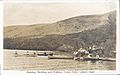
Como Park, in resort village of Sandy Beach on Katepwa Lake, 1920s
-
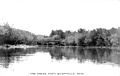
Qu'Appelle River, Fort Qu'Appelle, circa 1910
-
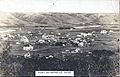
Fort Qu'Appelle, circa 1910


Besides summer fun on the lakes, the valley also has popular places for winter sports:
- White Track ski resort on Buffalo Pound Lake.
- Mission Ridge Winter Park, a popular place for skiing and snowboarding near Fort Qu'Appelle.
- Last Oak Golf Course, east of Regina.
- Hang gliding and paragliding are popular from the valley slopes, especially near Crooked Lake and Round Lake. The valley here is up to 450 feet (140 m) (137 meters) deep and a mile wide. This creates good wind conditions for pilots to fly for many hours.
The river valley has natural grasslands and coulees. These areas provide homes for native plants and animals like the loggerhead shrike and coyote. The eastern slopes have bur oaks, which are the only natural oak trees in Saskatchewan.
Industrial Land Uses
Moose Jaw-Regina Industrial Corridor
This area connects the cities of Regina and Moose Jaw. It is home to about 24% of Saskatchewan's population and produces 20% of the province's economic output. The corridor is next to the TransCanada Highway and two major railways, making it easy to move goods across Canada and to the United States.
This area is good for industry because:
- It has great transportation links (highway, railways, and the Global Transportation Hub).
- The land is flat, and there's easy access to water, natural gas, and electricity.
- It's close to Regina and Moose Jaw, which provides workers and access to airports.
- There are large amounts of high-quality potash underground.
Industries in this corridor include agriculture, fertilizer production, mining, and energy. Some major companies here are Yara Fertilizer, Alpine Plant Foods, Terra Grain Fuels (producing ethanol), and K+S Windsor Salt LTD.
Mining in the Valley
Saskatchewan produces a lot of potash, and many mines are in the Qu'Appelle Valley corridor. As of 2013, there were six mines operating and eight more planned. These mines use water from the Qu'Appelle River system, groundwater, and Lake Diefenbaker.
- Mosaic Belle Plaine Mine: This is the world's largest potash solution mine.
- Saskatchewan Mining and Minerals Inc. Chaplin Lake: This company has produced sodium sulphate for over 66 years. They manage flooding in the area, which creates habitats for shorebirds.
Potash Mining Impacts
K+S Potash Canada, Bethune Mine
The K+S Potash mine near Bethune started in 2017. It covers a large area (87 square kilometres (34 sq mi) or about 34 square miles) of farmland and grasslands. This mine, though planned for 55 years, has raised environmental concerns.
There is a risk that underground pipelines carrying salty water (brine) could break. If this happens, it could pollute the soil, groundwater, and surface water, harming habitats. There's also a risk of a spill from the tailings pond, which holds waste brine. The mine uses a lot of freshwater, taking 7% of Buffalo Pound Lake's water. Construction has also caused soil erosion and damaged wetlands and grasslands. Roads built for the mine can affect wildlife and spread invasive plant species.
The mine also affects local residents with noise, more traffic, loss of farmland, and changes to the landscape.
Project Albany
Project Albany is a planned new potash mine. It would produce up to 3.25 million tonnes of potash per year. The mine is expected to last up to 100 years.
This project covers a huge area (50,000 hectares or 120,000 acres), mostly farmland, but also grasslands and wetlands. There are concerns that spills could lower water quality. Filling wetlands for the mine would affect the entire watershed, leading to erosion and soil changes. Wildlife could be harmed by contact with salty water, vehicle collisions, or loss of habitat. Rare plants could also be lost.
Pipelines in the Valley
Two major pipelines run through the Qu'Appelle Valley.
- The TransCanada Mainline system carries natural gas.
- The Enbridge Mainline System carries oil and natural gas liquids.
In 2015, the Nature Conservancy of Canada created hiking trails along pipeline routes to raise awareness about the valley's fragile environment.
Pipeline Impacts
Enbridge Line 3 Replacement Project
This project involves replacing 1,067 kilometres (663 mi) (663 miles) of an old pipeline. Construction started in 2017. The new pipeline will carry different types of crude oil.
Building the pipeline can temporarily disturb land, wetlands, and water bodies. During operation, maintenance work can also cause impacts. A big risk with all oil pipelines is spills. Enbridge has had spills in the past. In 2014, the National Energy Board ordered Enbridge to stop work on Line 3 in Manitoba due to environmental and safety concerns.
Potential impacts include:
- Pollution of groundwater and surface water during construction or from spills.
- Damage to aquatic habitats (fish homes) from increased dirt in the water or changes to stream flow.
- Disturbance to wildlife habitats from clearing land. Pipelines can also break up habitats, making it harder for animals to move around and increasing invasive species.
- Loss of rare plant species.
- Land disturbance, soil erosion, and changes to the land.
- Increased noise during construction.
The new pipeline will carry heavy oil (bitumen) that is harder to clean up if it spills. Indigenous communities like Keeseekoose First Nation and Pasqua First Nation are worried because the pipeline is close to their lands. There are also concerns about leaving the old pipeline in the ground after it's decommissioned, as it could cause environmental problems later.
Railway in the Valley
The Canadian Pacific Railway (CP) transports oil, grain, and other goods through the Qu'Appelle Valley. The CP Belle Plaine Railway Spur was built to move potash from the Belle Plaine mine. This involved a lot of digging and moving earth to build the rail beds.
Railway Impacts
CP Railway Belle Plaine Spur
The Belle Plaine Spur connects the new potash mine to the existing railway. While it helps the economy by moving potash, it had major environmental impacts. Huge amounts of earth were dug up and moved to build the railway.
CP Railway chose the shortest route to try and limit impacts. They built in areas already used for farming, which they argued were less sensitive. However, they cut into both the north and south valley walls, in some places over 35 metres (115 ft) (115 feet) deep. These cuts went through underground water sources (aquifers), causing drainage and erosion problems. The natural shape of the valley has changed a lot. New structures like concrete culverts were built to manage floodwaters.
Before construction, experts checked for historical sites. They found two important historical sites within the railway's path.
Agriculture Impacts
Farming has led to more metal pollution in the Qu'Appelle watershed. This is from tilling the soil, irrigation, and using chemicals. These metals build up in lake sediment and can harm aquatic life.
Gravel Pits in the Valley
The Qu'Appelle Valley has sand and gravel deposits from old riverbeds. These are dug up in gravel pits. In some areas, this has disturbed the plants. Where the land has not been disturbed, many native plants are growing well.
Fish Species
The Qu'Appelle River is home to many fish species, including:
- walleye
- sauger
- yellow perch
- northern pike
- lake whitefish
- cisco
- mooneye
- white sucker
- bigmouth buffalo
- common carp
- channel catfish
- black bullhead
- brown bullhead
- burbot
- rock bass (Saskatchewan's only native bass)
- chub
Gallery
-
Qu'Appelle Valley near Cutarm, 1910
-
B-Say-Tah Point on Echo Lake in the Qu'Appelle Valley, a popular holiday resort and commuter community for Reginans since the 1880s
-
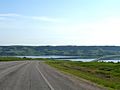
Buffalo Pound Lake
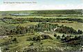
-
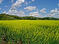
The Qu'Appelle Valley under cultivation in South East Saskatchewan


Images for kids
-
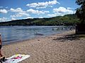
Echo Lake, south shore

See also
 In Spanish: Río Qu'Appelle para niños
