
Remote sensing facts for kids

Remote sensing is a way to gather information about something without actually touching it. Think of it like taking a picture or using a special scanner from far away. This is different from going to a place and touching or measuring things directly. We mostly use remote sensing to learn about Earth and other planets.
Scientists use remote sensing in many areas, like studying the Earth's physical features, maps, and how land is used. It also helps with things like understanding water, living things and their environment, weather, and oceans. Besides science, remote sensing is useful for military planning, business, and helping people in need.
Today, when we say "remote sensing," we usually mean using satellites or aircraft with special tools called sensors. These sensors help us find and identify objects on Earth, including its surface, air, and oceans. They do this by picking up signals, like electromagnetic radiation (which includes light and radio waves).
There are two main kinds of remote sensing:
- Active remote sensing: This is when a satellite or aircraft sends out a signal (like a radio wave or laser) and then listens for the signal to bounce back.
- Passive remote sensing: This is when the sensor just collects signals that are already there, like sunlight reflecting off the Earth or heat coming from objects.
Contents
How Remote Sensing Works
Remote sensing uses different tools to collect information from a distance.
Passive Sensing
Passive sensors collect energy that is either given off or reflected by objects. The most common energy source for passive sensors is reflected sunlight. Imagine taking a photo with a camera – that's a type of passive sensing! Other examples include infrared sensors (which detect heat) and radiometers.
Active Sensing
Active sensors are different because they send out their own energy to scan areas. Then, they measure the energy that bounces back.
- RADAR (Radio Detection and Ranging) is an active sensor. It sends out radio waves and measures how long it takes for them to return. This helps find an object's location, speed, and direction.
- LiDAR (Light Detection and Ranging) is similar but uses laser light instead of radio waves. It's very good at measuring heights and distances.

Remote sensing is great because it lets us collect data from places that are dangerous or hard to reach. For example, it helps us watch deforestation (trees being cut down) in places like the Amazon Basin. It also helps us study glaciers in the Arctic and Antarctic, and map the depths of oceans. During the Cold War, it was used to gather information about dangerous border areas without sending people there. It also saves money and time compared to collecting data on the ground, and it doesn't disturb the areas being studied.
Satellites orbiting Earth collect data from different parts of the electromagnetic spectrum (like visible light, infrared, and microwaves). When combined with information from planes or ground measurements, this helps scientists track changes like El Niño (a weather pattern) and other natural events. Remote sensing is also used for managing natural resources, checking farm fields, watching greenhouse gases, finding oil spills, and for national security.
What Can Remote Sensing See?
Remote sensing tools can see different things because objects reflect or give off unique types of energy. Here are some examples of what remote sensing can do:
- Radar for Weather and Maps: Regular radar helps control air traffic and gives early warnings. Doppler radar is used by police to check car speeds and by weather forecasters to see wind speed and direction within storms. A special type called Interferometric synthetic aperture radar (InSAR) can create very detailed 3D maps of large areas of land.
- Laser and Radar Altimeters: Satellites with these tools measure the height of the ocean surface very accurately. This helps them map the seafloor and understand ocean currents and wind speeds.
- LIDAR for Ground Features: LIDAR can measure the height of objects on the ground more precisely than radar. It's also used to find and measure different chemicals in the air. It's especially useful for studying plants and detecting changes in the ground.
- Radiometers: These are common tools that collect reflected and emitted energy across many frequencies, including visible light, infrared, and microwaves. They can also detect specific chemicals in the atmosphere. Radiometers are even used at night to see artificial light, which helps estimate population, economic activity, and damage from disasters. They can also monitor volcanic eruptions.
- Special Imaging:
- Stereographic pairs of aerial photographs are like 3D pictures from the air. They are used to make topographic maps (maps showing elevation) and plan things like highway routes.
- Multi-spectral imaging uses several wavelengths of light at once. Satellites like Landsat have been doing this since the 1970s. These images help create maps of land cover (what's on the surface) and land use (how people use the land). This can help find minerals, monitor farming, detect invasive plants, track deforestation, and check the health of crops and forests.
- Hyperspectral imaging collects even more detailed color information, with hundreds of narrow color bands. This is used in many fields, including geology, biology, and environmental studies.
- Fighting Desertification: Remote sensing helps scientists track areas at risk of turning into deserts. It helps them understand why this is happening and guides decisions on how to manage the environment.
- Biodiversity: Because different plants have unique "spectral properties" (how they reflect light), remote sensing can help assess the variety of life in an area. It can even help find rare plants for conservation.
How Data is Processed
The information collected by remote sensing tools needs to be processed to be useful.
Data Quality
The quality of remote sensing data depends on a few things:
- Spatial resolution: This is the size of the smallest area that the sensor can "see" in detail. A smaller number means more detail.
- Spectral resolution: This refers to the number and narrowness of the different color bands the sensor records. More bands mean more detailed color information.
- Radiometric resolution: This is how many different levels of brightness or intensity the sensor can tell apart. More levels mean a clearer image with more shades.
- Temporal resolution: This is how often a satellite or plane flies over the same area. It's important for studying changes over time, like deforestation.
Making Data Accurate
Before we can use remote sensing data to make maps, it often needs to be corrected.
- Georeferencing: This process makes sure the image data matches real-world locations accurately. It involves matching points in the image to known points on the ground.
- Radiometric correction: This fixes issues caused by uneven lighting or sensor problems, making the brightness values in the image more accurate.
- Topographic correction: In mountains, slopes facing the sun look brighter than shady slopes, even if they have the same type of land cover. This correction removes that effect, so we see the true brightness of objects.
- Atmospheric correction: The atmosphere (air) can make images hazy. This correction removes the haze, making the image clearer.
Once the data is processed, experts can interpret it to understand what it shows. In the past, this involved looking at photos on a special light table. Now, computers use advanced programs to analyze the images automatically.
Data Processing Levels
To make it easier to talk about how data is processed, scientists use different "levels":
- Level 0: This is the raw, unprocessed data straight from the sensor.
- Level 1a/1b: This data has basic corrections applied, like timing and location information.
- Level 2: This is the first level that scientists can directly use. It contains actual measurements of things like ocean wave height or soil moisture.
- Level 3: This data is organized into a regular grid, often combining information from many different passes of a satellite. It's easier to use for many applications.
- Level 4: This level includes results from models or analyses that use the lower-level data to figure out things that weren't directly measured.
Level 2 and 3 data are usually the most useful for scientists because they are easier to work with and contain valuable information.
Real-World Uses of Remote Sensing
Satellite images are very helpful for gathering information about land, farming, and forests. For example, early projects used Landsat images to estimate crop areas. Many other projects have followed, helping to estimate forest areas and track deforestation.
To make sure the information from satellite images is correct, scientists often compare it with "ground truth" data. This means going to the actual location and checking things on the ground. For example, to know how much wheat is growing, you might count the number of pixels classified as wheat in a satellite image and multiply by the area of each pixel. However, it's important to check this with real measurements from the fields.
Remote sensing provides a lot of information about a whole area at a low cost. This information is usually well-connected to what's happening on the ground, even though ground measurements can be expensive. So, scientists often combine detailed ground data from a small sample with the broader, cheaper data from satellites.
Remote sensing can also help measure things like how much a crop will yield or the "leaf area index" (how much leaf surface there is). For this, scientists might use indicators like the NDVI, which is a good way to measure how much chlorophyll (the green stuff in plants) is active.
A Look Back: History of Remote Sensing


The idea of remote sensing really took off with the invention of flight. In 1858, a balloonist named Nadar took photos of Paris from his balloon. People also used pigeons, kites, and rockets to take early pictures. However, these first individual images weren't very useful for making maps or for science.
During World War I, systematic aerial photography was developed for military spying. After the war, this technology was quickly used for everyday purposes. By 1941, a textbook noted that aerial photography was so widespread and valuable that even farmers knew its worth.
Remote sensing technology grew a lot during the Cold War. Modified combat planes and specially designed spy planes like the U2/TR-1 were used to collect information from far away. More recently, sensors have become smaller and can be used on both manned and unmanned aircraft. Later technologies included infrared, radar, and synthetic aperture radar.
The launch of artificial satellites in the second half of the 20th century allowed remote sensing to become global. Satellites like Landsat and Nimbus provided worldwide measurements for many uses. Space probes to other planets also used remote sensing. For example, the Magellan spacecraft created detailed maps of Venus.
The term "remote sensing" itself was coined in the early 1960s by Evelyn Pruitt. She realized that new technologies were creating so much data that "aerial photography" was no longer a good enough name. In 1999, the first commercial satellite, IKONOS, was launched, collecting very high-resolution images.
Learning About Remote Sensing
Remote sensing is becoming more and more important in our modern world. It's a key part of the aerospace industry and is growing economically. New sensors are always being developed, and there's a steady demand for people who know how to use them.
Remote sensing also affects our daily lives, from weather forecasts to reports on climate change and natural disasters. For example, many students use Google Earth, but most don't know much about how the satellite images they see are created. There's a big gap between using these tools and truly understanding them.
Even though remote sensing is important, it's not always taught much in schools. The computer software for it can be complex, so it's often not fully used in lessons. To really understand remote sensing, you need to know about physics and math, as well as how to use different types of media and methods, not just look at pictures.
Many teachers are interested in teaching remote sensing, but they often struggle to find clear information or materials that fit their curriculum. Organizations like the EGU are encouraging the creation of online learning tools to help students learn about remote sensing and develop important skills.
Software for Remote Sensing
Remote sensing data is processed and analyzed using special computer programs. There are many different types of software available, both paid and free, to work with this data.
Remote Sensing with Gamma Rays
Gamma rays can also be used for remote sensing, especially to find minerals. For example, they can be used to search for uranium deposits. By looking at radioactivity from potassium, scientists can find copper deposits. Some patterns of radiation have also been found above oil and gas fields.
Images for kids
-
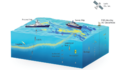
Examples of remote sensing equipment used by research ships.

See also
- Geographic information system (GIS)
- Global Positioning System (GPS)
- Image mosaic
- List of Earth observation satellites
- Radiometry
- Technical geography
