Rohtak facts for kids
Quick facts for kids
Rohtak
|
|
|---|---|
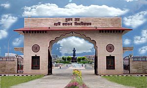
M.D. University, Rohtak, Haryana
|
|
| Country | |
| State | Haryana |
| District | Rohtak |
| Government | |
| • Type | Municipal Corporation |
| • Body | Rohtak Municipal Corporation |
| Area | |
| • Total | 139 km2 (54 sq mi) |
| Area rank | 5 |
| Elevation | 220 m (720 ft) |
| Population
(2011)
|
|
| • Total | 373,133 |
| • Rank | 119 |
| • Density | 2,684/km2 (6,953/sq mi) |
| Demonym(s) | Rohtakiya Haryanvi |
| Languages | |
| • Official | Hindi |
| • Additional official | English, Punjabi |
| • Regional | Haryanvi (Khadar) |
| Time zone | UTC+5:30 (IST) |
| PIN |
124 001 – 124 017
|
| Telephone code | 91 1262 XXX XXX |
| Vehicle registration | HR 12 (Private), HR 46 (Commercial) |
| Major Highways | NH10, NH71, NH71A & SH18 |
| Nearest City | Jhajjar, Sonipat, New Delhi |
| Railways Stations in City | Rohtak Jn, Asthal Bohar Junction railway station |
| Avg. winter temperature | 13 °C (55 °F) |
| Sex ratio | 1.13 ♂/♀ |
| Planning agency | Haryana Urban Development Authority |
| Civic agency | Municipal Corporation of Rohtak |
| Climate | Climatic regions of India (Köppen) |
| Avg. summer temperature | 44 °C (111 °F) |
Rohtak is a lively city in the Indian state of Haryana. It is the main city and administrative center of the Rohtak district. Rohtak is about 70 kilometers (43 miles) northwest of New Delhi. It is also about 250 kilometers (160 miles) south of Chandigarh, the state capital. The city is located on NH 9.
Rohtak is part of the National Capital Region (NCR). This helps the city get special support for developing its infrastructure. According to the 2011 census, Rohtak is the sixth most populated city in Haryana. It has a population of 373,133 people.
Contents
- What's in a Name? The History of Rohtak's Name
- Exploring Rohtak's Past: A Journey Through History
- Rohtak's Location and Weather
- People and Population: Rohtak's Demographics
- Rohtak's Economy and Industry
- Culture and Heritage of Rohtak
- Getting Around: Transportation in Rohtak
- Learning and Education in Rohtak
- Media and Communication
- Sports in Rohtak
- Famous People from Rohtak
- See Also
What's in a Name? The History of Rohtak's Name
The name Rohtak comes from the older name Rauhītaka. This name appears in a 12th-century text called Rājataraṅgiṇī. It was used to describe a town and district in northern India. The name also shows up in an old inscription from Lākhā Maṇḍal.
Exploring Rohtak's Past: A Journey Through History
Rohtak has a very long and interesting history. Archaeologists have found many old coins and clay seals here. These discoveries help us learn about how coins were made in ancient India.
Ancient Discoveries at Khokhrakot
At a place called Khokhrakot, many coin molds from the Yaudheyas' time were found. These date back to the 3rd or 4th century CE. Clay seals from the same period and later were also unearthed. Pieces of Gupta terracotta from the 4th to 6th centuries CE have been found too.
Rohtak in Ancient Texts
An ancient astronomy book, the Surya Siddhanta, from the 4th century CE, mentions Rohtak. It describes the Earth as round and says a main line (like the prime meridian) ran between Avanti and Rohitaka (Rohtak). This shows Rohtak was an important place for ancient scholars.
Jain History in Rohtak
In the 7th century CE, a statue of Parshvanatha was found in Asthal Bohar village. Parshvanatha is a very important figure in Jainism. Jain writings from the 9th century, like the Vipakasutra, show that Parshvanatha was highly respected in Rohtak.
Rohtak Through the Centuries
Rohtak continued to thrive until the 10th century CE. Coins from King Samanta Deva have been found here. The city was later taken over by the Ghaznavids between 1020 and 1030. In the 12th century, the Chahamanas ruled the Rohtak area.
Rohtak During the Mughal Empire
The 16th-century book Ain-i-Akbari lists Rohtak as a Mughal area. It was part of the Delhi region. The book also mentioned that there was a brick fort in Rohtak.
The Third Battle of Panipat (1761)
During the Third Battle of Panipat in 1761, Rohtak played a small role. Some Maratha forces were stationed nearby. They helped manage supplies and watched for enemy movements. After the battle, some of these families settled in the area.
Rohtak's Location and Weather
Rohtak is located about 70 kilometers (43 miles) northwest of New Delhi. It is also 250 kilometers (160 miles) south of Chandigarh. The city is part of the National Capital Region.
Rohtak's Climate: Hot Summers and Cool Winters
The weather in Rohtak changes a lot between seasons. Temperatures usually range from 2°C (36°F) to 46°C (115°F). It rarely freezes in winter (November to February). In summer (April to June), daytime temperatures are often between 30°C (86°F) and 42°C (108°F). The highest temperature ever recorded was 48.8°C (119.8°F) on May 29, 2024. The lowest was -0.8°C (30.6°F) on December 24, 2011.
| Climate data for Rohtak (1981–2010, extremes 1967–present) | |||||||||||||
|---|---|---|---|---|---|---|---|---|---|---|---|---|---|
| Month | Jan | Feb | Mar | Apr | May | Jun | Jul | Aug | Sep | Oct | Nov | Dec | Year |
| Record high °C (°F) | 30.4 (86.7) |
33.6 (92.5) |
40.0 (104.0) |
45.0 (113.0) |
48.8 (119.8) |
47.2 (117.0) |
44.9 (112.8) |
41.3 (106.3) |
40.5 (104.9) |
39.4 (102.9) |
37.0 (98.6) |
30.3 (86.5) |
48.8 (119.8) |
| Mean maximum °C (°F) | 26.1 (79.0) |
29.2 (84.6) |
35.8 (96.4) |
42.1 (107.8) |
44.5 (112.1) |
44.4 (111.9) |
41.0 (105.8) |
37.6 (99.7) |
37.5 (99.5) |
36.7 (98.1) |
33.1 (91.6) |
28.0 (82.4) |
45.0 (113.0) |
| Mean daily maximum °C (°F) | 20.5 (68.9) |
24.0 (75.2) |
29.7 (85.5) |
36.9 (98.4) |
39.9 (103.8) |
39.6 (103.3) |
36.2 (97.2) |
34.4 (93.9) |
34.6 (94.3) |
33.6 (92.5) |
29.0 (84.2) |
23.6 (74.5) |
31.8 (89.2) |
| Mean daily minimum °C (°F) | 6.9 (44.4) |
9.7 (49.5) |
14.4 (57.9) |
20.0 (68.0) |
24.9 (76.8) |
26.6 (79.9) |
26.9 (80.4) |
26.0 (78.8) |
24.1 (75.4) |
18.2 (64.8) |
11.9 (53.4) |
7.5 (45.5) |
18.1 (64.6) |
| Mean minimum °C (°F) | 2.7 (36.9) |
5.0 (41.0) |
9.3 (48.7) |
14.5 (58.1) |
19.2 (66.6) |
21.8 (71.2) |
23.5 (74.3) |
23.5 (74.3) |
20.4 (68.7) |
13.7 (56.7) |
7.0 (44.6) |
3.5 (38.3) |
2.3 (36.1) |
| Record low °C (°F) | −0.5 (31.1) |
0.2 (32.4) |
2.0 (35.6) |
10.4 (50.7) |
10.5 (50.9) |
19.0 (66.2) |
19.4 (66.9) |
21.1 (70.0) |
15.0 (59.0) |
8.3 (46.9) |
2.9 (37.2) |
−0.8 (30.6) |
−0.5 (31.1) |
| Average rainfall mm (inches) | 14.0 (0.55) |
16.6 (0.65) |
10.7 (0.42) |
14.2 (0.56) |
34.8 (1.37) |
66.5 (2.62) |
150.8 (5.94) |
192.4 (7.57) |
76.4 (3.01) |
12.8 (0.50) |
2.2 (0.09) |
5.5 (0.22) |
597.0 (23.50) |
| Average rainy days | 1.2 | 1.6 | 1.3 | 1.0 | 2.1 | 3.4 | 6.9 | 6.5 | 3.6 | 0.7 | 0.3 | 0.6 | 29.2 |
| Average relative humidity (%) (at 17:30 IST) | 60 | 50 | 43 | 27 | 29 | 42 | 64 | 70 | 59 | 47 | 51 | 57 | 50 |
| Source: India Meteorological Department | |||||||||||||
Rainfall in Rohtak
Rohtak receives about 58 centimeters (23 inches) of rain each year. Most of this rain, about 80%, falls during the monsoon season. This season lasts from July to September. Some rain also comes in winter from western disturbances. Because there isn't much rain, farming in Rohtak relies on canals and tube wells for water.
Water Resources: Hydrology of Rohtak
The availability of groundwater is very important for the area's development. Rohtak's groundwater is found in different types of underground layers. Many shallow tube wells, about 22,000 of them, are used to get water from these layers.
People and Population: Rohtak's Demographics
| Historical Population | ||
|---|---|---|
| Year | Pop. | ±% |
| 1901 | 20,323 | — |
| 1911 | 20,361 | +0.2% |
| 1921 | 25,240 | +24.0% |
| 1931 | 35,235 | +39.6% |
| 1941 | 48,148 | +36.6% |
| 1951 | 71,902 | +49.3% |
| 1961 | 88,193 | +22.7% |
| 1971 | 124,755 | +41.5% |
| 1981 | 166,767 | +33.7% |
| 1991 | 216,096 | +29.6% |
| 2001 | 294,577 | +36.3% |
| 2011 | 373,133 | +26.7% |
| Source: District Census Handbook | ||
Rohtak is the sixth most populated city in Haryana. In 2011, its population was 373,133 people. Between 2001 and 2011, the population grew by 26.7%. The city covers an area of about 72.18 square kilometers (27.87 square miles). There are 75,528 families living in Rohtak. The city has about 5,186 people per square kilometer, which is higher than the state average.
For every 1,000 males, there were 946 females in Rohtak. About 10.9% of the population was under six years old. The literacy rate (people who can read and write) was 84.08%. For males, it was 88.94%, and for females, it was 78.68%.
Religions in Rohtak City
| Religion in Rohtak City (2011) | ||||
|---|---|---|---|---|
| Religion | Percent | |||
| Hinduism | 97.11% | |||
| Jainism | 0.91% | |||
| Islam | 0.91% | |||
| Sikhism | 0.85% | |||
| Other or not stated | 0.22% | |||
According to the 2011 Census of India, most people in Rohtak follow Hinduism. There are also smaller groups of Jain, Muslim, and Sikh people living in the city.
Rohtak's Economy and Industry
Rohtak is becoming an important industrial center. The Haryana State Industrial and Infrastructure Development Corporation (HSIIDC) has created an Industrial Model Township (IMT).
Major Companies in Rohtak
Many big companies have started projects in Rohtak. These include Maruti Suzuki, Asian Paints, Suzuki Motorcycle, Nippon Carbide, Amul, Lakshmi Precision Screws, and Aisin Automotive. This shows that Rohtak is a growing place for businesses.
Maruti's Research and Development Plant
Maruti is building a huge research and development center in Rohtak. This facility will allow them to do advanced testing and development. This means they won't need to send their car models to Japan for testing anymore. This will save both time and money.
Culture and Heritage of Rohtak
Rohtak has a rich and old heritage. Many historic buildings and sites have been preserved.
Ancient and Medieval Structures
Places like Baba Mast Nath Math, Gokaran, and Kiloi temple show traditional Indian and Mughal styles. You can see spacious havelis (mansions) with beautiful designs. There are also finely carved wooden doors and sandstone pillars. Mosques that were once decorated with stucco work can also be found. Dharamshalas (rest houses) have lovely statues of Radha and Krishna.
In medieval times, a fort stood in Rohtak. It was built by Sheikhs from Yemen. This fort was very strong and could withstand long sieges.
British Period Buildings (1800-1947)
Rohtak is one of Haryana's oldest organized districts. British officers lived here starting in 1810. They built a Church in Rohtak, which was finished in 1867. It was named All Saints Church. The central hall was built by Major Feindala to remember his daughter.
There is also an old cemetery near the mini secretariat building. It has tombstones with dates from about 180 years ago. One of these is believed to belong to DC Moore. This historic cemetery is now overgrown with plants.
Getting Around: Transportation in Rohtak
Rohtak has good connections to other cities by road and rail.
Roads and Highways
Rohtak is connected to seven cities by three national highways: NH 9, NH 709, and NH 352. It also has two State Highways (SH16 and SH18).
The NH 9 from New Delhi to Rohtak has been upgraded to six lanes. It also has a 30 km (18.6 miles) bypass around Rohtak City. This helps vehicles traveling between New Delhi and Hisar avoid entering the city. The section of NH 9 from Rohtak to Hisar is being widened to four lanes.
Railway Connections
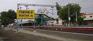
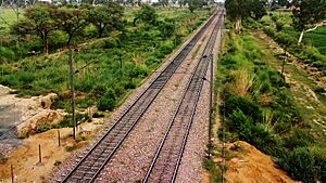
Rohtak City has a railway junction. It connects to major cities like Delhi, Panipat, Rewari, Bhiwani, and Jind. The railway line between New Delhi and Rohtak has been electrified. This means electric trains can run on it.
Rohtak Junction railway station is served by several important train services. These include three Shatabdi Express trains and the Ajmer Chandigarh Garib Rath Express.
Air Travel
Currently, Rohtak does not have a commercial airport. However, the state government is interested in building a new cargo airport at Meham town. This airport would serve Rohtak and the surrounding area. The closest international airport is Indira Gandhi International Airport in Delhi, about 72 km (45 miles) away.
Learning and Education in Rohtak
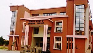
Rohtak is a hub for education with many important institutes.
- Indian Institute of Management Rohtak: This is one of India's top management schools. It is known for its focus on data analytics.
- Indian Institute of Technology Delhi extension campus: A branch of this famous engineering institute is also being set up in Rohtak.
- Pandit Bhagwat Dayal Sharma Post Graduate Institute of Medical Sciences: This is a government medical college established in 1960. There are plans to upgrade it to the level of AIIMS.
- State Institute of Film and Television: This film school was started in 2011. It is part of the State University of Performing And Visual Arts.
Universities in Rohtak
- Baba Mastnath University: A private university that opened in 2012.
- Maharshi Dayanand University: Established in 1976, named after the saint Dayananda Saraswati.
Media and Communication
All India Radio has a local station in Rohtak. It broadcasts many programs that are interesting to the public.
Sports in Rohtak
Rohtak has excellent sports facilities for young athletes and sports fans.
Rajiv Gandhi Sports Complex
The Haryana Urban Development Authority (HUDA) built the Rajiv Gandhi Sports Complex in Sector-6. It was finished in 2012. This complex has facilities for cricket, hockey, and football. It also has tennis courts, an athletics stadium, a wrestling hall, and swimming pools.
An athletic pavilion was also built at the complex. It is 100 feet tall and can hold 8,000 spectators. There is a special synthetic track for athletes to warm up. The complex can seat a total of 30,000 spectators for various sports events.
Chaudhary Bansi Lal Cricket Stadium
The Chaudhary Bansi Lal Cricket Stadium is a cricket ground in Lahli, near Rohtak. It can hold 8,000 spectators. This ground became famous when Sachin Tendulkar played his last Ranji match here in October 2013.
Famous People from Rohtak
Many notable individuals have connections to Rohtak.
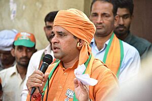
- Mahant Balaknath: He is the Chancellor of Baba Mastnath University in Rohtak.
- Mike Calvert: A British Army officer known for special operations in Burma during Second World War. He was born in Rohtak in 1913.
- Manushi Chhillar: She won Miss World 2017 and is now a model and actress.
- Bhupinder Singh Hooda: A former Chief Minister of Haryana.
- Deepender Singh Hooda: A well-known politician.
- Randeep Hooda: A famous Bollywood actor.
- Sakshi Malik: She won a Bronze Medal in Women's 58 kg Freestyle Wrestling at the 2016 Rio Summer Olympics.
- Amit Panghal: An Asian Games Gold Medalist in Light Flyweight Men's Boxing.
- Chhotu Ram: An important politician in Punjab and co-founder of the National Unionist Party.
- Dhruv Rathee: A popular Indian YouTuber.
- Karambir Singh: The 24th Chief of the Naval Staff of the Indian Navy.
- Major Mohit Sharma (soldier): An Indian Soldier from 1 Para SF, awarded AC SM.
See Also
 In Spanish: Rohtak para niños
 | John T. Biggers |
 | Thomas Blackshear |
 | Mark Bradford |
 | Beverly Buchanan |


