Rotselaar facts for kids
Quick facts for kids
Rotselaar
|
|||
|---|---|---|---|
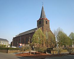
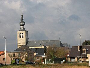
Church in Rotselaar
|
|||
|
|||
| Country | Belgium | ||
| Community | Flemish Community | ||
| Region | Flemish Region | ||
| Province | Flemish Brabant | ||
| Arrondissement | Leuven | ||
| Area | |||
| • Total | 37.57 km2 (14.51 sq mi) | ||
| Population
(2018-01-01)Lua error in Module:Wd at line 1575: attempt to index field 'wikibase' (a nil value).
|
|||
| • Total | Lua error in Module:Wd at line 1,575: attempt to index field 'wikibase' (a nil value). | ||
| Postal codes |
3110, 3111, 3118
|
||
| Area codes | 016 | ||
| Website | rotselaar.be | ||
Rotselaar is a town in Belgium, located in the province of Flemish-Brabant. It's where the Demer and Dijle rivers meet. Since 1977, Rotselaar has included the smaller towns of Werchter and Wezemaal. In 2006, about 15,068 people lived here. The total area is 37.57 square kilometers, meaning there are about 401 people per square kilometer.
Contents
Exploring Rotselaar's Geography
Rotselaar is special because it sits where two rivers, the Demer and the Dijle, come together. Other smaller rivers like the Winge and the Losting also flow into them. The Laak River forms a border to the north.
The area is also where three different types of land meet.
- Werchter, north of the Demer, is part of the Campine region.
- Wezemaal and Rotselaar Heikant are part of the Hageland region.
- Rotselaar-Centre, west of the Dijle, is part of Binnen-Vlaanderen, also known as Dijleland.
A Look at Rotselaar's History
Rotselaar and Wezemaal were first mentioned in old writings around the year 1044. Werchter appeared in historical documents about a century later, between 1138 and 1152.
In the 1100s, the Duke of Brabant ruled Rotselaar and Wezemaal. At the same time, the Counts of Aarschot and the Berthout family controlled Werchter. Around 1170, important people who served the Duke of Brabant settled in Wezemaal and Rotselaar.
The Lords of Rotselaar
By the 1200s, these important people became known as the noble Hereditary Marshals of Brabant. They started to rule the areas of Rotselaar and Wezemaal as lords. In the 1300s, the Lords of Wezemaal and Rotselaar also gained control of Werchter and Haacht. This brought the three villages of Wezemaal, Werchter, and Rotselaar together for the first time. They formed what was called the Land, or the Barony, of Rotselaar.
In 1516, the powerful House of Croÿ took over the Barony of Rotselaar. It became part of the Margraviate of Aarschot, which later became the Duchy of Aarschot in 1533.
Life in the Past
For a long time, until the late 1800s, most people in Rotselaar lived by farming. The people of Wezemaal, Werchter, and Rotselaar suffered greatly from many wars between 1488 and 1750. After 1750, life started to get better, first because of new farming methods. Later, in the second half of the 1800s, the Industrial Revolution also helped improve living conditions.
Rotselaar in World War I
During the First World War, a battle called the 'Slag aan de Molen' (Battle of the Mill) took place in Rotselaar. In this fight, 360 Belgian and German soldiers lost their lives. Overall, 67 houses were burned and 38 civilians were killed in Rotselaar during the war.
What Does "Rotselaar" Mean?
The exact meaning of the names Rotselaar, Wezemaal, and Werchter is not fully clear.
- Rotselaar might mean "laar of Hrosda." A laar is an open, clear spot in a forest, good for living or grazing animals. Hrosda is an old Germanic name.
- Wezemaal is thought to come from "Wis" and "male," which means a low, hollow area.
- Werchter is believed to be a name related to water, but its meaning is unknown.
When Rotselaar was first written down, it was spelled "Rotslar." Over time, it changed to "Rotselaer" and then to "Rotselaar." The "ae" in older spellings showed that the vowel before it was pronounced longer. Today, we often double the vowel to show this, like in "Rotselaar."
Different Meanings of Rotselaar
The name "Rotselaar" can have a few different meanings. It's good to know the difference to avoid confusion.
- Meaning 1: The Whole Municipality
* "Rotselaar" can mean the entire area that became one municipality in 1977. This includes Wezemaal and Werchter. People sometimes call this "Groot-Rotselaar" (Greater Rotselaar).
- Meaning 2: The Town Itself
* Most often, "Rotselaar" refers to the main town of Rotselaar, as it was before it joined with Wezemaal and Werchter in 1977.
- Meaning 3: Historical Land
* Less commonly, "Rotselaar" can refer to the historical Land of Rotselaar. This old area included not only today's Rotselaar, Wezemaal, and Werchter, but also other villages like Haacht.
- Meaning 4: Rotselaar-Centre
* Sometimes, "Rotselaar" refers only to Rotselaar-Centre, separate from Rotselaar Heikant (or just "Heikant"). The town of Rotselaar (before 1977) had these two parts. Usually, "Rotselaar" includes Heikant, but "Heikant" is used to tell the two parts apart.
Education in Rotselaar
Rotselaar has 7 primary schools. There is also a secondary school called Montfortcollege. This school is well-known in the area for its good education. Montfortcollege also offers boarding facilities, meaning students can live there.
Many young people from Rotselaar go to primary schools in the town. However, most go to secondary schools outside Rotselaar. This is because it can be hard to get a spot at Montfortcollege, unless you are a boarding student. Many students who go to secondary school outside Rotselaar attend schools in Leuven. Rotselaar is also home to the "Hagelandse Academie voor Beeldende Kunst" (Hageland Academy for Visual Arts).
Interesting Places to Visit
- The Keep "Ter Heide"
* This unique tower was likely built around 1350. It was ordered by Gerard vander Heyden, an important official in Brabant. The tower and its surrounding moat showed his high status. * The keep has six floors with a spiral staircase. It was built with brick on a white stone base that sits directly in the water. It also has sandstone and ironstone decorations. * The keep has been a protected monument since 1942 and was repaired in 1948. The keep "Ter Heide" is not open to visitors anymore.
- The Watermill "Van Doren"
* This watermill was first mentioned in the 1100s. It has been expanded and fixed many times since the 1500s. All these changes have been kept, so the building shows its long history. * The water turbine from 1902 was fixed in 1995. Now, it makes electricity again!
- Saint John the Baptist's Church (Sint-Jan-De-Doperkerk) in Werchter
* This church dates back to 1439.
- Saint Peter's Church (Sint-Pieterskerk) in Rotselaar
* This Neo-Gothic church is in the center of Rotselaar. It was rebuilt in 1846.
- The former Mena brewery building
* This is the building of an old brewery.
Fun Things to Do in Rotselaar
The Domain Ter Heide is the main place for fun activities in Rotselaar. People also call it "the lake of Rotselaar." It's a popular spot for walkers, cyclists, and bird-watchers.
Fishing and Swimming
You can go fishing in a special zone from June 1 to April 15, from sunrise to sunset. You need a public Flemish fishing permit, which you can get at the post office.
You can also go swimming or sunbathe. Outside of the swimming season, the swimming area is open daily from 8:30 AM until sunset. During the swimming season, it's open from 10:00 AM to 8:30 PM. People who live in Rotselaar can swim for free. Others need to pay to enter. Swimming is only allowed when lifeguards are on duty and a green flag is flying. The swimming season usually lasts from mid-May to late August, depending on the weather.
The swimming area is marked off by a ditch and buoys. It's not allowed to swim outside this area, partly because there's also a surfing zone. For hygiene reasons, dogs are not allowed in the whole area during the swimming season. However, from September 1, dogs on a leash are allowed in the domain, but not in the swimming zone.
Other Activities
Windsurfing is allowed from the Easter holidays until October 15 in a separate surfing zone for safety. Ice skating on natural ice is sometimes possible, but it's rare. You are only allowed to go on the ice if the town government says it's safe. If they allow it, they will announce it in local newspapers and on the Rotselaar website.
There is also a nature zone in the domain that is closed to the public. Other activities you can do include squash and beach volleyball.
Rock Werchter Music Festival
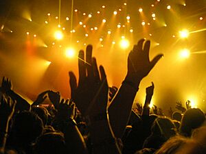
Rock Werchter is a huge music festival held every year in Werchter. It takes place during the first weekend of the summer holidays. The festival started in 1974. Since 2003, it has lasted four days. In 2003 and 2005, it won the Arthur award for the best festival in the world!
It is the biggest music festival in Belgium and one of the largest in Europe. It's famous even outside Belgium. Every year, many well-known bands and artists perform at Rock Werchter. Over 320,000 people come to the festival.
Originally, it was a "double-festival" called "Rock Torhout-Werchter." It had two festival areas in different places in Belgium: one in Werchter and one in Torhout. There is also a "Rock Werchterroute," which is a cycling path around Werchter and Leuven. Leuven also has its own popular music festival called Marktrock.
International Friendships
Rotselaar has special "sister city" relationships with other places around the world.
Bad Gandersheim, Germany
Since 1987, Rotselaar has been friends with Bad Gandersheim, a city in southern Lower Saxony, Germany. In 1990, a special committee was created to make the ties between Rotselaar and Bad Gandersheim even stronger. They do this through visits, exhibitions, language courses, and other activities. They also organize an annual "town twinning weekend," taking turns hosting it in Rotselaar and Bad Gandersheim.
Sal, Cape Verde
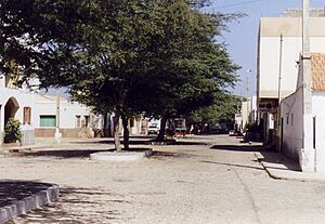
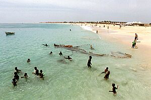
Rotselaar also had a cooperation project with Sal, one of the islands in Cape Verde. Sal is about 30 km long and 15 km wide, and it has about the same number of people as Rotselaar.
Sal has four main towns:
- Espargos: The main town and home to Cape Verde's international airport.
- Santa Maria: Where most of the tourism and hotels are.
- Pedra de Lume: Once a place where salt was collected (that's why the island is called "Sal," which means "salt" in Portuguese).
- Palmeira: A fishing village with a port.
The idea for this cooperation came from Sal itself. Basilio Ramos, who was the mayor of Sal at the time, wanted to connect with a town near Leuven. He had studied at the K.U.Leuven and wanted to strengthen ties with Belgium. This cooperation was about sharing experiences in areas like environment and youth work.
Vrânceni, Romania
In 1989, the local government of Rotselaar "adopted" the Romanian village of Vrânceni. This village is part of Căiuţi in the eastern county of Bacău. This was part of a project called "AdoptieDorpen Roemenië" (Adoption Villages Romania). A local group organizes activities throughout the year, and the money they raise goes to Vrânceni. For example, a school building was built in Vrânceni with help from Rotselaar.
Famous People from Rotselaar
Some famous people who were born, lived, or died in Rotselaar, Wezemaal, or Werchter include:
- Paul Bouts
- Jef Scherens
- Hugo Vandenberghe
- Cornelius Van Leemputten
See also
 In Spanish: Rotselaar para niños
 | Ernest Everett Just |
 | Mary Jackson |
 | Emmett Chappelle |
 | Marie Maynard Daly |


