Saintes, Charente-Maritime facts for kids
Quick facts for kids
Saintes
|
||
|---|---|---|
|
Subprefecture and commune
|
||
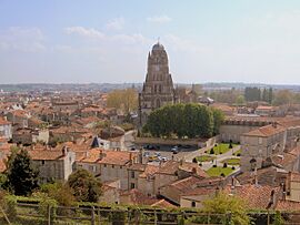
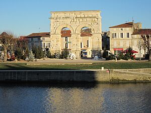
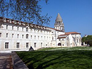
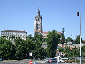
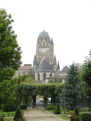
Panorama of Saintes with Saint-Pierre Cathedral in the center
|
||
|
||
| Country | France | |
| Region | Nouvelle-Aquitaine | |
| Department | Charente-Maritime | |
| Arrondissement | Saintes | |
| Canton | Saintes | |
| Intercommunality | CA Saintes | |
| Area
1
|
45.55 km2 (17.59 sq mi) | |
| Population
(2021)
|
25,518 | |
| • Density | 560.22/km2 (1,450.96/sq mi) | |
| Time zone | UTC+01:00 (CET) | |
| • Summer (DST) | UTC+02:00 (CEST) | |
| INSEE/Postal code |
17415 /17100
|
|
| Elevation | 2–81 m (6.6–265.7 ft) (avg. 47 m or 154 ft) |
|
| 1 French Land Register data, which excludes lakes, ponds, glaciers > 1 km2 (0.386 sq mi or 247 acres) and river estuaries. | ||
Saintes is a historic town in western France. It is located in the Charente-Maritime area, where it serves as a sub-prefecture. Saintes is the second-largest city in Charente-Maritime, with about 25,500 people living there in 2021. The area around the city is home to about 56,600 people. Much of the land around Saintes is used for farming, but some parts are still covered by forests.
In ancient Roman times, Saintes was called Mediolanum Santonum. For a long time in its history, the city's name was spelled Xaintes or Xainctes.
Saintes is mostly built on the left side of the Charente River. It became the first Roman capital of a region called Aquitaine. Later, it was the main city of the Saintonge province. After the French Revolution, Saintes was briefly the main city of the department. However, La Rochelle became the main city in 1810. Even so, Saintes remained an important center for legal matters. In the late 1800s, Saintes became a major hub for railways, which helped the city grow a lot.
Today, Saintes is still a key economic center in its department. It is also an important place for transportation. Some big companies operate here, working in electronics, train repair, and building equipment. The city has many shops and services, including the main office of Coop Atlantique, government offices, courts, banks, schools, and a hospital. Many jobs in Saintes are also in property care, retail, and tourism.
Saintes is a popular place for tourists because of its amazing Roman, medieval, and classical buildings. Since 1990, it has been part of the French Towns and Lands of Art and History. The city has several museums, a theater, cinemas, and hosts many festivals. There is also a European center for music research and practice at the Abbaye aux Dames.
Contents
Exploring Saintes: Geography
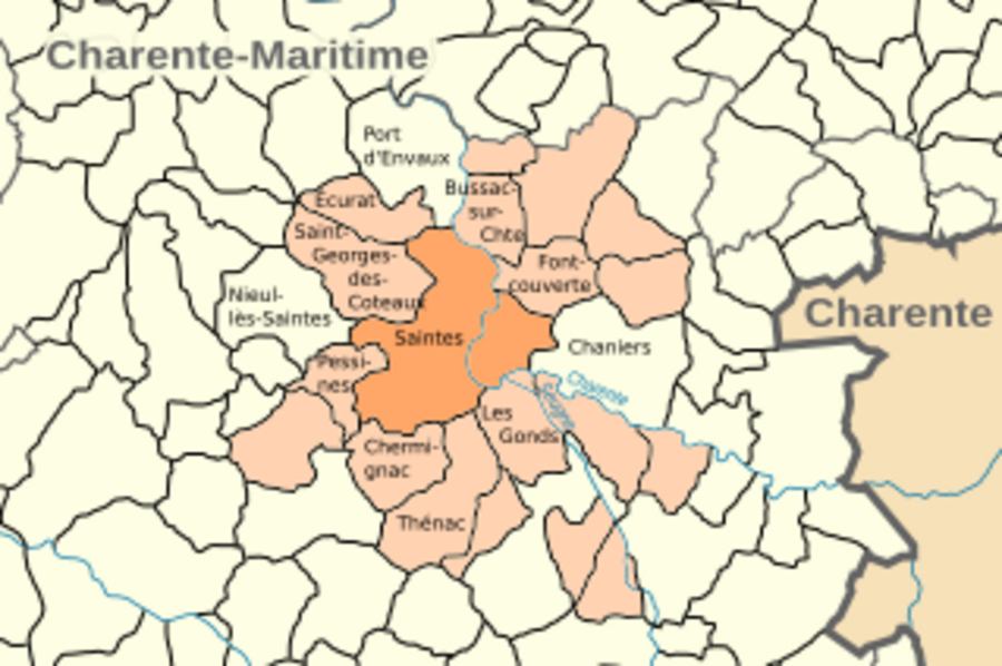
Where is Saintes?
Saintes is located on the banks of the Charente River. It is in the middle-eastern part of the Charente-Maritime area. The city is about 60 kilometers (37 miles) southeast of La Rochelle. It is also 33 kilometers (20 miles) northeast of Royan. Bordeaux is about 100 kilometers (62 miles) south of Saintes. You can easily reach Bordeaux using the A10 motorway.
What is the Ground Like?
The ground in Saintes is mostly made of a type of limestone rock. This rock is special because it contains flint and iron. People used this stone to build many of the city's old buildings. Near the river, the ground changes to softer, clay-like soil.
Parts of the City
Saintes is divided into 14 main areas. These include Les Boiffiers, Recouvrance, Saint-Vivien, Saint-Pierre, and Saint-Pallais.
Left Bank of the River
The Saint-Pierre area is between a hill called Capitole and the Charente River. It has many old buildings and is a protected historical zone. This area is built around the Saint-Pierre Cathedral and has narrow streets. You can find many medieval and classical buildings here.
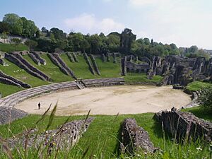
Next to Saint-Pierre is the Saint-Eutrope area. This part of the city grew around a rocky hill. It has the Saint-Eutrope basilica and remains of an old monastery. Small valleys here lead to the "arenas vale," where you can see a Roman amphitheater in a park.
The areas of Les Boiffiers and Bellevue are separated from the rest of the city by a main road. These areas mostly have modern housing. Bellevue is home to about 1,560 people.
La Recouvrance is a triangular area with a high school, a stadium, and a shopping mall. Its water tower has colorful paintings by artist Michel Genty.
In the north of the city, the Saint-Vivien area has an old part that has been lived in since ancient times. Here, you can find the remains of the thermes de Saint-Saloine, which were ancient Roman baths.
Right Bank of the River
The Saint-Pallais area on the right bank of the river was likely a city area even in ancient times. It was connected to the city center by a bridge with a large entrance, the Arch of Germanicus. In the Middle Ages, a church dedicated to Bishop Palladius was built here. Later, a large Benedictine abbey for women, the Abbaye aux Dames de Saintes, was also built. Because of these important historical sites, part of this area is also protected. In the 1800s, the old bridge was replaced by the pont Bernard-Palissy. This area also has the train station, a prison, and several parks.
Neighboring Towns
Roads and Travel
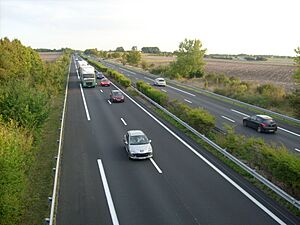
Saintes is an important travel hub. It is connected by two major motorways and several other roads. A bypass road goes around the city on its western and southern sides.
The A10 autoroute (France) passes through the western part of Saintes. You can get on the A10 at exit 35. Using the A10, Saintes is about 125 kilometers (78 miles) from Bordeaux and 470 kilometers (292 miles) from Paris.
The A837 autoroute connects Saintes to Rochefort, another important city in the area.
Saintes is also on a major expressway that connects it to cities like Limoges and Lyon to the east. A section of this road, connecting Saintes to Saujon, opened in 2008. An extension towards Royan on the coast was finished later.
The bypass road around Saintes includes National Road 137. This road connects to other important roads that lead to the Island of Oleron and Niort.
Train Travel
The Gare de Saintes (train station) is a central point for five railway lines. These lines connect Saintes to cities like Nantes, Bordeaux, Angoulême, Niort, and Royan. Most of the trains are part of the regional rail network called TER Nouvelle-Aquitaine.
In 1894, Saintes had a tramway system that was about 3 kilometers (1.9 miles) long. It stopped running in 1934. Another railway line, 42 kilometers (26 miles) long, connected Saintes to Mortagne-sur-Gironde. This line was removed in 1947.
The railway network in Saintes was very important because the city was a major railway center for a long time. The SNCF (France's national railway company) is still a big employer in Saintes. New train depots and workshops opened in 2009 and 2010.
Population of Saintes
The people who live in Saintes are called Saintaises (for girls and women) and Saintais (for boys and men) in French.
| Historical population | |||||||||||||||||||||||||||||||||||||||||||||||||||||||||||||||||||||||||||||||||||||||||||||||||||||||||||||||||||
|---|---|---|---|---|---|---|---|---|---|---|---|---|---|---|---|---|---|---|---|---|---|---|---|---|---|---|---|---|---|---|---|---|---|---|---|---|---|---|---|---|---|---|---|---|---|---|---|---|---|---|---|---|---|---|---|---|---|---|---|---|---|---|---|---|---|---|---|---|---|---|---|---|---|---|---|---|---|---|---|---|---|---|---|---|---|---|---|---|---|---|---|---|---|---|---|---|---|---|---|---|---|---|---|---|---|---|---|---|---|---|---|---|---|---|---|
|
|
||||||||||||||||||||||||||||||||||||||||||||||||||||||||||||||||||||||||||||||||||||||||||||||||||||||||||||||||||
| Source: EHESS and INSEE | |||||||||||||||||||||||||||||||||||||||||||||||||||||||||||||||||||||||||||||||||||||||||||||||||||||||||||||||||||
Famous Places in Saintes
- The Arch of Germanicus is a large arch that was once at the entrance of a bridge. This bridge was where a main Roman road crossed the Charente River. The bridge was taken down in 1843, but the Arch was saved and moved to its current spot by the river.
- The Roman amphitheatre ruins are on the main side of the Charente River. Its seating areas are built into the side of a hill.
- You can also see some parts of the thermae of Saint-Saloine, which were Roman baths from the 1st century. There is also an ancient Roman aqueduct.
- Pieces of the city walls from the 3rd century can be seen in the Place des Récollets. These walls were built using stones from other Roman buildings.
- Churches and Abbeys:
- The Abbaye-aux-Dames is a famous abbey. A well-known person named Madame de Montespan studied here.
- Other important churches include the Basilique Saint-Eutrope (Basilica of Saint Eutropius) and the Cathédrale Saint-Pierre, which is the main cathedral of Saintes.
- Museums:
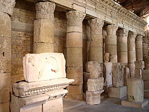
- The Musée archéologique (Archaeological Museum) has a restored Roman cart from the 1st century. It also has a collection of old sculptures and writings.
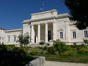
- The Musée du Présidial has a unique architectural style. It displays regional pottery and paintings from the 15th to 18th centuries.
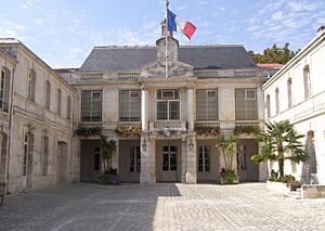
- The Musée de l'Échevinage shows beautiful porcelain from Sèvres and paintings from the 19th and 20th centuries.
Hospital in Saintes
The hospital in Saintes is the largest hospital in the Charente-Maritime area.
Schools and Learning
Saintes is part of the Poitiers school district.
|
|
|
Two universities from the United States, the University of Houston and the University of Southern California, have study abroad programs at the CEAU in Saintes.
Local TV Channels
Saintes is served by the local TV channel France 3 Nouvelle-Aquitaine.
Sister Cities
Saintes has special partnerships with other cities around the world. These are called "twin towns" or "sister cities."
See Also
 In Spanish: Saintes para niños
 | Delilah Pierce |
 | Gordon Parks |
 | Augusta Savage |
 | Charles Ethan Porter |


