Sangay facts for kids
Quick facts for kids Sangay |
|
|---|---|
 |
|
| Highest point | |
| Elevation | 5,286 m (17,343 ft) |
| Prominence | 1,588 m (5,210 ft) |
| Listing | Ultra |
| Naming | |
| English translation | The Frightener |
| Language of name | Quechua |
| Pronunciation | [saŋˈɡaj] |
| Geography | |
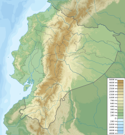
| Location | Ecuador |
| Parent range | Andes |
| Geology | |
| Mountain type | Stratovolcano |
| Volcanic arc/belt | North Volcanic Zone |
| Last eruption | 1934 to 2023 (ongoing) |
| Climbing | |
| First ascent | 4 August 1929 |
| Easiest route | Rock/Snow climb |
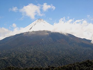
Sangay is an active volcano in central Ecuador. It is also known as Macas, Sanagay, or Sangai. This volcano often has small, explosive eruptions, like fireworks.
Sangay is special because it sits where two large pieces of the Earth's crust meet. This is why it is so active. Over its 500,000-year history, Sangay has been unstable. Two older versions of the mountain collapsed in huge landslides. You can still see signs of these collapses today.
Because Sangay is in a remote area, many animals live there. These include the mountain tapir, giant otter, Andean cock-of-the-rock, and king vulture. Since 1983, this area has been protected as part of the Sangay National Park. Even though climbing Sangay is hard due to its remote location, bad weather, and falling rocks, people still climb it. The first person to reach the top was Robert T. Moore in 1929.
Contents
How Sangay Was Formed
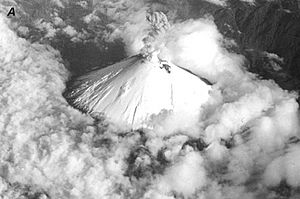
Sangay is located on the eastern side of the Andes mountains. It was created by volcanic activity when the Nazca Plate slid under the South American Plate. This process is called subduction.
Sangay is the southernmost volcano in a group called the Northern Volcanic Zone. The next active volcano in this chain, Sabancaya, is far away in Peru. Sangay's location at the edge of different types of underground rock helps explain why it is so active.
Local Legend
Many local people believe that gold is hidden deep under Sangay volcano.
Sangay's Changing Shape
Sangay volcano has grown and changed over three main periods. The oldest part of the volcano formed about 500,000 to 250,000 years ago. This first mountain was very large, but it collapsed in a huge landslide. This landslide scattered rocks and debris across the nearby forests.
After the first collapse, a second volcano began to grow between 100,000 and 50,000 years ago. This second mountain also collapsed, creating another large debris field. It was likely smaller than the first volcano.
Today, Sangay looks like a nearly perfect glacier-covered volcanic cone. It is about 5,286 meters (17,343 feet) tall. Its eastern side meets the Amazon Rainforest. The western side is a flat area of volcanic ash. Heavy rain has carved deep valleys into this ash.
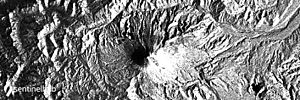
The top of Sangay has three active craters and a lava dome. Sangay has been active in its current shape for at least 14,000 years. It is still growing and filling the space left by its older versions.
Volcano Activity and Eruptions
Sangay is a very active volcano. The first recorded eruption was in 1628. Ash from this eruption fell as far as Riobamba, about 50 kilometers (31 miles) away. It was so bad that it covered pastures and caused local animals to starve.
The volcano erupted again in 1728 and stayed active almost constantly until 1916. It had very strong eruptions in certain years, like 1738–1744 and 1842–1843. After a short break, it erupted again on August 8, 1934. It has been erupting almost non-stop ever since, with very active periods in 1934–1937 and 1941–1942.
Sangay's eruptions are usually small and explosive, like Strombolian eruptions. They produce ashfall, lava flows, hot pyroclastic flows (fast-moving gas and rock), and lahars (mudflows). All known eruptions have been rated as a VEI 3 on the Volcanic Explosivity Index.
Even though Sangay is active, it is in a remote area where no one lives. Only a very large eruption, called a Plinian eruption, could threaten towns far to its west. However, a large landslide on its eastern side could affect nearby forests and possibly small settlements. It is hard to get to the volcano because it constantly throws out molten rock and other debris. Because of this, Sangay is not studied as much as other active volcanoes. The first detailed study was not published until 1999.
Nature and Wildlife
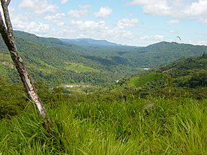
Sangay is one of two active volcanoes in the Sangay National Park. The other is Tungurahua to the north. This park has been a UNESCO World Heritage Site since 1983. Because the area is so isolated, its nature is almost untouched by humans. The park has many different types of environments, from icy glaciers on the volcano peaks to tropical forests on their lower slopes. The amount of rainfall and how high up an area is affect the plants and animals found there. The lushest areas are on the wetter eastern side of the volcano.
Near the snowline, you will find mostly lichen and bryophytes (mosses). Below this, there are small trees and shrubs. This then turns into montane forest (mountain forest) below 3,750 meters (12,300 feet). Trees here can grow from 5 meters (16 feet) tall near the top to 12 meters (39 feet) tall below 3,000 meters (9,800 feet). Below 2,000 meters (6,600 feet), you will find subtropical rainforest. Here, temperatures are between 18 and 24 degrees Celsius (64 and 75 degrees Fahrenheit), and there can be up to 500 centimeters (200 inches) of rain.
Animals also live at different heights. The highest areas are home to the endangered mountain tapir, cougar, guinea pig, and Andean fox. Lower down, you can find the spectacled bear, jaguar, ocelot, margay, white-tailed deer, brocket deers, northern pudú, and the endangered giant otter. Many bird species live here too, such as the Andean condor, Andean cock-of-the-rock, giant hummingbird, torrent duck, king vulture, and swallow-tailed kite.
Climbing Sangay
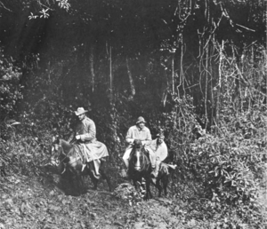
People do climb Sangay. The first successful climb was in 1929 by Robert T. Moore. This was before the volcano's current eruption started in 1934. Today, climbing Sangay is dangerous because of falling rocks and molten debris. In 1976, two climbers were unfortunately hit by falling rocks and debris, which was very dangerous.
Also, the volcano is in a remote area with bad roads, making it hard to reach. Heavy rains can cause rivers to flood and lead to landslides, blocking the climbing paths. Despite these challenges, the Instituto Ecuatoriano Forestal y de Areas Naturales, a local office, helps climbers. They provide local guides and rooms for visitors. A climb from Quito usually takes between 7 and 10 days. The weather on the volcano is often very wet and foggy, which can make it hard to see during the climb.
Recent Activity
Sangay has erupted at least eleven times in the last 11,700 years. Its most recent eruption started on March 26, 2019. It has been erupting continuously since then, as of October 15, 2021.
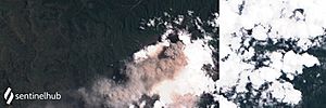
On June 15, 2022, the National Weather Service warned about ashfall. The volcano became very active, sending a plume of volcanic ash into the sky. Sailors nearby were told to be careful of falling debris.
See also
 In Spanish: Volcán Sangay para niños
- Lists of volcanoes
- List of volcanoes in Ecuador
 | John T. Biggers |
 | Thomas Blackshear |
 | Mark Bradford |
 | Beverly Buchanan |


