Sanibel, Florida facts for kids
Quick facts for kids
Sanibel, Florida
|
||
|---|---|---|
| City of Sanibel | ||
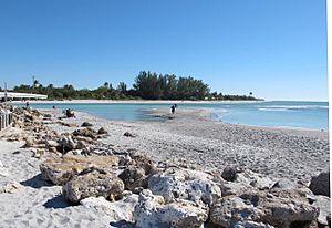
A 2014 view looking across to the northern tip of Sanibel from the Captiva side of Blind Pass. The bridge connecting the two islands is visible on the extreme left.
|
||
|
||
| Motto(s):
"A Barrier Island Sanctuary"
|
||
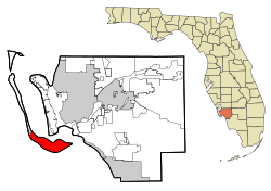
Location in Lee County, Florida
|
||
| Country | United States of America | |
| State | ||
| County | Lee | |
| Settled | 1832-1884 | |
| Incorporated | 1974 | |
| Government | ||
| • Type | Council-Manager | |
| Area | ||
| • Total | 33.21 sq mi (86.01 km2) | |
| • Land | 16.18 sq mi (41.90 km2) | |
| • Water | 17.03 sq mi (44.10 km2) 48.13% | |
| Elevation | 3 ft (0.9 m) | |
| Population
(2020)
|
||
| • Total | 6,382 | |
| • Density | 394.44/sq mi (152.30/km2) | |
| Time zone | UTC-5 (Eastern (EST)) | |
| • Summer (DST) | UTC-4 (EDT) | |
| ZIP code |
33957
|
|
| Area code(s) | 239 | |
| FIPS code | 12-63700 | |
| GNIS feature ID | 0290637 | |
| Website | City of Sanibel Florida Website | |
Sanibel is an island and city in Lee County, Florida, United States. In 2020, about 6,382 people lived there. It is part of the Cape Coral-Fort Myers, Florida Metropolitan Statistical Area. The island is also known as Sanibel Island.
Sanibel is a barrier island. This means it is a collection of sand that protects the mainland from ocean waves. It sits on the side of Pine Island that is sheltered from the wind.
Most of the city is on the eastern part of the island. In 1963, the Sanibel Causeway was built. This bridge replaced the old ferry service. The city was officially formed in 1974. Residents then created the Sanibel Comprehensive Land Use Plan. This plan helps to balance building new things with protecting the island's nature. In September 2022, Hurricane Ian badly damaged the causeway.
Sanibel is a popular place for tourists. It is famous for its shell-filled beaches and many wildlife areas. More than half of the island is made up of places where animals and plants are protected. The biggest one is the J. N. "Ding" Darling National Wildlife Refuge. The island also has the Sanibel Historical Village and the Bailey-Matthews National Shell Museum.
Contents
Exploring Sanibel's Past
Sanibel and Captiva were once one large island. This happened about 6,000 years ago. The first people known to live here were the Calusa. They arrived around 2,500 years ago. The Calusa were a strong Native American group. They controlled much of Southwest Florida through trade. They used a complex system of canals and waterways. Sanibel was an important Calusa settlement. Their power ended after Europeans arrived.
During the 1700s, fishermen from Cuba visited the area. They set up temporary fishing camps called ranchos along the coast. One of these camps was on Sanibel Island.
How Sanibel Got Its Name
In 1765, a map showed a harbor on Sanibel called Puerto de S. Nibel. The name might have come from this. Another idea is that the name came from "(Santa) Ybel". This name is still used for "Point Ybel," where the Sanibel Island Light is located. Some people believe Juan Ponce de León named it after Queen Isabella I of Castile. Others say it was named by a pirate's first mate for his lover. However, the name was used before these pirate stories.
Early Settlements and the Lighthouse
In 1832, a group called the Florida Peninsular Land Company tried to start a settlement on Sanibel. They spelled it "Sanybel." But the settlement did not grow and was left empty by 1849. This group was the first to ask for a lighthouse on the island.
The island was settled again after the Homestead Act in 1862. People again asked for a lighthouse. The Sanibel Island Lighthouse was finished in 1884. Even with the lighthouse, the community stayed small for a long time.
Growth and Protecting the Island
In May 1963, a causeway opened. This bridge connected Sanibel and Captiva to the mainland. This led to a lot of new buildings and growth. The City of Sanibel was officially formed in 1974. The city then passed new rules to control building. These rules helped protect the island's nature.
Developers tried to fight these rules, but the city and its people won. Because of these rules, the only buildings taller than two stories on the island were built before 1974. Also, most fast-food or chain restaurants are not allowed. Only two that were there before the rules can stay.
A new causeway was finished in 2007. It replaced the older bridge from 1963. The new bridge has a high part that sailboats can pass under. The old bridge was taken down. Its parts were sunk into the ocean to create new homes for sea life.
Island Features and Conservation
The main town area is on the eastern side of the island. A short bridge over Blind Pass connects Sanibel to Captiva Island. More than half of both islands are kept in their natural state as wildlife refuges. Visitors can explore the J. N. "Ding" Darling National Wildlife Refuge by driving, walking, biking, or kayaking.
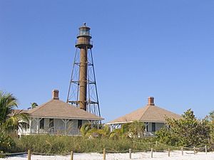
The Sanibel Lighthouse is the island's most famous landmark. It is at the eastern end, next to a fishing pier. Periwinkle Way is the main road. Most of Sanibel's shops and restaurants are here. The Gulf Drives (East, Middle, and West) have most of the places to stay.
The Sanibel-Captiva Conservation Foundation (SCCF) is a non-profit group. It has been very important in stopping too much building on the island. Since 1967, SCCF has worked to protect nature on Sanibel and Captiva. They buy and protect important land for wildlife. This includes places where rare plants grow and wetlands.
Sanibel's Location and Climate
Sanibel is located at 26°26′23″N 82°4′50″W / 26.43972°N 82.08056°W. It covers about 33.16 square miles (86.01 km2). About 17.21 square miles (41.90 km2) is land. The rest, about 15.96 square miles (44.10 km2), is water.
Weather on Sanibel Island
Sanibel Island has a warm and humid climate. Daily high temperatures are around 75°F (24°C) in winter. They reach about 90°F (32°C) in summer. From January to April, which is the busiest tourist time, temperatures are cooler. They range from 75°F (24°C) during the day to 55°F (13°C) at night. There is very little rain during these months.
In summer, the heat and humidity can reach 100°F (38°C). But cool breezes from the Gulf of Mexico help. Almost daily afternoon and evening rain showers also help cool things down. June is usually the wettest month.
Understanding Hurricanes
The area can be hit by tropical cyclones and hurricanes. Hurricane season starts in June. Most storms happen in September and October. People in the local communities know how to deal with these storms.
Southwest Florida does not get hit directly by hurricanes very often. But about every 20 years, a big storm hits. About every 40 years, a very strong one hits. Many of these have affected Sanibel.
On August 13, 2004, Hurricane Charley hit Sanibel. It was a very strong storm with 143 mph (230 km/h) winds. It was the strongest storm to hit Southwest Florida since Hurricane Donna in 1960. Many native plants survived. But the non-native Australian Pines were badly damaged. They blocked almost every road. Bird and sea turtle nests were destroyed. The Sanibel Lighthouse had little damage. The Sanibel Causeway had minor damage, but a tollbooth was tilted.
On September 28, 2022, Hurricane Ian caused a lot of damage to the island. It hit just north of Sanibel as a strong storm. The Sanibel Causeway partly broke apart during the storm. This meant no roads led to Sanibel or nearby Captiva, Florida.
Who Lives on Sanibel?
| Historical population | |||
|---|---|---|---|
| Census | Pop. | %± | |
| 1980 | 3,363 | — | |
| 1990 | 5,468 | 62.6% | |
| 2000 | 6,064 | 10.9% | |
| 2010 | 6,469 | 6.7% | |
| 2020 | 6,382 | −1.3% | |
| U.S. Decennial Census | |||
| Race | Pop 2010 | Pop 2020 | % 2010 | % 2020 |
|---|---|---|---|---|
| White (NH) | 6,219 | 6,030 | 96.14% | 94.48% |
| Black or African American (NH) | 40 | 27 | 0.62% | 0.42% |
| Native American or Alaska Native (NH) | 5 | 8 | 0.08% | 0.13% |
| Asian (NH) | 24 | 44 | 0.37% | 0.69% |
| Pacific Islander or Native Hawaiian (NH) | 1 | 2 | 0.02% | 0.03% |
| Some other race (NH) | 7 | 16 | 0.11% | 0.25% |
| Two or more races/Multiracial (NH) | 22 | 100 | 0.34% | 1.57% |
| Hispanic or Latino (any race) | 151 | 155 | 2.33% | 2.43% |
| Total | 6,469 | 6,382 |
In 2020, there were 6,382 people living in Sanibel. There were 3,919 households and 2,766 families. In 2010, there were 6,469 people. The population density was about 376 people per square mile (145 per km2). There were 7,821 homes.
In 2010, 8.5% of households had children under 18. Most households (63.8%) were married couples. About 27.9% of all households were single people. Of those, 16.7% were people aged 65 or older living alone. The average household had 1.92 people. The average family had 2.28 people.
In 2010, 8.5% of the population was under 19. About 50.1% of the population was 65 or older. The average age was 65 years. For every 100 females, there were about 90 males.
In 2010, the average household income was $97,788. The average family income was $138,194. The income per person was $79,742. About 7.0% of the population lived below the poverty line.
Sanibel's Nature and Wildlife
Plants and Animals of Sanibel
The island's curved shape creates Tarpon Bay on its north side. The Sanibel Causeway connects the island to the mainland. A short bridge links Sanibel Island to Captiva Island over Blind Pass.
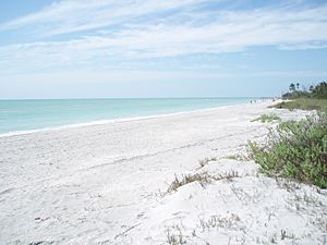
The Bailey-Matthews Shell Museum on Sanibel is the only museum in the world just for shells. The beaches on the Gulf side of Sanibel and Captiva are amazing. They are known worldwide for the many different kinds of seashells found there. You can find coquinas, scallops, whelks, sand dollars, and many other types of shells.
Sanibel Island is home to many different birds. These include the roseate spoonbill and several pairs of nesting bald eagles. You can see birds on the beaches, the causeway islands, and in the nature reserves. Common birds include pelicans, herons, egrets, and anhingas. You will also see terns, sandpipers, and seagulls.
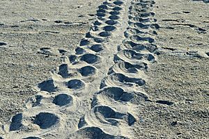
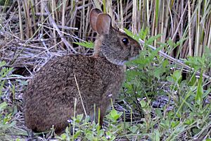
There are American alligators on Sanibel Island. Plants on the island include the native sea grape, sea oats, mangroves, and several types of palm trees. The Australian pine is a tree that was brought to the island. It has spread a lot and can take over from native plants.
Wildlife Protection Areas
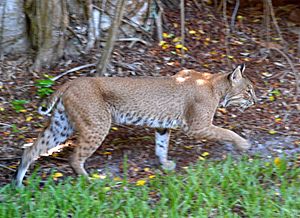
Protecting the island's nature is very important to its residents and visitors. The Sanibel-Captiva Conservation Foundation (SCCF) helps a lot with this. It was started in 1967. Its goal is to "preserve natural resources and wildlife habitat on and around the islands of Sanibel and Captiva."
The SCCF looks after about 1,300 acres (5.3 km2) of land on Sanibel. This land includes a "Marine Laboratory." This lab studies things like seagrasses, mangroves, harmful algal blooms, fish, and shellfish. The SCCF also has a project called RECON. This project uses sensors in the water to check water quality. The foundation also protects wildlife and teaches people about the island's unique nature.
The biggest wildlife refuge on the island is the J.N. "Ding" Darling National Wildlife Refuge. It covers more than 5,200 acres (21 km2) of land. The refuge works to keep these lands safe for local and traveling wildlife. It is part of a national network of refuges. The refuge also provides a home for many endangered animals. It is currently home to over 220 kinds of birds.
Visitors can walk, bike, drive, or kayak through the wildlife drive. This drive is about 5 miles (8 km) long. It goes through mangrove forests and tidal flats. It is a great place to see the island's wildlife and native plants. To make sure wildlife is protected, the drive is closed every Friday. This gives the animals a day to find food without being disturbed by people. There is also an education center. It has exhibits about the refuge's nature and the work of "Ding" Darling.
Beaches and Seashells
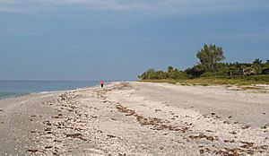
Sanibel's beaches attract people from all over the world. This is partly because of the huge number of seashells that wash ashore. Many sand dollars can also be found. One reason for so many shells is that Sanibel is a barrier island. It is "part of a large flat area that goes out into the Gulf of Mexico for miles. This flat area acts like a shelf where seashells collect." Sanibel also faces east-west, which is unusual for islands. This helps it get great sandy beaches and lots of shells.
People who are lucky enough to find a rare brown-spotted Junonia shell on a Sanibel beach often get their picture in local newspapers. Junonia shells live in deep water and rarely wash up whole. Finding a whole one is very special. You can buy Junonia shells in local shell shops. They are also shown at the Bailey-Matthews National Shell Museum and at the Sanibel Shell Fair in early March.
Throughout the year, people come to Sanibel's beaches to collect shells. People are often seen bending down to look for shells. This way of bending is called the "Sanibel Stoop." There are beaches almost all around the island. There are even beaches along the Sanibel causeway. These are great for fishing and windsurfing. Parking at the beaches is limited. It can be hard to find a spot during busy times.
Lighthouse Beach is named after the Sanibel Lighthouse. It has a popular fishing pier and nature trails. Bowman's Beach is the most private beach on the island. There are no hotels in sight, and it feels "pristine and quiet."
Getting Around Sanibel
Transportation on the Island
A new three-part causeway bridge to Sanibel was finished in 2007. It has a high section that replaced the old drawbridge. In September 2022, many parts of the causeway were destroyed by Hurricane Ian. This made it impossible to drive to the island.
Sanibel Public Library
The Sanibel Public Library was built in 1994. It was made bigger in 2004. It has more than 60,000 books and other items.
Famous People from Sanibel
One well-known person from Sanibel is Porter Goss. He used to be the Director of the CIA. He helped the island become a city and was its first mayor. He also represented the area in Congress.
Other notable people who live or used to live on Sanibel include:
- R. Tucker Abbott, a leading expert on shells
- Horace William Baden Donegan, a Bishop
- Clifton Fadiman, an author and TV personality
- Helaine Fendelman, an appraiser
- Jean Shepherd, an author and radio storyteller
- Willard Scott, a TV personality
- Randy Wayne White, a writer of crime and adventure stories
Sanibel in Books and Movies
Sanibel in Literature
Sanibel Island is the main place for crime novels written by local author Randy Wayne White. Many real places on the island are mentioned in his books. White's main character is Doc Ford. Because Doc Ford is so popular, White opened a restaurant called Doc Ford's Sanibel Rum Bar & Grill. Sanibel Island is also where the book People We Meet on Vacation begins.
Sanibel in Film
Parts of George A. Romero's movie Day of the Dead (1985) were filmed on Sanibel Island. Romero had a second home on Sanibel, where he rewrote the movie in 1984.
The movie Night Moves was filmed on the island in 1975. It was directed by Arthur Penn. It stars Gene Hackman, Jennifer Warren, and Susan Clark. It also features early appearances by James Woods and Melanie Griffith.
Places of Worship
- Saint Michael and All Angels Episcopal Church
|
See also
 In Spanish: Sanibel (Florida) para niños


