Strood facts for kids
Quick facts for kids Strood |
|
|---|---|
| Town | |
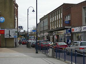 High Street, Strood |
|
| Population | 40,000 |
| OS grid reference | TQ725695 |
| Unitary authority | |
| Ceremonial county | |
| Region | |
| Country | England |
| Sovereign state | United Kingdom |
| Post town | ROCHESTER |
| Postcode district | ME2 |
| Dialling code | 01634 |
| Police | Kent |
| Fire | Kent |
| Ambulance | South East Coast |
| EU Parliament | South East England |
| UK Parliament |
|
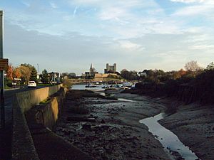
Strood is a town located in Medway, Kent, in South East England. It is part of a larger group of towns called the Medway Towns. These include Chatham, Rochester, Gillingham, and Rainham. Strood sits on the northwest bank of the River Medway. This is the lowest point where a bridge can cross the river.
Strood started as a small manor and then a church area of Frindsbury. It became its own parish in 1193. Today, Frindsbury is mostly considered part of northern Strood. The river has always been very important to Strood's history. Its bridges, for both roads and trains, have connected it to Rochester and other Medway Towns since Roman times. These connections link Kent to London and the rest of Britain.
Strood has shops and places for fun in its center. Many people who live in Strood work in the other Medway towns. They often work in business, industry, or logistics (moving goods). Some well-known areas in Strood are the "Earl estate" and Marlowe Park. One is named after a house builder, and the other after the land of an old large house.
Contents
- History of Strood
- Geography of Strood
- Strood Fair
- Newark Hospital
- Economy of Strood
- Transport in Strood
- River and the Strood Basin
- Mills in Strood
- Horticulture and Plants
- Housing in Strood
- Education in Strood
- Churches in Strood
- Media in Strood
- Sports and Fun in Strood
- Famous People from Strood
- See also
History of Strood
Early Times in Strood
Strood was part of Frindsbury until 1193. It was first called Strodes in an old book called the Textus Roffensis. Most early records spelled it Stroud. The old English name Strōd means "marshy land with lots of bushes." The town of Stroud in Gloucestershire has the same name origin.
The Romans built a stone bridge and a raised road across the marshy land. This road was called Watling Street, and it is still the A2 road today. In 764 AD, King Offa of Mercia and King Sigered of Kent gave land in Frindsbury to Eardulph. The Danes attacked Strood in 840, 994, and 998 AD. In 960 AD, a wooden bridge was built over the Medway River.
Medieval Strood
A small wooden church was built in Strood in 1122. It was a simple church for the people of Frindsbury parish. In 1160, King Henry II gave land to the Knights Templar. Their Manor House was used as a place for travelers to stay.
In 1193, Strood became its own parish. Monks from Newark Hospital managed it. In 1264, Simon de Montfort attacked Rochester Castle from the Strood side. During this fight, the wooden bridge was burned down. After Simon died, Strood had to pay a large fine because he had stayed there.
In 1293, the Rochester dock was in bad shape, so ships had to use Strood's docks. But since the bridge was gone, people had to use ferries to cross the river. In 1387, John de Cobham and Robert Knolles built a stone bridge. In 1460, Edward IV appointed a mayor for Rochester. This mayor also had power over the Strood riverfront.
Strood in Early Modern Times
Strood was owned by the Rochester monastery until King Henry VIII closed the monasteries. Then, it became part of the Hundred of Sharnel (Shamwell) and was given to George Brooke, Lord Cobham. His grandson, Henry Brooke, lost his lands in 1603 due to a false charge of treason. The Temple Manor was then given to Sir Robert Cecil, who later became a very important official under Queen Elizabeth.
In 1554, Thomas Wyatt started a rebellion. He was unhappy that Queen Mary I planned to marry a Catholic. He took Rochester Castle and the bridge. The Queen's soldiers, who were on Strood Hill, left their posts. Wyatt then marched on, but his rebellion failed, and he was executed.
Parish records for Strood began in 1555. After Queen Mary came to power, the country became Catholic again. A lot of money was spent to change the church back. But just nine years later, in 1565, more work was needed to change the church back to Protestant use under Queen Elizabeth I.
In 1672, the churches of St. Margaret's, Rochester, and St Nicholas, Strood, worked together. They got a ruling that allowed Watts charities to help more people. Strood parish used some of this money to create a workhouse for the poor.
In 1769, a tollgate was put up in Strood to help pay for improvements to the town. A historian named Hasted (1778–99) said that most people in Strood at that time were sailors, fishermen, or collected oysters.
Strood in the 19th and 20th Centuries
Between 1804 and 1824, the Thames and Medway canal was dug. You can find more details about this under the Transport section.
In 1974, the old City of Rochester joined with Chatham and part of the Strood Rural District. They formed the Borough of Medway. This was later renamed the City of Rochester-upon-Medway. In 1998, another merger with the rest of the Medway Towns created the Medway unitary authority.
Strood Today: 21st Century
Strood has grown a lot in the 21st century. This is because it is close to London and has more affordable housing. Even though Strood is a town with about 40,000 people (in 2019), it is also officially a very large suburb of Rochester. Interestingly, Strood has more people than Rochester itself, with a total population of around 68,000.
Geography of Strood
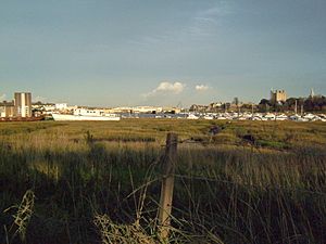
Strood is located next to marshy land along the River Medway. The chalk hills of the North Downs have a break here. This forms a steep river cliff that rises to 100 feet right behind the town.
Strood Fair
An annual fair started in Strood in 1206. It was held on August 26th and continued until the 18th century. The fair was traditionally held for three days and was linked to the Christian celebration of the Assumption. The Strood Fair was held regularly until the 1970s.
The land used for the fair was between Grange Road and Station Road, next to Strood railway station. For many years, it was part of a dairy farm. By the 1970s, the farm building became a car repair business. The fairground was then used by the Showman's Guild for winter quarters. An annual fair is still held on the site to help pay for its upkeep. In June 2007, the car repair building was taken down to build flats. Today, a market is held on Tuesdays and Saturdays, and a boot fair is held on Sundays.
Newark Hospital
Gilbert de Glanvill, Bishop of Rochester, started a hospital in Strood in 1190. It was called the Newark or Stroud Hospital. Newark Hospital helped make Strood more important. However, there were always worries about its money management and a rivalry with the Rochester Priory. In 1539, under King Henry VIII, the hospital came under the control of the Dean and Chapter of Rochester.
Today, the area where Newark Hospital once stood is mostly a car park behind Strood High Street. The railway line from the 19th century cuts across the back of the old hospital site. Strood Market used to be on part of this land, but it moved to make way for a food store, Aldi. Archaeologists dug up the site in the 1970s to learn more about its past.
Economy of Strood
Engineering in Strood
Small businesses were created to support the Chatham Dockyard.
Joseph Collis started as an ironmonger (selling metal goods) in 1777. By 1865, he was a wholesaler. He specialized in zinc, iron, tinplate, and locksmith work. By 1870, he and his partner, Stace, took over the Pelican Foundry. They made iron structures, toilet cisterns, and manhole covers.
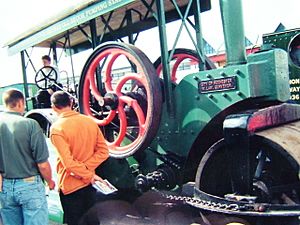
Thomas Aveling built his traction engines (steam-powered vehicles) at the Invicta Works. This factory was next to Rochester Bridge from 1861. Avelings was known for treating its workers well. They also let co-operative and radical groups use their buildings for meetings. Avelings later became the Wingets factory. Then it became the Rochester-upon-Medway Civic Centre, which is now used by Medway Council.
Shorts, a company that made seaplanes, used a yard on the Strood side of the river. They built the frames for F3 and F5 flying boats there.
Other important employers included Hobourn-Eaton, Kent Alloys, Fishers, and the Co-operative bakery.
Retail in Strood
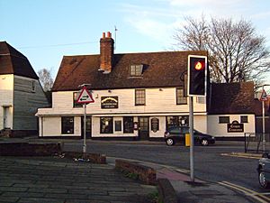
Strood's location at a bridging point made it a natural place for trade. The flat land on the Rochester side was needed for a walled town with a castle and cathedral. This stopped major development on that side of the river. The building of the London, Chatham and Dover Railway also limited land use. Small shops grew up around "The Angel" in Strood, forming the town center. More small shops were built along Gun Lane and Darnley Road.
By 2005, Strood had two large supermarkets. Tesco bought and cleared land for future expansion. Safeway built its store on the site of small businesses and a brewery. After Morrisons took over Safeway, the store closed. A new, larger Morrisons was built further away. The old town center store was empty until 2008. It was then redeveloped by Netto and Wilko. (The Netto store later became an Asda after a buyout).
Tesco had planned a new store on its land in 2013. However, a national policy change meant they focused on smaller Express stores instead. The planned Tesco store would have included a community center and library for Medway Council.
An Aldi supermarket opened in November 2012. It is located opposite Angel Corner, where Strood Market used to be. Locals were not happy about the Tuesday and Saturday markets moving to the Commercial Road car park.
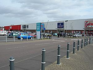
Strood Retail Park has grown to include stores like Next, Argos, Poundworld, Carpet Right, Matalan, and KFC. These stores show what kind of businesses are popular in the area.
A Poundland store opened in the Retail Park in February 2015. In March 2015, it was announced that B&Q would be replaced by a gym, a cafe, and three shops. In January 2016, Brantano closed down. A Poundworld store opened in the former Brantano site in May 2016.
In early 2017, it was announced that an M&S Foodhall, B&M, and a Maplin would open at the old B&Q site. Later, in July 2017, Starbucks Coffee also announced it would open in the new retail units. In February 2018, Maplin closed. Its space was used to expand B&M.
In June 2018, Carpetright announced it would close its Strood store. All its business moved to the Gillingham store. In August 2023, Wilko closed its Strood store. In December 2024, the former Wilko site opened as a Poundstretcher.
Strood's shopping center serves nearby villages and Rochester. It has six major supermarkets (Aldi, Asda, Morrisons, Tesco, Iceland, M&S Food Hall). It also has many smaller shops.
Transport in Strood
River Transport
The river has always been very important for transport in Strood. Even before the Romans, people used the river. The area was marshy then, with few people. As Strood grew, boatyards and ship repair businesses started. They were located on the river and in the small creeks that drained the marshes.
Roads in Strood
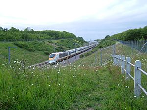
Strood was likely on old paths, but the Romans really shaped its road system. The lowest point to cross the River Medway is between Strood and Rochester. The first bridge was built soon after the Battle of the Medway. This road, from Dover towards north Wales, became known as Watling Street. It is now the A2 trunk road.
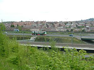
In the 20th century, road transport grew a lot. This led to the building of the M2 motorway. This road generally runs next to the old A2. Two high bridges were built in Strood, south of the town, for the M2. Beyond the M2 is the M20 motorway, which leads to the south of London. You can reach it from Strood using major roads. Strood is also on National Cycle Route 1.
The Thames and Medway Canal
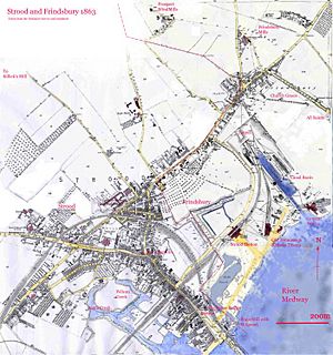
The Thames and Medway Canal was dug between 1804 and 1824. It provided a safe way to travel between the Medway and Thames rivers. Barges could avoid the long trip around the Isle of Grain. At the Strood end, boats entered the canal through a lock into Frindsbury basin. Then they went into a tunnel. The canal opened on October 4, 1824.
The canal was 8 feet (2.4 m) deep with 27 feet (8.2 m) of space above the water. It was 26 feet 6 inches (8.08 m) wide. This allowed for 94-foot (29 m) long, 60-ton Thames Barges. It also had a 5-foot (1.5 m) wide path for horses to pull boats. Dirt from the tunnel was used to fill in the marshland near St Mary's Church Strood. Frindsbury Basin could handle vessels up to 300 tons. A steam pump was installed there to keep the canal full of water.
The canal did not make much money. The tolls were high to cover the building costs. Also, boats could only enter the basins at high tide. This often made it faster to sail the 47 miles (76 km) around the Isle of Grain. After the Napoleonic wars ended, the military reason for the canal was also gone.
In 1844, a single railway line was laid through the tunnel. Part of it was on the towpath, and part on a wooden structure over the canal. The canal was sold in 1845 to the South Eastern Railway (SER). They filled in the canal inside the tunnel and laid a double track (see North Kent Line).
Rail Transport
The South Eastern Railway line used to end at Strood. Passengers would take a boat or coaches to get to Rochester or Chatham. The station, finished on February 10, 1856, was across from The Railway Tavern. It was later called the Old Terminus.
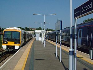
On June 18, 1856, the line was extended along the river bank to Maidstone. The Strood Station we see today was opened then (see Medway Valley Line). Also in 1856, the new road bridge over the Medway opened in its current spot, where the Roman bridge had been. In 1857, the old medieval bridge was taken down. Its stones were used to build the Strood Esplanade in 1858. In 1860, the SER built the Strood pier.
The East Kent Railway had permission to build a line from Faversham to Chatham. They wanted to connect with the South Eastern Railway at Strood. When talks failed, the East Kent, now called the London Chatham and Dover (LCDR), connected with another company at Bromley (see Chatham Main Line). The East Kent Railway built a bridge over the Medway (1853). Their line went north of The Angel, over Gun Lane and Watling Street, then south to Cuxton. The London Chatham and Dover built a station on the A2, near Canal Road. It had several names over the years, including Strood Station and Rochester Bridge.
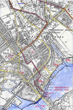
The South Eastern Railway built a parallel bridge (between 1866 and 1909). They ran a separate line into Chatham. To do this, a watermill was taken down, and its pond was filled in. An Oil and Seed Mill was built over the pond with its own railway tracks.
There was a loop between the lines at Strood, opened in 1859, but it closed in 1860. In 1875, Mayor N. E. Toomer made the two companies reopen the loop, which was nicknamed Toomers Loop. The service started again in 1877.
The SER and LCDR joined together in 1899 to form the South Eastern and Chatham Railway. Later, the SER branch to Chatham closed, and the LCDR Strood station closed. The SER bridge over the Medway was kept for the Chatham Main Line. The LCDR bridge was left unused (its supports were later used for the second road bridge). The link between the two lines was used for services from the Chatham line onto the North Kent Line.
For information about the current railway station, see Strood railway station.
River and the Strood Basin
All of Strood below The Angel Inn, near Strood Post Office, was built on marshland. This land had small creeks that were dug out to make useful docks and wharves. Two well-known creeks are Janes Creek and Temple Creek. Pelican Creek joined Janes Creek at a right angle. It has been filled in and is now a car park and the foundation for B & M. Strood often flooded, and the area around Temple Street (now a car park and a Tesco) was known as the 'Swamp'.
Big floods were recorded in Strood in 1158, 1235, 1309, 1682, 1735, 1791, 1854, 1874, 1887, 1953, 1968, and 1979.
William Curel was the oldest barge builder in Medway. He had two yards on the Strood bank. Curel's Upper Yard was next to the Railway Tavern. In 1900, Gill and Son took over the yard, and it became a place for making sails.
Mills in Strood
There was a windmill on Strood Hill, two on Broom Hill, and five in nearby Frindsbury.
- The Strood Hill Mill was a smock mill that was taken down in 1860. It was not in a good spot and had problems with changing winds. The site is now part of the Cedars Hotel.
- Killicks Mill on Broom Hill lost its top for the second time in 1880. It was fixed and worked for another year in 1890 but was not profitable. It was probably taken down in the 1920s. It had six sides instead of the usual eight.
- Fields Mill on Broom Hill burned down in 1875. In the time of Charles Dickens, the miller was Mr. Clark, but the owner was Mr. Field. Mr. Field loved music and had a piano, a harp, and a barrel organ in his living room. It is said that the organ was bought from Loose Church. It was set up so that the mill's power turned the organ's handle. Dickens would visit the mill on his walks and listen to the organ music.
The Frindsbury Mills:
- The oldest was a tripod – or post mill. It was called the Quarry Mill and was 100 yards southeast of the church. It was destroyed in 1850.
The other four mills were all owned by Mr. Kimmins.
- On Prospect Hill, there were two mills. The first was called Manwaring Mill, or Little Mill. It was a black, tarred smock mill and had four sets of grinding stones. Little Mill was hit by lightning and taken down in 1886.
- Also on Prospect Hill was Great Mill or Rose's Mill. It was the tallest in Kent. Together, the two mills made 400 sacks of flour a week. Great Mill was taken down in 1890.
- Kimmin's Mill on Frindsbury Hill was a smock mill with no base. The land later became a brick field. A man was killed by its turning arms.
- House Mill, also known as Kimmins Mill or Frindsbury Mill, stood on Frindsbury hill. It was a black smock mill. It was taken down in 1931.
There was also a tidemill. When the tide came in, water flowed into a mill pond, powering the mill. When the tide went out, water flowed back into the river, also powering the mill.
Horticulture and Plants
The 'Farleigh Damson' fruit has won an award from the Royal Horticultural Society.
The 'Farleigh Damson' is named after East Farleigh village in Kent. It was first grown by James Crittenden in the early 1800s. A letter from 1871 said that the original plant was found by Mr. Herbert, a gardener in Strood. He gave it to Crittenden. This damson has small, round, black fruit with a blue coating. It produces a lot of fruit, which made it very popular across England.
Housing in Strood
The area of Strood around Knight's Place and Temple Street was called the Swamp. In 1899, Smetham wrote that during floods, dirty water would enter people's homes. This left the area unhealthy for months. In 1912, there was a typhoid outbreak here. 56 people got sick, and five died.
In the 1880s, many new houses were built. Terraced houses were built on the hill, connecting Strood and Frindsbury. Land near St Mary's, which was now drained and close to the station, was used. There were different sizes of houses, from large detached homes to small terraced houses that opened onto the street. They were all built with local yellow bricks, with red details.
After World War I, the city built 19 houses in Steele St and 73 on Frindsbury Hill (Murray Road). After World War II, the city continued to build homes. This included the area between the A228, Watling Street, and the M2 motorway.
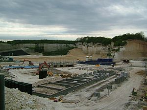
As more people moved to Strood, especially those who travel to work, more land has been developed by private companies. By 2000, the riverside near the station had new buildings. Kingswear Gardens off Canal Road is a social housing area. It is known for higher crime rates and is prone to flooding. The chalk pit near the A228 at Merral's Shaw now has 400 homes. This development is called Medway Gate. In 2009, there were plans to build on Temple Marsh. Up to 620 homes and over 12,300 square meters of mixed-use buildings were planned. This area is now called 'Temple Waterfront'.
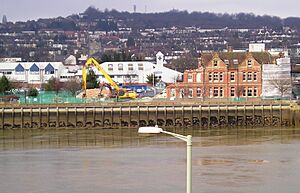
There are worries about protecting the old buildings in the area. A beautiful Edwardian building, the Aveling & Porter building, was sadly taken down in 2010 by Medway Council to make way for a car park.
Education in Strood
Strood Academy is the only secondary school in Strood. For high school, many students from Strood go to schools in nearby towns.
Churches in Strood
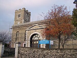
The main church for Strood is St Nicholas Church in College Yard. It is a Grade II listed building, meaning it is historically important. St Mary's Church (originally part of Frindsbury) opened in 1869. It is no longer an Anglican church but is now used by the New Testament Church of God. Another Anglican church in the area is St Francis.
There is also an old Catholic church, English Martyrs Church. It was rebuilt in 1964 in a modern style called brutalist. In recent years, it has been noted as an early example of this style for a Catholic church.
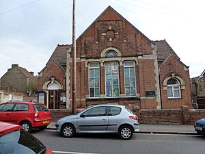
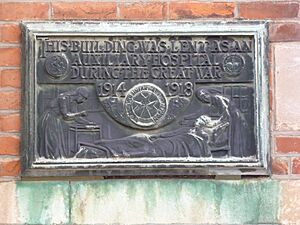
The Methodist church in Stonehouse Lane has had two name changes. First, the road name changed to Cliffe Road. Then, the church changed its name from "Jubilee" to "Peninsular." During the First World War, the church was used as a hospital to help wounded soldiers.
Protestant dissenters (people who disagreed with the main church) started the Zoar chapel in 1782. There is also a Gospel Mission Evangelical church in Brompton Lane and another Evangelical church in Darnley Road.
Media in Strood
Local news and TV shows for the region are provided by BBC South East and ITV Meridian. TV signals come from the Bluebell Hill TV transmitter.
Local radio stations include BBC Radio Kent on 96.7 FM, Heart South on 103.1 FM, Gold Radio on 1242 AM, and KMFM Medway on 100.4 FM. KMFM Medway broadcasts from its studios in Strood.
The town is served by these local newspapers:
- Medway Messenger
- Medway Times
- yourmedway
Sports and Fun in Strood
The Non-League football club Rochester United F.C., which used to be called Bly Spartans, plays at Bly Spartans Sports Ground in Strood. The club is in the Kent League. Gillingham FC, a professional team in EFL's League One, is the local professional team. It is about three miles from central Strood. Strood also has a great Sports Centre with astroturf football pitches that have lights for night games.
Famous People from Strood
- Lucy Ann Brooks (1835–1926) was born in Strood. She was a strong supporter of temperance (avoiding alcohol). She helped start and led the Women's Total Abstinence Union.
- Isaac Newell (1853–1907) was born in Strood. He was a teacher and a pioneer of football in Argentina. He founded a school and the Argentinean football club Newell's Old Boys, which is named after him. This club is one of the most important teams in Argentina.
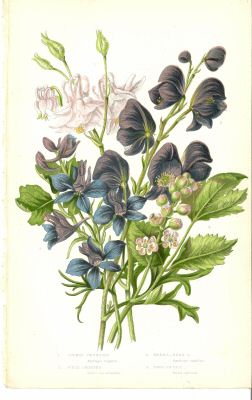
- Anne Pratt (1806–1893), a botanist, was born in Strood. She wrote many books about plants in the 19th century. She was so respected for her knowledge of wild flowers that she received money from the government. A picture of her is in the Rochester museum. Her most famous work is The flowering plants, grasses, sedges, and ferns of Great Britain.
- Charles Roach Smith (1806–1890) was a famous amateur archaeologist who died in Strood. He was born on the Isle of Wight. In 1826, he moved to London and started his own chemistry business in 1834. In 1876, he and his sister bought Temple Place in Cuxton Road, Strood. In London, he made the first collection of Roman coins found during digs. The British Museum bought this collection. He was a pioneer in studying old sites in cities. His book Illustrations of Roman London (1859) was the main book on the subject for many years. He also studied Roman coin hoards. After he died, four streets in Strood were named after him: Charles Street, Smith Street, Roach Street, and Antiquarian Street. Three of these streets still exist near the Tesco supermarket. Antiquarian Street was taken down, and the area is now part of the Tesco car park.
See also
 In Spanish: Strood para niños
 | Delilah Pierce |
 | Gordon Parks |
 | Augusta Savage |
 | Charles Ethan Porter |


