Surfers Paradise, Queensland facts for kids
Quick facts for kids Surfers ParadiseGold Coast City, Queensland |
|||||||||||||||
|---|---|---|---|---|---|---|---|---|---|---|---|---|---|---|---|
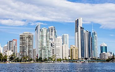
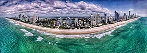
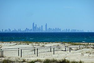
Surfers Paradise, as seen from Nerang River
|
|||||||||||||||
| Population | 26,412 (2021 census) | ||||||||||||||
| • Density | 4,260/km2 (11,000/sq mi) | ||||||||||||||
| Established | 1933 | ||||||||||||||
| Postcode(s) | 4217 | ||||||||||||||
| Elevation | 11 m (36 ft) | ||||||||||||||
| Area | 6.2 km2 (2.4 sq mi) | ||||||||||||||
| Time zone | AEST (UTC+10:00) | ||||||||||||||
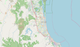
| Location |
|
||||||||||||||
| LGA(s) | City of Gold Coast | ||||||||||||||
| State electorate(s) | Surfers Paradise | ||||||||||||||
| Federal Division(s) | Moncrieff | ||||||||||||||
|
|||||||||||||||
|
|||||||||||||||
Surfers Paradise, often called Surfers, is a lively town in Queensland, Australia. It is the main part of the City of Gold Coast. In 2021, about 26,412 people lived there.
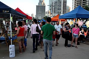
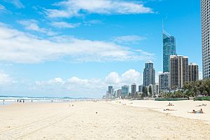
Surfers Paradise is famous for its many tall apartment buildings and a wide sandy beach perfect for surfing. The heart of the town is Cavill Mall. This area is full of shops and fun places. Cavill Avenue is named after Jim Cavill, who owned an early hotel. It is one of the busiest shopping streets in Queensland. It is also a popular spot for nightlife. You might even see the Surfers Paradise Meter Maids here. They are known for being friendly to tourists.
This town is the main entertainment and tourism hub of the Gold Coast. Its tall buildings are a well-known part of the city's skyline. In 2009, Surfers Paradise was named one of Queensland's "Q150 Icons" for its important role as a location.
Contents
- Exploring Surfers Paradise Geography
- Surfers Paradise History
- Surfers Paradise Population and People
- Important Places in Surfers Paradise
- Fun Things to Do in Surfers Paradise
- Events in Surfers Paradise
- Sports and Recreation
- Education in Surfers Paradise
- Awards and Rankings
- Getting Around Surfers Paradise
- Surfers Paradise Climate
- See also
Exploring Surfers Paradise Geography
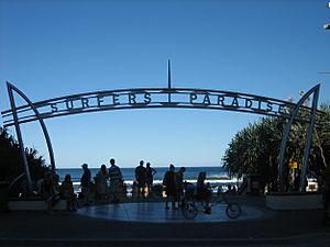
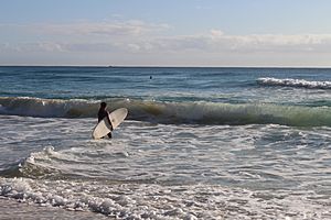
Surfers Paradise is on the eastern coast of Australia. It faces the Coral Sea, which is part of the Pacific Ocean. The entire coastline here is called Surfers Paradise Beach. It is a long, sandy beach perfect for surfing. A road called The Esplanade runs along the coast in the north-east.
The Nerang River forms the north-west border of Surfers Paradise. The river flows through the town and into the southern end of Moreton Bay. The south-west part of the town is on the western side of the river. It is bordered by Bundall Road.
The Gold Coast Highway also runs through Surfers Paradise from north to south. Over the years, the river has been changed a lot. Many islands were created for homes. Some were natural, while others were made from reclaimed land using canals.
Islands and Neighborhoods
- Macintosh Island is an island that has been developed into a canal housing area. It was named after Hugh Macintosh, a surveyor. The Gold Coast Highway goes through the eastern part of this island.
- Chevron Island is a natural island with many homes. Thomas Drive is the main road here. It connects the island to mainland Surfers Paradise and to Southport. There is also a bridge to Cronin Island to the north. Cronin Island is a smaller, man-made island with homes. It is named after Jack Cronin, an early engineer.
- Budds Beach is a beach on the Nerang River. It faces Macintosh, Chevron, and Cronin Islands. It was named after Alan Foster Budd. Jarriparilla Cove is the water between Budds Beach and Macintosh Island. This is an old Aboriginal name.
- Girung Island is a small, undeveloped island. Its name comes from a Yugambeh word for flying foxes (fruit bats). These bats often rest on the island.
- The Isle of Capri is not a true island. It is a neighborhood with canals in the south-west of Surfers Paradise. It is on the western side of the Nerang River.
- Evandale Park is also on the western side of the river, north of the Isle of Capri. This park has the Gold Coast Council Chambers and the Home of the Arts cultural center.
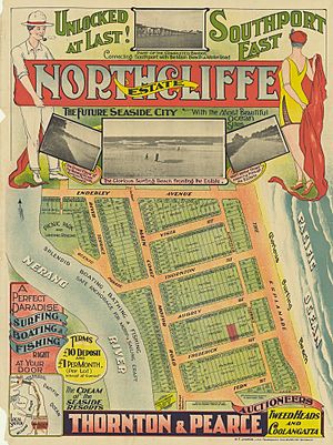
- Northcliffe Beach is a part of Surfers Paradise Beach. It is near Northcliffe Terrace, which was a real estate development in the 1920s.
Surfers Paradise History
The first European to settle here was James Beattie, a farmer. He started an 80-acre farm near where Cavill Avenue is today. His farm did not do well. In 1877, he sold it to Johan Meyer, a German immigrant. Meyer tried to grow sugar but also had little luck. He then focused on helping tourists get to the beach. From 1880 to 1928, Meyer's Ferry carried people and vehicles across the Nerang River. He also ran a horse-and-buggy service from Southport to the beach. He built the Main Beach Hotel.
By 1889, Meyer's hotel became a post office. The area around it was called Elston. This name came from the Southport postmaster, who named it after his wife's home in England. After Meyer died in 1901, his hotel's license ended. For 16 years, Elston was a tourist town without a hotel or post office.
How Surfers Paradise Got Its Name
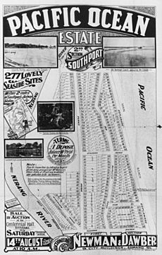
In 1917, a company tried to sell land in Elston. They called it the "Surfers' Paradise Estate." But the sale failed because it was hard to get there. This was the first time the name Surfers Paradise was used.
Elston started to get more visitors after the Jubilee Bridge opened in 1925. The South Coast Road was also extended. This made it easier to reach Elston. People began buying land around Elston and further south. New hotels opened for tourists.
In 1925, Jim Cavill, a hotel owner from Brisbane, opened the Surfers Paradise Hotel. This hotel was located where the Surfers Paradise Centre is now. It included the Surfers Paradise Beer Garden and Hard Rock Cafe. Cavill also opened a small zoo. These were the first attractions in the area. The hotel became very popular. Shops and services grew up around it.
Cavill wanted the name Elston changed to Surfers' Paradise. On December 1, 1933, the local council officially renamed the suburb. They thought "Surfers Paradise" would attract more visitors. In July 1936, Cavill's wooden hotel burned down. It was rebuilt the next year.
Growth and Development
In 1934, Surfers Paradise State School opened. It was first located on Laycock Street. In 1976, the school moved to its current spot on the Isle of Capri.
A Methodist Church was planned in the late 1930s. It finally opened in Clifford Street on December 14, 1940. Later, in 1977, it became the Clifford Street Uniting Church. This church was moved to Emmanuel College in Carrara in 1991.
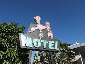
In the late 1940s, Margot Kelly opened the Hibiscus Room. This was a fancy restaurant and entertainment place. It attracted many important people. A big building boom happened in the 1950s and 1960s. The first tall building, called the Kinkabool, was built in 1959. It was 10 stories high and is still in Hanlan Street today. Many other tall apartment buildings followed. Famous ones included the Iluka, St Tropez, and The Pink Poodle. In the 1980s, Japanese investors also put a lot of money into development here.
Today, not much of the original plants or natural areas remain. The way the land was first divided into blocks is still there. But the new islands and bridges on the Nerang River have changed the area a lot. Some older spots, like Budds Beach, are still low-key. This beach was always a place for boating, fishing, and swimming.
By 2020, The Esplanade road along the beachfront became a main area for activities. It has many shops and restaurants. The busiest areas are around Cavill, Orchid, and Elkhorn Avenues. The tall buildings here are a very famous sight. You can see them from far away, even from Coolangatta to the south.
Surfers Paradise Population and People
In 2011, Surfers Paradise had 19,668 people. By 2016, the population grew to 23,689 people. About 51.1% were male and 48.9% were female. The average age was 37 years old. This is slightly younger than the national average of 38.
Many people in Surfers Paradise were born in Australia (44.6%). Other common birthplaces included:
- New Zealand (7.1%)
- England (3.7%)
- India (3.6%)
- Brazil (2.4%)
- Japan (2.1%)
Most people (59.3%) spoke only English at home. Other languages spoken included Mandarin, Portuguese, Japanese, Punjabi, and Spanish. The most common religions were No Religion (29.2%) and Catholic (19.3%). Surfers Paradise is a very diverse place. It has the largest Jewish, Spanish Australian, and Lebanese Australian communities in Queensland.
In 2021, the population of Surfers Paradise reached 26,412 people.
Important Places in Surfers Paradise
Surfers Paradise has several places that are important to its history. These are called heritage-listed structures:
- St Margaret's Church at 135 Bundall Road (Evandale Park). It was originally in Nerang.
- Matey Memorial at 44 Cavill Avenue (Cavill Park). This is a bronze statue from 1957 of a homeless dog.
- The Pink Poodle sign at 18 Fern Street.
- Kinkabool at 32–34 Hanlan Street. This was one of the first tall apartment buildings.
Fun Things to Do in Surfers Paradise
Surfers Paradise Beach and Foreshore
The Surfers Paradise Foreshore is a public area along the beach. It was updated in 2011. It has modern street design and keeps many old trees, like pandanus trees. This area hosts many free public events. These include the Australian Sand Sculpting Championships. The part of Surfers Paradise near the beach has many family-friendly attractions. These include Time Zone, Ripley's Believe it or Not museum, and Adrenalin Park.
Places to Stay and Shop
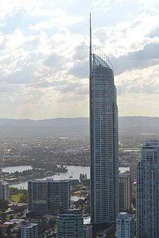
Surfers Paradise has many tall hotels and apartment buildings for tourists. Some well-known ones are Circle on Cavill, Hilton, Q1, and Soul.
You can find great shopping in Surfers Paradise. There are many stores on Cavill Avenue and nearby streets. The Centro Surfers Paradise Shopping Centre is also on Cavill Avenue.
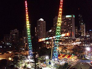
Adrenalin Park
Adrenalin Park is a small amusement park. It has exciting rides like the Sling Shot and Vomatron. There is also a mini golf course.
Nightlife and Entertainment
The "Gold Coast Nightlife Precinct" offers many activities after dark. This area is especially lively around Cavill Avenue. It is known as Australia's nightlife capital. Almost 20,000 visitors come here every day. The area also hosts the biggest Schoolies week event in Australia. Tens of thousands of high school graduates come here for this event.
Events in Surfers Paradise
Surfers Paradise hosts many free public events. These events are for local people, visitors from other parts of Queensland, and tourists from other countries.
Gold Coast Marathon
Every July, Surfers Paradise hosts the annual Gold Coast Marathon. Runners from all over the world come to take part in this race.
Gold Coast 500
The Surfers Paradise Street Circuit is in Surfers Paradise. It used to host CART races. Now, it hosts the Gold Coast 500 car race every October.
Schoolies Week
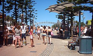
Schoolies week is an Australian tradition. High school graduates, called 'schoolies', have a week-long holiday after their final exams. This happens in late November and early December. The tradition started on the Gold Coast in the 1980s. Surfers Paradise is still the biggest place for this event. It often includes concerts and parties.
A special area for Schoolies is set up on Surfers Paradise Beach each year. It has live music and fun activities for young people. This area is safe and only for current Year 12 school leavers. The Schoolies Hub Beach area opens every night from 7 pm.
Volunteers in bright orange vests, called the Schoolies Support Team, help the graduates. They give advice and practical help. "Recharge Zones" are also set up near the Schoolies Hub. These are safe places to get free water and stay hydrated.
Sports and Recreation
Many well-known sports teams represent the Gold Coast area. These include the National Rugby League club, the Gold Coast Titans. There is also the Australian Football League team, the Gold Coast Suns.
Clubs and teams based in Surfers Paradise include:
- Australian Shooting Academy
- Surfers Paradise Rowing Club
- Surfers Paradise Apollo Soccer Club
- Surfers Paradise Rugby Union Club
- Surfers Paradise Triathlon Club
- Surfers Paradise Cricket Club
- Surfers Paradise Golf Club
- Surfers Paradise Surf Life Saving Club
- Surfers Paradise Baseball Club
Education in Surfers Paradise
Surfers Paradise State School is a public primary school. It teaches boys and girls from Preparatory to Year 6. It is located at 42 St Andrews Avenue on the Isle of Capri. In 2018, the school had 658 students. It also has special education and English language programs.
There is no public high school in Surfers Paradise. The closest public high schools are Keebra Park State High School in Southport and Benowa State High School in Benowa.
There are also several places for continuing education:
- Gold Coast Learning Centre offers classes in English, business, accounting, and more.
- English in Paradise is an English language school that started in 2001.
- Holmes Institute is a private school with different programs. It has a School of Secondary Education and English Language Centres.
Awards and Rankings
Surfers Paradise Beach is known as one of the best beaches on Australia's east coast. It has won many awards:
- The American Travel Channel voted Surfers Paradise beach as one of the best beaches in the world.
- The Keep Australia Beautiful Council named Surfers Paradise beach Queensland's Cleanest Beach in 2006.
Getting Around Surfers Paradise
The town has two main types of public transport. These are Kinetic Group's bus services and the G:link light rail service. The bus services connect Surfers Paradise to the western parts of the city. The G:link light rail runs from north to south.
G:link Light Rail Stations
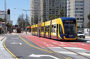
The G:link light rail system has five stations in Surfers Paradise:
- Northcliffe station is at the southern end of Surfers Paradise Boulevard. It is near Northcliffe Surf Lifesaving Club and Northcliffe Beach.
- Surfers Paradise station is on Surfers Paradise Boulevard. It is the closest station to the Q1 building.
- Cavill Avenue station is also on Surfers Paradise Boulevard. It is the closest station to Cavill Avenue, the heart of the town.
- Cypress Avenue station is on Surfers Paradise Boulevard. It is the closest station to Funtime amusement park. You can also catch buses here to Nerang railway station.
- Surfers Paradise North station is on the north side of the intersection of Surfers Paradise Boulevard and Ocean Avenue.
Surfers Paradise Climate
Surfers Paradise is a popular beach spot because it has a warm climate all year. Temperatures here are milder in summer and warmer in winter compared to Brisbane. The hottest temperature recorded was 40.5°C in February 2004. The coldest was 2.5°C in July 2007. The average sea temperature is about 21.5°C in winter (July and August) and 27.1°C in summer (February).
| Climate data for Gold Coast Seaway (27º56'24"S, 153º25'48"E, 3 m AMSL) (1992-2024 normals and extremes) | |||||||||||||
|---|---|---|---|---|---|---|---|---|---|---|---|---|---|
| Month | Jan | Feb | Mar | Apr | May | Jun | Jul | Aug | Sep | Oct | Nov | Dec | Year |
| Record high °C (°F) | 38.5 (101.3) |
40.5 (104.9) |
36.3 (97.3) |
33.3 (91.9) |
29.4 (84.9) |
27.1 (80.8) |
28.9 (84.0) |
32.4 (90.3) |
33.0 (91.4) |
36.8 (98.2) |
35.5 (95.9) |
39.4 (102.9) |
40.5 (104.9) |
| Mean daily maximum °C (°F) | 28.8 (83.8) |
28.7 (83.7) |
28.0 (82.4) |
26.0 (78.8) |
23.6 (74.5) |
21.5 (70.7) |
21.3 (70.3) |
22.2 (72.0) |
24.0 (75.2) |
25.4 (77.7) |
26.8 (80.2) |
28.0 (82.4) |
25.4 (77.6) |
| Mean daily minimum °C (°F) | 21.9 (71.4) |
21.8 (71.2) |
20.9 (69.6) |
18.3 (64.9) |
15.4 (59.7) |
13.1 (55.6) |
12.1 (53.8) |
12.5 (54.5) |
14.9 (58.8) |
17.0 (62.6) |
18.9 (66.0) |
20.5 (68.9) |
17.3 (63.1) |
| Record low °C (°F) | 16.7 (62.1) |
17.2 (63.0) |
13.4 (56.1) |
8.9 (48.0) |
6.6 (43.9) |
3.8 (38.8) |
2.5 (36.5) |
4.2 (39.6) |
7.9 (46.2) |
9.4 (48.9) |
8.2 (46.8) |
14.7 (58.5) |
2.5 (36.5) |
| Average precipitation mm (inches) | 138.8 (5.46) |
187.3 (7.37) |
155.7 (6.13) |
118.4 (4.66) |
103.2 (4.06) |
101.3 (3.99) |
50.9 (2.00) |
51.0 (2.01) |
43.4 (1.71) |
88.3 (3.48) |
109.4 (4.31) |
138.5 (5.45) |
1,287 (50.67) |
| Average precipitation days (≥ 1.0 mm) | 9.2 | 10.4 | 11.2 | 8.9 | 8.5 | 6.7 | 5.4 | 4.3 | 5.3 | 6.5 | 7.8 | 9.0 | 93.2 |
| Average relative humidity (%) | 70 | 70 | 68 | 65 | 62 | 58 | 55 | 56 | 62 | 66 | 68 | 69 | 64 |
| Average dew point °C (°F) | 20.5 (68.9) |
20.7 (69.3) |
19.3 (66.7) |
16.7 (62.1) |
13.8 (56.8) |
11.0 (51.8) |
9.8 (49.6) |
10.4 (50.7) |
13.2 (55.8) |
15.5 (59.9) |
17.3 (63.1) |
18.9 (66.0) |
15.6 (60.1) |
| Source: Bureau of Meteorology (1992-2024 normals and extremes) | |||||||||||||
| Historical population | ||
|---|---|---|
| Year | Pop. | ±% |
| 2006 | 18,501 | — |
| 2011 | 19,668 | +6.3% |
| 2016 | 23,689 | +20.4% |
See also
 In Spanish: Surfers Paradise para niños
 | William Lucy |
 | Charles Hayes |
 | Cleveland Robinson |


