Boothbay, Maine facts for kids
Quick facts for kids
Boothbay, Maine
|
||
|---|---|---|

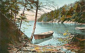
Postcard of Farnham's Cove, 1907
|
||
|
||
| Motto(s):
Pelegrinis Cibum Dedimus (Latin)
"We Fed the Pilgrims" |
||

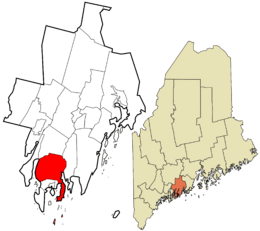
Location in Lincoln County and the state of Maine
|
||
| Country | United States | |
| State | Maine | |
| County | Lincoln | |
| Incorporated | 1764 | |
| Area | ||
| • Total | 71.80 sq mi (185.96 km2) | |
| • Land | 21.93 sq mi (56.80 km2) | |
| • Water | 49.87 sq mi (129.16 km2) | |
| Elevation | 127 ft (39 m) | |
| Population
(2020)
|
||
| • Total | 3,003 | |
| • Density | 142.3/sq mi (54.9/km2) | |
| Time zone | UTC−5 (Eastern (EST)) | |
| • Summer (DST) | UTC−4 (EDT) | |
| ZIP Codes | ||
| Area code(s) | 207 | |
| FIPS code | 23-06050 | |
| GNIS feature ID | 0582358 | |
Boothbay is a small town in Lincoln County, Maine, United States. About 3,003 people lived here in 2020. The town includes areas like Back Narrows, Dover, and Oak Hill. It also has the villages of East Boothbay and Trevett.
The area around Boothbay is very popular for summer tourists. Many people visit but do not live here all year. Boothbay is also known for its shipyards. The biggest one is called Washburn & Doughty.
Contents
Boothbay's Early History
The first people to live in this region were the Abenaki tribe. They called the area Winnegance. The first Europeans arrived in 1623. They were English fishermen who set up a small outpost.
In 1666, an Englishman named Henry Curtis bought land from the Abenaki leader Mowhotiwormet. But the English settlers were forced to leave in 1676. This happened during a conflict known as King Philip's War.
The colonists came back after the war. However, they were driven out again in 1689 during King William's War. After this, Winnegance was left empty for 40 years.
Becoming a Town
In 1730, Colonel David Dunbar started a new settlement. He named it Townsend. He convinced about 40 families from Ireland to move there. These families were mostly Presbyterians of Scottish and Irish background. Some of them had fought in the Glorious Revolution in 1688.
This new settlement grew and became the town of Boothbay. It was officially recognized on November 3, 1764. Later, some parts of Boothbay became their own towns. In 1842, Townsend became Southport. Then, in 1889, Boothbay Harbor also became a separate town.
Geography of Boothbay
Boothbay covers about 71.80 square miles (185.96 square kilometers). Most of this area, about 49.87 square miles (129.16 square kilometers), is water. The land area is about 21.93 square miles (56.80 square kilometers).
The town is located on the Cape Newagen peninsula. This land sticks out into the Gulf of Maine. Boothbay sits between the Sheepscot River and Damariscotta River. Damariscove Island is also part of the town.
State Routes 27 and 96 pass through Boothbay. It shares borders with Edgecomb to the north and Boothbay Harbor to the south. Across the water, it is close to Westport and South Bristol.
Boothbay's Climate
Boothbay has a humid continental climate. This means it has big changes in temperature throughout the year. Summers are warm or hot, and often humid. Winters are cold, sometimes very cold.
Population of Boothbay
| Historical population | |||
|---|---|---|---|
| Census | Pop. | %± | |
| 1790 | 997 | — | |
| 1800 | 1,246 | 25.0% | |
| 1810 | 1,582 | 27.0% | |
| 1820 | 1,950 | 23.3% | |
| 1830 | 2,286 | 17.2% | |
| 1840 | 2,631 | 15.1% | |
| 1850 | 2,504 | −4.8% | |
| 1860 | 2,857 | 14.1% | |
| 1870 | 3,200 | 12.0% | |
| 1880 | 3,575 | 11.7% | |
| 1890 | 1,718 | −51.9% | |
| 1900 | 1,766 | 2.8% | |
| 1910 | 1,700 | −3.7% | |
| 1920 | 1,432 | −15.8% | |
| 1930 | 1,345 | −6.1% | |
| 1940 | 1,370 | 1.9% | |
| 1950 | 1,559 | 13.8% | |
| 1960 | 1,617 | 3.7% | |
| 1970 | 1,814 | 12.2% | |
| 1980 | 2,308 | 27.2% | |
| 1990 | 2,648 | 14.7% | |
| 2000 | 2,960 | 11.8% | |
| 2010 | 3,120 | 5.4% | |
| 2020 | 3,003 | −3.7% | |
| U.S. Decennial Census | |||
In 2010, there were 3,120 people living in Boothbay. There were 1,386 households, which are groups of people living together. About 23% of these households had children under 18.
The average age of people in Boothbay was about 51.7 years old. About 17.2% of residents were under 18. And 24.9% were 65 years old or older. The town had slightly more females than males.
Places to Visit in Boothbay
- Bigelow Laboratory for Ocean Sciences
- Coastal Maine Botanical Gardens
- Bosarge Family Education Center
- Damarsicove Island
- Knight-Corey House
- Fisherman Island
- Hodgdon Yachts
- Old Gray House
- Ram Island Light
- Washburn & Doughty
Famous People from Boothbay
- George Herbert Baker, a painter
- Brenda Bettinson, an artist
- Cole Brauer, a sailor
- Deborah Bronk, an oceanographer
- Mabel Conkling, a sculptor
- Robert H. Conn, a government official
- Francis C. Florini, a politician
- Richard Ford, an author
- Matthew Forgues, a racewalker
- Jane Gilbert, an actress
- Woodbury S. Grover, a politician
- Palmer Hayden, an artist
- John B. Hayes, an admiral
- Dorothy M. Healy, an English professor and historian
- Paul LePage, a former Governor of Maine
- Beth Orcutt, an oceanographer
- Joseph Pollia, a sculptor
- Christopher Reeve, a famous actor
- Daniel Rose, a politician
- Dixie Selden, a painter
- Holly Stover, a politician
- T. J. Southard, a shipbuilder and politician
- John Welsh, a biologist
See also
 In Spanish: Boothbay (Maine) para niños


