Tucker, Georgia facts for kids
Quick facts for kids
Tucker, Georgia
|
|||
|---|---|---|---|
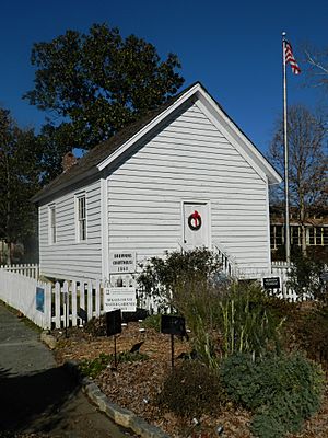
The historic Brownings Courthouse in December 2012
|
|||
|
|||
| Country | |||
| State | |||
| County | DeKalb | ||
| Area | |||
| • Total | 20.34 sq mi (52.67 km2) | ||
| • Land | 20.20 sq mi (52.33 km2) | ||
| • Water | 0.13 sq mi (0.34 km2) | ||
| Elevation | 1,122 ft (342 m) | ||
| Population
(2020)
|
|||
| • Total | 37,005 | ||
| • Density | 1,831.57/sq mi (707.16/km2) | ||
| Time zone | UTC-5 (Eastern (EST)) | ||
| • Summer (DST) | UTC-4 (EDT) | ||
| ZIP codes |
30084 & 30085
|
||
| Area code(s) | 404, 770, 678 | ||
| FIPS code | 13-77652 | ||
| GNIS feature ID | 0333270 | ||
Tucker is a city in DeKalb County, Georgia, USA, close to Atlanta. It started as a settlement in the 1820s and grew into a railroad town by 1892. In 2020, about 37,000 people lived there.
In November 2015, people in Tucker voted to make it an official city. Most voters (about 74%) said yes. Then, in March 2016, Tucker residents chose their first mayor and city council members.
Contents
- Tucker's Past: A Look at Its History
- Tucker's Location and Natural Features
- Tucker's Climate: Weather Patterns
- Who Lives in Tucker? Demographics
- Life in Tucker: Culture and Community
- Tucker's Economy: Businesses and Jobs
- Learning in Tucker: Education
- How Tucker Works: Infrastructure
- Getting Around Tucker: Transportation
- Famous People From Tucker
- Images for kids
- See also
Tucker's Past: A Look at Its History
Who Were the First Settlers in Tucker?
In 1821, the state of Georgia held a "Land Lottery." This opened up new areas for people to settle, including the land where Tucker is now. The Muscogee (Creek) Nation had given this land to the United States earlier that year.
The area that became Tucker was first part of Henry County, Georgia. Then, on December 9, 1822, DeKalb County was created, and Tucker became part of it. This area was known as the Brownings District.
There are about 30 cemeteries near Tucker's Main Street. In these cemeteries, you can find graves of people born in the 1700s, including four soldiers from the American Revolutionary War. There are also graves for twelve Confederate soldiers.
How Did the Civil War Affect Tucker?
Even though people in DeKalb County voted against leaving the United States, Georgia joined the Confederacy in 1861. This meant Georgia left the Union.
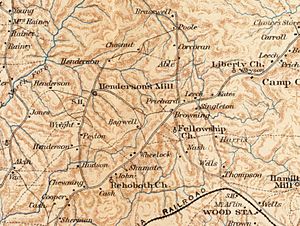
In July 1864, Union soldiers came to Tucker. They camped at Henderson's Mill and used the Brownings Courthouse. This courthouse was one of the few buildings they didn't burn down. The soldiers also took apart the railroad tracks leading to Stone Mountain. They were part of Sherman's army as it moved towards Atlanta.
The Railroad's Role in Tucker's Growth
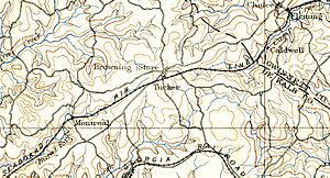
In 1886, a company called the Georgia, Carolina and Northern Railway planned a new train line between North Carolina and Atlanta. Before it was finished, another company, the Seaboard Air Line Railroad, took over. They wanted to extend their train lines to Atlanta.
Seaboard built train stations in many small towns. They often named these stations after railroad officials. The station in the Brownings District might have been named after Rufus S. Tucker, who was a director for several Seaboard railroads. Some people also think the name came from a local family named Tucker.
The very first train arrived at the new Tucker station on April 24, 1892. It carried 150 passengers and took about four hours to reach Atlanta. Two months later, the U.S. Postal Service opened the Tucker Post Office.
Over the years, the railroad companies changed names through mergers. Today, the line is operated by CSXT. Even though trains no longer stop for passengers, the Tucker depot is still used by CSX for track repairs.
Tucker is 1,117 feet (340 m) above sea level. This makes it the highest point on the railroad line between Atlanta and Richmond, Virginia.
Tucker in the 20th Century
After World War II, Tucker started to change. It went from being mostly farms to having more factories, shops, and homes. New water systems and jobs in nearby areas helped Tucker grow. Many people moved to Tucker from all over the country.
Old families began to sell their land for new neighborhoods and shopping centers. Local leaders started a bank and a youth football league. By the 1960s, newspapers called Tucker "DeKalb’s Area of Golden Opportunity." With more cars and affordable gas, Tucker became a great place to live.
Tucker's Location and Natural Features
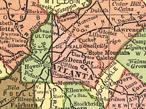
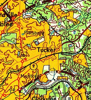
Tucker is in the northeastern part of DeKalb County. It's about 15 miles (24 km) northeast of downtown Atlanta. The city covers about 12.1 square miles (31 km2), with most of it being land and a small part being water.
What is the Eastern Continental Divide?
The Eastern Continental Divide runs through Tucker. This is an imaginary line that separates where water flows. Water that falls west of this line flows towards the Chattahoochee River and then to the Gulf of Mexico. Water that falls east of the line flows towards the Atlantic Ocean through the Ocmulgee River.
Tucker's Landscape and Waterways
Tucker is in Georgia's Piedmont region. This area has very old rocks that were formed by heat and pressure. You can find rocks like schist and granite here.
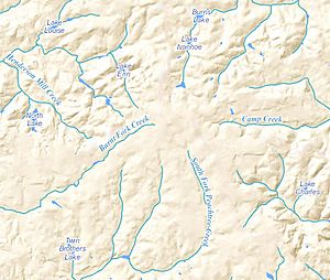
Many small creeks start in Tucker, such as Burnt Fork Creek and South Fork Peachtree Creek. Before homes had indoor plumbing, some of these creeks were used for mills or for baptism. Burnt Fort Creek was an important water source for Decatur until the 1940s.
Tucker's Climate: Weather Patterns
| Weather chart for Tucker | |||||||||||||||||||||||||||||||||||||||||||||||
|---|---|---|---|---|---|---|---|---|---|---|---|---|---|---|---|---|---|---|---|---|---|---|---|---|---|---|---|---|---|---|---|---|---|---|---|---|---|---|---|---|---|---|---|---|---|---|---|
| J | F | M | A | M | J | J | A | S | O | N | D | ||||||||||||||||||||||||||||||||||||
|
4.8
51
33
|
5
56
36
|
5
65
42
|
3.7
74
50
|
4.1
80
59
|
4.8
87
67
|
5
89
70
|
4.3
88
70
|
4.6
83
63
|
3.5
73
51
|
4.2
63
42
|
4.2
54
35
|
||||||||||||||||||||||||||||||||||||
| temperatures in °F precipitation totals in inches |
|||||||||||||||||||||||||||||||||||||||||||||||
|
Metric conversion
|
|||||||||||||||||||||||||||||||||||||||||||||||
Tucker has a humid subtropical climate. This means it has mild winters and hot summers. While the weather is usually moderate, Tucker can have extreme temperatures. The hottest temperature ever recorded was 110 °F (43 °C) in 1927. The coldest was −10 °F (−23 °C) in 1985.
Who Lives in Tucker? Demographics
| Historical population | |||
|---|---|---|---|
| Census | Pop. | %± | |
| 1980 | 25,399 | — | |
| 1990 | 25,781 | 1.5% | |
| 2000 | 26,532 | 2.9% | |
| 2010 | 27,581 | 4.0% | |
| 2020 | 37,005 | 34.2% | |
| U.S. Decennial Census 1850-1870 1870-1880 1890-1910 1920-1930 1940 1950 1960 1970 1980 1990 2000 2010 2020 |
|||
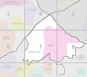
Tucker was first listed as a "census designated place" in the 1980 U.S. census. After it became a city, it was listed as a city in the 2020 U.S. census.
In 2020, there were 37,005 people living in Tucker. There were 14,479 households and 8,753 families.
| Race / Ethnicity (NH = Non-Hispanic) | Pop 2000 | Pop 2010 | Pop 2020 | % 2000 | % 2010 | % 2020 |
|---|---|---|---|---|---|---|
| White alone (NH) | 18,239 | 15,951 | 14,387 | 68.74% | 57.83% | 38.88% |
| Black or African American alone (NH) | 3,670 | 6,003 | 13,209 | 13.83% | 21.76% | 35.70% |
| Native American or Alaska Native alone (NH) | 31 | 57 | 72 | 0.12% | 0.21% | 0.19% |
| Asian alone (NH) | 2,095 | 2,022 | 3,054 | 7.90% | 7.33% | 8.25% |
| Pacific Islander alone (NH) | 10 | 19 | 7 | 0.04% | 0.07% | 0.02% |
| Other race alone (NH) | 55 | 75 | 230 | 0.21% | 0.27% | 0.62% |
| Mixed race or Multiracial (NH) | 385 | 526 | 1,423 | 1.45% | 1.91% | 3.85% |
| Hispanic or Latino (any race) | 2,047 | 2,928 | 4,623 | 7.72% | 10.62% | 12.49% |
| Total | 26,532 | 27,581 | 37,005 | 100.00% | 100.00% | 100.00% |
Life in Tucker: Culture and Community
Most homes in Tucker were built in the 1960s, 1970s, and 1980s. They are often ranch or split-level homes. Neighborhoods are usually grouped around elementary schools and parks.
Community Groups and Churches
Many groups in Tucker help bring the community together. These include the Tucker Business Association, Tucker Civic Association, and Tucker Historical Society. There are also groups like Friends of Henderson Park that help take care of local parks.
Tucker has many different churches, including Baptist, Lutheran, Methodist, and Catholic churches. Some churches offer services in other languages like Chinese, Korean, Spanish, and Vietnamese. Many churches, like Rehoboth Baptist, have large sports programs for young people.
Fun Outdoor Events in Tucker
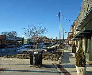
Outdoor events on Main Street are a big part of life in Tucker.
- Tucker Day is an annual event with a parade, food, artists, and music.
- Taste of Tucker and Tucker Chili Cook-Off are other yearly food events.
- The Tucker Cruise-In happens monthly from April to September, where people show off cool cars.
- The Farmers Market on Main Street offers fresh local produce.
Community groups often organize park and roadside cleanups. The Tucker Historical Society hosts events like Brownings Courthouse Day.
The Tucker High School varsity football team, the Tucker Tigers, is very popular. Many former and current residents come to watch their games.
Amateur Sports for All Ages
The Tucker Football League (TFL) and Triumph Youth Soccer Association (TYSA) are the biggest youth sports groups in the area. TYSA is the largest youth soccer association in DeKalb County.
Adults also enjoy sports, especially road bicycle racing. The weekly "Tucker Ride" is a challenging bike ride for experienced cyclists. The "Baby Tucker" ride is a bit easier.
Tucker's Economy: Businesses and Jobs
Tucker is home to the main offices for several well-known companies. These include Oglethorpe Power, YP Holdings (who publish The Real Yellow Pages), and Inland Seafood. The U.S. Poultry & Egg Association is also located here.
Community Improvement Districts (CIDs)
In 2013, the Tucker Community Improvement District (CID) was formed. It later changed its name to Tucker-Northlake CID. Tucker also has the Stone Mountain CID.
Commercial property owners in these districts agree to pay a small extra tax. This money is used to improve the community, like fixing roads, creating parks, and improving public transportation. This helps make Tucker a better place for businesses and residents.
Learning in Tucker: Education
In Tucker, most adults (91.4%) have finished high school, which is higher than the state average. Also, many adults (46.8%) have a college degree or higher.
Public Schools in Tucker
All public schools in Tucker are part of the DeKalb County School District. Tucker has several elementary, middle, and high schools.
Elementary Schools
- Briarlake Elementary School
- Brockett Elementary School
- Henderson Mill Elementary School
- Idlewood Elementary School
- Livsey Elementary School
- Midvale Elementary School
- Smoke Rise Charter Elementary School
- Stone Mill Elementary School
- Stone Mountain Elementary School
Middle Schools
- Henderson Middle School
- Stone Mountain Middle School
- Tucker Middle School
High Schools
- Lakeside High School
- Stone Mountain High School
- Tucker High School
How Tucker Works: Infrastructure
Tucker's growth was greatly helped by former DeKalb County Commissioner Scott Candler Sr. In the 1940s and 50s, he brought city services like better roads, public safety, water, and libraries to rural areas like Tucker. Local businesses also grew as more homes were built.
Today, DeKalb County continues to improve Tucker by adding green spaces and working on road projects.
Livable Centers Initiative: Making Tucker Better
In 2005, Tucker received a grant to develop a "Livable Cities Initiative" (LCI) plan. This plan aims to make Main Street a central hub for the community again. It also focuses on making the town center more friendly for walkers and other types of transportation.
Police, Fire, and Rescue Services
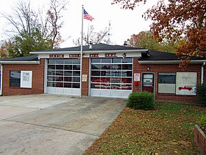
The DeKalb County Police Department headquarters is located in Tucker. Tucker also has two DeKalb County Fire and Rescue stations.
Parks and Recreation in Tucker
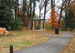
The Tucker area has over 230 acres (93 ha) of parks and recreation areas. These include lakes, creeks, trails, tennis courts, sports fields, a swimming pool, and playgrounds.
- Henderson Park
- Johns' Homestead (Undeveloped)
- Kelley C. Cofer Park
- Montreal Park
- Peters Park
- Smoke Rise Park
- Tucker Nature Preserve
- Tucker Recreational Center (Formerly Tucker Elementary School)
- Rosenfeld Park
Public Libraries
The DeKalb County Public Library has two branches in Tucker: the Tucker-Reid H. Cofer Library and the Northlake-Barbara Loar Library.
The Tucker-Reid H. Cofer Library moved to a new, larger building in 2010. This building is designed to be very energy efficient. The Northlake-Barbara Loar Library also expanded in 2009.
Getting Around Tucker: Transportation
Public Transit
MARTA, Atlanta's public transportation system, has nine daily bus routes that go through Tucker. These routes connect people to train stations south and west of the city.
Major Highways
 Interstate 285
 Interstate 85
U.S. Highways
State Routes
Walking and Biking Paths
- Stone Mountain Trail
- Tucker Path
Famous People From Tucker
- Kyle Sieg, NASCAR driver
- Ryan Sieg, NASCAR driver
- Shane Sieg, former NASCAR driver
- Asher Allen, former NFL player
- Patrick Pass, former NFL player
- A. J. Bouye, football player
- Steve Walsh, musician from the band Kansas
- Seantavius Jones, a professional football player
- Andy Stanley, founder and preacher of North Point Community Church
- Stephen Hill, former NFL player
- Brendan O'Brien, record producer and musician
Images for kids
See also
 In Spanish: Tucker (Georgia) para niños


