U.S. Route 6 in California facts for kids
Quick facts for kids
U.S. Route 6 |
||||
|---|---|---|---|---|
|
US 6 highlighted in red
|
||||
| Route information | ||||
| Defined by S&HC § 306 | ||||
| Maintained by Caltrans | ||||
| Length | 40.51 mi (65.19 km) | |||
| Existed | 1936–present | |||
| Major junctions | ||||
| South end | ||||
| North end | ||||
| Location | ||||
| Counties: | Inyo, Mono | |||
| Highway system | ||||
| United States Numbered Highways List • Bannered • Divided • Replaced State highways in California(list • pre-1964)
|
||||
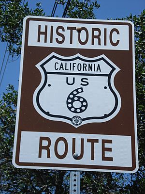
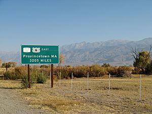
U.S. Route 6, also known as US 6, is a very long road that crosses the entire United States. It starts in Bishop, California, on the west side, and goes all the way to Provincetown, Massachusetts, on the east coast. The part of US 6 that runs through California is in the eastern part of the state. It stretches from Bishop in the Owens Valley north to the border with Nevada. Before 1964, US 6 used to go all the way to the Pacific Ocean in Long Beach, California. This longer route was part of a famous old road called the Grand Army of the Republic Highway.
Contents
What is US 6 Like?
US 6 starts in Inyo County, in the town of Bishop. Here, it meets US 395 near the Bishop Paiute-Shoshone Indian Colony. After leaving Inyo County, the highway enters Mono County. It then goes straight north to the town of Benton. In Benton, it connects with SR 120.
From Benton, the highway starts to climb up the lower parts of the White Mountains. It heads towards Montgomery Pass, which is in Nevada. The road reaches the state line before it gets to the top of the pass. While still in California, US 6 passes by Boundary Peak. This peak is the highest point in Nevada, even though it's seen from California.
US 6 is an important road in California. It is part of the California Freeway and Expressway System. This means it's a key road for fast travel. It's also part of the National Highway System. This system includes highways that are very important for the country's economy, defense, and for people to travel easily. The Federal Highway Administration decides which roads are part of this system. US 6 could also be named a State Scenic Highway. However, the California Department of Transportation has not officially called it a scenic highway yet.
History of US 6 in California

The California part of US 6 was officially opened in 1937. It was an extension of the highway that started in Greeley, Colorado. This was part of the historic Grand Army of the Republic Highway, which was an early "auto trail" for cars.
The Grand Army of the Republic Highway
Over time, US 6 was made even longer. It stretched south through the Mojave Desert and Los Angeles. It finally ended in Long Beach in Southern California. This longer route shared parts of the road with other highways. These included what are now US 395, SR 14 (also known as Sierra Highway), I-5, I-110 / SR 110, and SR 1.
When the famous Four Level Interchange was built in Los Angeles, US 6 was the first number given to the part of SR 110 there. The highway used to go from Long Beach west to San Pedro. Then it went north on Figueroa Street. For a short time, it ran with US 66 in Los Angeles. After that, it turned northwest and shared the road with US 99 on San Fernando Road.
Changes to the Highway Numbers
In 1964, a big change happened. All the parts of US 6 in California that were south of Bishop lost their official US 6 signs. The highway was shortened to only run from Bishop north to Nevada. This change was part of a large project to renumber highways in California that year.
Main Road Connections
Except where prefixed with a letter, postmiles were measured on the road as it was in 1964, based on the alignment that existed at the time, and do not necessarily reflect current mileage. R reflects a realignment in the route since then, M indicates a second realignment, L refers an overlap due to a correction or change, and T indicates postmiles classified as temporary (for a full list of prefixes, see the list of postmile definitions). Segments that remain unconstructed or have been relinquished to local control may be omitted. The numbers reset at county lines; the start and end postmiles in each county are given in the county column.
| County | Location | Postmile |
Destinations | Notes |
|---|---|---|---|---|
| Inyo INY R0.00-8.35 |
Bishop | 0.00 | This is where US 6 starts in the south; it used to go further south. | |
| Mono MNO 0.00-32.29 |
Benton | 25.72 | ||
| | 27.30 | Agricultural Inspection Station (only for cars going south) | ||
| | 32.29 | This is where US 6 continues into Nevada. | ||
| 1.000 mi = 1.609 km; 1.000 km = 0.621 mi | ||||
See also
 In Spanish: U.S. Route 6 (California) para niños
 | William Lucy |
 | Charles Hayes |
 | Cleveland Robinson |


