Sierra Highway facts for kids
Quick facts for kids Sierra Highway |
|
|---|---|
| El Camino Sierra | |
| Lua error in Module:Infobox_road/map at line 15: attempt to index field 'wikibase' (a nil value).
Sierra Highway highlighted in red
|
|
| Route information | |
| Length | 424 mi (682 km) |
| Existed | 1910–present |
| Component highways |
|
| Major junctions | |
| South end | San Fernando Road in Los Angeles |
| North end | |
| Location | |
| Counties: | Los Angeles, Kern, Inyo, Mono, Alpine, El Dorado |
| Highway system | |
| State highways in California(list • pre-1964) History • Unconstructed • Deleted • Freeway • Scenic |
|
The Sierra Highway is a famous road in Southern California, United States. It is also known as El Camino Sierra, which means "The Sierra Road" in Spanish. This name refers to a long trail that started in the 1800s. It was later turned into highways in the early 1900s. The full route goes from Los Angeles all the way to Lake Tahoe. It follows parts of modern roads like State Route 14, U.S. Route 395, and State Route 89.
Today, only two parts of this historic road are still called Sierra Highway. One part is an older section of State Route 14 and U.S. Route 6 that runs from Los Angeles to Mojave. This section is even called State Route 14U in Santa Clarita. The "U" means "un-relinquished," which we'll explain later. The second part of Sierra Highway is a section of U.S. Route 395 in Bishop.
This road travels through many different parts of California. It goes from the hot Mojave Desert to the tall Sierra Nevada mountains. People have been promoting El Camino Sierra since 1910 to show off California's amazing natural beauty. Even though much of the original Sierra Highway was replaced by faster freeways in the 1970s, it is still a very well-known road. A part of the road in the San Gabriel Mountains was even used to film the movie Duel.
Contents
Exploring the Sierra Highway Route
|
|
|
|---|---|
| Location: | Santa Clarita |
| Existed: | 1971–present |
El Camino Sierra connects Los Angeles to Lake Tahoe. It runs along the eastern side of California. The road passes through six different counties. These are Los Angeles, Kern, Inyo, Mono, Alpine, and El Dorado counties.
The part of the road called Sierra Highway goes from Los Angeles to Mojave. North of Mojave, the road is known by its number names. These include State Route 14, U.S. Route 395, and State Route 89. As the highway crosses California, it goes over several mountain passes. It crosses the San Gabriel Mountains at Soledad Pass. In the Sierra Nevada mountains, it goes over Sherwin Summit, Deadman Summit, Conway Summit, Devil's Gate Pass, Monitor Pass, and Luther Pass.
Southern California Sections
Sierra Highway starts in the northern part of Los Angeles. It meets San Fernando Road there. This spot used to be where two major U.S. highways, U.S. Route 99 and U.S. Route 6, met. It is also close to where modern freeways, Interstate 5 and State Route 14, meet today.
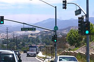
The highway is a main road in Santa Clarita. In 1971, the main State Route 14 was moved to a faster freeway. However, the old part of Route 14 was not officially removed from the state's control. So, this section is signed as California State Route 14U. The "U" means "un-relinquished," which means the state still owns it. The California Department of Transportation (Caltrans) still takes care of Sierra Highway (14U) for a certain distance. The rest of Sierra Highway in Santa Clarita is maintained by the city.
Sierra Highway, the modern Route 14, and a Union Pacific Railroad line all cross the San Gabriel Mountains. They reach the highest point at Soledad Pass, which is about 3,179 feet (969 meters) high. These three paths for travel take different routes up the mountains. They separate in Santa Clarita and come back together near Acton. Sierra Highway uses Mint Canyon. The railroad uses Soledad Canyon. The modern Route 14 uses a mix of ridges and side canyons. These canyons were formed by the Santa Clara River and its smaller streams.
After leaving the mountains, Sierra Highway enters the Antelope Valley. It becomes a main street in cities like Palmdale, Lancaster, and Rosamond. It runs next to the modern Route 14 and the railroad. It acts like a smaller road next to a main highway. Before reaching Mojave, the freeway part of Route 14 ends. The old Sierra Highway becomes a dirt path and then stops. From this point, the original Sierra Highway route joins State Route 14 and goes through downtown Mojave.
Connecting to U.S. Route 395 and State Route 89
North of Mojave, the paths of State Route 14, 89, and U.S. Route 395 have not changed much since they were first paved. This part is still called El Camino Sierra. Many sections have been made into a divided highway, which has two separate lanes for each direction. But most of these upgrades used the same path as the old two-lane road.
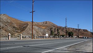
The highway cuts through Red Rock Canyon State Park. It then follows valleys along the edge of the Sierra Nevada mountains. While in the Owens Valley, Sierra Highway passes by Mount Whitney. This is the highest point in the contiguous United States, and it is about 10,000 feet (3,000 meters) above the highway. As of 2009, the only other part of the road still signed as Sierra Highway is a section of U.S. Route 395 in Bishop. This is after it separates from U.S. Route 6.
U.S. Route 395 was rebuilt in some areas, like when it goes up to Sherwin Summit and around Crowley Lake. Unlike the changes in southern California, the old roads here were given new names. They are now called Lower Rock Creek Road, Old Sherwin Grade, and Crowley Creek Road. They are not called Sierra Highway. From here to Lake Tahoe, the highway goes through mountains in the Sierra Nevada. This is how the highway got its name. In the Sierra Nevada, the road passes by popular places like Mammoth Mountain, Yosemite National Park, and Mono Lake.
El Camino Sierra leaves U.S. Route 395 just before the Nevada state line at Topaz Lake. It then follows State Route 89. This is the only part of the route that is not open all year. Caltrans closes Route 89 over Monitor Pass during the winter. If drivers want to go to Lake Tahoe in the winter, they can continue on U.S. Route 395 into Nevada. Then they can return to California using Nevada State Route 88 or Nevada State Route 207.
The History of El Camino Sierra
Early Explorers and Promotion
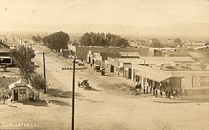
The first recorded trip along what would become El Camino Sierra was by Jedediah Smith in 1826. The trail was often used by prospectors during the California Gold Rush and Comstock Lode. Even when it was mostly a dirt road, many people started to promote El Camino Sierra as a beautiful scenic route.
In 1910, the Los Angeles Times newspaper announced that Governor Gillet had set aside money to build a new road. This road would connect El Camino Real with Yosemite National Park. When it was finished, it would create a "wonderful circuit" route. El Camino Sierra would become "one of the most beautiful scenic routes in the world."
In 1912, the Southern Pacific Railroad published an article called "Two Mules and a Motorist." It described a trip down El Camino Sierra. The article promoted the trail as a scenic side trip from its train lines, using pack mules. In 1915, the California Teachers Association shared a book at a big meeting. This book had an article praising this "soon-to-be-world-famous highway" called El Camino Sierra. The article said it was still mostly an unpaved trail. But it promised that county and state officials were working hard to improve the route. With the help of convict labor, it would soon be a "boulevard the entire distance from Los Angeles to Lake Tahoe." The article ended by saying El Camino Sierra was "a highway with a hundred by-ways, each by-way with a hundred wonders." It also asked the state government to make El Camino Sierra longer. It suggested extending it to Truckee, Quincy, and Susanville. This would follow a route similar to modern State Route 89 and SR 70, returning to US 395.
By 1918, El Camino Sierra was included in the Blue Book. This was an early road map of the United States. The Los Angeles Times announced that El Camino Sierra was complete on February 19, 1931. It said that the part from Mojave to Owens Valley was now paved. A special event would be held the following Sunday to celebrate.

Sierra Highway and Movies
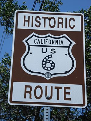
In the 1930s, two U.S. highways were extended into California using El Camino Sierra. Both of these highways were created in 1926. The southern end of U.S. Route 395 was extended from Spokane, Washington to San Diego by 1935. It used El Camino Sierra from near Topaz Lake to Inyern. By 1937, U.S. Route 6 was extended from Colorado to Long Beach. It used El Camino Sierra south of Bishop. As part of a highway renumbering in 1964, U.S. Route 6 was shortened to end at Bishop. The route from where it separated from U.S. Route 395 to Interstate 5 was renamed State Route 14.
Even though most of Sierra Highway was replaced by faster roads in the 1970s, the old two-lane road remained famous. In 1971, Steven Spielberg made his first full-length movie, Duel, along Sierra Highway near Acton. The movie is about a truck driver who chases and tries to harm a motorist. It clearly shows the desert parts of Sierra Highway. Because Duel is so well-known, one of the trucks used in the movie is still around and being fixed up. The person who owns it now has driven the truck along Sierra Highway for fun. They enjoy seeing the scared looks from drivers who recognize it. Other movies have also been filmed in this area, including scenes from The Terminator.
Major Road Connections
Here are some of the main roads that connect with Sierra Highway:
| County | Location | mi | km | Destinations | Notes | ||
|---|---|---|---|---|---|---|---|
| Los Angeles | Los Angeles | 0.0 | 0.0 | San Fernando Road, The Old Road | This is the south end of Sierra Highway. It used to be part of US 99. | ||
| 0.1 | 0.16 | This is an interchange. You can enter from I-5 north from San Fernando Road. You can enter from SR 14 from The Old Road. There are no exits or entrances from I-5 south. | |||||
| Santa Clarita | 2.5 | 4.0 | Newhall Avenue – Newhall, Saugus, Ventura | This used to be part of SR 126 west and San Fernando Road. This is where SR 14U and state maintenance begin. | |||
| 3.6 | 5.8 | Placerita Canyon Road – Palmdale | |||||
| 5.0 | 8.0 | Golden Valley Road | |||||
| 6.3 | 10.1 | This is where SR 14U and state maintenance end. An exit from SR 14 north connects directly to Sierra Highway. | |||||
| 7.3 | 11.7 | Soledad Canyon Road | |||||
| Agua Dulce | 18.8 | 30.3 | Agua Dulce Canyon Road | ||||
| | 24.9 | 40.1 | This is an interchange. | ||||
| Acton | 26.7 | 43.0 | Crown Valley Road – Acton | ||||
| 28.9 | 46.5 | Santiago Road | |||||
| 30.4 | 48.9 | This is an interchange. | |||||
| | 32.5 | 52.3 | This is an interchange. | ||||
| | 33.7 | 54.2 | Pearblossom Highway – Littlerock, Victorville | ||||
| Palmdale | 36.4 | 58.6 | Avenue S | ||||
| 37.9 | 61.0 | ||||||
| 39.5 | 63.6 | Rancho Vista Boulevard (Avenue P) | This road serves LA/Palmdale Regional Airport. | ||||
| 41.6 | 66.9 | R. Lee Eerney Avenue (Avenue N) | |||||
| 42.6 | 68.6 | Columbia Way (Avenue M) | |||||
| Lancaster | 43.6 | 70.2 | Avenue L | This is an interchange. | |||
| 44.6 | 71.8 | Avenue K | |||||
| 45.6 | 73.4 | ||||||
| 46.6 | 75.0 | Avenue I | |||||
| 47.7 | 76.8 | Avenue H | This is an interchange with a southbound entrance only. Other access is through Avenue G-12 and 7th Street West. | ||||
| 48.7 | 78.4 | Avenue G | |||||
| | 49.7 | 80.0 | Avenue F | ||||
| | 51.8 | 83.4 | |||||
| Kern | Rosamond | 57.8 | 93.0 | Rosamond Boulevard – Rosamond, Edwards AFB | |||
| | 64.1 | 103.2 | Backus Road | ||||
| | 67.3 | 108.3 | This is the south end where SR 14 overlaps. | ||||
| See SR 14 (KER R12.15–64.56) | |||||||
| Kern | | This is an interchange with a southbound exit and northbound entrance. It is the north end of SR 14 overlap and the south end of US 395 overlap. | |||||
| See US 395 (KER R29.64–MNO 116.96) | |||||||
| Mono | | This is the north end of US 395 overlap and the south end of SR 89 overlap. | |||||
| See SR 89 (MNO 0.00–ED 8.55) | |||||||
| El Dorado | | This is the north end of Sierra Highway and the north end of SR 89 overlap. | |||||
| 1.000 mi = 1.609 km; 1.000 km = 0.621 mi | |||||||
See also
 In Spanish: Autopista Sierra para niños
 | Chris Smalls |
 | Fred Hampton |
 | Ralph Abernathy |


