Warringah Council facts for kids
Quick facts for kids Warringah CouncilNew South Wales |
|||||||||||||||
|---|---|---|---|---|---|---|---|---|---|---|---|---|---|---|---|
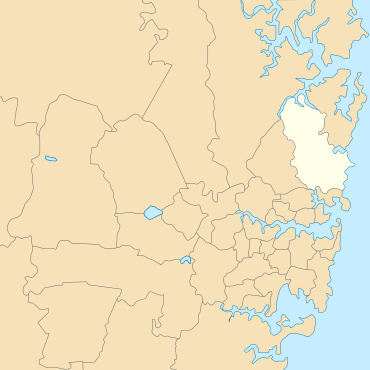
Location of Warringah Council, 1992–2016
|
|||||||||||||||
| Population | 140,741 (2011 census) | ||||||||||||||
| • Density | 938.3/km2 (2,430/sq mi) | ||||||||||||||
| Established | 7 March 1906 | ||||||||||||||
| Abolished | 12 May 2016 | ||||||||||||||
| Area | 150 km2 (57.9 sq mi) | ||||||||||||||
| Mayor | Michael Regan | ||||||||||||||
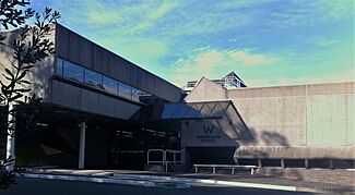
| Council seat | Warringah Civic Centre, Dee Why | ||||||||||||||
| Region | Metropolitan Sydney | ||||||||||||||
| State electorate(s) |
|
||||||||||||||
| Federal Division(s) | |||||||||||||||
 |
|||||||||||||||
| Website | Warringah Council | ||||||||||||||
|
|||||||||||||||
Warringah Council was a local government area in the northern beaches part of Sydney, New South Wales, Australia. It was created on March 7, 1906, as the "Warringah Shire Council." Later, in 1993, its name changed to "Warringah Council."
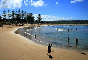
In 1992, a part of Warringah Shire became a separate council called Pittwater Council. After this, Warringah Council managed about 152 square kilometres of land. This area included nine beaches and 14 kilometres of coastline. Before it closed, it had 6,000 hectares of natural bushland. Narrabeen Lagoon was its northern border, and Manly Lagoon was its southern border.
On May 12, 2016, the government announced that Warringah Council would join with Pittwater Council and Manly Council. Together, they formed the new Northern Beaches Council. The last mayor of Warringah Council was Michael Regan. He was elected on September 13, 2008. The council's main office was at the Warringah Civic Centre in Dee Why.
Suburbs and Localities
Warringah Council included many suburbs and smaller areas. These places were part of the council's responsibility.
The following suburbs were located within Warringah Council:
- Allambie Heights
- Beacon Hill
- Belrose
- Brookvale
- Collaroy
- Collaroy Plateau
- Cottage Point
- Cromer
- Curl Curl
- Davidson
- Dee Why
- Duffys Forest
- Forestville
- Frenchs Forest
- Freshwater
- Ingleside
- Killarney Heights
- Manly Vale
- Narrabeen
- Narraweena
- North Balgowlah
- North Curl Curl
- North Manly
- Oxford Falls
- Queenscliff
- Terrey Hills
- Wheeler Heights
The following smaller areas (localities) were also part of Warringah Council:
- Akuna Bay
- Allambie
- Bantry Bay
- Bungaroo
- Collaroy Beach
- Cromer Heights
- Curl Curl Beach
- Dee Why Beach
- Fishermans Beach (Collaroy)
- Freshwater Beach
- Gooseberry Flat
- Long Reef Beach (Collaroy)
- Narrabeen Beach
- Narrabeen Peninsula
- North Curl Curl Beach
- North Narrabeen Beach
- Peach Trees
- Sorlie
- Wingala
How the Council Worked
A council is a group of people elected to make decisions for a local area. Warringah Council had a mayor and councillors. They worked together to manage local services and planning.
Council Members and Elections
The number of councillors and how they were elected changed over time.
| Term | Councillors | Wards | President/Mayor |
|---|---|---|---|
| 1906 (Temporary) | 5 | No wards | N/A |
| 1906–1914 | 6 (2 per ward) | A Riding B Riding C Riding |
Annual election by Councillors |
| 1914–1962 | 9 (3 per ward) | ||
| 1962–1968 | 15 (5 per ward) | ||
| 1968–1977 | 12 (4 per ward) | ||
| 1977–1992 | 12 (3 per ward) | A Riding B Riding C Riding D Riding |
|
| 1992–1993 | 9 (3 per ward) | A Riding B Riding C Riding |
|
| 1993–2008 | A Ward B Ward C Ward |
||
| 2008–2016 | 10 (3 per ward, 1 mayor) | Direct quadrennial election |
In its final years (2008-2016), Warringah Council had ten members. This included the mayor and nine other councillors. The mayor was chosen directly by voters every four years. The other nine councillors were elected from three different areas called "wards." Each ward elected three councillors. The last election was held on September 8, 2012.
History of Warringah
The land of Warringah was originally home to Aboriginal people. Sadly, many of them disappeared from the area after Europeans arrived. This was mainly due to a smallpox outbreak in 1789.
The name "Warringah" comes from an Aboriginal word. It means "Middle Harbour." This word was written down by a surveyor named James Larmer in 1832. The name also means "grey head" or "signs of rain" in other Aboriginal languages.
Europeans explored Warringah soon after they settled in Sydney in 1788. But for most of the 1800s, it remained a rural area. There were only small communities in the valleys. Even though it was close to Sydney, traveling there by land was a very long journey.
Beginning of Warringah Shire Council
On March 7, 1906, the Warringah Shire was officially created. This happened because of a new law called the Local Government (Shires) Act 1905. Warringah was one of 133 new shires formed. It stretched from Broken Bay in the north to Manly Lagoon in the south. To the west, it reached Middle Harbour Creek and Cowan Creek.
The new shire covered about 264 square kilometres. Around 2,800 people lived there in 700 homes. People who owned property worth at least five pounds could vote for up to nine councillors. These councillors served for three years.
At first, a temporary council was put in place. The first meeting of this temporary council was on June 19, 1906. It took place in the Narrabeen Progress Hall. The first official election for Warringah Shire Council was on November 24, 1906. The six elected councillors met for the first time on December 3. Thomas Fisbourne was chosen as the first Shire President.
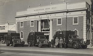
The council first met in Narrabeen. Later, they moved to a special building in Brookvale. This building became too small. So, in 1912, the council moved to a new Shire Hall in Brookvale. They stayed there for 60 years.
Growth and Development
In the early 1920s, Warringah Shire started bringing electricity to the area. The electricity supply and streetlights were officially ready on March 29, 1923. A tramline was also built. It ran along Pittwater Road from Manly Lagoon to Narrabeen. Another line went through Harbord to Freshwater Beach.
The opening of the Spit and Roseville bridges in 1924 made it easier to travel to Warringah. The Sydney Harbour Bridge opening in 1932 made it even easier. At first, many people built weekend or holiday homes here. Surf clubs and rock pools also started to appear on the beaches.
After World War II, more families began to build permanent homes. This was especially true near the beaches. Shops, small businesses, and better public facilities followed. Around this time, the tram lines were removed to make way for more roads for cars.
In the 1970s and 1980s, more suburbs grew in the Northern Beaches. Warringah Council made long-term plans for this growth. A new Dee Why civic centre began construction in 1971. It was designed by a famous architect, Colin Madigan. This new building replaced the old Shire Hall in Brookvale. The civic centre was finished in 1972, and the council has been there since 1973.
In November 1979, Warringah Council opened the Warringah Aquatic Centre. It was located in Frenchs Forest. This centre hosted major swimming events, including the 1992 Olympic trials. The Glen Street Theatre also opened in July 1985. It was part of the Forest Community Centre.
Pittwater Council Separates
From 1906, Warringah Council was divided into areas called A, B, and C Ridings. In 1977, a new D Riding was added. For many years, some people in A Riding felt their area was being ignored. They thought the council's plans were not right for them.
In 1991, people in A Riding voted on whether to separate from Warringah Council. Most people who voted (73.5%) wanted to separate. Even though not everyone voted, the Minister for Local Government, Gerry Peacocke, decided to let A Riding become its own council. This new council was named Pittwater Council.
On May 2, 1992, the new Municipality of Pittwater was officially created. It covered the area that used to be 'A' Riding of Warringah Shire.
Renamed "Warringah Council"
After Pittwater separated, a new law was passed in 1993. This law meant Warringah dropped "Shire" from its name. It became "Warringah Council." The "Shire Clerk" became the "General Manager," and the "Shire President" became the "Mayor." The remaining B, C, and D Ridings were renamed A, B, and C Wards.
Council Symbols
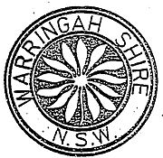
The traditional symbol of Warringah was the flannel flower. This flower grows commonly in the bushland and coastal areas of the Northern Beaches. The council chose it as its symbol in 1906. A lawyer named Ernest Henry Tebbutt said the flannel flower was a gentle and natural symbol for the new council.
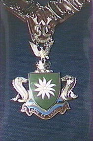
Warringah Council adopted a coat of arms in 1968. This coat of arms can be seen on the mayor's chain and on old council street signs. It features dolphins, a wedge-tailed eagle, a flannel flower, and the Latin motto, "Arte et Labore" (meaning "by Skill and Labour").
In 1994, the council changed its logo to a rectangle with the flannel flower. A graphic designer named Bev Biram created it. It had a white flannel flower on a blue background (for the sea) and a green stem (for the bushland). In 2013, a new logo with a "W" was adopted. Mayor Michael Regan explained that the flannel flower was used by other councils too. However, the flannel flower remained the official council seal and flower symbol.
Times the Council Was Managed by Others
Warringah Council was temporarily managed by appointed administrators a few times. This happened when there were serious concerns about how the council was being run.
1967
In April 1967, the council was temporarily managed by others. This happened after two councillors faced legal issues related to development decisions.
1985
The council was again temporarily managed by others in December 1985. This was due to concerns about how development applications were handled. After investigations, it was found that there was no evidence of wrongdoing by the councillors. The council was returned to elected members in 1987. Seven councillors from the previous council were re-elected, including the shire president, Ted Jackson.
2003
On January 15, 2003, a public inquiry looked into Warringah Council. The inquiry found that the community had lost trust in the councillors. It was suggested that the council should be temporarily managed by an administrator. It was also recommended to make it easier to get information from the council.
Following this report, Warringah Council was temporarily managed by Dick Persson AM starting July 23, 2003. His term was extended until the local elections in September 2008.
Joining Other Councils in 2016
In 2015, the NSW Government reviewed local councils. They suggested that Warringah Council should join with nearby councils. Warringah Council itself suggested joining with Pittwater and Manly councils. Many people from the Northern Beaches supported this idea. In fact, 65% of all submissions about council changes across the state came from Northern Beaches residents.
On May 12, 2016, the Northern Beaches Council was officially formed. It brought together Manly, Pittwater, and Warringah councils. The first meeting of the new Northern Beaches Council was held on May 19, 2016, at Manly Town Hall.
Awards
In 2015, Warringah Council won the AR Bluett Award for the second time. They first won this award in 1973. This award is known as a very important achievement for a council.
 | Sharif Bey |
 | Hale Woodruff |
 | Richmond Barthé |
 | Purvis Young |


