Washington County, Georgia facts for kids
Quick facts for kids
Washington County
|
|
|---|---|

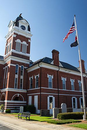
County courthouse
|
|

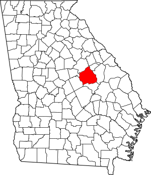
Location within the U.S. state of Georgia
|
|
 Georgia's location within the U.S. |
|
| Country | |
| State | |
| Founded | February 25, 1784 |
| Named for | George Washington |
| Seat | Sandersville |
| Largest city | Sandersville |
| Area | |
| • Total | 684 sq mi (1,770 km2) |
| • Land | 678 sq mi (1,760 km2) |
| • Water | 5.9 sq mi (15 km2) 0.9%% |
| Population
(2020)
|
|
| • Total | 19,988 |
| • Estimate
(2023)
|
19,820 |
| • Density | 29.222/sq mi (11.283/km2) |
| Time zone | UTC−5 (Eastern) |
| • Summer (DST) | UTC−4 (EDT) |
| Congressional district | 12th |
Washington County is a place in the state of Georgia, USA. In 2020, about 19,988 people lived there. Its main town, or county capital, is Sandersville.
The county was created on February 25, 1784. It is named after George Washington, a famous general from the American Revolutionary War and the first President of the United States.
Contents
Exploring Washington County's Geography
Washington County covers a total area of about 684 square miles. Most of this area, about 678 square miles, is land. The remaining 5.9 square miles (0.9%) is water.
The western part of the county, including the area west of Sandersville, is in the Lower Oconee River area. This river flows into the larger Altamaha River.
The northeastern part of the county, north of Riddleville, is part of the Upper Ogeechee River area. The southeastern part, around Harrison, is in the Ohoopee River area, which also flows into the Altamaha River.
Main Roads in Washington County
Many important roads help people travel through Washington County. These roads connect different towns and areas within the county and to other parts of Georgia.
Neighboring Counties
Washington County shares its borders with several other counties in Georgia. These include:
- Glascock County (to the northeast)
- Jefferson County (to the east)
- Johnson County (to the south)
- Wilkinson County (to the southwest)
- Baldwin County (to the west)
- Hancock County (to the northwest)
Towns and Communities
Washington County has several towns and communities where people live and work.
Cities
- Davisboro
- Oconee
- Sandersville (This is the county's main town)
- Tennille
Towns
Other Communities
- Warthen (a census-designated place)
- Ennis
- Goat Town
- Hamburg
- Irwins Crossroads
- Pringle
- Sun Hill
- Veal
Who Lives in Washington County?
The number of people living in Washington County has changed over many years. The U.S. Census counts the population every ten years.
| Historical population | |||
|---|---|---|---|
| Census | Pop. | %± | |
| 1790 | 4,552 | — | |
| 1800 | 10,300 | 126.3% | |
| 1810 | 9,940 | −3.5% | |
| 1820 | 10,627 | 6.9% | |
| 1830 | 9,820 | −7.6% | |
| 1840 | 10,565 | 7.6% | |
| 1850 | 11,766 | 11.4% | |
| 1860 | 12,698 | 7.9% | |
| 1870 | 15,842 | 24.8% | |
| 1880 | 21,964 | 38.6% | |
| 1890 | 25,237 | 14.9% | |
| 1900 | 28,227 | 11.8% | |
| 1910 | 28,174 | −0.2% | |
| 1920 | 28,147 | −0.1% | |
| 1930 | 25,030 | −11.1% | |
| 1940 | 24,230 | −3.2% | |
| 1950 | 21,012 | −13.3% | |
| 1960 | 18,903 | −10.0% | |
| 1970 | 17,480 | −7.5% | |
| 1980 | 18,842 | 7.8% | |
| 1990 | 19,112 | 1.4% | |
| 2000 | 21,176 | 10.8% | |
| 2010 | 21,187 | 0.1% | |
| 2020 | 19,988 | −5.7% | |
| 2023 (est.) | 19,820 | −6.5% | |
| U.S. Decennial Census 1790-1880 1890-1910 1920-1930 1930-1940 1940-1950 1960-1980 1980-2000 2010 2020 |
|||
Population in 2020
In 2020, the census counted 19,988 people living in Washington County. There were 7,503 households and 5,315 families.
The population is made up of different groups. In 2020, about 42% of the people were White (not Hispanic). About 53.5% were Black or African American (not Hispanic). Other groups, including Asian, Native American, and people of mixed races, made up smaller parts of the population. About 1.67% of the people were Hispanic or Latino.

Schools and Learning
The Washington County School District manages the public schools in the county. These schools help students learn and grow.
- Ridge Road Elementary School
- T.J. Elder Middle School
- Washington County High School
There is also one private school in the county:
- Brentwood School
See also
 In Spanish: Condado de Washington (Georgia) para niños

