
Wentworth, New Hampshire facts for kids
Quick facts for kids
Wentworth, New Hampshire
|
|
|---|---|
|
Town
|
|

Wentworth Common
|
|

Location in Grafton County, New Hampshire
|
|
| Country | United States |
| State | New Hampshire |
| County | Grafton |
| Incorporated | 1766 |
| Area | |
| • Total | 42.1 sq mi (109.0 km2) |
| • Land | 41.6 sq mi (107.7 km2) |
| • Water | 0.5 sq mi (1.3 km2) 1.22% |
| Elevation | 630 ft (190 m) |
| Population
(2020)
|
|
| • Total | 845 |
| • Density | 20/sq mi (7.8/km2) |
| Time zone | UTC-5 (Eastern) |
| • Summer (DST) | UTC-4 (Eastern) |
| ZIP code |
03282
|
| Area code(s) | 603 |
| FIPS code | 33-80500 |
| GNIS feature ID | 0873752 |
Wentworth is a small town located in Grafton County, New Hampshire, United States. In 2020, about 845 people lived there. This town is special because it has a beautiful central area called a common. A classic church and old homes surround this common. Wentworth is also home to the Plummer's Ledge Natural Area. Part of the White Mountain National Forest is in the town's northeast section.
Contents
Exploring Wentworth's Past
How Wentworth Began
Wentworth was officially created on November 1, 1766. Governor Benning Wentworth gave the land to John Page and 60 other people. The town was named after the governor himself. Many of the first settlers came from Massachusetts, especially from a town called Salisbury.
A Charming New England Village
Since the 1800s, Wentworth has been known for its charm. Its pretty New England common sits on a raised piece of land. People often said that Wentworth had "more than ordinary share" of beautiful scenery.
Farming and Lumber in Early Wentworth
Early settlers were farmers who grew crops in the rich soil near the rivers. The Boston, Concord & Montreal Railroad also passed through the town. Wentworth had a lot of water power from the Baker River. This helped it become a town known for producing lumber, with nine sawmills.
The Great Flood of 1856
A big disaster happened on August 6, 1856. Dams on the Upper and Lower Baker ponds in Orford broke during a flash flood. A huge wall of water rushed down Pond Brook into the Baker River. This powerful water traveled about 3 miles (5 km) down the rocky river channel. It destroyed many of Wentworth's riverside mills, houses, barns, sheds, and roads. The flood also made the river nearly 90 feet (27 meters) wider.
Image:Wentworth_Common_Houses.JPG|Homes around Wentworth Common Image:Wentworth Town Offices.JPG|The town offices Image:Webster_Memorial_Library_Wentworth.JPG|The Webster Memorial Library Template:/gallery
Wentworth's Location and Landscape
Where is Wentworth Located?
The town of Wentworth covers about 109.0 square kilometers (42.1 square miles). Most of this area is land, with only a small part being water. The Baker River and its South Branch flow through the town. These rivers are part of the larger Pemigewasset and Merrimack River systems.
Highest Point and Main Roads
The highest point in Wentworth is Carr Mountain. It stands at 3,453 feet (1,052 meters) above sea level in the northeast part of town. Major roads like New Hampshire Route 25 and New Hampshire Route 118 cross the town from north to south. New Hampshire Route 25A starts in the town center and goes west towards Orford.
Who Lives in Wentworth?
Population Changes Over Time
The number of people living in Wentworth has changed quite a bit over the years. In 1790, there were only 241 residents. The population grew to over 1,000 people by the mid-1800s. However, it then decreased for many years, reaching a low of 300 people in 1960. Since then, the population has slowly grown again. In 2020, 845 people lived in Wentworth.
| Historical population | |||
|---|---|---|---|
| Census | Pop. | %± | |
| 1790 | 241 | — | |
| 1800 | 488 | 102.5% | |
| 1810 | 645 | 32.2% | |
| 1820 | 807 | 25.1% | |
| 1830 | 924 | 14.5% | |
| 1840 | 1,119 | 21.1% | |
| 1850 | 1,197 | 7.0% | |
| 1860 | 1,055 | −11.9% | |
| 1870 | 971 | −8.0% | |
| 1880 | 939 | −3.3% | |
| 1890 | 698 | −25.7% | |
| 1900 | 617 | −11.6% | |
| 1910 | 595 | −3.6% | |
| 1920 | 507 | −14.8% | |
| 1930 | 459 | −9.5% | |
| 1940 | 491 | 7.0% | |
| 1950 | 413 | −15.9% | |
| 1960 | 300 | −27.4% | |
| 1970 | 376 | 25.3% | |
| 1980 | 527 | 40.2% | |
| 1990 | 630 | 19.5% | |
| 2000 | 798 | 26.7% | |
| 2010 | 911 | 14.2% | |
| 2020 | 845 | −7.2% | |
| U.S. Decennial Census | |||
A Look at the People in 2000
Based on the census from 2000, there were 798 people living in Wentworth. There were 310 households, which are groups of people living together in one home. Most people in Wentworth were White. A small number of people were African American, Asian, or from other backgrounds.
About 31.9% of households had children under 18 living with them. The average household had about 2.57 people. The average family had about 3.04 people. The median age in town was 40 years old. This means half the people were younger than 40 and half were older.
Wentworth's Weather
What is the Climate Like?
Wentworth has a warm-summer humid continental climate. This means it has warm summers and cold, snowy winters. The weather can change a lot between seasons.
Record Temperatures
The hottest temperature ever recorded in Wentworth was 97°F (36°C). This happened on August 16, 2002, and again on August 12–13, 2016. The coldest temperature ever recorded was -25°F (-32°C). This very cold day occurred on January 16–17, 2009.
| Climate data for Wentworth, New Hampshire, 1991–2020 normals, extremes 2000–present | |||||||||||||
|---|---|---|---|---|---|---|---|---|---|---|---|---|---|
| Month | Jan | Feb | Mar | Apr | May | Jun | Jul | Aug | Sep | Oct | Nov | Dec | Year |
| Record high °F (°C) | 60 (16) |
64 (18) |
85 (29) |
90 (32) |
95 (35) |
95 (35) |
96 (36) |
97 (36) |
96 (36) |
82 (28) |
78 (26) |
65 (18) |
97 (36) |
| Mean maximum °F (°C) | 46.6 (8.1) |
50.7 (10.4) |
58.6 (14.8) |
73.1 (22.8) |
86.4 (30.2) |
89.2 (31.8) |
90.8 (32.7) |
88.9 (31.6) |
86.1 (30.1) |
73.6 (23.1) |
63.8 (17.7) |
50.0 (10.0) |
92.5 (33.6) |
| Mean daily maximum °F (°C) | 29.4 (−1.4) |
33.1 (0.6) |
42.2 (5.7) |
55.5 (13.1) |
68.4 (20.2) |
76.6 (24.8) |
82.0 (27.8) |
80.7 (27.1) |
72.5 (22.5) |
58.6 (14.8) |
46.3 (7.9) |
35.2 (1.8) |
56.7 (13.7) |
| Daily mean °F (°C) | 18.2 (−7.7) |
20.6 (−6.3) |
29.8 (−1.2) |
42.3 (5.7) |
54.3 (12.4) |
63.3 (17.4) |
68.6 (20.3) |
66.9 (19.4) |
59.5 (15.3) |
46.9 (8.3) |
35.8 (2.1) |
25.4 (−3.7) |
44.3 (6.8) |
| Mean daily minimum °F (°C) | 7.0 (−13.9) |
8.0 (−13.3) |
17.4 (−8.1) |
29.0 (−1.7) |
40.1 (4.5) |
49.9 (9.9) |
55.2 (12.9) |
53.1 (11.7) |
46.4 (8.0) |
35.3 (1.8) |
25.3 (−3.7) |
15.6 (−9.1) |
31.9 (−0.1) |
| Mean minimum °F (°C) | −11.4 (−24.1) |
−8.8 (−22.7) |
−0.7 (−18.2) |
19.3 (−7.1) |
28.3 (−2.1) |
38.1 (3.4) |
45.5 (7.5) |
44.4 (6.9) |
32.8 (0.4) |
23.3 (−4.8) |
12.6 (−10.8) |
−0.8 (−18.2) |
−15.1 (−26.2) |
| Record low °F (°C) | −25 (−32) |
−24 (−31) |
−13 (−25) |
5 (−15) |
19 (−7) |
30 (−1) |
42 (6) |
40 (4) |
26 (−3) |
17 (−8) |
−4 (−20) |
−15 (−26) |
−25 (−32) |
| Average precipitation inches (mm) | 2.75 (70) |
2.30 (58) |
3.01 (76) |
3.35 (85) |
3.56 (90) |
4.12 (105) |
4.61 (117) |
3.87 (98) |
3.62 (92) |
4.66 (118) |
3.50 (89) |
3.55 (90) |
42.90 (1,090) |
| Average snowfall inches (cm) | 17.8 (45) |
20.2 (51) |
13.3 (34) |
3.2 (8.1) |
0.1 (0.25) |
0.0 (0.0) |
0.0 (0.0) |
0.0 (0.0) |
0.0 (0.0) |
0.8 (2.0) |
3.0 (7.6) |
18.1 (46) |
76.5 (193.95) |
| Average extreme snow depth inches (cm) | 11.7 (30) |
16.7 (42) |
13.3 (34) |
5.5 (14) |
0.1 (0.25) |
0.0 (0.0) |
0.0 (0.0) |
0.0 (0.0) |
0.0 (0.0) |
0.3 (0.76) |
2.6 (6.6) |
9.7 (25) |
18.2 (46) |
| Average precipitation days (≥ 0.01 in) | 11.7 | 10.4 | 9.4 | 11.4 | 15.0 | 16.1 | 15.7 | 13.7 | 11.3 | 16.6 | 12.4 | 13.1 | 156.8 |
| Average snowy days (≥ 0.1 in) | 9.8 | 9.2 | 5.8 | 2.1 | 0.1 | 0.0 | 0.0 | 0.0 | 0.0 | 0.4 | 2.4 | 8.5 | 38.3 |
| Source 1: NOAA | |||||||||||||
| Source 2: National Weather Service | |||||||||||||
Famous People from Wentworth
Wentworth has been home to a few notable people:
- Charles Henry Turner (1861–1913) was a US congressman.
- Thomas Whipple, Jr. (1787–1835) was also a US congressman.
Images for kids
-
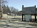
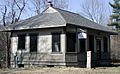
Wentworth Transfer Station
-
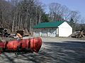
Wentworth Town Garage
-
Wentworth Post Office
-
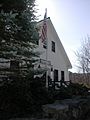
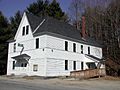
Wentworth Congregational Church
-
Wentworth Historical Museum
-
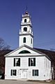
Wentworth Town Hall
-
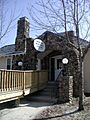
Webster Memorial Library Entrance
-
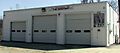
Wentworth Volunteer Fire Department


See also
 In Spanish: Wentworth (Nuevo Hampshire) para niños
