
Ashland County, Wisconsin facts for kids
Quick facts for kids
Ashland County
|
|
|---|---|

Ashland County Courthouse
|
|

Location within the U.S. state of Wisconsin
|
|
 Wisconsin's location within the U.S. |
|
| Country | |
| State | |
| Founded | March 27, 1860 |
| Named for | Henry Clay's farm Ashland |
| Seat | Ashland |
| Largest city | Ashland |
| Area | |
| • Total | 2,292 sq mi (5,940 km2) |
| • Land | 1,045 sq mi (2,710 km2) |
| • Water | 1,247 sq mi (3,230 km2) 54% |
| Population
(2020)
|
|
| • Total | 16,027 |
| • Estimate
(2023)
|
16,079 |
| • Density | 15.3/sq mi (5.9/km2) |
| Time zone | UTC−6 (Central) |
| • Summer (DST) | UTC−5 (CDT) |
| Congressional district | 7th |
Ashland County is a county in the state of Wisconsin. It is located in the northern part of the state. In 2020, about 16,027 people lived there. The main city and county seat is Ashland.
The county was created on March 27, 1860. It was formed from parts of La Pointe County. Part of the Bad River Band of the Lake Superior Tribe of Chippewa Indians reservation is also in Ashland County.
Contents
History
Ashland County got its name from a famous farm. This farm was called Ashland. It belonged to Henry Clay, a well-known politician from Kentucky. One of the people who helped start the city of Ashland really admired Henry Clay.
Geography
Ashland County is quite large. It covers a total area of about 2,292 square miles. A big part of this area is water, about 1,247 square miles. This means that more than half of the county (54%) is covered by water. It is the second-largest county in Wisconsin by total area.
The Apostle Islands are a group of islands in Lake Superior. Most of these islands are located in Ashland County. Only a few, like Eagle and Sand Islands, are in Bayfield County.
Neighboring Counties
Ashland County shares its borders with several other counties:
- Iron County – to the east
- Price County – to the southeast
- Sawyer County – to the southwest
- Bayfield County – to the northwest
- Lake County, Minnesota – to the northwest
- Cook County, Minnesota – to the north
- Ontonagon County, Michigan – to the northeast
- Gogebic County, Michigan – to the northeast
Main Roads
Several important roads run through Ashland County. These roads help people travel around the area.
|
|
Railroads
- Watco
Buses
- Bay Area Rural Transit
- Indian Trails
Airports
- John F. Kennedy Memorial Airport (KASX) serves the county.
- Major Gilbert Field Airport (4R5) also helps with air travel.
Protected Natural Areas
Parts of two important natural areas are found in Ashland County:
- Apostle Islands National Lakeshore
- Chequamegon National Forest
Population Information
| Historical population | |||
|---|---|---|---|
| Census | Pop. | %± | |
| 1860 | 515 | — | |
| 1870 | 221 | −57.1% | |
| 1880 | 1,559 | 605.4% | |
| 1890 | 20,063 | 1,186.9% | |
| 1900 | 20,176 | 0.6% | |
| 1910 | 21,965 | 8.9% | |
| 1920 | 24,538 | 11.7% | |
| 1930 | 21,054 | −14.2% | |
| 1940 | 21,801 | 3.5% | |
| 1950 | 19,461 | −10.7% | |
| 1960 | 17,375 | −10.7% | |
| 1970 | 16,743 | −3.6% | |
| 1980 | 16,783 | 0.2% | |
| 1990 | 16,307 | −2.8% | |
| 2000 | 16,866 | 3.4% | |
| 2010 | 16,157 | −4.2% | |
| 2020 | 16,027 | −0.8% | |
| U.S. Decennial Census 1790–1960 1900–1990 1990–2000 2010 2020 |
|||
In 2020, the population of Ashland County was 16,027 people. The county has a mix of different backgrounds. Most residents are White, and a significant number are Native American. There are also smaller groups of Black, Asian, and Pacific Islander residents. Some people identify with two or more races. About 2.4% of the population is of Hispanic or Latino heritage.
Communities
Ashland County has different types of communities. These include cities, a village, and many towns and smaller places.
Cities
- Ashland (This is the county seat. Part of it is in Bayfield County.)
- Mellen
Village
Towns
Census-designated places
These are areas that are like towns but are not officially incorporated as cities or villages.
- Bayfront
- Birch Hill
- Clam Lake
- Diaperville
- Franks Field
- Glidden
- Jolmaville
- Marengo
- New Odanah
- Odanah
Unincorporated communities
These are smaller places that don't have their own local government.
Images for kids
-
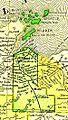
An old map of Ashland County from 1895.
-
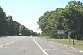
A sign welcoming you to Ashland County on U.S. Route 2.


See also
 In Spanish: Condado de Ashland (Wisconsin) para niños
