Barra Head facts for kids
| Gaelic name | Beàrnaraigh |
|---|---|
| Norse name | Bjarnaray |
| Meaning of name | Old Norse for "Bjørn's island" |
| OS grid reference | NL553799 |
| Coordinates | 56°48′N 7°39′W / 56.8°N 7.65°W |
| Physical geography | |
| Island group | Uist and Barra |
| Area | 204 ha (0.79 sq mi) |
| Area rank | 107 |
| Highest elevation | Sotan, 193 m (633 ft) |
| Administration | |
| Sovereign state | United Kingdom |
| Country | Scotland |
| Council area | Outer Hebrides |
| Demographics | |
| Population | 0 |
Barra Head, also known as Berneray (Scottish Gaelic: Beàrnaraigh), is the most southern island in the Outer Hebrides of Scotland. It's part of the Barra Isles group of islands. The name "Barra Head" first referred only to the very southern tip of Berneray. Now, it's a common name for the whole island. The highest point on the island is a hill called Sotan.
People have lived on Barra Head since ancient times. Between 20 and 50 people lived there permanently for many centuries, with the most people living there in the 1800s. The islanders made a living by farming, fishing, and hunting birds. The tall cliffs are home to many seabirds, so many that Berneray is now a special protected area for them.
The Barra Head Lighthouse, designed by Robert Stevenson, has been working since 1833. From 1931 to 1980, only the lighthouse keepers and their families lived on Barra Head. Now, the lighthouse works by itself, and no one lives on the island anymore. The rough seas around the island have even been used to test new lifeboat designs.
Contents
What Does Barra Head Mean?
The name "Berneray" comes from the Old Norse words for "Bjorn's island." This name then became Beàrnaraigh in Gaelic, and finally "Berneray" in English.
Other Names for Berneray
The island has a few other Gaelic names. Beàrnaraigh Cheann Bharraigh means "Berneray of Barra Head." This refers to the southern tip of the island. Another name, Beàrnaraigh an Easbaig, means "Berneray of the Bishop." This name points to the "Bishop's Isles," which is another name for the Barra Isles group. "Barra Head" is also an English name used for the island.
Where is Barra Head Located?
Berneray is located west of the Sea of the Hebrides. It lies south of Mingulay, separated by the Sound of Berneray, which has strong ocean currents. The island is shaped like a wedge, about 3 kilometres (1.9 mi) long and 1.3 kilometres (0.8 mi) wide.
Island Features and Rocks
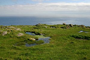
The island doesn't have many different types of land. There are no large valleys or bays, and the few streams are very small. Most of the island is made of a type of rock called gneiss. However, the lighthouse was built using granite from a small quarry on the island.
The ocean floor to the west of the island is also made of gneiss, about 120 to 140 metres (390 to 460 ft) deep. This rocky area extends south of Barra Head for at least 50 kilometres (31 mi). Because of glaciers in the past, the sea channel to the east is much deeper, reaching up to 365 metres (1,198 ft).
Coasts and Cliffs
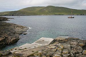
The northern coast is rocky and has a small landing spot called Leac na Fealia. Further east, there's a small jetty at Achduin. From there, a path goes up towards the lighthouse. West of Achduin, the land is flatter and lower, known as "The Aird." This area ends at Nisam Point, which looks out over the small islands of Rubha Niosaim and Sgeir Mhor.
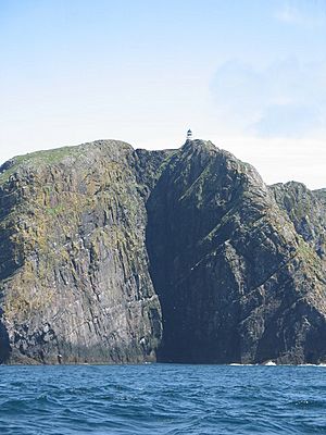
The southern coast has very high cliffs, reaching 190 metres (620 ft) at Skate Point in the southwest. Barra Head itself is the southern point in the middle of the south coast. The highest point on the island is Sotan, a hill whose top is above high cliffs between Barra Head and Skate Point. You can easily reach Sotan from the path that goes from Achduin to the lighthouse. The lighthouse is located near Sròn an Duin, just east of Skate Point, above a narrow gap called Sloc na Bèiste (which means "ravine of the monster").
History of Barra Head
People have lived on Berneray since prehistoric times, long before written history. Experts have found 83 old sites on the island, most of them from before the Middle Ages. There are four ancient tombs and five other sites that might be burial mounds. This suggests that many people lived here during the Neolithic (New Stone Age) and Bronze Age.
Ancient Forts and Chapels
The fort of Dùn Briste (the broken fort) is in the northwest. Another ancient site nearby was mostly destroyed when the lighthouse was built. A writer named Martin Martin visited in the late 1600s and described this fort as having "little apartments" inside its walls. A century later, Edward MacQueen thought it might have been a "watch tower."
There's also a place where a chapel might have been, near MacLean's Point. An old cross, possibly from the 6th to 9th centuries, was found there. Even though there's not much proof of the Norse people in the Hebrides, some boat-shaped stone settings found near the chapel might be graves from their time on the island.
Life and Population Changes
Martin Martin wrote that life on "Bernera" was not too hard. He said the island was good for farming and fishing. In the 1700s, over 50 people lived there, mostly around the northeast coast. The number of people living on the island changed over time:
- In 1841, there were 30 people.
- In 1881, the population reached 56.
- By 1891, it dropped to 36 people living in nine houses.
- Around 1910, the last native islanders left.
After that, only the three families of the lighthouse keepers lived on the island. When the lighthouse became automated in 1980, the island became completely empty of people.
How Many People Lived on Barra Head?
| Year | Permanent Residents | Total Population |
| 1764 | 20 | |
| 1794 | 3 families | |
| 1841 | 21 | 30 |
| 1851 | 28 | 44 |
| 1861 | 20 | 33 |
| Year | Permanent Residents | Total Population |
| 1871 | 20 | 38 |
| 1881 | 21 | 56 |
| 1891 | 17 | 36 |
| 1901 | - | 17 |
| 1911 | 0 | 5 |
- Permanent Residents means people who lived there all the time. This number was not recorded in 1901.
- Total Population also includes lighthouse keepers and, sometimes, fishermen who were visiting when the census was taken.
Life on the Island: Economy and Culture
In the 1800s, people on Barra Head grew crops like barley, potatoes, oats, turnips, and cabbages. They also raised sheep and cattle. They had ponies, possibly to carry supplies to the lighthouse, and goats. The island didn't have peat (a type of fuel), so they had to bring it from the nearby island of Mingulay, which was a lot of work.
Fishing was very important. The island was a good base for fishermen from other islands to catch many white fish. Seabirds were also a key part of their life, providing food and feathers to sell. There were so many birds that in 1868, one bird hunter caught 600 birds in just six to eight hours!
Visitors and Education
The travel writer Isabella Bird visited in 1863. She said the islanders were "well-dressed, cleanly and healthy looking." Most of them spoke Gaelic, with only a few knowing a little English. She enjoyed the "delicious cream" they offered. The islanders often traded dried fish for things they bought.
In 1851, some children on the island were taught at home. Later, some went to school on Mingulay. The Barra School Board even started a "sub-school" on Berneray, but it never had more than ten children and closed in 1887.
The Barra Head Lighthouse
The Barra Head Lighthouse helps ships find their way into The Minch, a sea channel. It's about halfway between the Eilean Glas and Rinns of Islay lighthouses. The 58-foot (18-metre) stone tower stands on the west side of the island, on top of a very steep cliff. This makes the light 693 ft (211 m) above sea level, and it can be seen from 18 nmi (33 km) away.
Lighthouse Construction and Challenges
There is no shallow water west of Berneray to stop the force of Atlantic storms. Sometimes, small fish are even thrown onto the grass at the top of the cliff! In 1836, Sir Archibald Geikie noted that a 42-long-ton (43-tonne) rock moved 5 feet (1.5 m) during a strong storm.
Robert Stevenson designed the lighthouse, and James Smith built it. The light first shone on October 15, 1833. It originally burned oil, then changed to a brighter light in 1906. On October 23, 1980, the lighthouse became automatic, and the last keepers left.
Because landing on the island was so dangerous, Barra Head lighthouse was called a "Rock Station" in the early 1900s. This meant that boats could not land next to the slipway, and the lighthouse keepers couldn't keep small boats on shore. After the last farming families left, there were no regular boat trips. Fog also made signaling difficult. So, a wireless radio system was set up by 1925 to communicate with Castlebay on Barra.
A pier was built in the late 1930s when World War II was approaching. A special radar system was put in place to protect the Western Approaches. This involved bringing hundreds of steel beams and cables to the island, and a strong crane was built to lift them ashore.
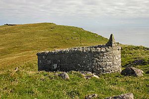
A small cemetery with a wall was built between the lighthouse and Sotan hill for the keepers. It holds the graves of a visiting inspector and several of the keepers' children. A Blenheim bomber plane crashed into the cliffs nearby during World War II. The wreckage was not found until many years later by a rock climber.
Lifeboats and Rescue Training
In the early 1970s, a project helped the RNLI (Royal National Lifeboat Institution) develop the Atlantic 21 class lifeboat. This project used a special safety boat to test in the rough seas around Barra Head. It involved many groups working together, including the Royal Marines.
In 2008, the Barra RNLI Life Boat, named Edna Windsor, was shown on a series of Royal Mail stamps. A first-class stamp showed the 17-metre (56-foot) Severn class lifeboat in action in the Sound of Berneray, 20 km (12 mi) southwest of Barra. The picture showed it in 3.5-metre (11 ft) waves and a 30 km/h (16 kn) wind.
Nature and Wildlife
| Sotan | |
|---|---|
| Highest point | |
| Elevation | 193 m (633 ft) |
| Prominence | 193 m (633 ft) |
| Listing | Marilyn |
| Geography | |
| Location | Barra Isles, Outer Hebrides, Scotland |
| OS grid | NL553799 |
| Topo map | OS Landranger 31 |
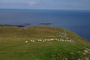
The National Trust for Scotland bought the island in 2000. They were able to buy it thanks to a gift from Miss J. M. Fawcitt, who wanted to create a beautiful natural area to remember her parents and brother. In 2009, the National Trust removed all the sheep from the island because it was too difficult to care for them in such a remote place.
Seabirds and Plants
Berneray and Mingulay are very important places for seabirds to breed. About 100,000 pairs of seabirds nest there. They are especially important for the razorbill, as these two islands have at least 2% of the UK's razorbill population. Other birds found here include different types of gulls, guillemots, puffins, kittiwakes, shags, and fulmars.
Most of the island is covered by grassland near the sea. There are also areas of machair (a special type of fertile grassland) and heath (a type of shrubland). You can find flowers like primroses, violets, yellow flag iris, and celandine growing there. Grey seals are often seen near the landing cove. The island is protected as a SSSI and, with Mingulay, is a Special Protection Area.
Famous People from Barra Head
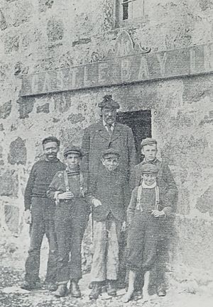
The most well-known person who used to live on the island was Peter Sinclair, also known as Pàdraig Mòr or the "Barra Giant." When he was 17 in 1866, he was measured at 2.03 metres (6.66010499 ft)*. He joined a traveling show, but he didn't like being famous. So, he returned to the islands to run a dairy in Castlebay during the summer and spent winters at his home on Berneray.
See also
 In Spanish: Barra Head para niños
- Barra Head Lighthouse
 | Jessica Watkins |
 | Robert Henry Lawrence Jr. |
 | Mae Jemison |
 | Sian Proctor |
 | Guion Bluford |


