Blorenge facts for kids
Quick facts for kids Blorenge |
|
|---|---|
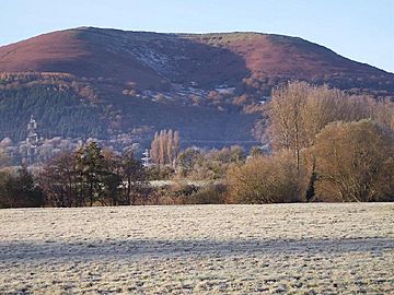
Blorenge from Abergavenny
|
|
| Highest point | |
| Elevation | 561 m (1,841 ft) |
| Prominence | 134 m (440 ft) |
| Parent peak | Coity Mountain |
| Listing | Dewey, HuMP |
| Geography | |
| Location | Monmouthshire, Wales |
| Parent range | Brecon Beacons |
| OS grid | SO269118 |
| Topo map | OS Landranger 161 |
Blorenge, also known as The Blorenge ( Welsh: Blorens), is a well-known mountain in southeast Wales. It stands tall over the River Usk valley, close to Abergavenny in Monmouthshire. This mountain is part of the beautiful Brecon Beacons National Park. Its highest point is about 561 meters (1,841 feet) high.
Contents
Discovering Blorenge's Landscape
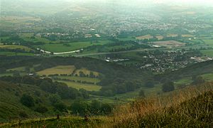
Blorenge looks down on the town of Abergavenny and the villages of Llanfoist and Govilon. These places are all in the Usk Valley to the north. At the base of the mountain, you'll find the Monmouthshire and Brecon Canal. The mountain slopes drop steeply to the northwest into an area called Cwm Llanwenarth. To the south, the land gently slopes down towards Blaenavon.
From Blorenge, you can see other famous peaks. These include the Skirrid to the east of Abergavenny. You can also spot the Sugar Loaf to the north. South of the Foxhunter car park, the high moorland continues. This part is called Mynydd y Garn-fawr. You can find ancient burial mounds from the Bronze Age here. One of the most noticeable is Carn y Defaid.
How Blorenge Was Formed
Blorenge is made up of different types of rocks, stacked like a cake. The lower parts are made of sandstones and mudstones. These rocks were formed during the Devonian period and are called the Old Red Sandstone. Higher up, you'll find mudstones, limestones, and sandstones from the Carboniferous age. The very top of the mountain has coarse sandstones. These are found where the Millstone Grit meets the Coal Measures. All these rock layers tilt towards the southwest.
The mountain's shape changed a lot during the ice ages. A large glacier in the Usk Valley flowed past its northern side. A smaller glacier, fed by snow, dug out a hollow on the eastern side. This hollow is now known as The Punchbowl. There are also small landslips on Blorenge's slopes. One well-known one is called The Tumble. This is where the B4246 road climbs up towards Keeper's Pond.
Special Protected Areas
Blorenge is a very special place. It's located inside two important protected areas. One is the Brecon Beacons National Park. The other is the Blaenavon Industrial Landscape, which is a World Heritage Site. This means it's recognized globally for its unique history and nature.
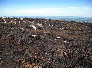
Much of the mountain is also a Site of Special Scientific Interest. This is mainly because of its heather moorland. This moorland is a vital home for breeding red grouse. The Punchbowl area, a natural hollow, is owned and looked after by the Woodland Trust. They manage it as a nature reserve.
Exploring Blorenge: Access for Visitors
Most of Blorenge is open for people to explore on foot. There are many footpaths and bridleways that cross the mountain. A popular walking trail goes all around Blorenge. It's a favorite spot for both tourists and hikers.
Climbing to the top from Llanfoist or Abergavenny, through Cwm Craf, is very steep. But the hard work is worth it! From the summit, you get amazing views across the Usk River valley. You can see Abergavenny and the Black Mountains, Wales. An easier way to reach the top is from the Foxhunter car park. This car park is also a good starting point for exploring the northern edge of the plateau.
Fun Things to Do on Blorenge
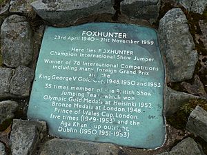
Most people who visit Blorenge come for walking and sightseeing. Some visitors come to see the grave of Foxhunter. This was a very famous showjumping horse owned by Sir Harry Llewellyn. Foxhunter won Britain's only Gold medal in the 1952 Summer Olympics. He is buried near the road between Blaenavon and Llanover on Blorenge. A car park nearby is named in his honor.
Members of the SE Wales Hang Gliding & Paragliding Club often take off from the summit. The club owns the entire upper part of the mountain, which is about 998 acres. Paragliders often land in Castle Meadows, next to the River Usk in Abergavenny.
Every November, a challenging fell race takes place on the mountain. It starts and finishes at St Faith's Church in Llanfoist. The race route even goes under the Monmouthshire and Brecon Canal.
There's also a special pale ale named after Blorenge. It has won a Great Taste Award. This drink is made not far away in Llanhilleth.
Blorenge's Industrial Past
You can still see parts of an old tramway on Blorenge. It was built around 1796. This tramway connected a limestone quarry on the north side of the mountain to the ironworks in Blaenavon. Hill's Tramroad goes around the western side of the hill. It drops steeply down to Llanfoist using a series of slopes.
There are many old quarry sites around the northern and eastern edges of Blorenge. You can also find abandoned sandstone quarries near the Foxhunter car park. You can even see signs of an old method called hushing near Keeper's Pond. This was used to find ironstone. The Monmouthshire and Brecon Canal also wraps around the base of Blorenge to the north and east.
The Name Blorenge
People have different ideas about where the name Blorenge comes from. Some think it might come from the Welsh word plor, which means 'pimple'. This could be linked to the Middle English word blure, meaning 'blister'. Another idea is that it comes from blawr ais, which means 'grey ribbed'.
Cycling "The Tumble"
|
The Tumble / Y Tymbol
|
|
|---|---|
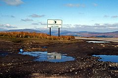
The summit of The Tumble
|
|
| Start | Govilon |
| Gain in altitude | 347 m (1,138 ft) |
| Length of climb | 4.1 km (2.5 mi) |
| Maximum elevation | 482 m (1,581 ft) |
| Average gradient | 9.0 % |
The western side of Blorenge has a road called the B4246. This road connects Llanfoist and Blaenavon. It includes a famous climb known as "The Tumble" ("Y Tymbol"). This climb reaches a height of about 482 meters (1,581 feet) near Keepers Pond.
"The Tumble" is often part of cycle races. Since 1989, it has been the finish line for the last stage of the Junior Tour of Wales. It's even listed as one of the 100 Greatest Cycling Climbs in Britain. From Govilon, the climb is about 4.1 kilometers (2.5 miles) long. Cyclists gain 347 meters (1,138 feet) in height, with an average slope of 9.0%. Stage 3 of the 2014 Tour of Britain ended at the summit on September 9, 2014. The Italian rider, Edoardo Zardini, won that stage.
 | James Van Der Zee |
 | Alma Thomas |
 | Ellis Wilson |
 | Margaret Taylor-Burroughs |


