
Bromley-by-Bow facts for kids
Quick facts for kids Bromley |
|
|---|---|
Arrow Road, a residential street in Bromley |
|

Bromley
|
|
| Population | 14,480 (2011 Census. Bromley Ward) |
| OS grid reference | TQ375825 |
| London borough | |
| Ceremonial county | Greater London |
| Region | |
| Country | England |
| Sovereign state | United Kingdom |
| Post town | LONDON |
| Postcode district | E3, E14 |
| Dialling code | 020 |
| Police | Metropolitan |
| Fire | London |
| Ambulance | London |
| EU Parliament | London |
| UK Parliament |
|
| London Assembly | |
Bromley, often called Bromley-by-Bow, is a lively area in East London. It's part of the London Borough of Tower Hamlets. You can find it on the western side of the River Lea, in a part of East London known as the Lower Lea Valley.
Bromley is different from Bow, which is just to its north. The border between them runs along Bow Road. The name "Bromley-by-Bow" became popular because the local tube station was renamed in 1967. This was done to avoid confusion with another Bromley station in a different part of London. Over time, the station's name stuck to the whole area. Bromley officially became its own parish (a type of local area) in 1537.
Bromley has a long and interesting past. Many old buildings have been lost over time. Today, it's well-connected by the London Underground and Docklands Light Railway.
Contents
What's in a Name? (Toponymy)
The name "Bromley" has been around for a long time. In old records, it appeared as Brambele or Brembeley. It probably comes from old Saxon words. Brembel meant "bramble" (a thorny bush), and lege meant "a field". So, it might have meant "field of brambles".
As mentioned, the area became known as Bromley-by-Bow after the tube station changed its name in 1967. This helped people tell it apart from Bromley railway station in the London Borough of Bromley. Eventually, the station's name was used for the whole district.
Bow itself, which is nearby, was once called Stratforde. It became Stratford-at-Bow when a bridge was built there. This bridge had an arched shape, like a bow. This helped people tell it apart from Stratford Langthorne on the other side of the River Lea.
Bromley's Story (History)
Early Times to the Parish Creation
The earliest mention of Bromley, as Braembeleg, dates back to around the year 1000. At that time, it was one of the estates owned by St Paul's Cathedral.
Bromley was once home to St Leonard's Priory. This was a Benedictine nunnery, a place where nuns lived and prayed. It was founded during the time of William the Conqueror. The priory is even mentioned in Geoffrey Chaucer's famous book, The Canterbury Tales. The priory was destroyed in 1536 during the Dissolution. This was a time when King Henry VIII closed down many monasteries and priories in England. The land then went to Sir Ralph Sadleir, a special advisor to King Henry VIII. Only the priory chapel was saved.
.jpg)
The small Tudor period building called Bromley Hall was built in the late 1400s. It was the manor house for Lower Bromley. Over the centuries, it was used for many things. These included a calico printing works, a gunpowder factory, and a carpet warehouse. It is believed to be the oldest brick house in London.
From 1537 to 1850
The old priory chapel became the church for a new area called Bromley St Leonard. This new area separated from the larger parish of Stepney.
In 1606, a grand palace was built for King James I. It was mainly used as a hunting lodge. This large house had 24 rooms, including a special Stateroom. Later kings, Charles II and James II, also used and improved it.
The palace was pulled down in the late 1800s to make way for a new school. Many of its original features, like the Stateroom and wood panels, were still in good condition. Some of these pieces were even sold to the Victoria and Albert Museum.
From 1850 to Today
In 1868, a hospital called the Poplar and Stepney Sick Asylum opened near the current Bromley-by-Bow tube station. It later became St Andrew's Hospital and closed in 2006. Now, new homes stand on that site.
In 1873, Henry Grattan Guinness started a training institute for missionaries in Bromley-by-Bow. This school grew and later moved, eventually becoming Cliff College.
Between 1899 and 1965, Bromley St Leonard was part of the Metropolitan Borough of Poplar.
The old gas holders in Bromley by Bow are very important historical structures. They are listed as Grade II buildings, meaning they are protected. However, they are currently at risk of falling apart.
Gandhi's Visit
In 1931, Mahatma Gandhi came to London for important talks. These discussions were about the future of India, which was then part of the British Empire. This was the only time Gandhi left India between 1914 and his death.
Gandhi chose not to stay in a fancy hotel in central London. Instead, he preferred to live in the East End, among working-class people, just as he did in India. He stayed at Kingsley Hall in Powis Road, Bromley-by-Bow, for three months. People in the East End welcomed him with great enthusiasm.
World War II and After
Bromley suffered a lot during World War II bombings, known as the Blitz. St Leonards Church was destroyed by enemy action in 1941. The area around Aberfeldy Street was heavily bombed. It was later rebuilt as the Aberfeldy Estate in 1947.
The church ruins were cleared away in the 1960s when the Blackwall Tunnel Approach Road was built.
Local Government (Governance)
Bromley is divided into three areas, or wards, within the London Borough of Tower Hamlets. These wards are Bromley North, Bromley South, and Lansbury. Local councillors are elected to represent these areas and help make decisions for the community.
Bromley's Location (Geography)
Where is Bromley? (Extent)
Bromley-by-Bow is part of the London Borough of Tower Hamlets. It includes parts of the E3 postal district (in the north) and E14 (in the south).
To the north is Bow. The historic border is along Bow Road. To the east, across the River Lea, are Stratford, West Ham, and Canning Town. The River Lea forms the boundary between Tower Hamlets and the Newham. The historic Three Mills site is just over the border in Newham.
Mile End is to the west. Poplar is to the south.
The area is cut through from north to south by the Blackwall Tunnel Approach Road (A12). The land between this road and the River Lea is currently being redeveloped.
Who Lives Here? (Demographics)
In 2001, about 11,581 people lived in the Bromley-by-Bow ward. There were about 2.8 people per home. More than half the population (51%) were female. About 30% of residents were under 16 years old. Around 40% of the people were of Bangladeshi origin.
Most homes in Bromley-by-Bow were rented, with only about 15% owned by the people living in them. This was higher than the average for the whole borough.
Getting Around (Transport)

Bromley-by-Bow station is right in the middle of Bromley. It's served by the London Underground District and Hammersmith & City lines.
The Docklands Light Railway also has a station nearby called Langdon Park DLR station, which opened in 2009.
Several London Buses routes operate in the area, including routes 108, 309, 323, 488, and D8. Route 108 uses the Blackwall Tunnel, which can sometimes cause long delays.
Major roads connect the area to the wider National Road Network. These include the north-south A12 (East Cross Route). Other local roads like B140 Devons Road and Bromley High Street also provide access.
For walkers and cyclists, the Lea Valley Walk runs along the River Lea Navigation and River Lea on the eastern side of the area. To the south, the Limehouse Cut starts at the Bow Locks.
Community Life (Community)
Kingsley Hall is a famous community centre. It's known for Mahatma Gandhi's visits in 1931. It also hosted a special clinic run by psychologist R. D. Laing from 1965. Even after a big fire in 1995, Kingsley Hall is still a very active community hub.
The Bromley-by-Bow Centre is well-known for its unique approach to health care. It offers nursery care, training courses, and acts as a community centre. It's seen as a great example for how community services and health care can work together in the future.
The Bromley By Bow Community Organisation (BBBCO) helps young people and the wider community. They run projects like five football teams, a Girls Group, and a Youth Group. They also offer services for older people. Their goal is to help residents improve their lives in one of Tower Hamlets' most challenging areas.
Learning in Bromley (Education)

Bow School is a large secondary school for boys and girls. In September 2014, the school moved to a brand new building in Bromley-by-Bow, near Bow Locks.
Other schools close to Bromley-by-Bow include Little House Nursery, Wellington Primary, Marner Primary, Old Palace Primary School, St Paul's Way Trust secondary, Phoenix primary and secondary, and Central Foundation Girl's School secondary.
The Bromley-by-Bow Centre also provides training opportunities for adults. These can include nursing training or apprenticeships.
Art and Fun (Arts and culture)
The fictional area of Walford, where the BBC soap opera EastEnders is set, is based on Bromley-by-Bow. The main square in the show, Albert Square, is inspired by Fassett Square in nearby Hackney.
The CBeebies television series Apple Tree House started filming its episodes on the Devons Estate in 2017.
Images for kids
-
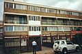
Broomfield Street in 1998, before regeneration.

