Connersville, Indiana facts for kids
Quick facts for kids
City of Connersville, Indiana
|
|||
|---|---|---|---|
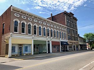
Central Avenue in Downtown Connersville
|
|||
|
|||
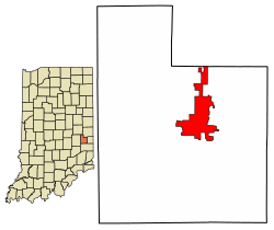
Location of Connersville in Fayette County, Indiana.
|
|||
| Country | United States | ||
| State | Indiana | ||
| County | Fayette | ||
| Government | |||
| • Type | Mayor–council | ||
| • Body | Connersville City Council | ||
| Area | |||
| • Total | 7.70 sq mi (19.94 km2) | ||
| • Land | 7.68 sq mi (19.90 km2) | ||
| • Water | 0.01 sq mi (0.04 km2) | ||
| Elevation | 846 ft (258 m) | ||
| Population
(2020)
|
|||
| • Total | 13,324 | ||
| • Density | 1,734.44/sq mi (669.67/km2) | ||
| Time zone | UTC-5 (EST) | ||
| • Summer (DST) | UTC-4 (EDT) | ||
| ZIP code |
47331
|
||
| Area code(s) | 765 | ||
| FIPS code | 18-14932 | ||
| GNIS feature ID | 2393620 | ||
| Website | Fayette County/ Connersville Website | ||
Connersville is a city in Fayette County, Indiana, United States. It is about 66 miles (106 km) (106 km) east of Indianapolis. In 2020, about 13,324 people lived there. Connersville is the main city and county seat of Fayette County. It is the only official city in the county.
The city is in a large countryside area in east central Indiana. The closest big city is Richmond, about 26 miles (42 km) (42 km) away. Connersville has the only high school in Fayette County. The city's economy depends on making things (manufacturing), stores, and healthcare. Since the 1960s, the number of jobs and people living here has gone down. This makes Connersville one of the less wealthy areas in Indiana.
Connersville is one of the oldest cities in Indiana. It was started in 1813 by a person named John Conner, who the city is named after.
Contents
Exploring Connersville's Past
Connersville gets its name from John Conner. He was an early settler and the older brother of William Conner, who was also important in Indiana's history.
Ancient Whitewater Valley and Early People
The Whitewater River valley was formed by glaciers about 13,600 years ago. This area was at the edge of the ice. Over time, melting ice created lakes and rivers, shaping the hills and valleys we see today.
Long ago, different Native American groups lived here. The Miami Indians were powerful, and the Potawatomi and Shawnee also lived in the region. Delaware Indians moved here from the east and settled along the Whitewater River. Even older groups, called mound builders, lived in these valleys. They built large burial mounds, which you can still find today.
After a battle in 1794, the Delaware Indians lost control of the land. In 1795, the Treaty of Greenville gave much of Ohio and a small part of Indiana to the United States. The Whitewater River valley was a good path for settlers to move north from the Ohio River. People started farming and trading here even before the land was officially sold in 1801. An old Indian trail followed the river, passing through where Connersville is now.
Conner's Trading Post
John Conner and his brother William came to the Whitewater Valley in 1802. They set up a fur trading post near what is now Cedar Grove. By 1808, they moved the trading post about 20 miles (32 km) (32 km) north. This new spot was where the Whitewater River met an Indian trail. It was a good place for trading furs.
In 1809, the Treaty of Fort Wayne was signed. This treaty gave the government a strip of land known as the "Twelve Mile Purchase." This land included most of Fayette County. John Conner bought his land here in 1811.
Connersville's First 50 Years
After the War of 1812, many Delaware Indians left Indiana. This meant John Conner's fur trading business changed. He then focused on building a town.
John Conner planned the town of Connersville in March 1813. It was built next to his fur trading post. The first buildings were a saw mill, a grist mill (for grinding grain), a general store, and a place to make alcohol. At first, not many people moved there. In 1815, there were only four cabins. In 1818, Fayette County was created, and Connersville became its main city.
John Conner was briefly the sheriff of Fayette County. In 1820, he helped plan the new state capital, Indianapolis. He moved his fur trading business to Noblesville in 1822. He also served as a state senator and representative. John Conner passed away in Indianapolis in 1826.
The first post office in Connersville opened in 1818. The first courthouse was built between 1819 and 1822. The first newspaper, Indiana Statesman, started in 1824. The first church was Presbyterian, built in 1824. A school building was constructed in 1858. In 1833, Connersville had about 500 people. It became an official town in 1841.
Connersville was an important stop on the Whitewater Canal. This canal opened in 1847 and connected the Whitewater River to the Ohio River. It helped move goods, but its main use stopped in 1849. The first railroad came to Connersville in 1862. Before the Civil War, the main jobs were milling, packing pork, and making wool products.
In 1857, a separate village called East Connersville was created. It was on the other side of the river. East Connersville joined Connersville in the 1920s.
Early Growth and Inventions
The Roots blower, a type of air pump, was invented by the Roots brothers in Connersville in the 1850s. It was patented in 1859 and made in Connersville for over 150 years.
Connersville became a chartered city in June 1869. William H. Beck was chosen as its first mayor. The first high school opened in 1875. In 1882, James H. Fearis started the first telephone service in Connersville. The Connersville Electric Light Company began providing electricity in 1890. Central Avenue was paved with brick in 1902, becoming the city's first paved street.
For many years, Connersville was known as the "furniture and buggy town." This was because these two industries were very important there. In 1898, Stant company was founded in Connersville. It became the world's largest maker of piano tuning pins. In 1906–07, Dr. W. Otto Miessner started the first public high school band in the U.S. at Connersville High School.
Automotive and Industrial Age (to 1960s)
In the early 1900s, Connersville was called "Little Detroit." This was because it was very important to the car industry. During World War II, over 500,000 jeep bodies were made in the city. Many car brands were made in Connersville, including Auburn, Cord, Duesenberg, Ansted, Empire, Lexington, and McFarlan.
Many factories were located in the western part of town for 150 years. These included Roots Blower (later Dresser Industries), Stant, McQuay-Norris, Design & Manufacturing Co. (D&M), H. H. Robertson, Visteon, and Philco Ford.
McQuay-Norris, which made car parts, started in Connersville in 1921. It closed its Connersville plant in 1983. Design & Manufacturing (D&M) made dishwashers. By 1972, D&M made 25% of all dishwashers in the country. The company closed in 1990. H. H. Robertson, which made building products, also had a plant here. It moved its operations in the late 1980s.
Recent Changes in Connersville
The 1980s saw many factories in Connersville close down. This was due to higher costs and other reasons. The number of union workers in Connersville went from 10,000 to about 600 by 2012. Connersville stopped making cars when the Visteon factory closed in 2007.
One reason for the decline might be transportation. When the interstate highways were built in the 1950s, Connersville was not directly on the main routes between big cities. For example, Interstate 70 and Interstate 74 do not pass through Connersville.
Some companies still remain, like GE Energy (formerly Roots Blower/Dresser Industries) and Stant. There are also some furniture makers and other local factories. In March 2014, the city faced financial difficulties because its income was less than its expenses.
Connersville's Location
Connersville is generally laid out from north to south. The center of town is around Central Avenue and 5th Street.
In 2010, Connersville covered about 7.755 square miles (20.09 km2) (20.09 km²). Most of this area, about 7.74 square miles (20.05 km2) (20.05 km²), is land. Only a small part, about 0.015 square miles (0.04 km2) (0.04 km²), is water.
People of Connersville
| Historical population | |||
|---|---|---|---|
| Census | Pop. | %± | |
| 1840 | 596 | — | |
| 1850 | 1,396 | 134.2% | |
| 1860 | 2,119 | 51.8% | |
| 1870 | 2,496 | 17.8% | |
| 1880 | 3,228 | 29.3% | |
| 1890 | 4,548 | 40.9% | |
| 1900 | 6,836 | 50.3% | |
| 1910 | 7,738 | 13.2% | |
| 1920 | 9,901 | 28.0% | |
| 1930 | 12,795 | 29.2% | |
| 1940 | 12,898 | 0.8% | |
| 1950 | 15,550 | 20.6% | |
| 1960 | 17,698 | 13.8% | |
| 1970 | 17,604 | −0.5% | |
| 1980 | 17,023 | −3.3% | |
| 1990 | 15,550 | −8.7% | |
| 2000 | 15,411 | −0.9% | |
| 2010 | 13,481 | −12.5% | |
| 2020 | 13,324 | −1.2% | |
| Source: US Census Bureau | |||
In 2019, the population was estimated to be about 12,796 people. About 55% of all people in Fayette County live in Connersville.
Population Details (2010)
In 2010, there were 13,481 people living in Connersville. There were 5,582 households and 3,506 families. The city had about 1,739 people per square mile (671 people per km²).
Most people (95.7%) were White. About 2.1% were African American, and 0.2% were Native American. About 0.3% were Asian, and 0.3% were from other races. About 1.3% were from two or more races. People of Hispanic or Latino background made up 1.0% of the population.
About 31.1% of households had children under 18. About 41.9% were married couples. The average household had 2.37 people, and the average family had 2.95 people. The average age in the city was 39.4 years old.
Religious Life
About 44% of the people in Connersville are part of a religious group. Many are Roman Catholic (25%). Other groups include United Methodist, Southern Baptist, and non-denominational Christian churches. There are also Lutheran, Presbyterian, Reformed Episcopal, and Church of Jesus Christ of Latter-Day Saint churches. Several Pentecostal churches are also in town.
Fun and Culture in Connersville
The Fayette County Public Library is located in Connersville. You can also find a golf course called Willowbrook Country Club. For movies, there's Showtime Cinemas. The high school has a football field used for sports like gymnastics and track.
If you like camping, Whitewater River Campground is south of town. Every June, the Heritage MusicFest happens there, with local bands playing different kinds of music.
Parks and Nature Spots
- Roberts Park: This park is in the northeast part of town. It has a public pool, a community center, a grandstand, and a racetrack. It hosts the annual Fayette County Free Fair, a week-long event in late summer.
- Whitewater Memorial State Park: This park is about 10 miles (16 km) (16 km) southeast of Connersville. It's next to Brookville Lake, which is about 5,260-acre (2,130 ha) (21.3 km²) big.
- Manlove Park: About 8 miles (13 km) (13 km) northwest of downtown, this park is around Manlove Lake.
- Shrader-Weaver Woods Nature Preserve: This preserve is about 4 miles (6.4 km) (6 km) northwest of Connersville. It has 108 acres (44 ha) (0.44 km²) of old forest, great for hiking and bird watching.
- Mary Gray Bird Sanctuary: This large area (over 700 acres (280 ha) or 2.8 km²) has forests, meadows, and ponds. It's good for hiking, picnics, camping, and bird watching. It's about 5 miles (8.0 km) (8 km) southwest of Connersville.
- Doc-O-Lake: This 50-acre (20 ha) (0.2 km²) lake is 7 miles (11 km) (11 km) north of town. You can camp and boat here, but fishing is limited.
Cemeteries
Connersville has a few cemeteries: Connersville City Cemetery, Dale Cemetery, and Tullis Chapel Cemetery. There are also some smaller family or church cemeteries nearby.
Historic Places to Visit
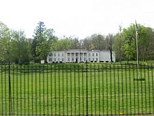
- Elmhurst: This historic estate south of town was built in 1831. It was the home of Caleb Blood Smith, who worked for President Abraham Lincoln. You can sometimes see re-enactments of the American Civil War here.
- Whitewater Valley Railroad: This is a 19-mile (31 km) (31 km) long scenic train ride and museum. It runs between Connersville and Metamora.
- Fayette County Historical Museum: This museum is in the city.
- Canal House: Built in 1842, this building was the main office for the Whitewater Canal Company.
- Other historic spots: The Fayette County Courthouse and Roberts Park are also listed as important historic places.
Getting Around Connersville
Connersville does not have commercial air or bus service. However, there is Amtrak (passenger) train service and CSX (freight) train service. The Whitewater River is not used for commercial transport.
Most goods move in and out of Connersville by truck. They use State Road 1 to get to Interstate 70 (to Indianapolis) or U.S. Route 52 and Interstate 74 (to Cincinnati). State Road 44 is mostly for local traffic. The nearest big cities are Cincinnati (58 miles (93 km) southeast), Indianapolis (66 miles (106 km) west), and Dayton, Ohio (60 miles (97 km) east).
Local Airport
Mettel Field is a private airport about three nautical miles (6 km) north of Connersville's downtown. It is for private planes, not commercial flights. The closest commercial airport is Cincinnati/Northern Kentucky International Airport, about 62 miles (100 km) (100 km) southeast.
Train Service
Amtrak, the national passenger train system, serves Connersville. Trains run three days a week. You can take a train west to Indianapolis, Lafayette, and Chicago. Or you can go east to Cincinnati, cities in Kentucky, and all the way to New York City.
Bus and Taxi Services
There is no regular bus service to Connersville. However, local public transportation is available if you call the public transit office. There is also one local taxi service in town.
Main Roads
 Indiana State Road 1: Runs north-south through downtown Connersville. It goes north past Fort Wayne and south to Lawrenceburg.
 Indiana State Road 44: Runs east-west through downtown Connersville. It goes west to Martinsville and east to the Ohio state line.
 Indiana State Road 121: Runs north-south from downtown Connersville (at SR44) south to Metamora.
 Interstate 70: About 14 miles (23 km) (23 km) north via SR1. It runs east-west from Indianapolis to Columbus, Ohio.
 U.S. Route 40: About 12 miles (19 km) (19 km) north via SR1. It runs east-west from near Indianapolis to Richmond, Indiana.
Learning in Connersville
All public schools in Connersville are part of the Fayette County School Corporation. In 2012, there were about 1,200 high school students, 700 middle school students, and 1,800 public elementary school students. About 300 students attended private elementary schools.
The Whitewater Technical Career Center is a school for grades 10-12. It helps students who don't plan to go to college get ready for jobs in different trades. There are no four-year colleges directly in Connersville. However, the Connersville Center offers classes through Indiana University East. The closest four-year colleges are IU East and Earlham College in Richmond, Indiana, and Miami University in Oxford, Ohio. All are about 25 miles (40 km) (40 km) away.
In 2017, the Fayette County School Corporation was featured on CBS News. This was because of their school nutrition programs. They partnered with a food service company to offer free breakfast, lunch, and supper to all students. They even had "second chance" breakfasts for teens and free suppers with after-school movies.
Middle, High, and Trade Schools
- Connersville High School
- Connersville Middle School
- Whitewater Career Center
Elementary Schools
- Eastview
- Grandview
- Frazee
- Fayette Central
- Everton
Private Elementary Schools
- St. Gabriel's (Catholic)
- Community (Christian)
- Faith (Christian)
Healthcare Services
Reid Health runs the hospital and related health services in Connersville. They took over most of the services from the former Fayette Regional Health System in 2018.
Media and News
Connersville has a daily newspaper called The News Examiner. It has been published since 1849.
Radio station WLPK-AM 1580 broadcasts local shows and classic hits. It also broadcasts on FM 106.9. There is also a WIFE-FM radio station (94.3).
Connersville High School has a daily TV news program called CHS Today. It started in 1970 and was the first student-produced TV news program in the United States. It is broadcast live to the community and re-airs later in the evening.
Famous People from Connersville
Many notable people have connections to Connersville:
- E. L. Cord: An industrialist and car maker who founded American Airlines.
- Howard Garns: The person who created the logic game Sudoku. He was born in Connersville in 1905.
- Finly H. Gray: A U.S. Congressman for Indiana.
- Scott Halberstadt: A television actor.
- Tom T. Hall: A country singer and member of the Grand Ole Opry.
- Matt Howard: A basketball player who graduated from Connersville High School in 2007.
- Bill Hunt: A racing driver.
- James N. Huston: Served as the Treasurer of the United States.
- Virginia Claypool Meredith: Known as the "Queen of American Agriculture."
- Louis T. Michener: Indiana Attorney General and campaign manager for Benjamin Harrison.
- Caleb Blood Smith: A Congressman and Secretary of the Interior for President Lincoln.
- Oliver H. Smith: A Congressman and Senator.
- Joey Sturgis: A music producer, sound engineer, and musician.
- Dan Toler: A rock musician who played with the Allman Brothers Band.
- Robert Wise: A Hollywood director and producer. He graduated from Connersville High School in 1932.
See also
 In Spanish: Connersville (Indiana) para niños
 | John T. Biggers |
 | Thomas Blackshear |
 | Mark Bradford |
 | Beverly Buchanan |


