Henry Mountains facts for kids
Quick facts for kids Henry Mountains |
|
|---|---|

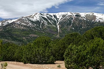
Peaks in the Henry mountains viewed from a high mountain road
|
|
| Highest point | |
| Peak | Mount Ellen |
| Elevation | 11,522 ft (3,512 m) |
| Geography | |
| Country | United States |
| State | Utah |
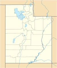
| Range coordinates | 37°56′36″N 110°41′56″W / 37.94333°N 110.69889°W |
| Parent range | Rocky Mountains |
| Geology | |
| Type of rock | igneous |
The Henry Mountains are a mountain range in southeastern Utah, USA. They stretch about 30 miles (48 km) from north to south. These mountains were named by Almon Thompson to honor Joseph Henry, who was the first secretary of the Smithsonian Institution. The closest town is Hanksville, Utah, located north of the mountains.
Did you know the Henry Mountains were the last mountain range to be added to maps of the 48 connected U.S. states? This happened in 1872. Before they got their official name, people sometimes called them the "Unknown Mountains." In the Navajo language, they are still known as Dził Bizhiʼ Ádiní, which means "mountain whose name is missing." Most of the land here is public and managed by the U.S. Bureau of Land Management. A herd of about 350 American Bison lives freely in these mountains.
Contents
Exploring the Henry Mountains

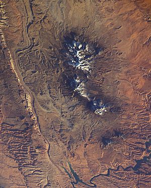
The Henry Mountains are split into two main parts. Highway 276 runs between them. The northern part is much taller and covers a larger area. Its highest peaks include Mount Ellen, which is 11,522 ft (3,512 m) high. Other tall peaks are Mount Pennell at 11,371 ft (3,466 m) and Mount Hillers at 10,723 ft (3,268 m).
The southern part of the range is much lower. It has two peaks: Mount Ellsworth at 8,235 ft (2,510 m) and Mount Holmes at 8,000 ft (2,400 m). This southern group is also called the "Little Rockies."
Water and Weather
Many canyons drain water away from the Henry Mountains. This water flows into rivers like the Fremont River to the north, the Dirty Devil River to the east, or Lake Powell to the south. There isn't much surface water in the Henrys.
The amount of rain and snow changes with how high you are. At the base of the mountains, around 5,000 ft (1,500 m) high, it gets about 6 in (150 mm) of rain each year. Higher up, at 7,000 ft (2,100 m), it gets about 15 in (380 mm). At the very highest parts, it drops a bit to about 13 in (330 mm).
How the Mountains Were Formed
The rocks of the Henry Mountains were first studied in 1875-1876 by Grove Karl Gilbert. He came up with the word "laccolith" to describe how some of the mountains were shaped. A laccolith is like a mushroom-shaped blob of magma (melted rock) that pushes up the layers of rock above it without breaking through to the surface.
The main type of igneous rock (rock formed from cooled magma) found here is called porphyritic diorite. Geologists still study this area to understand how magma pushes its way into existing rock layers. The flat layers of sedimentary rock here are clearly folded and bent because of the magma pushing them up.
The rocks in these mountains are between 23 and 31 million years old. They formed inside older sedimentary rocks that range from the Permian to the Cretaceous periods. The way these mountains formed is similar to the La Sal Range and the Abajo Mountains, which are also in southeastern Utah.
A Look Back in Time
Native Americans lived in the Henry Mountains for thousands of years before the first White settlers arrived. The first explorer to visit the Henrys was Almon Harris Thompson in the spring of 1872. He climbed the highest peak and named it Mount Ellen after his wife.
Some Mormon settlements were started in the 1880s, but they didn't last long. In the 1890s, there were a few short "gold rushes" in the Henrys. Around 1900, ranchers brought large herds of sheep to the area. By the 1930s, too many sheep were grazing, which caused erosion and harmed the native plants. The Taylor Grazing Act of 1934 helped to stop most of the overgrazing. A report from 2015 showed that most of the plant life had improved.
The Henry Mountains have always been a tough place to live. The dry conditions, isolation, and rugged land have kept the population and development very low. The landscape is simply too harsh, and the distances are too vast.
The Henry Mountains Bison Herd

The Henry Mountains are home to about 350 American bison. This herd is special because it's one of only three free-roaming, genetically purebred bison herds on public lands in the United States. Scientists found this out through genetic testing in 2015. They also discovered that the Henry Mountains bison are free of brucellosis, a disease that came to North America with domestic cattle. The other two purebred herds are in Yellowstone National Park and Wind Cave National Park in South Dakota.
The Henry Mountains Bison Herd started in 1941. Eighteen bison, including three males, were moved from Yellowstone National Park. They were released near the Dirty Devil River, south and east of Hanksville, Utah. Five more males were added in 1942. Over time, the herd moved closer to the Henry Mountains. They often go to elevations as high as 10,000 ft (3,000 m). This herd has been free of brucellosis since 1963.
Wildlife experts in Utah aimed to have about 325 bison in the Henry Mountain herd by 2012. Since bison reproduce quickly and the herd had grown larger than this in the past, a plan was made to reduce its size. To do this and to help increase the genetic variety of bison in other places, some animals are moved from this herd to new locations. For example, in January 2008, officials moved 31 bison to the Book Cliffs in eastern Utah. These joined 14 bison that had been released earlier from a private herd. Also, special hunting permits are given out each year to help manage the population. In 2009, 146 permits were issued for hunting bison in the Henry Mountains.
Managing the Land
Much of the Henry Mountains area is managed by the United States Bureau of Land Management. They work to protect the land and its wildlife.


